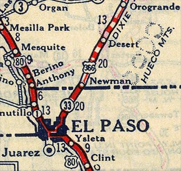
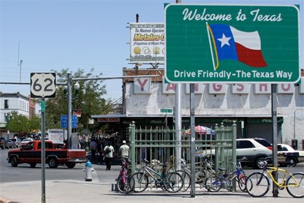
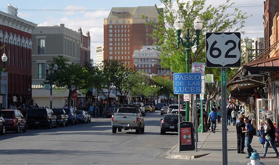
In the beginning (1926), El Paso was served by only two US routes - one of which ceased to exist in the 1930s, and the other has not been seen in these parts since 1991. US 80 came in from the east on Alameda Avenue, which angles southwest and heads downtown as Texas Avenue. At Mesa Street, US 80 took a turn to the northwest and headed out of town. In other words, US 80 followed the routing of today's TX hwy. 20.
|
US 366 was a diagonal route, originating in Amarillo and passing through the New Mexico cities of Clovis, Roswell, and Alamogordo, before arriving back in Texas:
|
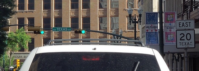
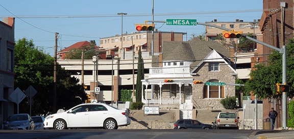
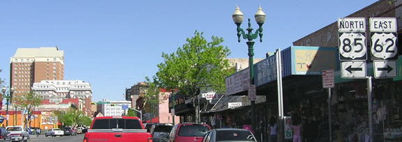
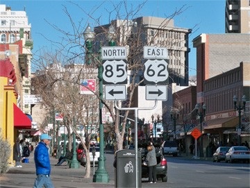
US 366 came into El Paso on Dyer Street, and then angled off to Pershing Drive, which gradually curves until it runs east-west. At Piedras Street, US 366 turned south, and at Alameda it turned west again, overlapped with US 80. That becomes Texas Av, and most likely the US 366 designation ended at Mesa, the intersection where US 80 took a right-hand turn. This interactive image is looking southwest on Texas:
|
|
That was westbound US 80 (which turned right there on Mesa) and US 366 (which ended there). That designation was eliminated in 1931, replaced by a rerouted US 70 (which would have ended at that same intersection).
|
|
The following year, El Paso welcomed the arrival of another US route: highway 62 was extended west from Carlsbad NM. It came into town on Montana Avenue, which junctioned with US 70 at Piedras. From there the two routes were co-signed south, and at Alameda, they joined US 80. US 62 then shared US 70's endpoint, on Texas at Mesa.
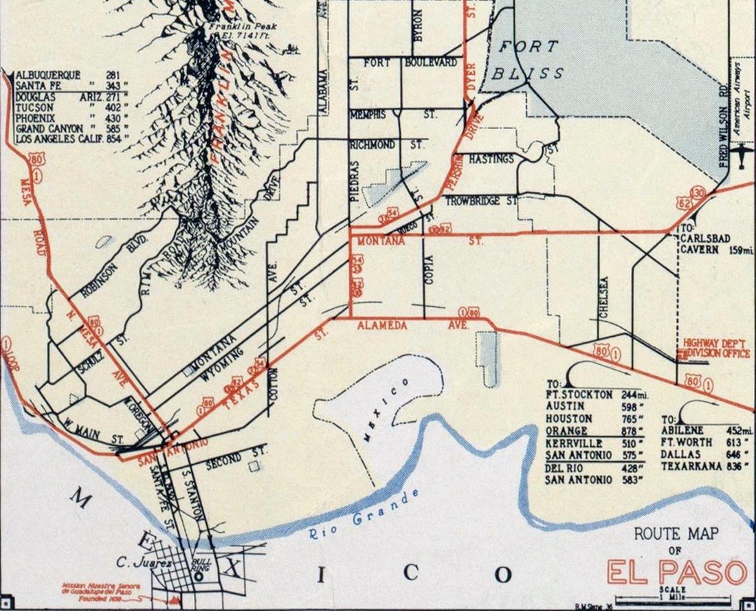
By 1935, US 70 had been rerouted again, and so the north-south highway coming into El Paso received its third number in less than a decade: US 54. It ended at the same place where US 70 had before, and US 366 before that. That is the arrangement shown on the earliest El Paso highway map I have seen, which is dated 1937:
By 1935, US 70 had been rerouted again, and so the north-south highway coming into El Paso received its third number in less than a decade: US 54. It ended at the same place where US 70 had before, and US 366 before that. That is the arrangement shown on the earliest El Paso highway map I have seen, which is dated 1937:
|
Admittedly, it is only an assumption that the endpoint of US 54 shown there was the same intersection as its predecessors (US 366 and US 70), but it was a common practice for Texas to sign all highways to a common junction in the central business district.
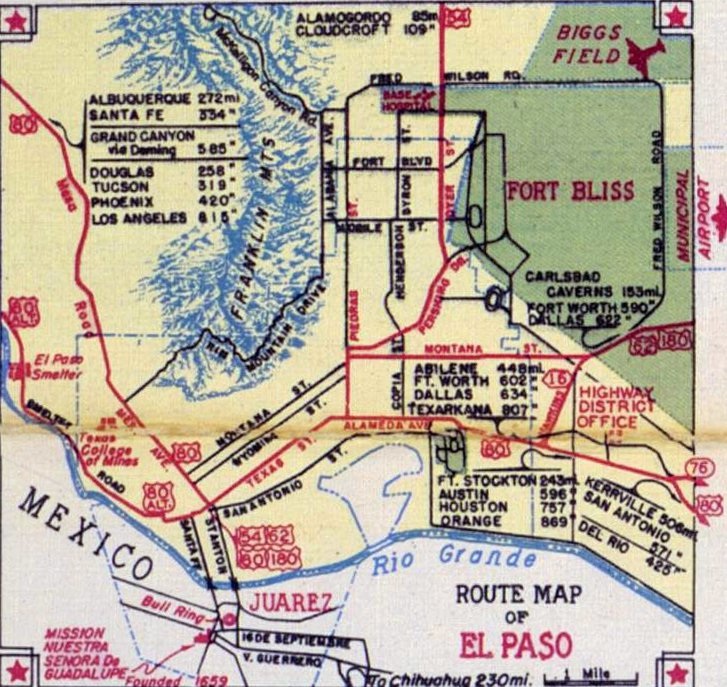
In 1944, US 180 was commissioned. Its west end was in El Paso, which is a bit strange, since its routing was concurrent with the already-existing US 62 eastward all the way to Hobbs NM... a distance of about 230 miles! The 1946 map clearly marks its endpoint at this same intersection: |
|
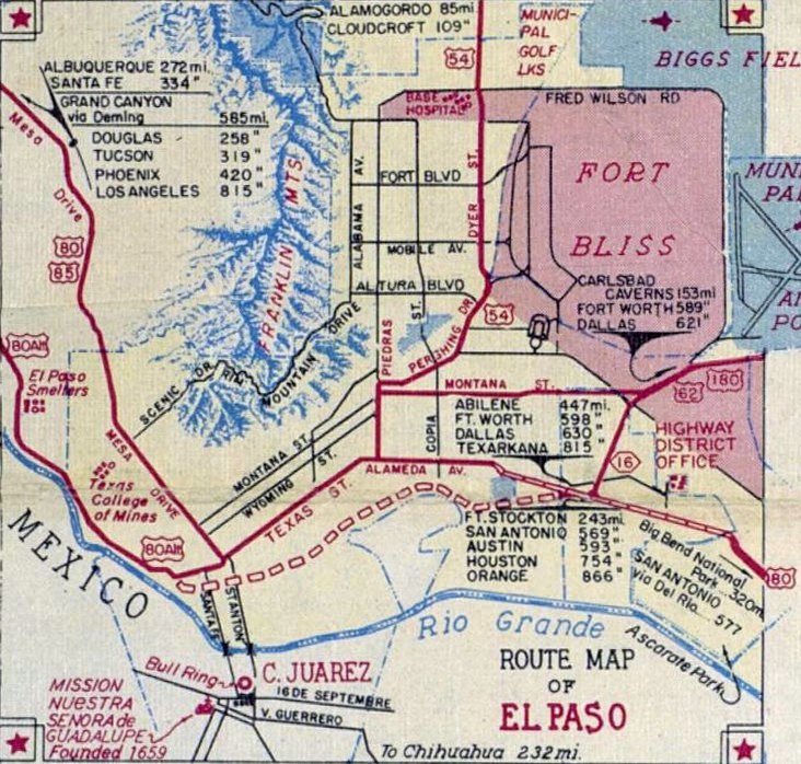
That was the same year that US 85 was extended south from Las Cruces to El Paso. It came into town on Mesa, co-signed with US 80. But it did not go all the way to the international boundary, as it does today. The 1949 map shows it ending at -- you guessed it -- the same intersection:
|
|
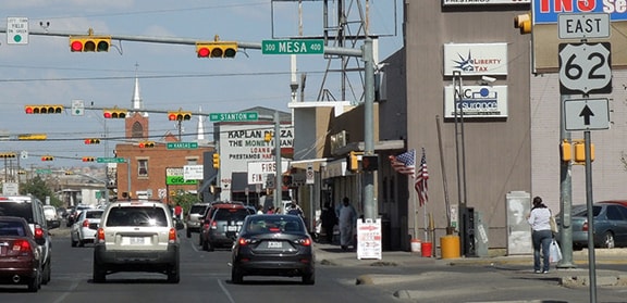
That was looking southeast on Mesa. It is nice that there is a TX 20 highway marker there (better than the lack of any signage approaching this intersection from Texas Av), but it should include a left turn arrow, because the route turns at Texas, which is the signal just ahead. Formerly this was eastbound US 80; US 85 was extended down this way in 1946, and it ended here where US 80 turned left. But for the next five years or so, that turn also marked the beginning of US 54, 62, and 180. And formerly US 366 and US 70 began there too; I do not believe any other junction can claim a total of six US route termini.
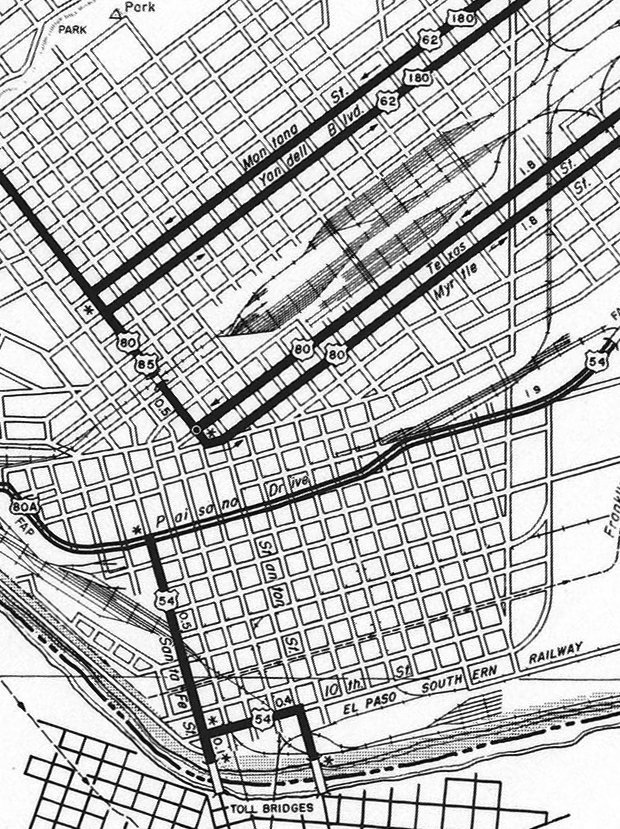
Note also that the maps above show the original ports-of-entry south of downtown, but neither Santa Fe nor Stanton streets carried a highway designation. However, Paisano Drive was opened to traffic in 1950 (the 1949 map above shows that it was under construction), so presumably it was about then that US 54 was rerouted by extending south of Alameda on Piedras, and then west on Paisano, as shown on the 1961 map here: |
|
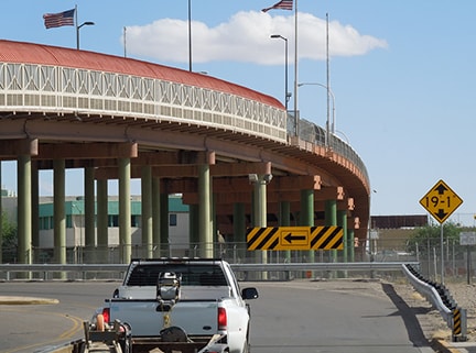
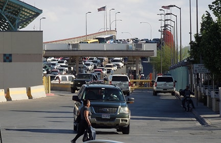
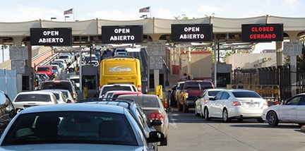
So US 54 became the first route to be signed all the way to the international boundary. Most likely the split endpoint reflected the fact that one bridge was used for entering Mexico, and the other for entering the U.S. (as is still the case today). Here we are looking south on Santa Fe Street:
|
|
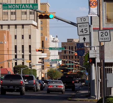
So those crossings became the end and the beginning for US 54, and later the termini for both US 62 and US 85. More on that below, but first I want to address something else that changed on that 1961 map: notice how US 62 and US 180 had been rerouted onto the Montana Avenue/Yandell Drive couplet. Apparently both routes ended at Mesa (at their junction with US 80-85), rather than overlapping back to the Mesa/Texas intersection (although US 85 is clearly shown still ending there). This photo was looking southwest on Montana at Mesa:
|
Westbound US 62-180 came in from the left on Montana, but eastbound began to the left one block ahead, on Yandell. That carried US 62-180 traffic from Mesa to Copia Street, where drivers were directed north to join westbound traffic on Montana. US 180 did not end there for long -- in 1961 that designation was extended westward out of El Paso -- but US 62 continued to end at Mesa until 1974.
|
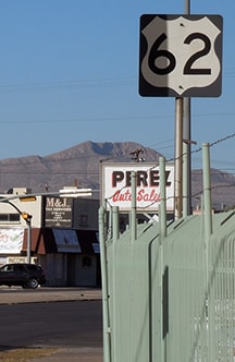
According to official TXDoT route designation files, US 54, US 62, and US 85 were all "relocated" in 1974. That basically means their routings were changed, and that is most likely interpreted thus: US 54 was redirected to a newer border crossing (known variously as Cordova, Bridge of the Americas, BOTA, and/or "the free bridge"; more info on the main US 54 page). US 62 was rerouted along Paisano, and then used Stanton and Santa Fe to new termini at the original border crossings downtown (the former endpoints of US 54). US 85 was also rerouted onto Paisano, and it joined US 62 to end at the downtown ports-of-entry. This is a photo of the last westbound US 62 marker:
|
|
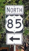
That was heading west on Paisano, just past St. Vrain Street (part of the Sierra Juarez is visible in the background). There was no signage directing traffic to turn south on Stanton. Continuing west on Paisano, US 85 traffic comes up to Paisano via El Paso St, but for some reason there is a US 85 sign just before that intersection...
|
|
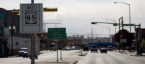
...and oddly it says "West", which makes one wonder if it was supposed to be a US 62 marker. And that sign appears to be variable, but it is unclear what it might be changed to. Regardless: after US 85 officially joins westbound Paisano, the first confirming marker is at Coldwell, where Paisano bends back to the left at the train depot:
|
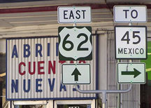
No US 85, but there is a repurposed Texas state highway sign referencing Mexico highway 45 (there are actually quite a few of these in the area, including some that are placed in perplexing locations). Until 2019, traffic coming in from Mexico (using the El Paso St. crossing) was immediately on US 62-85, but this was the lone sign that greeted those arriving in the U.S.:
|
Strange how US 62 was signposted, but not US 85. Based on the signage in this area, one could easily get the impression that US 85 does not actually make it to the border. Officially, both routes still do actually begin and end at the border, but in 2019 TXDoT removed the US 62-85 designations from El Paso St, so now those routes exist only along Stanton. Strange thing is, Stanton is not signposted as US 62-85 at all, whereas drivers on El Paso do encounter some highway signage around the intersection with Paisano:
|
So things are kind of screwy now: drivers coming in from Mexico on El Paso St. are not on a designated highway (even though there are still some highway signs on El Paso). On the other hand, drivers leaving the U.S. via Stanton St. are on a designated highway, even though there are no signs to indicate that.
That leaves only one more change in terms of endpoints, and it is unclear what year this happened, but at some point, US 54 was changed slightly, such that it no longer goes all the way to the BOTA crossing, but rather it ends nearby at its interchange with TX 375 (the Border Highway). Photos from that terminus are on the main US 54 page.
That leaves only one more change in terms of endpoints, and it is unclear what year this happened, but at some point, US 54 was changed slightly, such that it no longer goes all the way to the BOTA crossing, but rather it ends nearby at its interchange with TX 375 (the Border Highway). Photos from that terminus are on the main US 54 page.
Research and/or photo credits: Raymundo Aguirre; Chris Elbert; Karin and Martin Karner; Dale Sanderson
Page originally created 2006;
last updated Sep. 21, 2019.
last updated Sep. 21, 2019.
