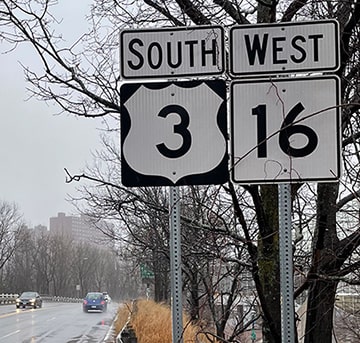
End of US highway 3 |
 |
|
1926-1928
|
1928-1938
|
1938-present
|
Summa
|
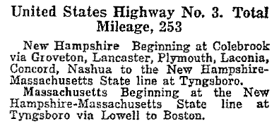
Mileage: in 1989 AASHTO listed a figure of 279 miles for US 3... however, that included the mileage of US 3's associated business route. According to the state subtotals on AASHTO's 1989 spreadsheet, mainline US 3's actual end-to-end total at the time was 273 miles. That closely matches our own 2020 measurement, which yielded 277.6 miles (reroutings and realignments likely explain the difference).
|
|
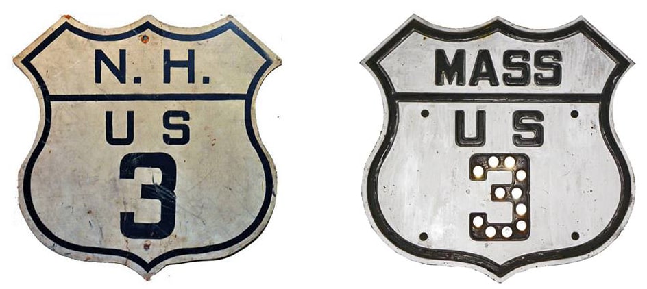
US 3 was among the original routes commissioned in 1926. In the inaugural route log, its north end was listed as Colebrook:
Why there? Colebrook was the north end of pre-1926 New England Interstate Route 6. But the road north of there (along the east bank of the Connecticut River) was being improved during this time, and apparently it was always the intention that the US 3 designation would be extended further north as these segments were completed:
|
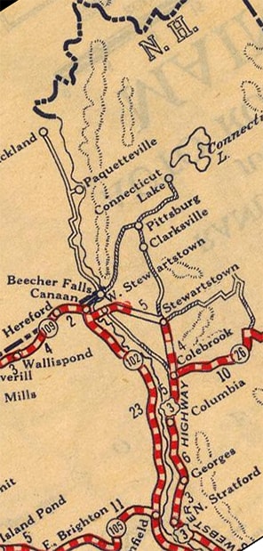
c. 1927, Rand McNally
|
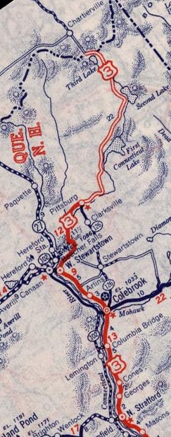
c. 1939, Rand McNally
|
|
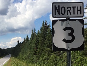
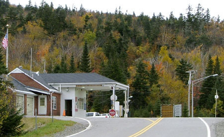
Already by 1928 US 3 went as far as West Stewartstown, and by 1937 it had been extended to Pittsburg (some photos from along this stretch of US 3: start there and continue to the right). It was the next year (1938) when New Hampshire's lone border crossing (in Connecticut Lakes State Forest) first opened... although, at the time, the northernmost 22 miles were gravel, and in winter the road was not plowed north of Second Connecticut Lake. This first shot shows the approach from Canada:
|
Sanderson, Oct. 2004
|
|
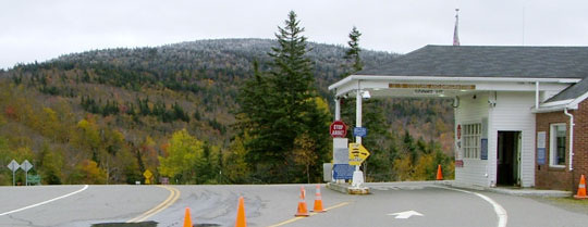
U.S. customs is on the right, and the north beginning of US 3 is straight ahead. Just ahead, a ways down the hill, is the first southbound marker:
|
Sanderson, Oct. 2004
|
Bourey, Jul. 2020
|
|
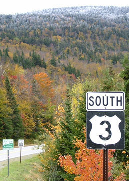
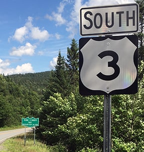
Heading the opposite direction, the last northbound reassurance marker is between 2nd and 3rd Connecticut Lakes:
|
Sanderson, Oct. 2004
|
Bourey, Jul. 2020
|
|
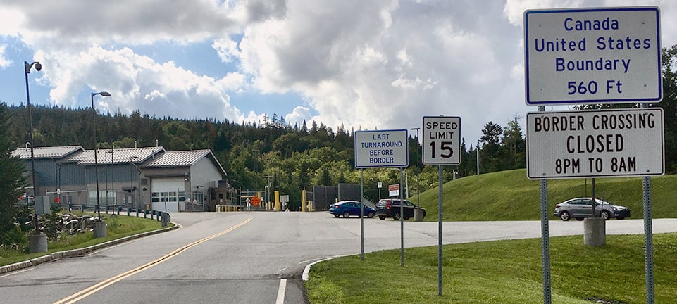
Here we are approaching the end of US 3, and the other side of the US customs building is visible at left:
|
Sanderson, Oct. 2004
|
Bourey, Jul. 2020
|
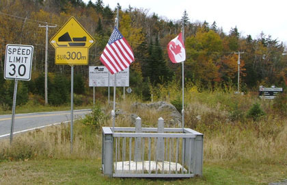
In this region, the US/Canada border runs along the ridge that divides watersheds flowing northward (to the St. Lawrence River) from those that flow southward (in this case into Long Island Sound, but just east of here into the Gulf of Maine). For that reason, the border crossings in this area are situated on mountain passes. On the crest just ahead is a small monument marking the international boundary:
|
Sanderson, Oct. 2004
|
|
Just ahead is Canadian customs, and just past that (at the south beginning of Quebec provincial highway 257) is the signage shown here:
|
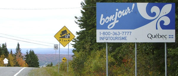
Sanderson, Oct. 2004
|
|
When I first saw that 13% grade sign, I thought "No way can it be that steep -- maybe they measure these things differently in Canada..." But no, it really is a 13% grade -- check out this photo, taken just ahead:
|
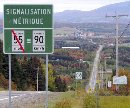
Sanderson, Oct. 2004
|
That is quite a hill leading down into Chartierville, visible in the distance. Looking at a map, I had always wondered why there are so many more roads on the Canadian side, and why their roads seem so much straighter than those on the US side... could the topography really be that much flatter on the Canadian side? Based on what I observed during my three-hour drive through Quebec (where I drove on grades of 10% or more at several points between here and Jackman Maine), I think the Canadian roadbuilders simply tended to ignore topography more than the Americans. If they wanted a road connecting two points, they simply surveyed a straight line and built it, even if there was a mountain in the way.
|
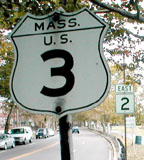
US 3 is quite short (less than 300 miles), but despite that, there is a marked contrast between its two endpoints. The south terminus of US 3 has been in the Boston area from the outset. Historically, when US 1 ran along surface streets through town, the US 3 designation went south from Memorial Drive, over the Boston University Bridge, to end at its junction with US 20. This map illustrates historic US routes in this part of Boston (US 1 is highlighted in yellow, US 3 is pink, and US 20 is blue):
|
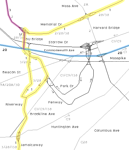
Moraseski/Sanderson
|
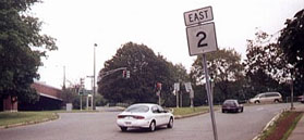
...but that has long since disappeared, and as of 2021, the last southbound marker was on Alewife Brook Parkway, right next to the Alewife "T" station, just after Concord Turnpike (MA 2) traffic joins US 3:
|
Bourey, Mar. 2021
|
|
The remaining five miles of US 3 were not signposted. Approaching the terminus, drivers encounter this interchange at the B.U. Bridge:
|
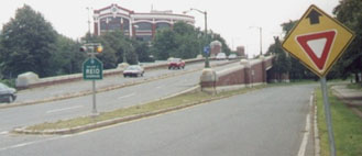
Moraseski, 2000
|
|
No signage going this direction, but according to the official state road inventory, eastbound MA 2 exits here and goes right, while southbound US 3 continues straight ahead. But first, we will exit and follow historic US 3 to its original terminus. As late as 2000, when one exited from eastbound Memorial and dropped down to Brookline/B.U. Bridge, this sign was posted...
|
Moraseski, 2000
|
|
...but it was gone by 2001. The white and black cars are on what used to be southbound US 3 as well. Just ahead, where they turn right to go over the B.U. Bridge, that was where US 3 traffic joined with US 1. As they are crossing the bridge, the sign shown here will be visible:
|
Google Maps Street View, Aug. 2009
|
|
Halfway across the bridge, drivers enter a narrow strip within Boston city limits. US 20 runs along Commonwealth Avenue, and that was where US 3 originally ended (here, Commonwealth forms the boundary between Boston and Brookline):
|
|
|
Southbound US 1 continued ahead just through the intersection, and then angled left on Mountfort Street (I-90 traffic whizzes underneath this intersection now). This interactive image is looking west on Commonwealth:
|
|
Northbound US 1 came in from the left on Carlton Street, and then jogged straight ahead before turning right onto the B.U. Bridge. That right turn also marked the south beginning of US 3.
|
Now, back to Cambridge and current southbound US 3: heading east from B.U. Bridge on Memorial, the next trailblazer in that direction is shown here:
|
Moraseski, 2003
|
|
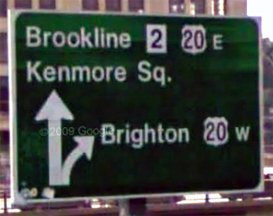
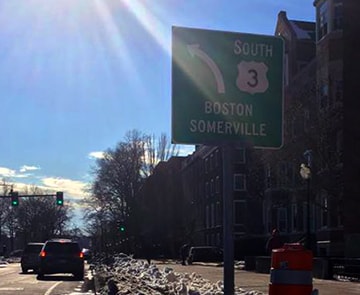
That sign (also gone now) gave the impression that US 3 actually ended back at the B.U. Bridge rotary. However, the road inventory indicates that it is actually the next interchange to the east (Massachusetts Avenue, or the Harvard Bridge) where US 3 ends and MA 3 begins:
|
Google Maps Street View, 2012
|
|
That was looking east on Memorial; the Harvard Bridge is visible on the right side of the photo. The left fork passes underneath Massachusetts, so that is technically MA 3. US 3 takes the right fork and ends at Massachusetts, which carries MA 2A.
The sign shown here is for MA 2A traffic heading north on the Bridge: |
Bourey, Mar. 2017
|
|
No mention of US 3 there, but historically that sign was a little different:
|
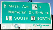
Moraseski, Sep. 2001
|
|
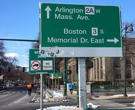
At the time, if one wanted to go left on Memorial, they had to first turn right, and then make a U-turn. That is no longer the case, so the sign was changed... and now, just ahead, on the sign at westbound Memorial, there is finally a mention of US 3...
|
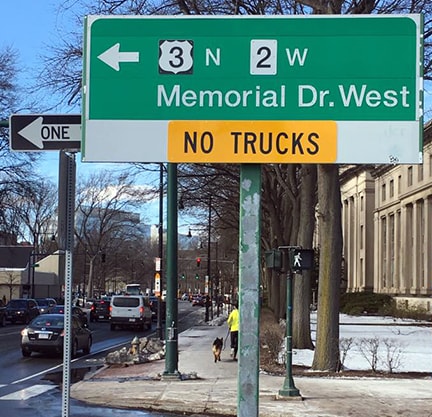
Bourey, Mar. 2017
|
|
...although that is on the right-hand side of the road, so if a driver is not already in the left lane, they are probably going to miss the turn.
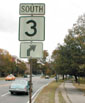
As of 2017, if one does take that left turn onto Memorial, the first reference to US 3 is for drivers who want to make a U-turn and head back the opposite direction to the south terminus! Strange... |
Bourey, Mar. 2017
|
|
The first "standard" northbound US 3 reassurance marker is not posted until after the B.U. Bridge:
|
Moraseski, Sep. 2002
|
Bourey, Mar. 2017
|
It should be noted that there are error US 3 signs (referring to what is actually MA 3) at least as far south as Kingston.
Research and/or photo credits: Chris Bianchi; George Bourey; Dave Montuori; Dan Moraseski; Dale Sanderson; Michael Summa
Page originally created 2000;
last updated Mar. 6, 2023.
last updated Mar. 6, 2023.
