End of US highway 310 |
 |
Summa
|
1926-present
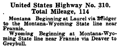
Mileage: in 1989 AASHTO listed a figure of 108 miles for US 310. That is reasonably close to our own 2020 measurement, which yielded 103.6 miles.
|
|
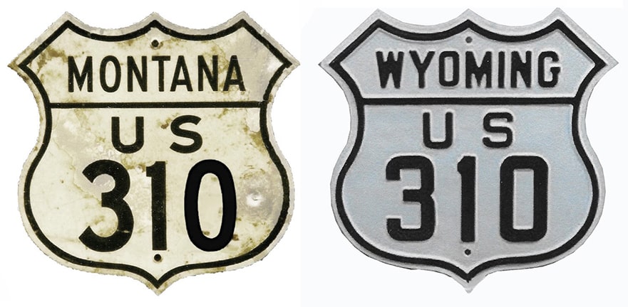
US 310 has been around since the beginning in 1926 (the preceding image was from AASHO's April 1927 route log). Its purpose was to connect US 10 at Laurel with US 20 near Greybull. Today there is no US 10 west of Fargo ND, but its "child" US 310 still hearkens back to its existence through Montana. US 310 serves as an example of a north/south branch route which had to be assigned an east/west number (because it did not connect with any other north/south routes)...
|
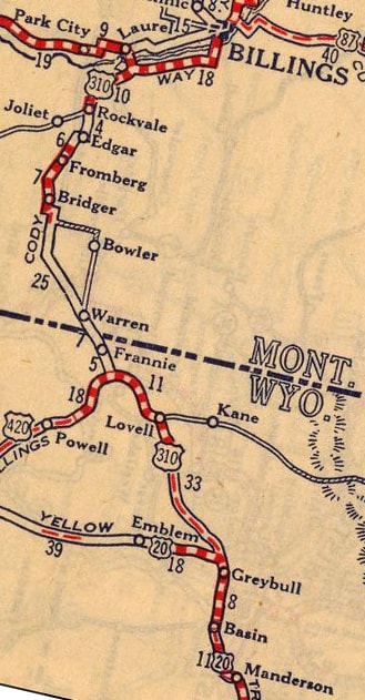
c. 1927, Rand McNally
|
US 310 begins to the right; that former sign bridge has since been replaced with ground-mounted signs:
Sanderson, Sep. 2022
|
|
Sanderson, Sep. 2022
|
|
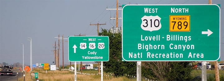
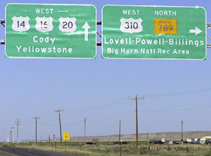
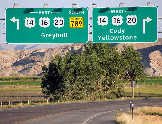
At the "east" end (or south end) of US 310, this next photo shows how the intersecting routes at the junction were signed:
|
Sanderson, Sep. 2022
|
|
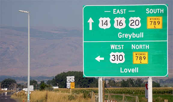
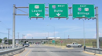
The sign bridge visible in the distance is shown close-up in these next two photos:

Elbert, July 2005
The stop sign in the distance marks the actual terminus of US 310, but there was no additional route signage ahead.
|
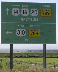
Sanderson, Sep. 2022
|
|
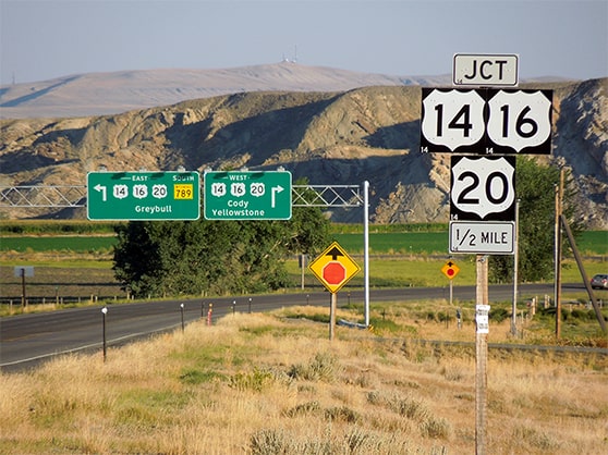
Heading to the north in 2022, there was no confirming marker, and in fact no references to US 310 at all until Lovell (a distance of 27 miles!) But here is a photo of one trailblazer heading that direction:
Winkler, Aug. 2000
|
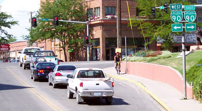
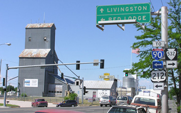
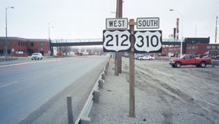
Heading into Montana from there, directional signage on US 310 changes from east-west to north-south. Today most signs indicate that the north end of US 310 is still at its junction with old US 10 (now Business I-90) in Laurel. This photo was looking north on US 310 and east on US 212, just south of the I-90 interchange:
Elbert, July 2009
|
|
In about 2013, the panels on that sign bridge were replaced, and instead of a US 212 shield on the right, there was an erroneous US 310 shield. But actually US 212 and US 310 split at that point: from there US 212 is overlapped with I-90 through Billings, all the way to the Little Bighorn Battlefield. US 310 continues north another mile or so, to its junction with Main Street, or Business I-90:
Hamilton, July 2004
|
So today, although US 310 has been orphaned, its number still bears witness to the time when its parent, the once-grand US 10, ran through these parts. Heading east on Main, the signage looks like this:
Hamilton, July 2004 (still there as of 2021)
|
|
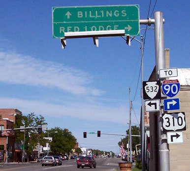
It is unclear whether the "TO" banner was meant to apply only to I-90, or to US 310 as well. Heading the opposite direction, there was a US 310 sign posted as if Business I-90 is US 310...
Elbert, July 2009
|
...but probably the intention was to have a left-arrow included there, because there is no mention of US 310 on the upcoming assembly:
Elbert, July 2009 (replaced later that year; verbiage same as of 2021)
|
|
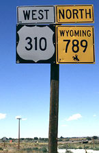
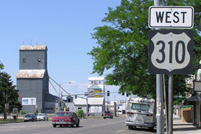
Sometime between 2009-2018 a crew replaced the highway signs in Laurel, and that "West 310" sign was simply replaced in-kind instead of being fixed:
Balaguy, 2020
|
Anyway, if a driver took that left turn ahead, they would not see the first confirming marker until south of I-90:
Sanderson, Mar. 2000
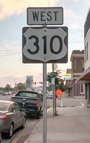
It seems US 310 is predominantly signed north-south in Montana, except for the "West 310" sign shown above, and except for some signage around the US 212 split at Rockvale.
|
Research and/or photo credits: Nathan Balaguy; Chris Elbert; Alan Hamilton; Dale Sanderson; Michael Summa; Jonathan Winkler
Page originally created 2000;
last updated Sep. 6, 2022.
last updated Sep. 6, 2022.
