End of US highway 60 |
 |
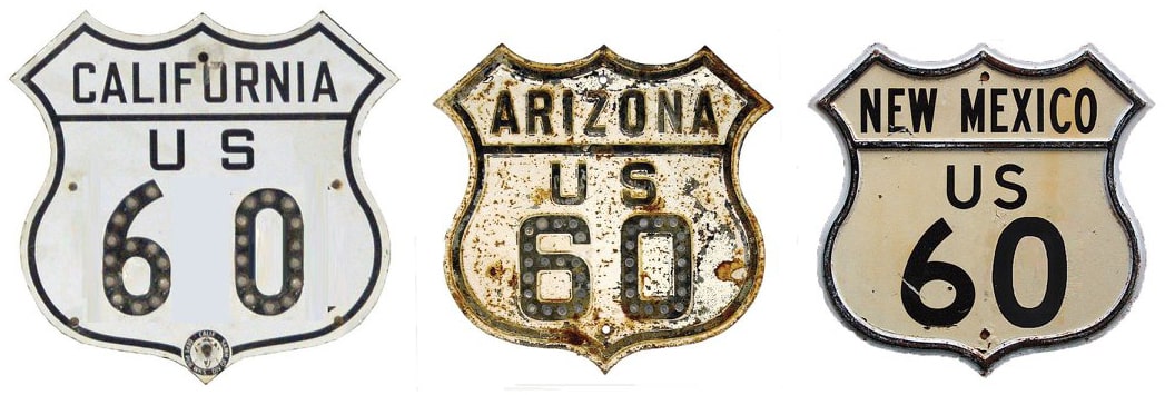
Summa
|
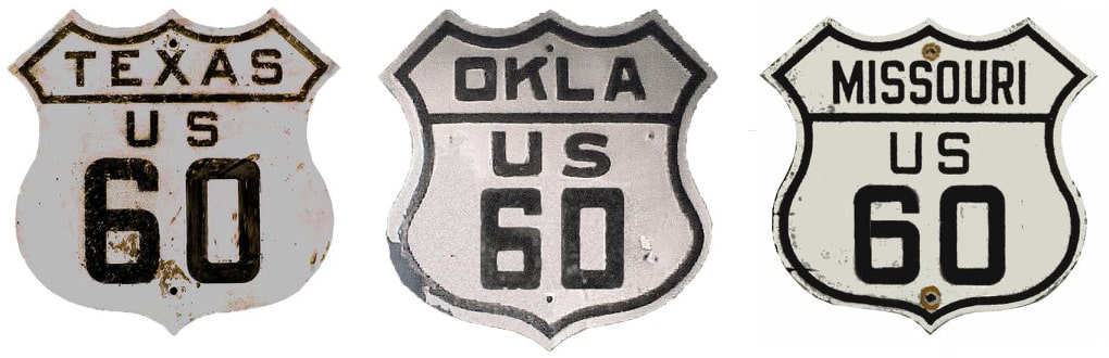
Summa
|
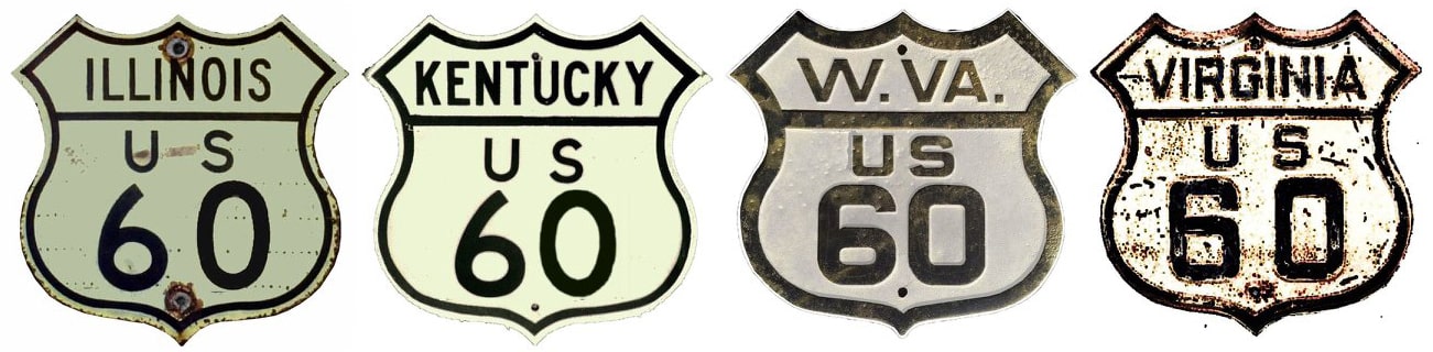
Summa
|
|
|
1926-1930
|
1930-1931
|
1931-1965
|
1965-1969
|
1969-present
|
Mileage: in 1989 AASHTO listed a figure of 2748 miles for US 60... however, that included the mileage of US 60's associated business/bypass/alternate routes. According to the state subtotals on AASHTO's 1989 spreadsheet, mainline US 60's actual end-to-end total at the time was 2670 miles. That is reasonably close to our own 2020 measurement, which yielded 2654 miles (reroutings and realignments likely explain the difference). That puts the midway point of US 60 in Fairland OK. When US 60 went all the way to California, it was 2910 miles long, and at that time its midpoint was between Ponca City and Burbank OK.
|
The east end of US 60 has always been in the Hampton Roads area of Virginia, and specifically in Virginia Beach since 1930. The history of US highway endpoints in that area is quite complex, and even controversial: I have probably spent more time researching this terminus than any of the other 1300+ endpoints. It is all detailed on the Virginia Beach page, but for those who may not be interested in reading through all that material, here is a quick answer to the question of where US 60 ends: this sign is posted at the south end of the Rudee Inlet bridge, just past the point where Pacific Avenue becomes General Booth Boulevard:
|
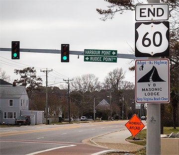
James, Feb. 2016
|
Heading west from Virginia Beach, originally the US 60 designation made it only as far as Springfield. Within a few years, it had been extended to Amarillo, and after one more year, US 60's western terminus was in Los Angeles (more details on each of those pages). US 60 served Los Angeles for over 30 years. During that time, it was essentially a coast-to-coast route, but California put an end to that when they began eliminating their US routes. Starting in 1964, US 60 may have been truncated incrementally, but by 1965 CalTrans had cut off the route at its junction with US 95 in Blythe, just shy of the Arizona border. Note that although Blythe was the official endpoint, in practice CalTrans probably eliminated US 60 signage from the entire state, including the short segment east of Blythe. Actually US 60 no longer had any independent routing west of its current terminus near Brenda, at I-10's exit 31, and Arizona may have stopped co-signing US 60 along I-10 between Brenda and the California line as early as 1969. But the states did not make that official with AASHTO until 1982; here is that agenda item from the minutes of their meeting in November of that year:
|
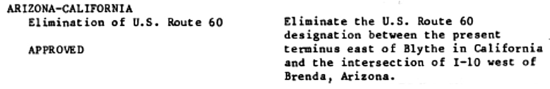
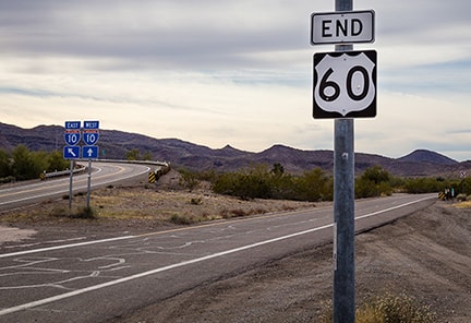
As of 2016 the last westbound marker was posted at the west edge of Brenda:
|
Sanderson, Oct. 2023
|
|
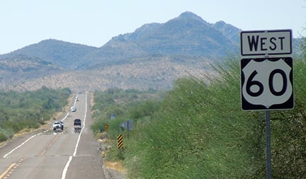
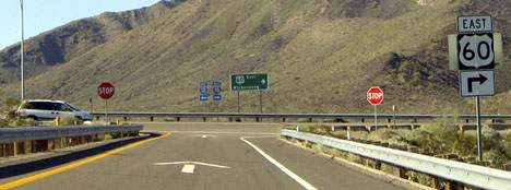
The I-10 junction is about three miles ahead, where one comes to the scene shown here:
|
Hamilton
|
|
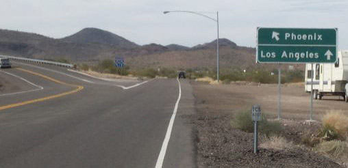
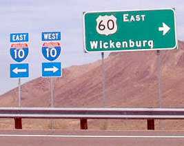
At the time there was no end sign; only markers indicating options at the I-10 interchange. But sometime after 2004, most of the signs at this junction were replaced; note the Clearview version of that same sign, shown here...
|
Kaiser, July 2008
|
|
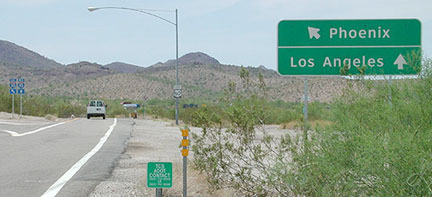
...and what was that mounted on the lightpole in the distance? It is shown close-up here:
|
James, Jan. 2016
|
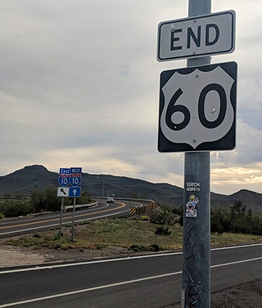
Fox, Mar. 2019 (same as of 2023, except more stickers)
|
|
That is a welcome addition. Originally, US 60 continued straight ahead, along the corridor now occupied by I-10. West of here, it was co-signed with US 70, roughly following today's I-10 all the way into L.A. Here is a view of the exit to US 60 as seen from eastbound I-10:
|
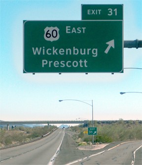
Karners, Jan. 2012
|
|
Traffic exits to the right, crosses the bridge visible in the background, and then continues roughly the same direction as this photo. This next shot is from the opposite direction (westbound I-10)...
|
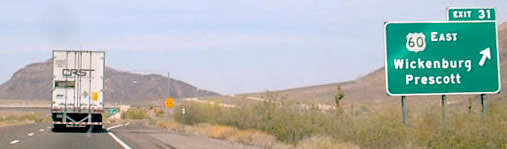
Field, 2003
|
|
...before the green sign was replaced with a Clearview version. Upon exiting there, drivers are presented with this sign:
|
Field/Nitzman, Jan. 2005
|
|
The white car has just exited from the opposite direction (eastbound I-10) and crossed over the freeway. The signage in the distance is shown close-up here:
|
Field, 2003 (now replaced with Clearview version)
|
|
Left goes across the overpass to the eastbound onramp. The road to the right curves and merges to join the historic alignment of US 60, which now only goes east from here. Heading that direction, this sign soon came into view:
|

Field/Nitzman, Jan. 2005 (gone as of 2016)
|
|
That was the first eastbound confirming marker from the beginning of US 60. Next is a close-up photo of the mileage sign visible in the distance:
|
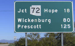
Field/Nitzman, Jan. 2005
|
|
By making just a little bit better use of the space on that sign, one more destination could have been added, and my suggestion would be: Virginia Beach - 2654 miles. That sign has since been replaced with a Clearview version: the content is the same, except there is no reference to "Hope", and there is no space to add another control city. Brenda itself is about three miles in that direction, and as of 2016 that is how far one must drive before encountering the first eastbound US 60 marker (apparently the one shown above is gone):
|
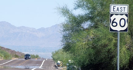
Sanderson, Oct. 2023
|
Research and/or photo credits: Mike Ballard; Jake Bear; Nathan Edgars; Andy Field; Joe Fox; Alan Hamilton; Robert James; Cameron Kaiser; Karin and Martin Karner; Jeff Morrison; Alex Nitzman; Dale Sanderson; James Schecter; Michael Summa
Page originally created 1999;
last updated Dec. 17, 2023.
last updated Dec. 17, 2023.
