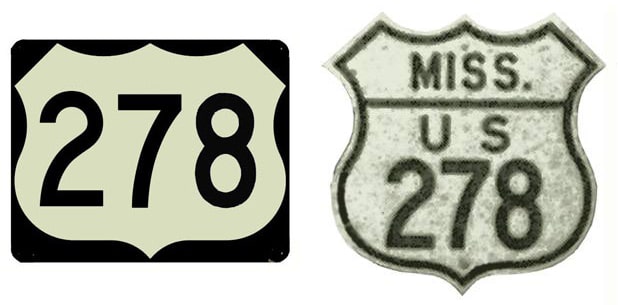
End of US highway 278 |
 |
Summa
|
Summa
|
|
1951-1954
|
1954-1964
|
1964-1967?
|
1967?-1997
|
1997-present
|
|
Mileage: in 1989 AASHTO listed a figure of 605 miles for US 278... but at the time, US 278 still ended near Amory. Since then it has been extended to Wickes, and our own 2020 measurement yielded 1073.9 miles. Historically (prior to the toll road in Hilton Head) it was 1077.3 miles long.
|
|
|
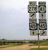
US 278 was commissioned in 1951; that makes US 278 a relative latecomer to the US route system. At the time it functioned as an alternate route for US 78, connecting to that highway both at its west terminus (in Tupelo) and on its east (in Guin). By the time of this map, US 278 had been extended further east (more on that below), but nevertheless it is adequate for illustrating the very short original route of US 278:
|
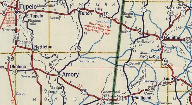
c. 1956, Gousha
|
|
This image was looking north along Gloster Street at Main Street. Today this is MS hwy. 145, but it was once northbound US 45 (which continued straight ahead). Also straight ahead was eastbound US 78, and westbound was to the right on Main, so US 278 ended at this junction. Today this is a quite non-descript intersection with no highway signage, although there is a very cool vintage neon sign on the northeast corner:
|

Aug. 2009, copyright DeepFriedKudzu.com
|
|
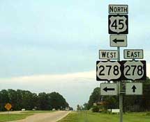
Heading the opposite direction, US 45-278 were overlapped for about 22 miles, where US 278 finally split off on its own... and it went only as far as Guin: a very modest distance of another 44 miles. At Guin, instead of approaching town from the south as it does today, US 278 came in on what is now AL hwy. 142, ending at its junction with US 43 (which was also US 78 at the time). This photo was looking south on 11th Street:
|
Nelson, July 2006
|
Today that is US 43 and US 278, which split there. But originally US 278 began to the right on 11th Avenue, or AL 142 (which was not referenced on that assembly).
|
|
But that endpoint did not last for long: in 1954 US 278 was extended east from Guin to Georgia. At Thomson it rejoined with US 78, and the two routes overlapped into Augusta:
|
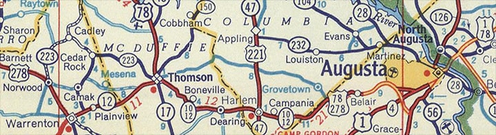
c. 1956, Gousha
|
|
Initially, US 278 came into town on Milledgeville Road, along with US 1 and US 78. It is not clear from this map exactly where US 278 ended...
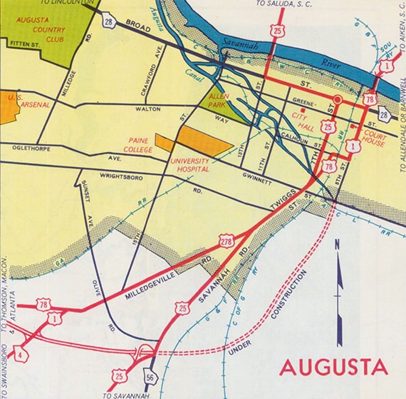
c. 1955, GA DoT
|
...but highway routes through Augusta were soon changed anyway. This inset suggests that US 278 ended on 5th Street at Broad Street:
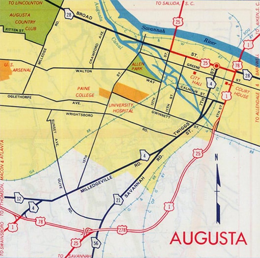
c. 1957, GA DoT
|
|
At Broad, US 1-78 continued straight, US 25 turned west, and US 278 probably ended. This image is looking west on Broad. Today US 1-25-78-278 is on an overpass just behind the camera. But during the 1950s and '60s, straight ahead was northbound US 25, while southbound was to the left on 5th. Also to the left was US 1, US 78, and the east beginning of US 278:
|
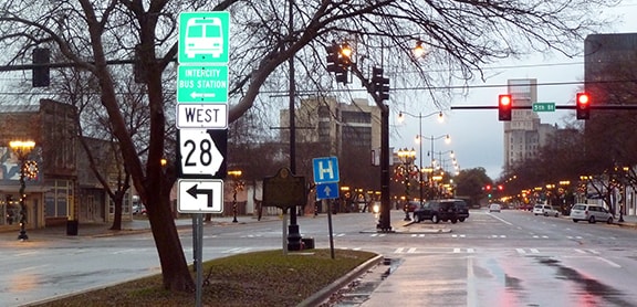
Karners, Dec. 2016
|
|
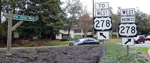
In 1964, US 278 was extended further east, this time to Hilton Head Island. At the time, Cross Island Parkway did not exist, so US 278 followed William Hilton Parkway (today's Business 278) all the way through the island. Initially, US 278 turned towards the beach via Pope Avenue, and ended at Coligny Circle (which is where Pope ends at its junction with Forest Beach Drive). This map shows the historic endpoint (the circle at lower right) in relation to the current endpoint (circle at upper left):
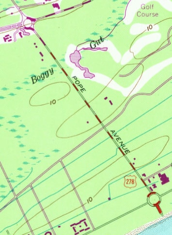
c. 1971, USGS
|
This image is looking southeast on Pope at Coligny Cir/Forest Beach, and it shows US 278's first Hilton Head endpoint:
Karners, Jan. 2017
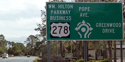
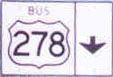
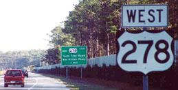
That was the case until about 1975, when US 278 was cut back to its current terminus at Sea Pines Circle (where Pope, Hilton Pkwy, Palmetto Bay Road, and Greenwood Drive converge). This shot was looking southwest on Hilton Pkwy, at the former east end of US 278...
Dawson, Dec. 2001
...which is now the east end of Business 278. Today US 278 begins at the first exit to the right, or Palmetto Bay Rd. That becomes Cross Island Parkway, connecting to the original US 278 towards the north end of the island.
|
|
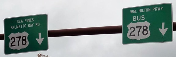
These photos were taken looking southeast on Palmetto Bay. The toll highway behind the camera opened in 1998. US 278 is now routed onto it, and the designation ends at the rotary ahead:
|
Prince, Aug. 2001
|
Karners, Jan. 2017
|
|
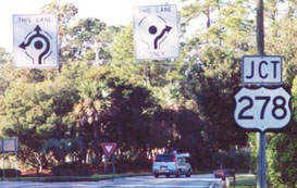
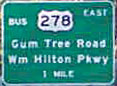
Northeastbound Hilton Parkway is the beginning of Business US 278. Before Cross Island, that was the east beginning of mainline US 278. These photos show the signage further ahead at the rotary, where the designation actually ends:
|

Dawson, Dec. 2001
|
Karners, Jan. 2017
|
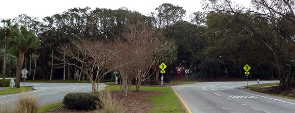
These next shots were taken approaching the rotary from the opposite direction (northwest on Pope Avenue):
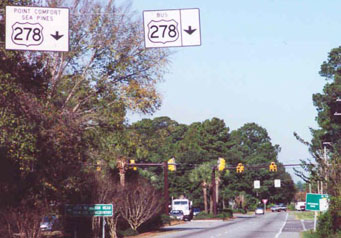
Dawson, Dec. 2001
|
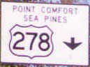
(detail)
(detail)
|
Karners, Jan. 2017
|
Dawson, Dec. 2001
|
Karners, Jan. 2017
|
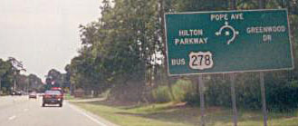
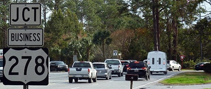
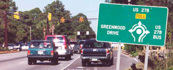
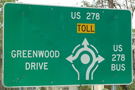
The east beginning of US 278 is straight ahead now (second exit). But the first exit to the right on Business 278 (or Hilton Pkwy) was formerly the east beginning of mainline 278. These photos show the perspective heading that direction from the rotary:

Dawson, Dec. 2001
|
Karners, Jan. 2017
|
|
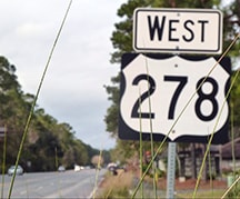
Historically, drivers heading out on Palmetto Bay (mainline US 278) did not see the first confirming marker for another four miles (after they had gone through the toll booth)... and at that point, they were nearly back to the junction with old 278 (now Business 278)...
|
Dawson, Dec. 2001
|
(detail)
|
|
...however, as of 2017, a newer confirming marker had been posted just a fraction of a mile north of Sea Pines Circle:
|
Karners, Jan. 2017
|
As of June 2021, Cross Island Parkway (mainline US 278) is no longer tolled.
|
|
Back to the west end: sometime around 1967, US 278's concurrency with US 45 was eliminated, as the route was truncated to its junction with US 45, which is about eight miles west of Amory. This photo was taken looking east at that junction:
|
Nelson, Aug. 2005
|
Formerly the west beginning of US 278 was straight ahead.
Here, we are looking the opposite direction; historically this was the west end of US 278: |
Nelson, Aug. 2005
|
|
At their Nov. 1997 meeting, AASHTO approved re-extending the US 278 designation north from there with US 45, through Tupelo again, and then further west via a convoluted route all the way to its current terminus at Wickes:
|
Ivy/Nitzman, Oct. 2021
|
|
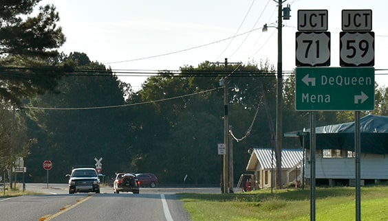
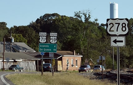
That is where US 278 ends, at its junction with US 59-71. There was no "End" sign, but that junction signage is an improvement over what was there in 2007 (no signage whatsoever). This next photo shows the west beginning of US 278, as signposted for northbound traffic:
|
Backlin, Nov. 2007
|
|
That was looking north on US 59-71; the west beginning of US 278 is to the right. This photo was looking the opposite direction:
|
Ivy/Nitzman, Oct. 2021
|
|
That was from southbound US 59-71. For travelers who take that left turn, the first eastbound marker soon comes into view:
|
Ivy/Nitzman, Oct. 2021
|

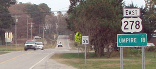
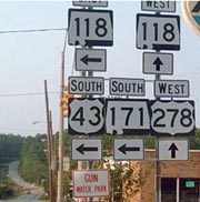
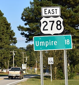
When US 278 was extended into Arkansas, it replaced state hwy. 4, but the routes were dual-signed during a transitional period.
Research and/or photo credits: David Backlin; David Dawson; Adam Froehlig; Brent Ivy; Karin and Martin Karner; Jeremy Lance; Steven Nelson; Alex Nitzman; Adam Prince; Dale Sanderson; Michael Summa
Page originally created 2000;
last updated Dec. 10, 2023.
last updated Dec. 10, 2023.
