Southeast corner of New Mexico
|
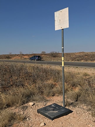
This photo was taken looking northeast. For reference, my car in the background was parked on the shoulder of northbound Texas Farm-to-Market Road 1218 (which runs due north-south just a few feet east of the NM-TX border). The black plate is situated on the southeast corner of New Mexico:
|
|
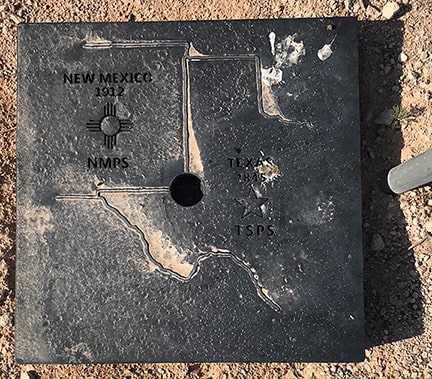
This point can be described as an interior corner of Texas, which "wraps" around the marker in a 270 degree arc. Winkler County TX encompasses the majority of directions from this plate, including straight ahead (NE), to the right (SE), and behind the camera (SW). But the 90 degree arc to the left (NW) is part of Lea County, New Mexico.
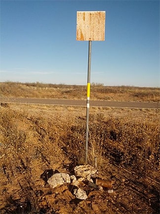
This point was first established during an 1859 survey, and was intended to mark the intersection of 32 deg. north latitude and 103 deg. west longitude (although due to an inaccuracy in the survey, it is over two miles west of the actual meridian). The current plate was installed in 2015. This photo was taken just prior to that, and shows what the corner looked like before re-monumentation: |
|
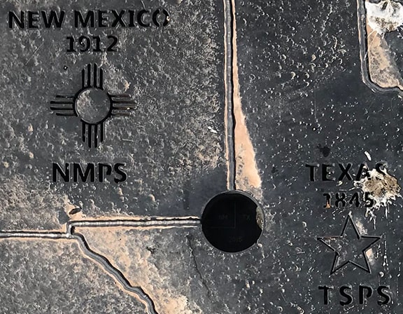
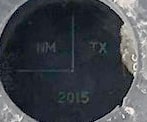
The hole in the plate is there to provide surveyors access to the actual benchmark, which is situated directly underneath. By magnifying the photo and adjusting the levels we can begin to make out some of the embellishments on the benchmark:
For much more detail about the history of this corner, please refer to this fascinating article, which was written by one of the surveyors who participated in the 2015 re-monumentation project (or if that link is broken, click here).
|
Research and/or photo credits: Dale Sanderson; "Anjbe" (Wikipedia contributor)
Page originally created 2021;
last updated Jun. 04, 2023.
last updated Jun. 04, 2023.
