End of US highway 7 |
 |
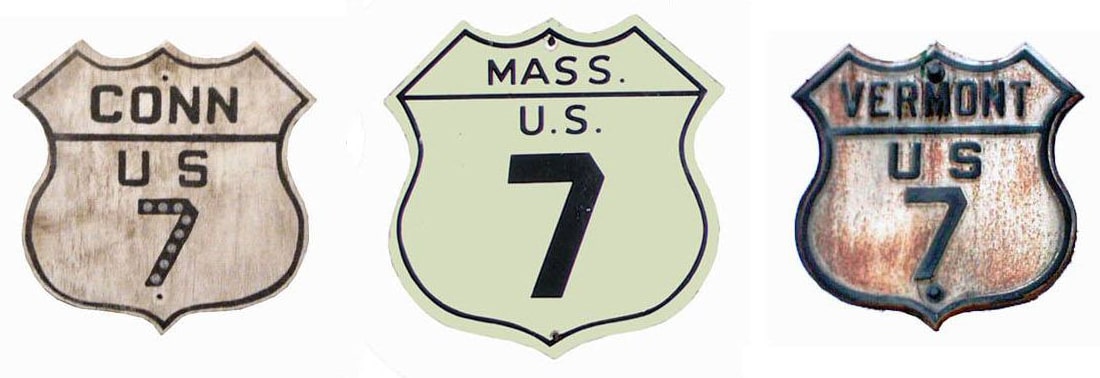
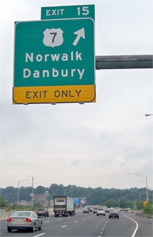
Summa
|
|
|
Mileage: in 1989 AASHTO listed a figure of 309 miles for US 7. That closely matches our own 2020 measurement, which yielded 307.9 miles.
The original plan for US 7 had it going through only the northwest corner of Connecticut before entering New York and following today's NY hwy. 22 all the way down to its junction with US 1 in Manhattan. At the time, US 1 (later NY 1A) would have run east-west on Houston Street, and US 7 would have run north on Lafayette Street (NY 22)...
|
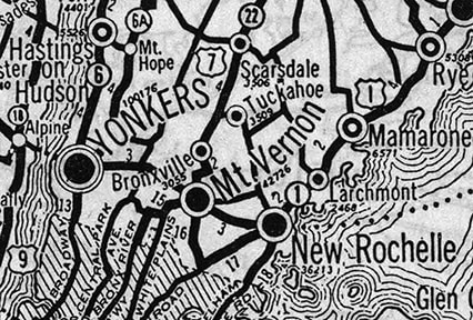
c. 1927, Rand McNally
|
|
...however, New York never signposted US 7 (no US routes were signed at all in New York City until after 1931). And already by April 1927 AASHO's route log showed US 7 rerouted to go through western Connecticut and end in Norwalk. Until some time after 1951, US 7 ended on Main Street at the intersection with Wall Street (today's US 1 was formerly US 1A, while mainline US 1 traffic used Wall). Here is an historic view of that intersection:
|
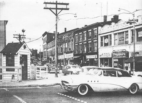
c. 1955, from a redevelopment booklet
|
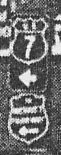
(detail, showing US 7 marker and a Merritt Parkway shield)
|
|
During this era, Connecticut used colored US markers through the cities: US 7 was blue, US 1 was red. At some point (no later than 1959), US 1 was rerouted to its current path through Norwalk. So then US 7 began where CT hwy. 123 begins today:
|
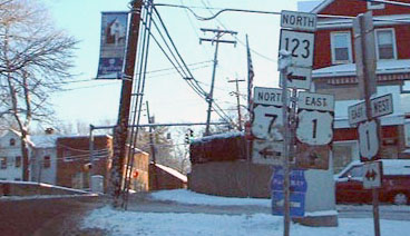
Kerr, Jan. 2002
|
|
Interestingly, there was still a US 7 shield installed, directing traffic north on Main -- that probably dates back to when US 7 really did begin to the left. But US 7 has not used Main since the 1980s, when US 7 traffic was diverted over to today's freeway. Now the south end of US 7 is at its interchange with the Governor John Davis Lodge Turnpike (I-95). Just before that interchange, the last southbound sign is posted:
|
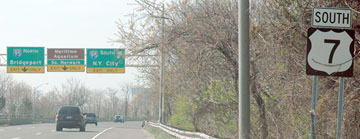
Mortell, May 2007
|
|
"End US 7" would be a more appropriate assembly at that point (since the route essentially ends at the sign bridge just ahead), but that does function as a confirming assembly for US 1 drivers who have just entered US 7. A close-up of the signage ahead is shown in this photo...
|
Nitzman, June 2005
|
|
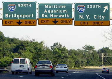
...although that was taken before "Maritime Aquarium" was changed to a brown panel (that center lane leads to a local road). This shot shows a sign on northbound I-95 for the south beginning of US 7...
|
Nitzman, July 2004
|
|
...and here is signage from southbound I-95...
|

Kerr
|
Karners, Aug. 2010
|
|
Drivers who take that exit will soon see the first northbound marker...
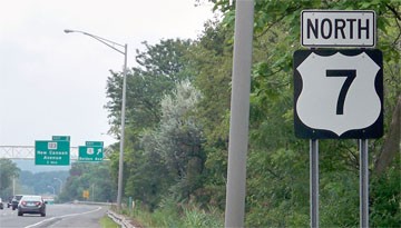
Karners, Aug. 2010
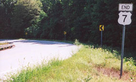
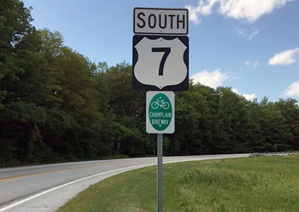
...and the last such marker is located about 300 miles ahead, shown here:
|
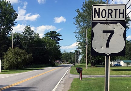
Bourey, Jul. 2019
|
|
About six miles further ahead, the north end of US 7 was originally at the Canada border, outside Highgate Springs...
|
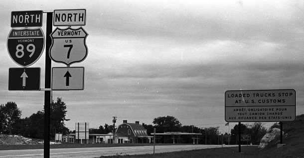
c. 1966, courtesy of Doug Bassett
|
|
...however, the northernmost segment of US 7 was paved over when I-89 was built, and now the designation has been truncated to the northernmost interchange on I-89 (exit 22). Heading northbound on I-89 and taking that last exit, travelers are greeted with the signage shown here:
|
Field, Aug. 2007
|
|
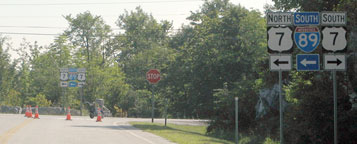
From that, one could easily get the impression that US 7 must continue up to the Canada line. However, as one takes that left turn, US 7 immediately curves west over the interstate (just south of the customs facility), and then curves again, back around to the south. On that last curve, this sign was posted...
|
Field/Nitzman, July 2000 (still there as of 2007)
|
|
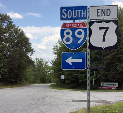
...which was a bit prior to the actual terminus of US 7 just ahead, at the on-ramp that leads back southbound, via I-89:

Field/Nitzman, Aug. 2007
In 2010 a new assembly combining both signs was posted at that junction. So yes, when one reaches the north terminus of US 7, they are actually heading south:
|
Bourey, Jul. 2019
|
|
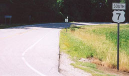
To the right is a visitor center, and straight ahead dead-ends in a country club. This photo was taken more or less across the road, looking the opposite direction:
|
Field/Nitzman, July 2000
|
Bourey, Jul. 2019
|
|
Despite the sign, we are actually facing north there; US 7 crosses I-89 to the right and keeps curving until it commences a more southerly direction of travel. This view was looking north from that overpass:
|

Field/Nitzman, July 2000
|
That is the north end of I-89, and it is also where the historic north end of US 7 was located. Today southbound US 7 continues to the right from this overpass, and then curves south into Highgate Springs.
Research and/or photo credits: George Bourey; Andy Field; Karin and Martin Karner; Doug Kerr; Dan Moraseski; Robert Mortell; Alex Nitzman; Dale Sanderson; Michael Summa
Page originally created 2000;
last updated Feb. 19, 2021.
last updated Feb. 19, 2021.
