End of US highway 830 |
 |
|
US 830 measured 201.7 miles in total length.
|
|
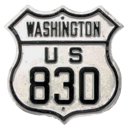
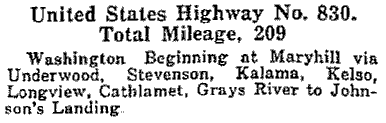
Claim to fame: US 830 had the highest number of any US route. There were never any US 9xx designations, and US 830 was the only 8xx. Following is how the route was described in AASHO's Apr. 1927 route log:
|
|
|
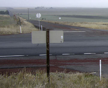
US 830 was entirely in Washington, running along the north bank of the Columbia River, connecting US 97 to US 101. It never connected with its implied "parent" (US 30), but that route ran (and still does run) along the south bank in Oregon, right across the river from US 830. This first photo was looking west on WA hwy. 4 where it ends at US 101:
|

Wiley, Aug. 2001
|
|
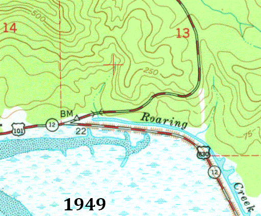
That is the modern functional equivalent of US 830's terminus (the town of Naselle is about five miles behind the camera). However, historic topo maps reveal that junction did not exist prior to the 1980s, and that US 830's endpoint was actually a half-mile further west:
|
|
|
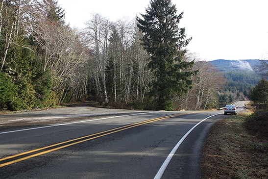
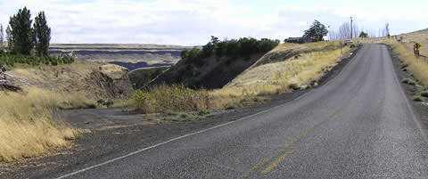
This is the junction that was described as "Johnson's Landing" in the 1927 route log (above). This image was taken looking east on northbound US 101. The road visible at left was US 101's original alignment, while straight ahead was historically the west beginning of US 830:
|
Elbert, Feb. 2017
|
|
That segment of historic US 101 is no longer open to vehicles. Today US 101 continues ahead for about a half-mile, and then makes a left turn to the north. After another half-mile or so, it rejoins the original alignment.
This photo was looking the opposite direction (west, on southbound US 101). Historically US 101 traffic came in from behind the tree at far right, so this was the perspective of a driver at the west end of US 830: |
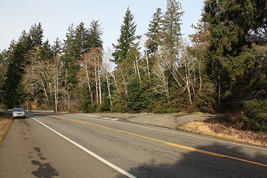
Elbert, Feb. 2017
|
|
Until the mid-1930s the highway running along the north bank of the Columbia (today's WA hwy. 14) was not complete between Lyle and Maryhill. So when US 830 was first commissioned, traffic was routed northeast out of Lyle, along what is now known as the Centerville Highway: through its eponymous town, ending at US 97 about four miles south of Goldendale. This 1927 map attempted to illustrate that (note the lack of a road between Maryhill and Lyle):
|
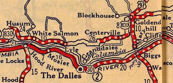
c. 1927, Rand McNally
|
|
The old routing of US 830 was still shown on this map, even though by this time the "new" US 830 had been completed between Lyle and Maryhill:
|
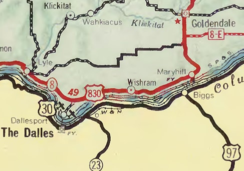
c. 1939, WSDoT
|
|
This photo shows the signage at that original endpoint. Goldendale is to the left via northbound US 97; to the right is the junction with WA 14, which leads to Vancouver:
|
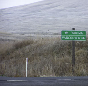
Elbert, Dec. 2004
|
|
The backside of that sign is visible in this photo, which was looking west across US 97, along the historic east beginning of US 830:
|
Elbert, Dec. 2004
|
In about 1933, US 830 was rerouted east of Lyle, following the north bank of the Columbia River, largely along what is now WA 14. So then its endpoint was still at US 97, but further south of Goldendale, closer to Maryhill. Originally US 97 followed an older alignment up the Columbia Hills north of Maryhill:
|
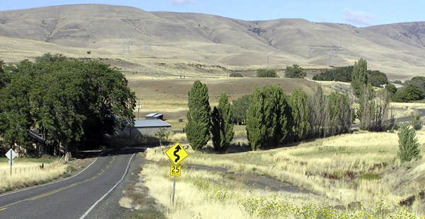
North of modern hwy. 14, this route is now known as the "Old Maryhill Loops Road", so-called because of the tortuous switchbacks that almost seem to be stacked on top of each other (this old alignment has since been re-paved and opened to non-motorized traffic). South of hwy. 14, US 97 partially followed what is now a county road used to access the Stonehenge replica. However, the middle segment of that road is newer, and old US 97 probably followed a different route slightly downslope from there (now mostly abandoned). This photo was looking west on Stonehenge Road:
|
Elbert, summer 2004
|
|
Historically that was southbound US 97, which probably continued down the canyon at left, winding up at the old ferry landing in Maryhill (US 97 traffic crossed the Columbia via ferry until about 1962). Straight ahead would have been the east beginning of US 830. Here we are looking the opposite direction (west on Stonehenge):
|
Elbert, summer 2004
|
That likely shows the former east end of US 830, because US 97 came up from the lower right and continued ahead and to the right. It was about 1949 when this route was bypassed in favor of modern US 97. At that time US 830 was reconfigured too, and then its east end was a little ways to the north and west from here (where today's WA 14 meets US 97); more info and photos on the Maryhill page.
Research and/or photo credits: Mark Bozanich; Chris Elbert; Dale Sanderson; Michael Summa; Mike Wiley
Page originally created 2002;
last updated Dec. 7, 2023.
last updated Dec. 7, 2023.
