End of US highway 57
 |
|
|
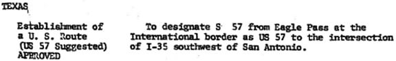
US 57 was commissioned in 1970; here is that section from the minutes of AASHO's annual meeting in November of that year:
|
|
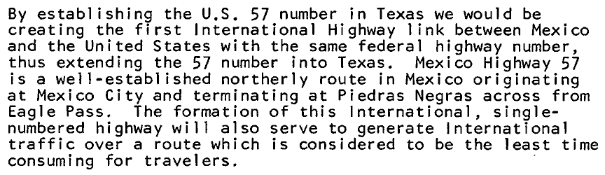
Note the part (in parentheses) about "US 57 suggested": normally it would have been AASHO's responsibility to determine the number of a new US route, but in this case TXDoT suggested the specific designation they wanted: US 57. And "suggested" is not the best word for it: the number "57" was really the whole point. Following is an excerpt from TXDoT's Sep. 1970 application to AASHO:
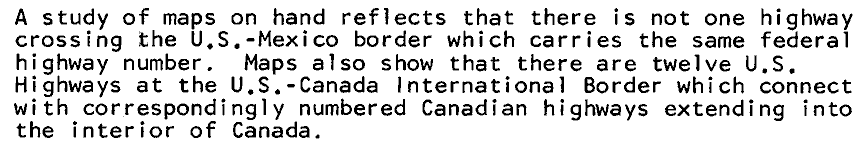
However, there was one big obstacle: for the past few decades AASHO had taken the position that they would not approve any more single-state US routes. And, as a matter of fact, just a few months earlier, AASHO had brought up the issue again by strongly encouraging the state DOTs to eliminate their single-state US routes by re-designating them as state routes. A few years prior to this, TXDoT had renumbered this particular route as state hwy. 57, so AASHO could have responded by pointing out that state routes were just as good as US routes, and that it would not be possible to bring this particular highway into the US route system. But TXDoT had obviously anticipated that line of reasoning; following was their argument for why a state route designation was not good enough:
Apparently those arguments were enough to convince AASHO to grant an exception (and they have not approved any more single-state US routes since then). The fact that US 57 was conceptualized as a unified international route explains why the highway is signposted north/south, despite having a much more east/west bearing in Texas. And actually, the number "57" does make a little sense when viewed in context with nearby US 59; the map linked above shows both routes.
|
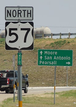
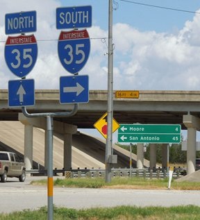
The "north" end of US 57 is at its junction with I-35, about three miles south of Moore. These photos were from southbound I-35:
|
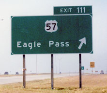
Taylor, 2002
|
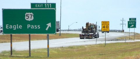
Sanderson, Aug. 2013
|
|
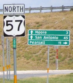
For northbound interstate traffic there is an identical sign, and for travelers who take that exit, the beginning of US 57 is signed thus:
|
Karners, Dec. 2014
|
|
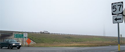
At left is the I-35 overpass; the pickup with headlights on had just reached the north end of US 57.
Here is an overview of the interchange taken from the top of that overpass; we are looking west along the north beginning of US 57: |
Taylor, 2002
|
|
Traffic from southbound I-35 comes in from the right. Just past the Yield sign is the first southbound US 57 sign, shown close-up here:
|
Sanderson, Aug. 2013
|
|
Looking the opposite direction, the last northbound sign is just shy of the interchange:
|
Sanderson, Aug. 2013
|
Sanderson, Apr. 2022
|
|
Visible in the background is the embankment for the I-35 overpass, where US 57 ends, so that "North" tab should be replaced with an "End" tab. Here is the actual interchange:
|
Sanderson, Aug. 2013
|
|
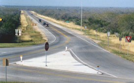
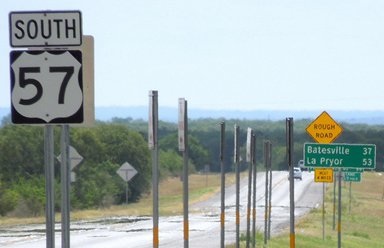
The "south" end of US 57 is at the Mexico border crossing in Eagle Pass. Here is the last southbound sign:
|
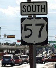
Sanderson, Aug. 2013
|
|
That was looking west on Garrison Street; in the distance can be seen the customs station that marks the end of the route. There was no "End" sign, but this shot shows the terminus:
|
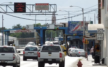
Sanderson, Aug. 2013 (as of 2014, the facade has been changed)
|
|
TX Spur 240 begins to the right on Commercial Street; that is as far as one can go before committing to crossing the International Bridge, where the route becomes Mexico 57.
Looking south on Commercial, US 57 begins to the left on Garrison: |
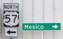
Sanderson, Aug. 2013 (same as of 2023, but partially covered with fencing)
|
|
The next photo shows the first northbound sign, heading east on Garrison:
|
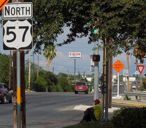
Sanderson, Aug. 2013
|
Research and/or photo credits: Karin and Martin Karner; Alex Nitzman; Dale Sanderson; Michael Summa; Stephen Taylor; Charles Turner
Page originally created 2000;
last updated Jun. 19, 2023.
last updated Jun. 19, 2023.
