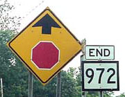
End of US highway 220 |
 |
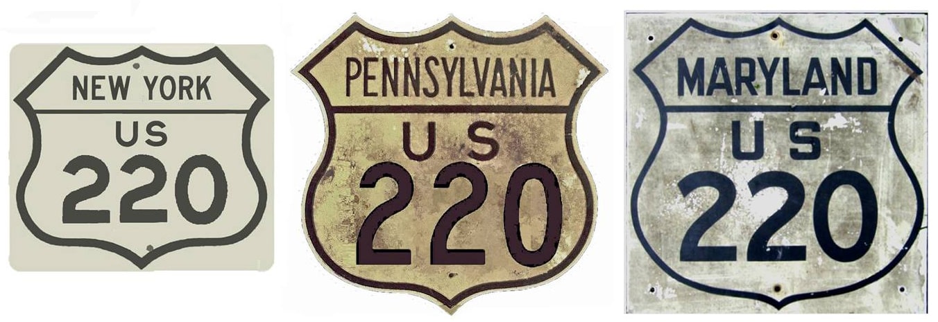
Summa
|
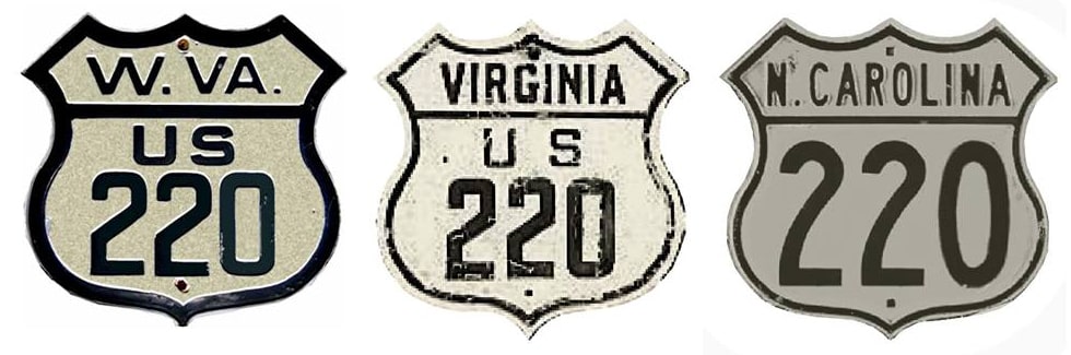
Summa
|
|
1926-1927
|
1927-1928
|
1928-1934
|
|
1934-1950?
|
1950?-2017
|
2017-present
|
|
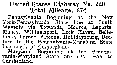
Mileage: in 1989 AASHTO listed a figure of 749 miles for US 220... however, that included the mileage of US 220's associated business routes. According to the state subtotals on AASHTO's 1989 spreadsheet, mainline US 220's actual end-to-end total at the time was 681 miles. That closely matches our own 2020 measurement, which yielded 676.5 miles (reroutings and realignments likely explain the difference).
|
|
Apparently US 220 was never even so much as planned to connect with its implied parent, US 20, which is a good 75 miles further north. Its number may have derived from the fact that it originally did connect with its "sibling", US 120. But US 220 is a north/south route, so an east/west number really was not appropriate (it is one of a surprisingly small group of 3dus routes whose numbers belie their direction). "US x01" or "US x11" would have worked, but "US x15" probably would have been the best choice.
|
The 1926 map that AASHO approved actually showed US 220 heading north from Williamsport PA (along today's US 15), ending in Lawrenceville at the New York state line. But Pennsylvania did not sign its US routes for another couple years, and since the time of AASHO's April 1927 route log, the north end of US 220 has always been in the Waverly area:
|
|
|
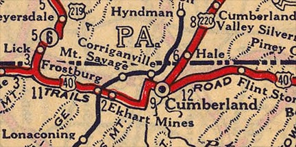
Originally the south end of US 220 was in Cumberland. It came into town on Bedford Street, ending at its junction with US 40, which at the time was Mechanic Street (with Centre Street as the westbound counterpart):
|
c. 1927, Rand McNally
|
|
This shot was looking east on Mechanic, which was eastbound US 40, and US 220 began to the left on Bedford:
|
Nelson, Sep. 2007
|
In 1928, US 220 was extended further south, to New Creek, and the route's southern terminus remained there until 1934. This photo was apparently taken in 1937, just a few years after US 220 had been extended still further south, but nevertheless it illustrates how this junction looked when US 220 began here:
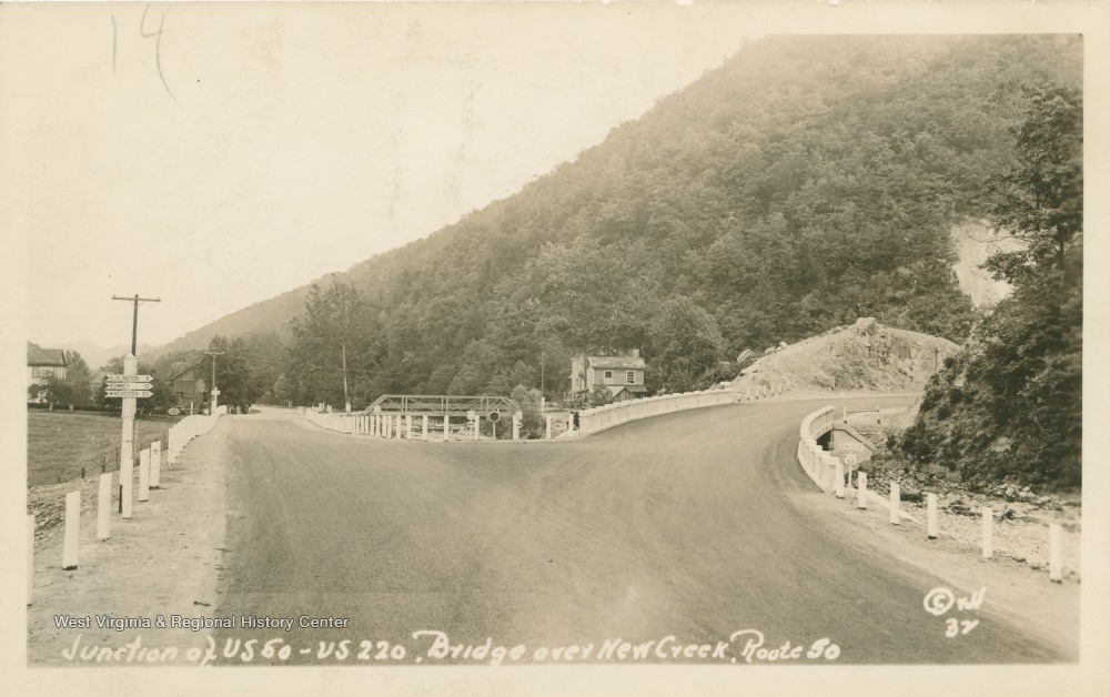
c. 1937, West Virginia University (linked to source)
The view there is to the northeast on eastbound US 50, which continues to the right over the still-extant 1931 bridge. For a few years, the south beginning of US 220 was straight ahead, via what is now WV hwy. 972. The signpost at far left gave mileages to Burlington, Romney, and Winchester (all further east on US 50). This next photo was taken from essentially the same perspective, but probably from a few years later. The signpost had been changed to indicate mileage not only to Romney, Winchester, and Washington DC (all on US 50), but also Moorefield (which is on US 220, reflecting US 220's then-recent extension to the right with US 50):
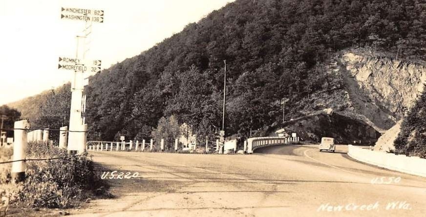
(date and attribution unknown)
|
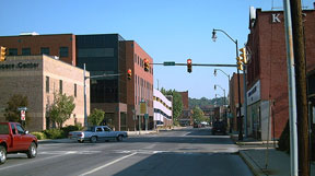
Following are some modern perspectives from that area. Heading south from Keyser on US 220, one comes to the junction shown here:
|

Elkins
|
|
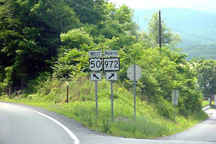
Today US 220 is directed to the left, bypassing New Creek a few miles to the east. But in 1929, US 220 was routed along today's WV 972, passing through New Creek and ending at US 50:
|
Elkins
|
|
This shot was taken heading west on US 50:
|
Elkins
|
For a few years, the south beginning of US 220 was to the right, but then in 1934, US 220 was extended south to Rockingham, where it has remained ever since.
|
Research and/or photo credits: H.B. Elkins; Steven Nelson; Adam Prince; Mike Roberson; Dale Sanderson; Michael Summa
Page originally created 1999;
last updated Dec. 10, 2023.
last updated Dec. 10, 2023.
