End of US highway 26 |
 |
|
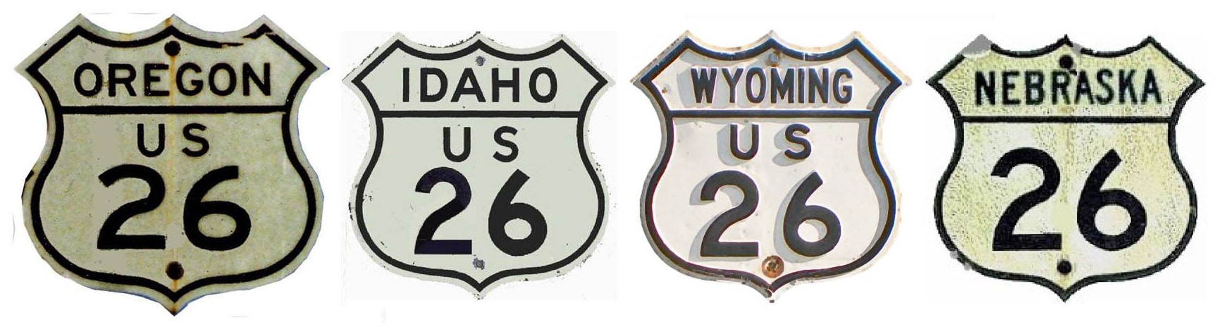
1926-1949
|
1949-1951
|
1951-2003
|
2003-present
|
Summa
|
|
Mileage: in 1989 AASHTO listed a figure of 1529 miles for US 26... however, that included the mileage of US 26's associated business route. According to the state subtotals on AASHTO's 1989 spreadsheet, mainline US 26's actual end-to-end total at the time was 1526 miles. Our own 2020 measurement yielded 1498.3 miles. The bulk of that difference is explained by the fact that US 26 still went to Astoria in 1989, although our measurement shows that is was actually only 1517.6 miles long at the time.
The east end of US 26 has always been in Ogallala... not many US highways have eastern ends that far west. The North Platte and South Platte rivers join to form the main Platte River near the city of North Platte. By the time the two rivers reach that point, they have been flowing parallel to each other for a remarkable distance... and all the while averaging maybe only five miles apart. Not until the vicinity of Ogallala -- about 50 miles upstream (west) from North Platte -- do the two valleys finally diverge:
The east end of US 26 has always been in Ogallala... not many US highways have eastern ends that far west. The North Platte and South Platte rivers join to form the main Platte River near the city of North Platte. By the time the two rivers reach that point, they have been flowing parallel to each other for a remarkable distance... and all the while averaging maybe only five miles apart. Not until the vicinity of Ogallala -- about 50 miles upstream (west) from North Platte -- do the two valleys finally diverge:
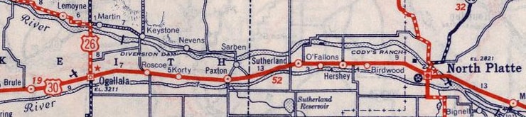
c. 1939, Rand McNally
|
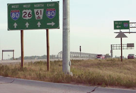
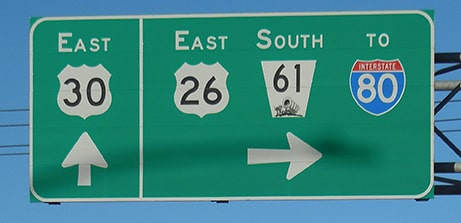
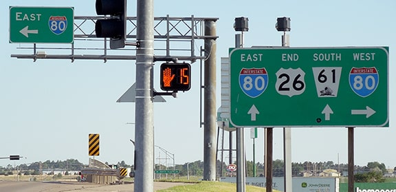
US 26 is the road that takes westbound traffic off US 30 (and now I-80 as well), and up the North Platte River valley -- roughly following the same path into Wyoming as the historic Oregon and Mormon trails. This photo shows the signage from westbound I-80 for the US 26 exit:
|
Sanderson, June 2001
|
|
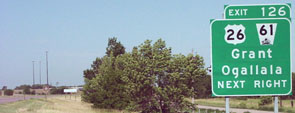
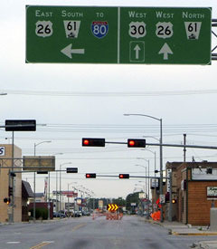
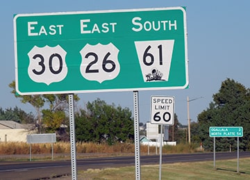
Approaching that interchange from the south on NE hwy. 61, the signage looks like this:
|
Sanderson, June 2001
|
|
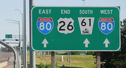
That is the east beginning of US 26. Not far on the other side of the overpass we encounter the first westbound confirming assembly:
|
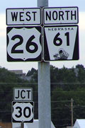
Sanderson, Aug. 2005
|
|
That part of US 26 (the segment south of US 30) was signed as such only after I-80 was built; originally the route's terminus was at its junction with US 30. Here we are looking west on 1st Street (US 30) at East "A" Street:
|
Sanderson, Aug. 2005
|
|
To the left is a newer viaduct connecting to the I-80 interchange. Until recently, westbound US 26 continued to the right on one-way "A" Street (it was about 2000 when US 26/NE 61 traffic was co-signed with US 30 ahead to a new bypass west of town). Eastbound US 26 came from the right on the next block ahead (Spruce Street), turned this direction, and continued off to the left. But before I-80 was here, the west beginning of US 26 was to the right on Spruce (which formerly ran both directions). To the left (south of US 30) was designated NE 61, and Spruce crossed the railroad at-grade. It still does, but originally it continued further south via its own bridge across the South Platte, and it connected with today's NE 61 alignment south of I-80. This shot was looking south on Spruce:
|
Sanderson, Feb. 2000
|
|
US 26 and NE 61 are no longer routed through here (in fact, this old route is not even signed as a business loop). The stoplight in the distance is at US 30; here is a shot of the signage there:
|
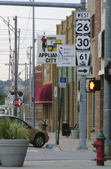
Sanderson, Aug. 2005
|
Historically that was the east end of US 26; NE 61 continued straight ahead and over a now-dismantled bridge. Now eastbound US 26 traffic is directed east (left) one block.
|
|
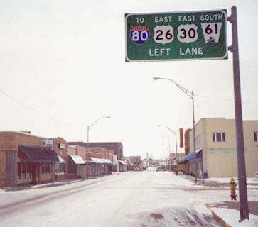
Today traffic on eastbound US 26 is directed to turn south along a bypass that skirts the west side of town, and then east along US 30:
Sanderson, Oct. 2021
|
That is the location of the last US 26 reassurance marker. About two miles ahead, US 26 diverges from its brief overlap with US 30:
Sanderson, Jun. 2020
|
|
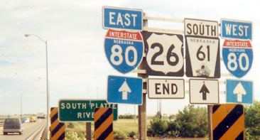
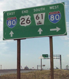
There, US 26 traffic is directed south over the newer viaduct. Not far ahead, for quite some time there have been two "End" assemblies posted: one at the river bridge, and the other at the interchange. This set of photos illustrates both:
|
Summa, 1987
|
Sanderson, June 2001
|
Sanderson, Jun. 2020
|
Sanderson, Jun. 2020
|
|
Originally the west end of US 26 was at its junction with the now-defunct US 185, at a place known as Dwyer Junction. This is about 10 miles west of Guernsey, and about a mile east of US 26's modern junction with I-25 (exit 92):
|
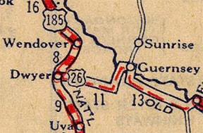
c. 1927, Rand McNally
|
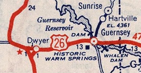
c. 1940, Rand McNally
|
|
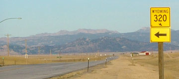
For the most part, US 185 followed what is now WY hwy. 320 north from Wheatland. However, just shy of the junction with US 26, today's WY 320 veers to the northeast (along what was the southeast segment of the "Y" junction shown on the 1940 map above). US 185 continued on a northwesterly angle, aligning with Pepper Road, which is still drivable north of US 26. This photo was looking north on historic US 185:
|
Sanderson, Mar. 2004
|
|
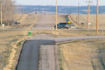
Behind the camera, this road now dead-ends (but historically it connected with WY 320). The view ahead shows how it aligns with (but no longer directly connects with) Pepper Rd. That was formerly US 185, and later US 87 (notice the raised roadbed). The suv has just reached the historic west end of US 26, and is turning north on old US 185-87. (Today Pepper Rd. connects with I-25 at exit 94.) Here we are looking west on US 26 at the junction with WY 320:
|
Sanderson, Mar. 2004
|
|
Historically a left turn there was US 26's connection to southbound US 185-87. Travelers wanting to go north on US 185-87 continued straight ahead, where there was another junction near the red and white barn in the distance:
|
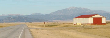
Sanderson, Mar. 2004
|
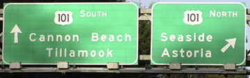
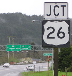
That is where Pepper Rd. cuts across, so US 26 ended at that junction. After I-25 was built, US 26 was extended straight ahead to that interchange (those are the Laramie Mountains prominent on the horizon). But before that happened, the US 26 designation had already been extended to Alpine WY in 1949. This extension added over 400 miles to the length of US 26, but only 58 of those miles were along highways that were not already part of other US routes (illustrating Wyoming's penchant for overlapping US routes for unusually long distances). A year later US 26 was extended west again, this time to Idaho Falls. And the following year (1951) the west end of US 26 was extended again, this time to Astoria. In 2003 Oregon eliminated US 26's multiplex with US 101, such that its west end is now at a place some maps label "Cannon Beach Jct" (which is a few miles south of Seaside). These photos were looking west on US 26 at what is now its west terminus:
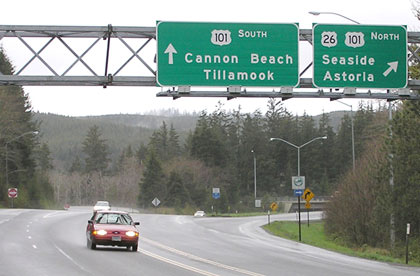
Elbert, Mar. 2004
Elbert, Nov. 2004
|
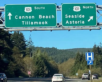
Marion, Sep. 2020
|
|
Historically, US 26 overlapped with US 101 up to Astoria. But today, if one follows the ramp to the right, they almost immediately encounter the "End" sign shown here:
|
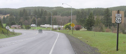
Elbert, Mar. 2004
|
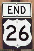
Elbert, Mar. 2004
|
|
That is where westbound US 26 merges with northbound US 101; reportedly that is the first assembly where an "End" sign was used by ORDoT. Heading south on US 101, the west beginning of US 26 appears thus:
|
Elbert, Mar. 2004
|

Elbert, Mar. 2004
|
|
The opposite direction (north on US 101) looks like this:
|
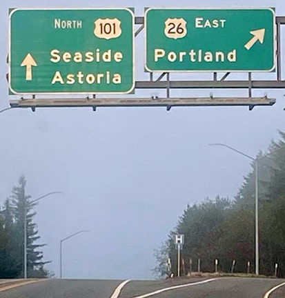
Marion, Sep. 2020 (unchanged since at least 2004)
|
Drivers taking that exit will soon see the first eastbound confirming marker:
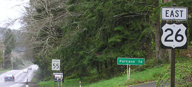
Elbert, Mar. 2004
|
Research and/or photo credits: Chris Elbert; Tom Grier; Mark Long; Gail Marion; Dale Sanderson; Michael Summa
Page originally created 2000;
last updated Dec. 15, 2023.
last updated Dec. 15, 2023.
