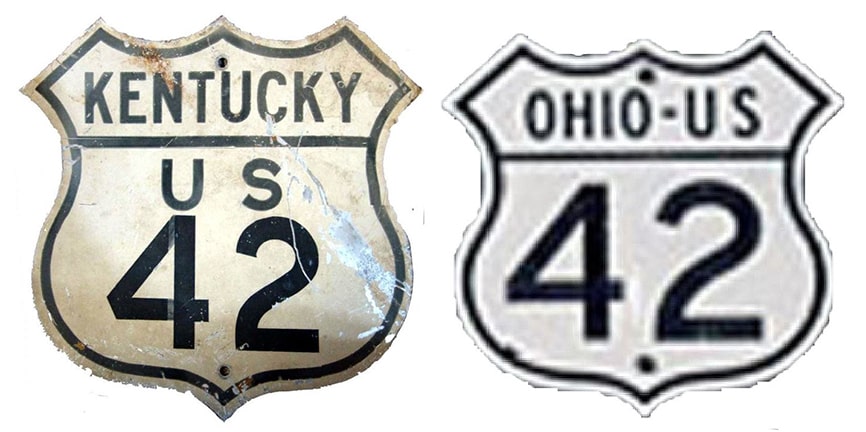
End of US highway 42 |
 |
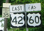
Summa
|
Mileage: in 1989 AASHTO listed a figure of 355 miles for US 42. That closely matches our own 2020 measurement, which yielded 350.1 miles (reroutings and realignments likely explain the difference).
|
|
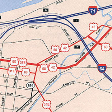
The north end of US 42 is in Cleveland (despite the fact that it is numbered as an east-west highway, it is signed north-south in Ohio). US 42 was an original 1926 highway, but at that time it ran from Cleveland only to Cincinnati. In 1932, the west end of US 42 was extended to Louisville (its original terminus is described on that page).
Sometime in the 1950s, the US 42 designation was extended south from Main via Clay Street. Later this movement was changed to a one-way couplet consisting of Shelby Street (southbound) and Logan/Campbell streets (northbound). That was the situation illustrated on this map:
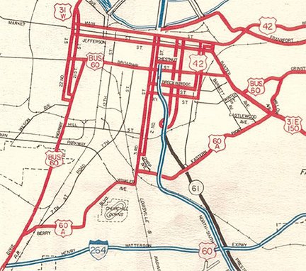
c. 1962, KYDoT
|
From there (per 1950s USGS topos), US 42 continued west on Breckinridge Street, then south again on 3rd Street, at least to the University of Louisville campus. But the exact endpoint is a bit unclear. I have not seen any government-issued maps (including the one above) that show US 42 going any further south than that, suggesting that the route ended at Eastern Parkway, where it junctioned US 60 Alternate. Some commercial maps agree, but others (such as this one) do not:
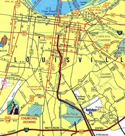
c. 1962, Esso
|
|
That (and several other commercial maps, from roughly the mid-1940s to mid-1960s) shows US 42 overlapped US 60A along Winkler Av, Taylor Blvd, Berry Blvd, and 7th St, ending at the Watterson Expressway (today's I-264) in Shively. And there is at least one photo showing a US 42 shield in that area:
(date and attribution unknown)
|
So clearly US 42 was signposted down to Shively for at least some period of time. It was probably in the 1970s US 42 was truncated to its current terminus east of downtown:
|
|
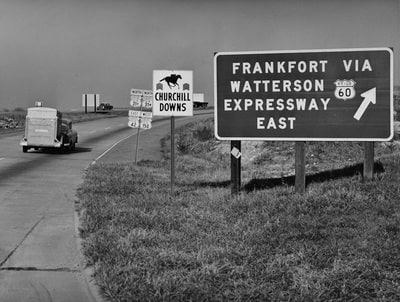
US 42 comes into Louisville from the east on Brownsboro Road. The right edge of that map illustrates how traffic is split into one-ways. At the I-64 underpass, what is now the last US 42 sign is posted:
|
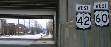
Mortell, Mar. 2010
|
|
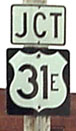
As drivers continue west on Story Avenue, they would formerly see these signs:
|
Elkins
|

Elkins
|
|
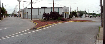
As of 2015, the 31E sign is still there, but badly faded; all that remains of the 60-42 assembly is the "West" tab. Anyway, in addition to "West US 60", that sign should have included a reference to "North US 31E", as well as "End US 42". That same median is visible in this photo, which was taken looking the opposite direction (east on Main):
|
Elkins
|
That shows both the west end of US 42 (coming towards the camera at left is Story) and the west beginning of US 42 (heading away from the camera behind the median is Main Street, which becomes Mellwood Avenue). Story is also westbound US 60, and Main/Mellwood is also eastbound US 60. Off to the right side is Baxter. Northbound US 31E traffic on Baxter would be directed to take a left, towards the camera, joining Main. Southbound US 31E traffic joins Baxter via Market Street (one block to the right).
|
This last photo shows the first US 42 sign heading east, a little further down Main/Mellwood from the spot shown in the photo above:
|
Sanderson, July 2007
|
Research and/or photo credits: Nathan Edgars; H.B. Elkins; Robert Mortell; J.P. Nasiatka; Mike Page; Mike Roberson; Dale Sanderson; Michael Summa
Page originally created 2000;
last updated Dec. 21, 2021.
last updated Dec. 21, 2021.
