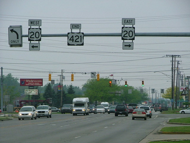
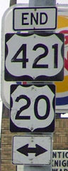
End of US highway 421 |
 |

Summa
|
1930-1931
|
1931-1932
|
1932-1938
|
|
1938-1949
|
1949-1950
|
1950-present
|
*US 421 ended in Cumberland Gap for many years according to AASHO, and this was shown on many maps, including Virginia's official state highway maps. However, VDOT did not make their own maps, and they did not signpost US 421 west of Bristol until 1949, and never anywhere at all between Stickleyville and Cumberland Gap.
|
Mileage: in 1989 AASHTO listed a figure of 950 miles for US 421... however, that included the mileage of US 421's associated business routes. According to the state subtotals on AASHTO's 1989 spreadsheet, mainline US 421's actual end-to-end total at the time was 941 miles. That is reasonably close to our own 2020 measurement, which yielded 949.3 miles (reroutings and realignments likely explain the difference).
|
Historically, when it went to downtown Michigan City, US 421 was 952.2 miles long.
|
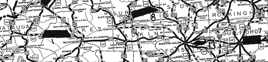
US 421 was originally commissioned in 1930, running essentially due east-west between Boone and Greensboro:
c. 1930, NC DoT
|
In Greensboro, US 421 came from the west on Walker Avenue, meeting US 70 at Aycock Street. It could have ended there, but more likely it overlapped with US 70 north on Aycock, then east on Market Street, ending downtown:

c. 1931, Gousha
|
That was before Elm Street and Greene Street functioned as a one-way couplet, and it is unclear which one carried north-south highway traffic at the time (the preceding map shows Greene, but I have seen others that show Elm). This interactive image shows the Market-Elm intersection:
|
|
Information about US 421's original west terminus can be found on the Boone page. In 1931 US 421 was extended south and east, ending in Wilmington. That same year it was also extended further west, to Bristol. Many maps and route logs showed that US 421 went all the way west to Cumberland Gap... but that was never actually the case.
Meanwhile, in 1938 US 421 was extended down the peninsula south of Wilmington, along a road that had initially been built in the 1920s. For the roadbed, construction crews used coquina stone mined from the nearby shoreline, which almost immediately caused an increase in the beach erosion rate. Initially the US 421 designation ended right at Fort Fisher, but eventually a segment of the road (near where the Ft. Fisher monument is located today) had to be rerouted slightly inland: |
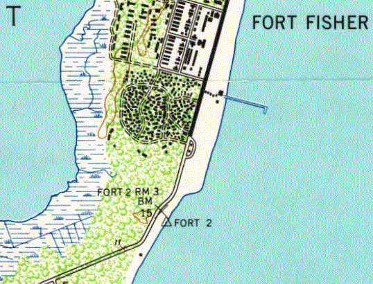
c. 1946 and 1997, USGS
|
|
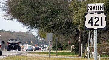
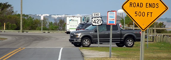
Likely it was right around this same time that US 421 was also extended a bit further south and west to its current terminus at Federal Point. As of 2017, the last southbound marker was nine miles north of US 421's endpoint:
|
Sanderson, Mar. 2017
|
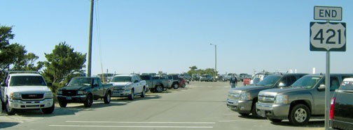
The terminus is on the Cape Fear River side of the peninsula, and the highway provides access to the ferry that runs across to Southport. Just past there, the road ends at a parking area/boat ramp:
|
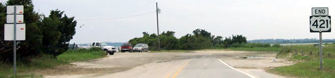
Field, May 2005
|
Younce, Nov. 2012
|
Sanderson, Mar. 2017
The water tower visible in the background of that photo is located across the Cape Fear River, in Southport. Here is a close-up of the "End" assembly:
|
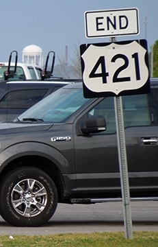
Sanderson, Mar. 2017
|
|
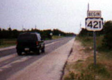
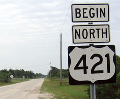
Directly across the road from there is a "Begin" assembly for northbound traffic:
|

Younce, Nov. 2012
|
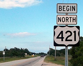
Younce, June 2015
|
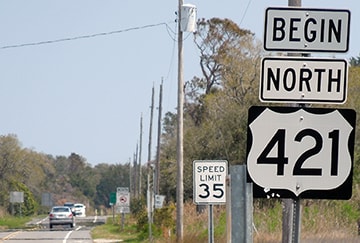
Sanderson, Mar. 2017
|
|
Kudos to North Carolina for the great signage at the south end of this road! Steve Ford emailed a comment about this terminus:
"It is a glorious place to end, or begin, a highway, made only more so by the certainty that following the trail will take you, incongruously, through the Indiana outback to a terminus in Michigan City, of all places... not exactly dust to dust, but certainly sand to sand..." Ahead, just past the road that leads to the Southport ferry, the first northbound trailblazer is posted: |
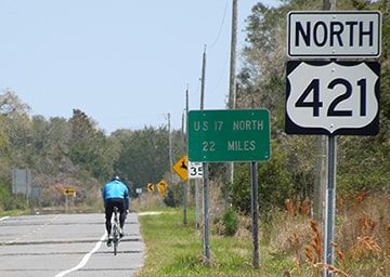
Sanderson, Mar. 2017
|
|
Not far ahead from there, travelers soon come to this curve at the Battle Acre parking area:
|
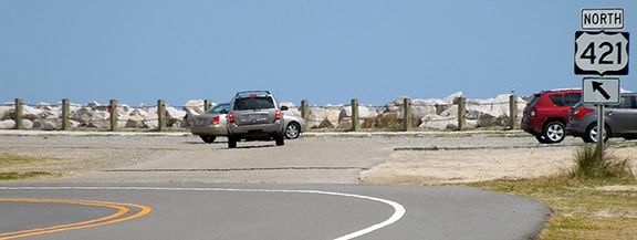
Sanderson, Mar. 2017
|
|
As noted previously, beach erosion necessitated the modern alignment (to the left) in about 1951, but prior to that, the original road continued straight ahead, out just a ways into what is now open water before curving left, aligning with modern US 421 again near Surfrider Court (in Kure Beach). So the point where US 421 historically ended has been washed away... but then, much of the original Ft. Fisher is also gone now, with this monument placed in its historic location:
|
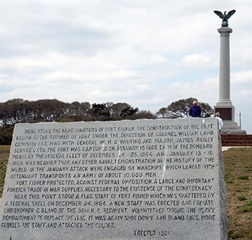
Sanderson, Mar. 2017
|
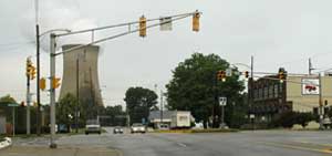
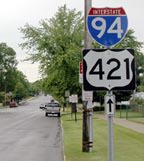
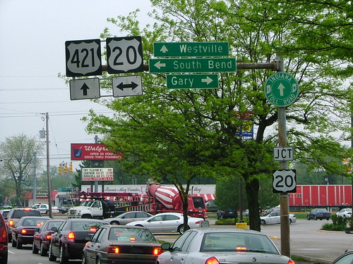
In 1949, US 421 was extended north through Kentucky, with a temporary endpoint at Madison IN. But already by the next year US 421 had been extended all the way up to Michigan City. These photos were taken looking north on Franklin Street, approaching its junction with US 20:
Sanderson, May 2005
|

Younce, Nov. 2016
|
|
The actual endpoint is about a block ahead, at the traffic signal. On a pole at that intersection, there was another "End" sign:
|
Sanderson, May 2005
|
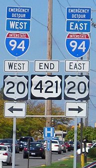
Morrison, Oct. 2013
|
|
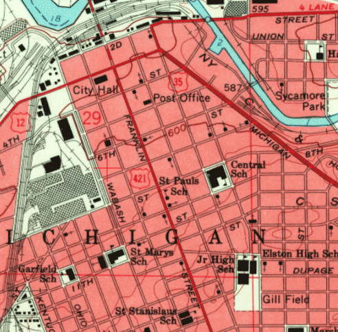
Franklin continues ahead into downtown, and originally the US 421 designation also extended ahead along Franklin. In 1975 INDOT obtained AASHTO approval to truncate US 421 to its junction with US 20; here is the agenda item from their meeting in November of that year...
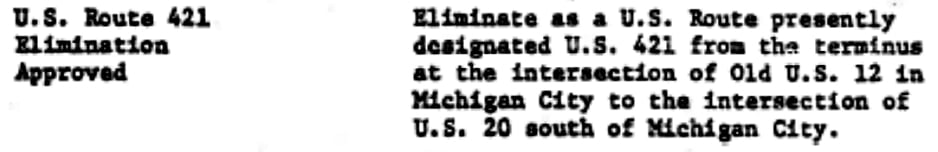
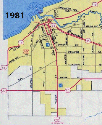
...although it was not until the 1982 issue of INDOT's state highway map that their Michigan City inset began to illustrate that truncation:
|
|
Originally Franklin continued past 4th, right through what is now the site of the Library, and US 421 ended at Michigan Boulevard (US 12). The following photo was taken looking south on Franklin from US 12; the first US 421 marker is visible at right:
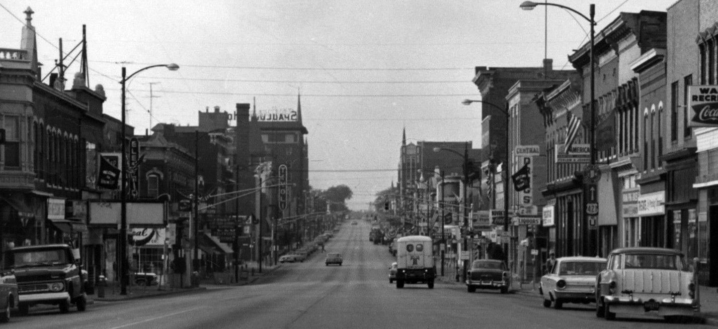
attribution unknown
|
Visible on the same post is a marker for the Indiana Toll Road, so it is certain the photo was taken after 1956. But later in the 1960s highway traffic was diverted away from Franklin; at 9th Street, northbound traffic was directed one block to the east, and then north again via Pine Street, where the route ended at Michigan:
|
USGS, 1962 and 1969
|
|
AASHO actually approved that change at their June 1970 meeting, but it appears Indiana had already implemented the change a few years earlier. At far right in this photo, taken looking north on Pine at Michigan, is a sign assembly that has probably carried over from when Pine still carried US 421:
|
Mortell, June 2006
|

(detail)
|
|
Incidentally (as can be seen on the map above) just one block to the right was the north beginning of US 35. Pine was (and still is) one-way northbound. Southbound US 421 began off US 12 via Washington Street (which runs one block west of Franklin, and two blocks west of Pine). If the car in the photo above were to turn left and proceed two blocks, the driver would reach the intersection shown here:
|
Mortell, June 2006
|
|
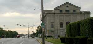
That was looking west on US 12; the north beginning of US 421 was to the left on Washington. City Hall is just off the left edge of that photo -- it is shown in the photo below, which was looking the opposite direction (east) on US 12:
|
Mortell, June 2006
|
|
The north beginning of US 421 was to the right. If a driver turns that way, there is another sign that hints at US 421's historical presence here:
|
Mortell, June 2006
|
|
At 9th, traffic was directed east one block to Franklin, and then continued southward out of town. A sign assembly heading that direction (south on Franklin) is a remnant from back when US 421 still existed north of US 20...
|
 |
|
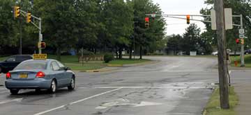
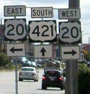
...but today US 421 begins at US 20; just ahead are the first southbound confirming markers:
|
Morrison, Oct. 2013
|
Sanderson, May 2005
|
|
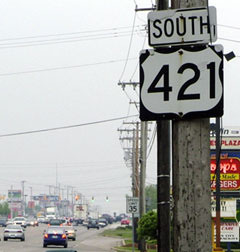
From eastbound US 20, the beginning of US 421 looks like this...
|
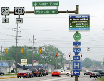
Sanderson, May 2005
|
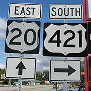
Morrison, Oct. 2013
|
|
...and it was pretty much the same arrangement from westbound US 20, although the signs have since been replaced:
|
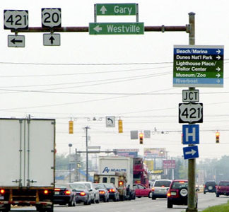
Sanderson, May 2005
|

Morrison, Oct. 2013
|
|
Ahead from there was one more assembly marking the north beginning of US 421:
|
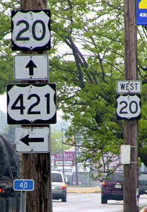
Sanderson, May 2005
|
Research and/or photo credits: Andy Field; Brian LeBlanc; Jeff Morrison; Robert Mortell; Adam Prince; Mike Roberson; Dale Sanderson; Michael Summa; Morgan Younce
Page originally created 2000;
last updated Dec. 11, 2023.
last updated Dec. 11, 2023.
