End of US highway 177 |
 |
|
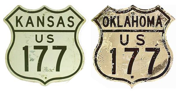
1927-1965
|
1965-1984
|
1984-present
|
Summa
|
Mileage: in 1989 AASHTO listed a figure of 233 miles for US 177. That closely matches our own 2020 measurement, which yielded 233.6 miles.
|
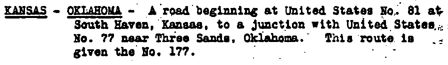
US 177 was not among the inaugural routes of 1926, but it was one of the first routes to be added to the system. This agenda item was in the minutes of AASHO's executive committee meeting in Oct. 1927:
|
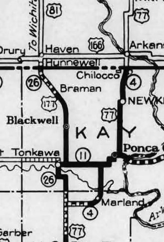
Since its commissioning, US 177 has been essentially an Oklahoma intrastate route -- although its north end does venture four miles into Kansas, ending at its junction with US 81 in South Haven:
|
c. 1928, OK DoT
|
|
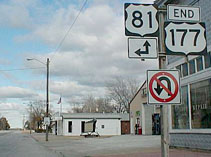
These photos were taken right in the center of town, looking north on Main Street at Stuart Street. Southbound US 81 is to the left. The US 177 designation ends here, and straight ahead becomes northbound US 81:
|
Prusia, Jan. 2002
|
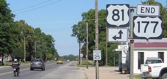
Morrison, Sep. 2018
|
|
A half-mile ahead on Main is the junction marking the west terminus of US 166, and in fact, heading north on US 81 (east on Stuart), US 166 is signed as if it begins to the north on Main, the same intersection where US 177 begins to the south on Main:
|

Turner, Jul. 2023 (unchanged since at least 2016)
|
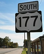
Heading south on Main, southbound US 81 traffic is directed to turn west on Stuart, while straight ahead is the north beginning of US 177:

Turner, Jul. 2023
|
Drivers continuing that direction will soon encounter the first southbound confirming assembly:
Nitzman, Oct. 2016 (unchanged as of 2023)
|
|
Originally the south end of US 177 was at a place known as Three Sands Junction. Most road atlases do not label Three Sands, and the highways in that area have changed quite a bit. Heading north on US 77 between Perry and Tonkawa, drivers come to a junction with OK hwy. 156. That is Three Sands Jct (the actual locale of Three Sands is about three miles further north):
|
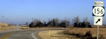
Stuve, Jan. 2003
|
Today US 77 continues straight ahead: north from Three Sands to Tonkawa, then due east with US 60 to Ponca City. But until about 1967, US 77 instead went east (to the right) on what is now OK 156 to get to Ponca. Back then, if a traveler stayed straight (in order to continue north to Tonkawa), they were on the south beginning of US 177.
|
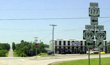
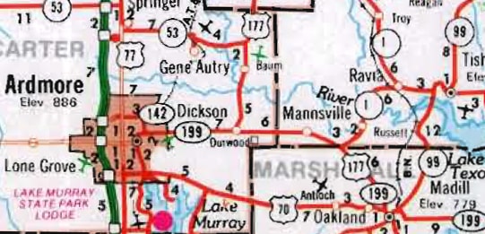
In 1965, US 177 was truncated back to Tonkawa, and instead routed east from there with US 60 to Ponca. (Incidentally, that change brought about an interesting which-way concurrency between the two towns: drivers heading from Tonkawa to Ponca are on eastbound US 60, northbound US 77, and southbound US 177.) From Ponca, the US 177 designation was extended south all the way to Dickson, mostly along what had been OK hwys 40 and 18. Dickson was a logical place for US 177 to end at the time, because US 70 between Ardmore and Madill was routed through Dickson then:
|
c. 1965, OK DoT
|
|
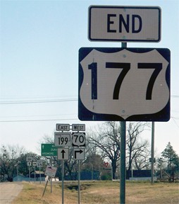
Today US 70 is routed west of Madill along what was then marked as OK 199. State highway maps through 1984 show OK 199 dead-ending at the county line. But by the time of the 1985 issue, US 70 between Ardmore and Madill had been rerouted to go through Oakland and McMillan (instead of through Dickson). Its old route was signed as an extension of OK hwy. 199, as you can see in this photo:
|
Stuve, May 2004
|
|
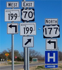
That is the former south end of US 177. However -- instead of continuing to have US 177 end there (at what had become a state highway) -- the designation was extended east (left) from there, along the route of old US 70, to its current southern terminus at US 70 in Madill:
|
c. 1986, OK DoT
|
|
In the background of these "End" sign photos are some examples of both old and new Oklahoma state route signs:
|

Hamilton, 2000
|
Karners, Jan. 2012
|
|
Crews began replacing the old-style signs in about 2009, and some of the modern signs shown in these photos were brand-new at the time. This next shot was looking east on US 70:
|
Karners, Jan. 2012
|
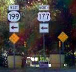
|
That was a slightly awkward assembly -- it is unclear why "West 199" and "North 177" were on two separate posts. From that direction on Wiggs Avenue, traffic approaches something of a "T" intersection; US 70 continues by turning right onto First Street, while a left turn marks the south beginning of US 177. Signage at the junction itself is shown here:
|
Hamilton, 2000
|
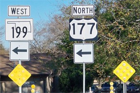
Karners, Jan. 2012
|
|
That same assembly is visible in this next photo (side view in the middleground), which was taken while heading north on 1st:
|
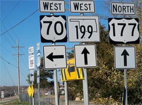
Karners, Jan. 2012
|
|
That carries westbound US 70, but drivers following that route must turn left on Wiggs; if one continues straight, they are on the beginning of US 177. Barely visible in the lower left corner is the first northbound confirming assembly, which is shown close-up here:
|
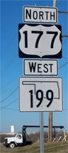
Karners, Jan. 2012
|
Research and/or photo credits: Alan Hamilton; Karin and Martin Karner; Jeff Morrison; Alex Nitzman; Ben Prusia; Dale Sanderson; Eric Stuve; Michael Summa; Charles Turner
Page originally created 2000;
last updated Dec. 9, 2023.
last updated Dec. 9, 2023.
