c. 1940, Kingstree SC, attribution unknown
End of US highway 521 |
 |
Summa
|
|
Mileage: in 1989 AASHTO listed a figure of 194 miles for US 521... however, that included the mileage of US 521's associated business route. According to the state subtotals on AASHTO's 1989 spreadsheet, mainline US 521's actual end-to-end total was 191 miles... but that was during the brief timeframe when US 521 went all the way up to Billy Graham Pkwy in Charlotte. Since then it has been truncated a couple times, and our own 2020 measurement yielded 176.6 miles.
|
US 521 was commissioned in 1932; its south end has always been in Georgetown. Originally the north end of US 521 was in Pineville (just south of Charlotte):
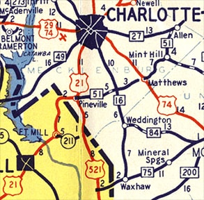
c. 1940, NC DoT
|
At the time, US 21 came in from the west on Main Street, or modern NC hwy. 51, and then went north along Polk Street (which soon becomes South Boulevard). This image was looking west on Main:
Buchanan/Ivy/Nitzman, Nov. 2021
|
|
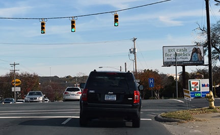
A pretty nondescript intersection now, but originally that was northbound US 21, which continued to the left on Polk. To the right on Polk was the north beginning of US 521.
In 1968, US 521 was extended straight ahead, initially overlapped with US 21 into downtown Charlotte. But the US 21 designation was gradually shifted over to what is now I-77 (as segments of that freeway were opened to traffic), leaving only US 521 on South Blvd: |
c. 1970, NC DoT
|
|
At Morehead Street, US 521 turned west, ending at Graham Street, where it junctioned US 29. Graham no longer connects with Morehead (because of the nearby stadium and I-277); this image shows what is there now:
|
|
That is looking east on Morehead, or north on US 29, which today continues by turning left on Mint Street, on the far side of the freeway overpass. But historically, US 29 turned left just on this side of the overpass, at what is now an entrance to the stadium, but was once Graham Street. So the north beginning of US 521 was straight ahead.
|
That was the case until 1976. Then northbound US 521 traffic was directed to turn west on Woodlawn Road, passing through I-77's interchange 6, and ending at Tryon Street (NC 49). Here is a modern view of that junction:
|
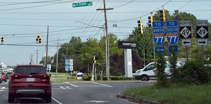
Buchanan/Ivy/Nitzman, Nov. 2021
|
|
That was looking west on Billy Graham Parkway; Woodlawn begins straight ahead, and historically that direction was also the north beginning of US 521. This next photo was looking north on Tryon:
|
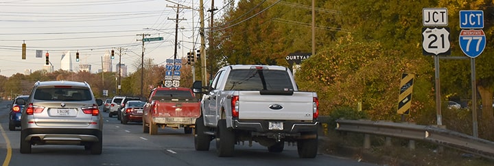
Buchanan/Ivy/Nitzman, Nov. 2021
|
|
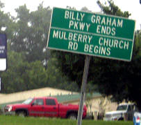
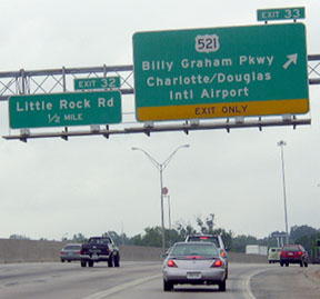
For a few years, the north beginning of US 521 was to the right on Woodlawn. But then in 1984, when Billy Graham (to the left) was completed, US 521 was extended that direction to a new terminus at I-85's interchange 33:
|
 c. 1990, NC DoT c. 1990, NC DoT
|
|
These shots were looking north on BGP. There was no "End" sign... well, at least not for the end of US 521:
|

Curley, 2001
|
Patriarca, summer 2003
|
These photos show the exit from I-85 (northbound and southbound, respectively), as well as the first US 521 marker heading south on BGP:
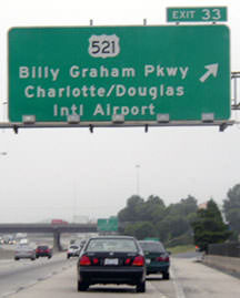
Patriarca, summer 2003
|
Patriarca, summer 2003
|
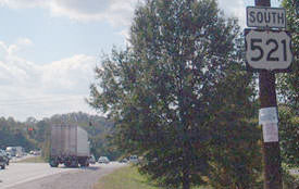
Field/Nitzman, Oct. 2001
|
|
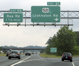
When the I-485 loop was complete through the area and Johnston Road was built as a new four-lane connector, US 521 was switched over to Johnston and then overlapped with I-485 to South Blvd, allowing traffic to bypass Pineville and a large segment of the original routing. Then in 2003, when the west loop of 485 was completed (joining 77 and 85), US 521 was truncated to its interchange with I-485 (exit 61). This photo shows the spot...
|
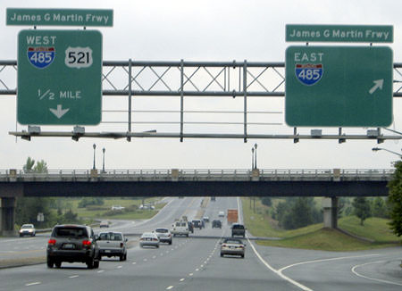
Nitzman, May 2005
|
|
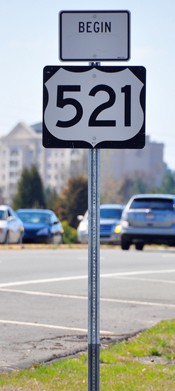
...although at that time the sign still reflected US 521's concurrency with westbound I-485. Just ahead, an "End" sign was posted:
|

Clifton, Feb. 2012
|
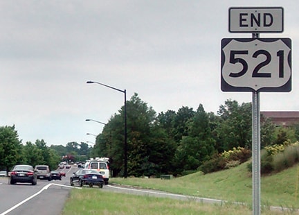
Younce, June 2017
|
|
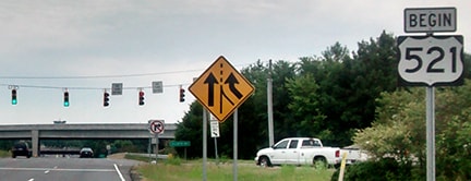
This photo shows the beginning of US 521 as seen from eastbound I-485:
|
Nitzman, May 2005
|
|
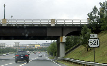
Heading south on Johnston, this sign was posted at the I-485 interchange...
|
Clifton, Mar. 2010
|
Younce, June 2017
...and continuing ahead, the first southbound sign was posted at the point where I-485 traffic merges in:
Nitzman, May 2005
|
Research and/or photo credits: Carter Buchanan; Mark Clifton; Richard Cuff; Chris Curley; Andy Field; Brent Ivy; Brian Miller; Alex Nitzman; Chris Patriarca; Mike Roberson; Dale Sanderson; Michael Summa; Morgan Younce
Page originally created 2000;
last updated May 28, 2023.
last updated May 28, 2023.
