End of US highway 422 (western segment)
 |
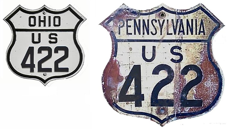
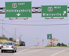
Summa
|
1926-present
Mileage: in 1989 AASHTO listed a figure of 186 miles for US 422(w). That closely matches our own 2020 measurement, which yielded 187.5 miles.
|
|
The west end of the western segment of US 422 has always been in Cleveland.
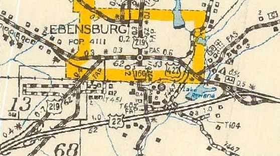
US 422 has been around since the beginning in 1926. The east end of its western segment has always been in the Ebensburg area, although it has moved around several times: |
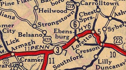
c. 1927, Rand McNally
|
|
Heading west, US 22 originally followed Rowena Drive into Ebensburg; then High Street through downtown and southwest to its current alignment. Heading east from Belsano, US 422 originally followed what is now PA 271 south to Nanty Glo, and then Beulah Road west to its terminus at US 22 (about two miles southwest of downtown Ebensburg):
|
c. 1930, PennDoT
|
|
This photo was looking northeast on Admiral Peary Highway (eastbound US 22); the original east beginning of US 422 was to the left on Beulah:
|

Nelson, May 2008
|
Signage at that intersection indicates that Beulah is still on the state highway system, although it was long ago demoted to a secondary road numbered 3034:
|

Nelson, May 2008
|
|
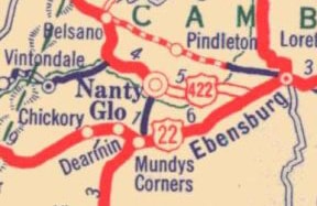
In 1932, US 422 was rerouted to its current alignment between Belsano and Ebensburg...
|
c. 1940, PennDoT
|
|
...except right in town traffic followed Park Street (instead of Ben Franklin Highway), ending at High Street (US 22). This photo was looking northeast on High:
|
PennDoT, 2012
|
|
That was once eastbound on US 22. US 422 came in from the left on Park and ended there. That was the case until about 1939, when traffic was directed to follow Ben Franklin to intersect High. If a driver continues ahead a couple blocks from the photo above, they will reach this junction:
|
Nelson, May 2008
|
|
That is still looking northeast on High, or historic eastbound US 22, which continued to the right. To the left was the east beginning of US 422. This next shot was looking east on Ben Franklin, where US 422 ended at High (eastbound US 22 was straight ahead, and westbound was to the right):
|

Nelson, May 2008
|
|
Here we are looking the opposite direction (west on High). This was westbound US 22, which curved to the left. Straight ahead on Ben Franklin was the beginning of US 422:
|
Kasprzyk, July 2010
|
|
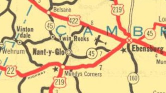
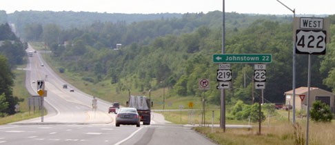
It was 1961 when US 22 was rerouted along its current bypass to the south of Ebensburg (the Admiral Peary Hwy):
c. 1962, PennDoT
|
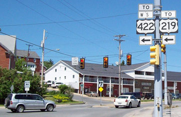
At that time, the US 422 designation was extended east along High and Rowena (old US 22), ending at its junction with current US 22:
Elbert, July 2006
|
|
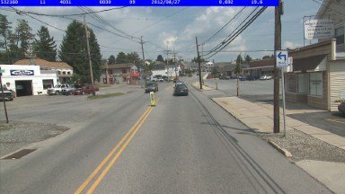
That was the case until 1991, which is when US 219 was rerouted onto the bypass around the west side of town. At that time the US 422 designation was truncated to its junction with this new highway (about 1.5 miles west of downtown). These photo were looking east at the end of US 422; the overpass is US 219:
|
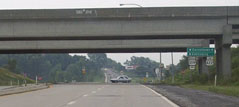
Kitsko, Aug. 2001
|
Kitsko, Aug. 2001
|
|
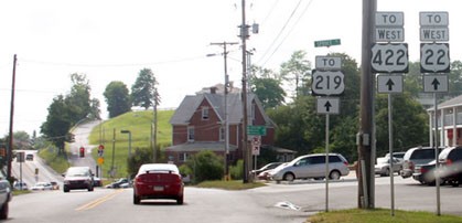
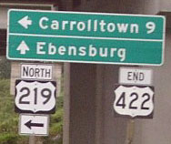
It is unfortunate that US 422 no longer continues ahead into Ebensburg, because it no longer has a junction with its parent route. Here we are heading the opposite direction, looking at the first westbound marker for US 422:
|
Kasprzyk, July 2010
|
Research and/or photo credits: Nathan Edgars; Chris Elbert; Bruce Kasprzyk; Jeff Kitsko; Steven Nelson; Mike Roberson; Dale Sanderson; Michael Summa
Page originally created 2001;
last updated Nov. 28, 2021.
last updated Nov. 28, 2021.
