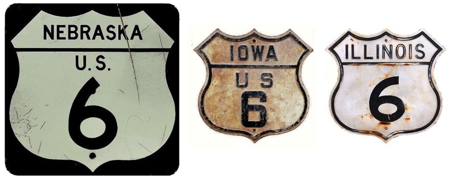
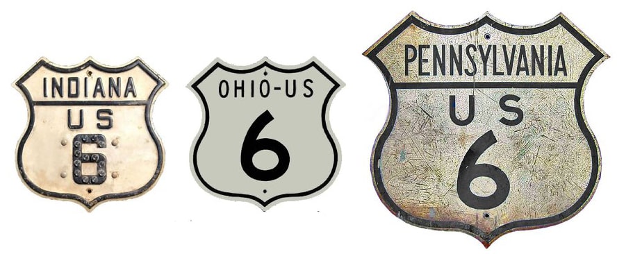
End of US highway 6 |
|
1926-1928 (east segment)
|
1926-1927 (west segment)
|
1927-1928 (west segment)
|
|
1928-1931
|
1931-1937
|
1937-1963
|
1963-present
|
Claims to fame:
Judging from the volume of feedback US Ends .com receives regarding US 6, this route seems to capture the interest of road enthusiasts more than most other US highways. In Jack Kerouac's novel On the Road, the main character described it as "one great red line across America". There is something fascinating about a road that is mostly rural, yet still stretches nearly the length of the entire country. And the way it follows the spiral of Cape Cod is particularly endearing. In the late 1930s (when it was extended west from Denver to the Los Angeles area), US 6 became the longest highway in the history of US routes. (That may no longer be the case, as the segment between Bishop and Long Beach was decommissioned in 1963, and by some measures the current route is now shorter than US 20.)
The early history of US 6 is complicated, primarily because it was planned to go through New York and Pennsylvania. New York wanted only a few US routes, and US 6 was not among them (that was also the case with several other routes, and for that reason, many US routes initially ended at the NY state line). In contrast, New York's neighbor to the south and west, Pennsylvania, wanted lots of its highways to be given US route designations. However, Pennsylvania was notorious for making several revisions to its routes, many of them shortly after the "final" plan was approved in November 1926.
The 1925 plan had US 6 running from Provincetown to Brewster NY (by which they meant the New York state line just west of Danbury CT). After changes that resulted in the plan's actual approval by the states in late 1926, the map included two disconnected segments of US 6: an east leg as described above, and a west leg running between Matamoras and Kane PA (where US 6 was to end at its junction with US 120). In other words, initially US 6 had a gap in New York. But by the time an April 1927 route log was published, New York had agreed to accept US 6... however, it went northeast from Matamoras to Kingston (along what eventually became US 209), and there still was no US 6 between Kingston and Danbury. On its west end, Pennsylvania planned to truncate US 120, and instead it was US 6 that would be extended to Erie.
However, it appears that neither Pennsylvania nor New York actually signed their portions of the highway with US 6 markers until 1928, and by then the route had changed again. The two separate segments had been joined using the more direct corridor between Brewster and Matamoras, so when US 6 was first signed, it essentially followed its current alignment from Provincetown all the way to Union City PA. From that point, US 6 was routed northwest to end at US 20 (more info on the Erie page). The segment of the earlier-planned US 6 that was to run between Kingston and Matamoras was designated US 6N [i].
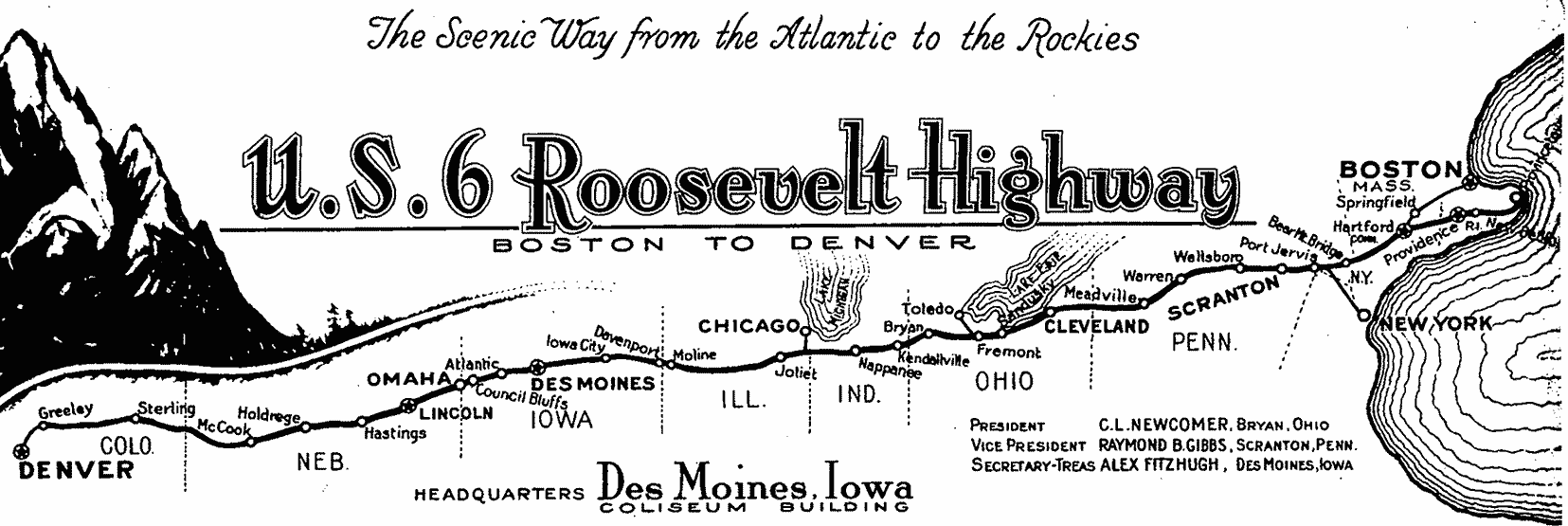
In the early 1930s, the US 6 designation got a major extension to the west, through Cleveland and the Chicago area. From there, the new US 6 swallowed up US 32 all the way to Council Bluffs, and retired US 38 from Omaha to Greeley CO, where it ended at US 85 (more info on the Greeley page). This was the letterhead of a Route 6 organization during the brief timeframe when US 6 ran from Provincetown to Greeley:
- From 1937-1963, US 6 ran about 3500 miles from coast to coast. That was the greatest length of any US route, current or historic. (More about its mileages and its midpoints.)
- US 6 reaches 11,990' at the summit of Loveland Pass in Colorado, which is the highest elevation of any US route that is open year-round. (That is about 200' lower than US 34's high point along Trail Ridge Road, but that highway is open only during the summer months.)
Judging from the volume of feedback US Ends .com receives regarding US 6, this route seems to capture the interest of road enthusiasts more than most other US highways. In Jack Kerouac's novel On the Road, the main character described it as "one great red line across America". There is something fascinating about a road that is mostly rural, yet still stretches nearly the length of the entire country. And the way it follows the spiral of Cape Cod is particularly endearing. In the late 1930s (when it was extended west from Denver to the Los Angeles area), US 6 became the longest highway in the history of US routes. (That may no longer be the case, as the segment between Bishop and Long Beach was decommissioned in 1963, and by some measures the current route is now shorter than US 20.)
The early history of US 6 is complicated, primarily because it was planned to go through New York and Pennsylvania. New York wanted only a few US routes, and US 6 was not among them (that was also the case with several other routes, and for that reason, many US routes initially ended at the NY state line). In contrast, New York's neighbor to the south and west, Pennsylvania, wanted lots of its highways to be given US route designations. However, Pennsylvania was notorious for making several revisions to its routes, many of them shortly after the "final" plan was approved in November 1926.
The 1925 plan had US 6 running from Provincetown to Brewster NY (by which they meant the New York state line just west of Danbury CT). After changes that resulted in the plan's actual approval by the states in late 1926, the map included two disconnected segments of US 6: an east leg as described above, and a west leg running between Matamoras and Kane PA (where US 6 was to end at its junction with US 120). In other words, initially US 6 had a gap in New York. But by the time an April 1927 route log was published, New York had agreed to accept US 6... however, it went northeast from Matamoras to Kingston (along what eventually became US 209), and there still was no US 6 between Kingston and Danbury. On its west end, Pennsylvania planned to truncate US 120, and instead it was US 6 that would be extended to Erie.
However, it appears that neither Pennsylvania nor New York actually signed their portions of the highway with US 6 markers until 1928, and by then the route had changed again. The two separate segments had been joined using the more direct corridor between Brewster and Matamoras, so when US 6 was first signed, it essentially followed its current alignment from Provincetown all the way to Union City PA. From that point, US 6 was routed northwest to end at US 20 (more info on the Erie page). The segment of the earlier-planned US 6 that was to run between Kingston and Matamoras was designated US 6N [i].
In the early 1930s, the US 6 designation got a major extension to the west, through Cleveland and the Chicago area. From there, the new US 6 swallowed up US 32 all the way to Council Bluffs, and retired US 38 from Omaha to Greeley CO, where it ended at US 85 (more info on the Greeley page). This was the letterhead of a Route 6 organization during the brief timeframe when US 6 ran from Provincetown to Greeley:
By 1933, US 6 went from Union City through Edinboro to US 20 at West Springfield, bypassing Erie to the south. Its former route from Union City to Erie was then designated US 6N [ii]. Around this time, US 6N [i] between Kingston and Port Jervis was decommissioned (US 209 was extended north along that route by 1935). US 6N [ii] lasted only a few years, because in the mid- to late-1930s, the route of US 6 was changed again: this time to its current alignment through Meadville PA. At that time, US 6N [ii] was decommissioned, and that designation was instead re-applied to a third route: the modern US 6N running between West Springfield and Mill Village PA.
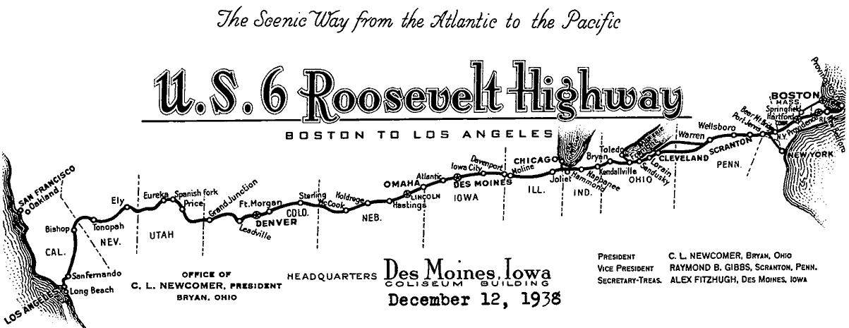
In 1937, US 6 was extended all the way to the west coast. Its former segment between Wiggins CO and Greeley became part of US 34. US 6 instead went from Wiggins along the "Denver Cutoff" to its eponymous city, and then west essentially along its current route to Bishop CA. From there, US 6 was co-signed with US 395 to a junction near Inyokern, and then south along today's CA hwy. 14 into greater Los Angeles. More info about the historic westernmost terminus of US 6 can be found on the Long Beach page. Here is the letterhead from the same organization, updated after US 6 was extended to the Pacific:
In 1937, US 6 was extended all the way to the west coast. Its former segment between Wiggins CO and Greeley became part of US 34. US 6 instead went from Wiggins along the "Denver Cutoff" to its eponymous city, and then west essentially along its current route to Bishop CA. From there, US 6 was co-signed with US 395 to a junction near Inyokern, and then south along today's CA hwy. 14 into greater Los Angeles. More info about the historic westernmost terminus of US 6 can be found on the Long Beach page. Here is the letterhead from the same organization, updated after US 6 was extended to the Pacific:
US 6 basked in the glory of its coast-to-coast, longest-US-route status for nearly 30 years. But in 1963 the designation was truncated to its current terminus, leaving only about 40 miles of US 6 in CA (more info on the Bishop page).
|
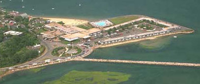
One thing that has not changed about US 6 -- from the time it was planned in 1925 -- is that its eastern end has always gone all the way out to the tip of Cape Cod. There most of its original route is now MA hwy. 6A. Through Provincetown, however, 6A is directed onto Bradford Street today, whereas when US 6 went through town, it was on Commercial Street (which carried both directions of traffic back then). The US 6 designation ended at the rotary on the west end of Commercial:
|
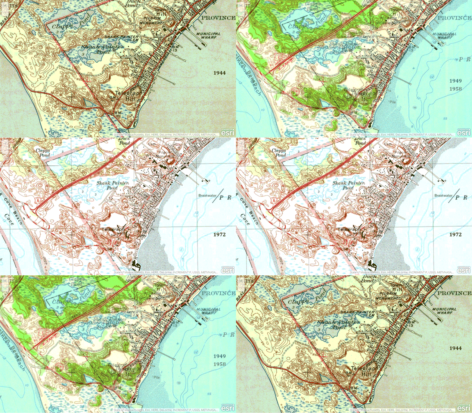
The view there is essentially east. Heading north from the rotary (towards the lower left) is Bradford Street Extension, which is officially a state road (as is the rotary), but has no route number. 1/5th of a mile up that road is the junction of Bradford, Bradford Ext, and Province Lands Road. At that intersection, MA 6A is signed "South" on Bradford back into town and "North" on Province Lands Rd, where it eventually ends at the same intersection where modern US 6 begins. Heading east from the rotary (towards the upper left) is Commercial Street, the original US 6 (though at the time there was no rotary at that location, and from that point, one cannot actually drive east on Commercial anymore, because today it is one-way westbound). That endpoint is located at the bottom center of this animation, which shows how the east terminus of US 6 has changed over the years:
US 6 and MA hwy. 6A formerly ended at a large, oblong, complicated rotary, but in 1982 the whole area was reconfigured into a more simple junction. Despite that, the actual geographical location of the terminus of US 6 hasn't changed by more than a few yards, but the geometry of the endpoint has changed tremendously. Now it is easier for drivers to go right past the endpoint of US 6, seamlessly transitioning to MA 6A, perhaps without even realizing that they have just reached the end of one of the longest highways in the country.
|
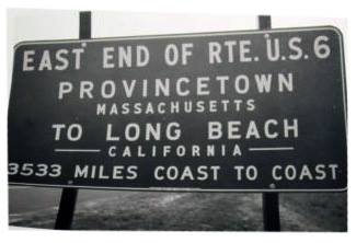
Historically there was a cool sign at the east end of US 6, stating (among other things) the mileage to Long Beach. That rotary is now the site of "Pilgrims' First Landing Park", but there is no longer any indication that the longest highway in US history once ended there:
|
|
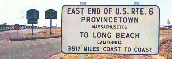
The sign would have been moved (and maybe changed as well) in the 1950s, when US 6 traffic was rerouted onto the bypass (see next section). Here is an image from an old postcard that shows the sign at the west beginning of US 6 after it was moved to its current location (which has since been dramatically reconfigured). Note the slight change to the route's length:
|
|
That was heading north, away from town and the original endpoint. The fork to the left led to Provincelands Road (the sign says "Race Point Coast Guard Station" and "Airport"). To the right was the east beginning of US 6. That sign was taken down after US 6 was truncated back to Bishop. Here is a shot from roughly the same spot, but later:
|
|
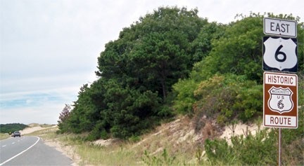
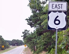
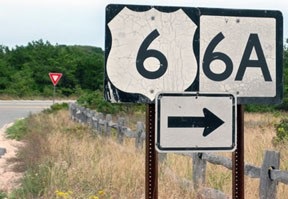
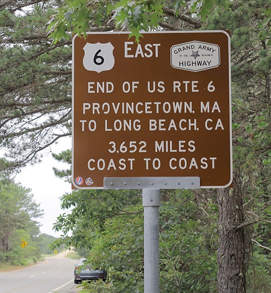
Since about 1957, US 6 traffic north of Truro is routed onto a newer bypass. Where this highway reaches the end of the Cape, it loops back around and connects with the original highway through P-town. Because of the geography of the Cape, drivers are actually heading west when they come to the eastern end of US 6. Understanding this will help the descriptions below to make more sense. For example, "eastbound US 6" is actually a westward direction of travel in the P-town area. Shown here was one of the last eastbound US 6 markers, along with an interesting addition:
|
|
That was near the junction with Mayflower Road. The historic sign is cool, but the choice of location is a bit perplexing. That is current US 6, but it is not historic US 6. Historic US 6 was routed along MA 6A, which is a few hundred yards to the left, running parallel. The very last eastbound marker was another mile or so ahead, near the junction with Shank Painter Road:
|
|
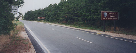
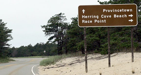
The sign on the right says "Province Lands; Cape Cod National Seashore", and the sign on the left says "State Highway Ends". However, that is not where the US 6 designation ends. Rather, it simply means that section of the highway is maintained by the National Park Service, instead of the state. US 6 actually ends at the highway's junction with Province Lands Road, a little ways ahead. Here is the sign approaching that intersection...
|
|
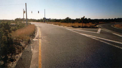
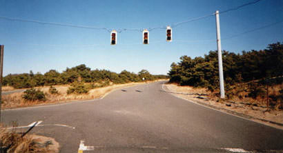
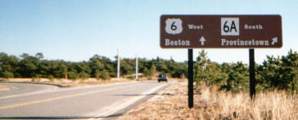
The US 6 designation ends right where the biker is: literally in the middle of a curve in the road. The road veering off to the right is northbound Province Lands Rd. The road that curves to the left is also Province Lands, but it is designated state highway 6A. So eastbound US 6 doesn't have a nice, clear terminus like some highways do. Formerly there was a traffic signal at this junction; this photo was taken from roughly the same perspective, 13 years earlier:
|
|
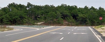
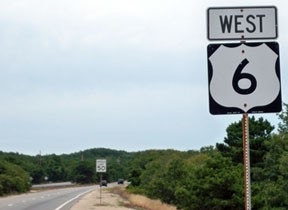
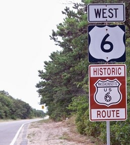
That provided the best visible proof that this junction does indeed mark the true eastern terminus of US 6. The car in the background was stopped at the traffic signal visible in the two photos above. If the driver turned right, they would be on highway 6A; if they turned left, they would be heading east on US 6... but the sign was correct where it said "West" towards Boston, because the highway mimics the curve of the Cape, and eventually it does head westward on its long path to California. If one takes a left turn there, the first westbound confirming marker looks like this:
|
That is the latest of several attempts to sign the significance of this highway, since it seems MassDOT's handiwork often gets stolen. A few miles ahead, in North Truro, current US 6 rejoins its original alignment, as it gradually curves towards a true westerly direction of travel.
Research and/or photo credits: Emi Briet; Chris Bianchi; Cameron Kaiser; Karin and Martin Karner; Josh Lintz; Eric Paulsen; Dale Sanderson; Michael Summa; Ernie Tripp
Page originally created 1999;
last updated Feb. 26, 2024.
last updated Feb. 26, 2024.

