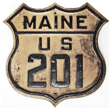
End of US highway 201
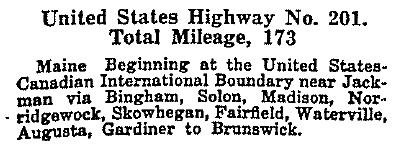
 Mileage: in 1989 AASHTO listed a figure of 183 miles for US 201... however, that included the mileage of US 201's associated alternate route. According to the state subtotals on AASHTO's 1989 spreadsheet, mainline US 201's actual end-to-end total at the time was 157 miles. That closely matches our own 2020 measurement, which yielded 157.2 miles.
|
|
|
US 201 has run between Brunswick and the Canada border ever since the US routes were first commissioned in 1926:
|
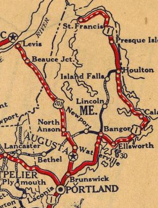
c. 1927, Rand McNally
|
|
The most notable difference is that traffic was originally routed along the highway now designated "Alternate US 201" between Skowhegan and Solon. Here is the last northbound reassurance marker:
|
Sanderson, Oct. 2004
|
|
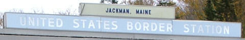
That was just past "The Falls" rest area. The north end of US 201 is at the port of entry to Quebec, about 15 miles north of Jackman (in Canada the road continues as provincial route 173 to Quebec City):
|
Sanderson, Oct. 2004
|
|
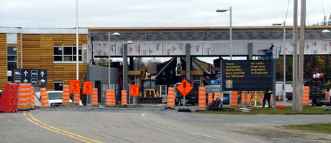
This road is a heavily-used trade route between Canada and the US; at the time of that photo Canada was in the process of building a new port of entry that presumably accommodates more traffic volume. Here is the old US customs building, approaching from Canada:
Sanderson, Oct. 2004
|
Sanderson, Oct. 2004
|
|
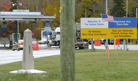
After clearing customs, the north beginning of US 201 looks like this:
|
Sanderson, Oct. 2004
|
Sanderson, Oct. 2004
|
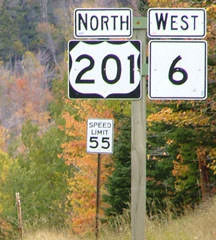
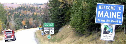
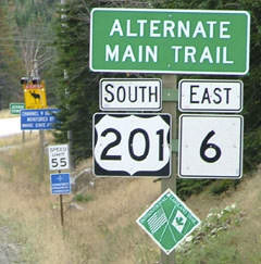
Highways 6 and 201 split near Jackman. Note the moose warning sign in the distance -- there are a lot of those in Maine's north woods.
|
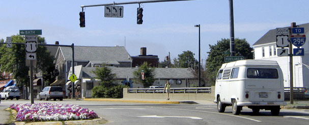
The south end of US 201 has always been at its junction with US 1 in Brunswick. However, the routing of US 1 has changed over the years, and as a result the location of US 201's terminus has changed. We will start from the perspective of northbound US 1 (which actually heads more easterly through this area):
|
Buchanan/Nitzman, June 2005
|
|
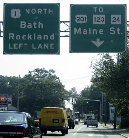
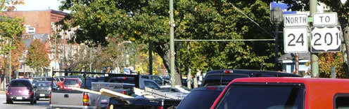
Today US 1 traffic curves to the left via Mill Street (a bypass route). In that direction there is an interchange with Maine Street (US 201 and ME 24) on the north edge of town. However, left turns are not permitted from the offramps. So traffic is still directed to use old US 1 ahead (Pleasant Street) to get to US 201. A few blocks straight ahead we come to this sign at Maine St:
|
Buchanan/Nitzman, June 2005
|
|
Originally northbound US 1 continued by turning to the right there (and then resumed eastward via what is now ME 24, or Bath Road). That arrangement was illustrated on this map (note that Mill St existed at the time but was not yet used by US 1 traffic):
|
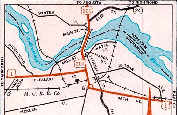
c. 1950, Maine DOT
|
|
So the original south beginning of US 201 was to the left on Maine St. Turning that direction, this assembly is posted:
|
Sanderson, Oct. 2004
|
|
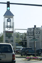
That photo was taken looking north on Maine. Historically that was southbound US 1, which continued to the left on Pleasant, so US 201 began there. But US 1 traffic is now routed along the bypass, which runs a few blocks ahead. Signage at that interchange looks like this:
|
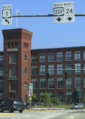
Buchanan/Nitzman, June 2005
|
|
That is the current south beginning of US 201. Ahead, the first confirming marker is next to the lovely old Androscoggin River bridge:
|
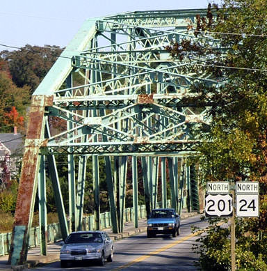
Sanderson, Oct. 2004
|
|
Looking the opposite direction, there is an "End" sign for US 201:
|
Sanderson, Oct. 2004
|
|
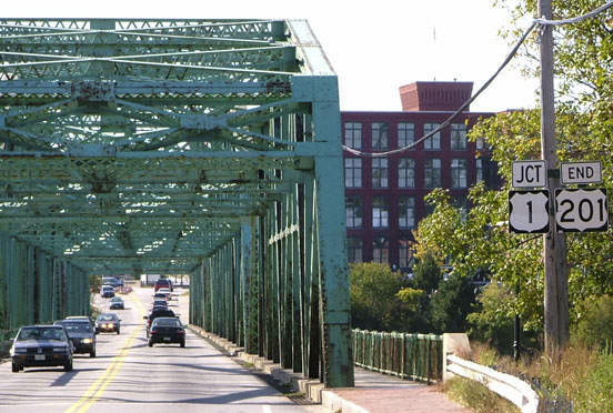
That was taken looking south on Maine St. On the far side of the bridge is the actual terminus of US 201, at its interchange with US 1:
|
Buchanan/Nitzman, June 2005
|
|
Next is a view of the south beginning of US 201 as seen from southbound US 1:
|
Sanderson, Oct. 2004
|
Heading that direction, this exit is signed for US 201, because drivers can turn right on Maine. But note how it is not signed for "Brunswick" or south ME 24, because a left turn is not permitted. Instead, traffic heading into Brunswick exits to Bath Road, a couple miles behind the camera.
Research and/or photo credits: Carter Buchanan; Alex Nitzman; Dale Sanderson; Michael Summa
Page originally created 1999;
last updated Mar. 12, 2023.
last updated Mar. 12, 2023.
