End of US highway 49 |
 |
|
1926-1927
|
1927-1963
|
1963-1978
|
1978-1979
|
1979-present
|
Mileage: in 1989 AASHTO listed a figure of 617 miles for US 49... however, that included the mileage of US 49's associated business routes, and it also included the mileage of both US 49E and US 49W. According to the state subtotals on AASHTO's 1989 spreadsheet, mainline US 49's actual end-to-end total at the time was 516 miles (via US 49W). That closely matches our own 2020 measurement, which yielded 518.3 miles (again via US 49W, although US 49E is only .3 miles longer).
Summa
|
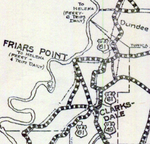
US 49 was commissioned in 1926 to run from Gulfport to Jackson. But the endpoint in Jackson was probably never even posted as such, because already in Oct. 1927 the north end had officially been extended to Clarksdale. Here is that agenda item from AASHO's meeting minutes:
|
c. 1928, MSDoT
|
Here, we are looking north on DeSoto Avenue, where US 49 ended at its junction with historic US 61 (State Street):
Karner, Jun. 2013
|

Karner, Jun. 2013
|
|
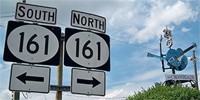
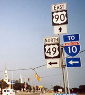
That junction is identified with a large sign marked "The Crossroads" with US 49 and US 61 shields. That intersection has significance to music fans of blues guitarist Robert Johnson. However, he died in 1938, and until that year, this intersection was not the crossroads of US 49 and 61. US 61 was originally routed along 4th Street, so we continue ahead on DeSoto for a few blocks:
|
|
|
That is the intersection where US 49 ended at US 61, until about 1938. But even that is not the original endpoint of US 49: until perhaps the early 1930s, US 49 traffic used Tallahatchie Street. This interactive image is looking north on Tallahatchie:
|
|
|
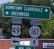
That was the original endpoint of US 49, at its junction with 4th (US 61). US 49 was changed to DeSoto prior to 1935, and in 1938 US 61 traffic was redirected onto State. This next view is looking south on State, which today is MS hwy. 161:
|
Mortell, Aug. 2013
|
|
From 1938 to 1963, the north beginning of US 49 was to the left on DeSoto. (Even though the sign says US 49, it is actually MS 322 now; US 49 traffic has been rerouted along a bypass.)
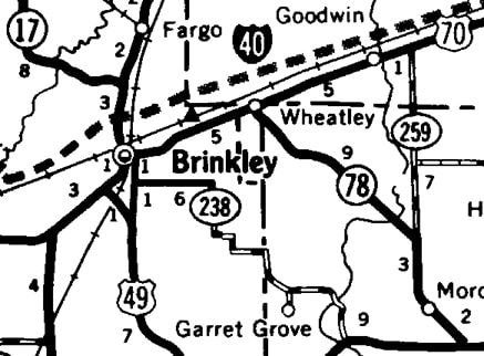
In 1963 the north end of US 49 was extended into Arkansas, to US 70 near Brinkley: |
c. 1964, AHTD
|
|
In this photo, we are looking east on US 70; the north beginning of US 49 was formerly to the right:
Mortell, Aug. 2013
|
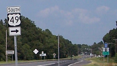
Next is a view from northbound US 49; this was the north end of US 49 throughout most of the 1960s:
Mortell, Aug. 2013
|
|
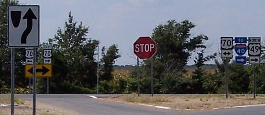
US 49 now extends to the right with US 70; AASHTO approved that short extension in Oct. 1967 (after I-40 had been completed through the area). US 49 was extended about two miles further: through downtown Brinkley, and then north to end at I-40's interchange 216:
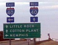
Nelson, Jan. 2006
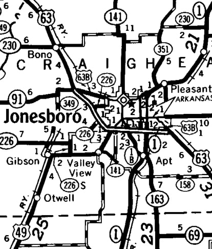
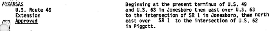
That lasted until 1978, when the designation was lengthened again. At first US 49 continued north only as far as Jonesboro, ending at its interchange with US 63 (now I-555)...
|
c. 1979, AHTD
|
|
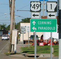
...but within one year it was extended to its current terminus in Piggott:
Piggott is not an attractive name, but the town is actually quite scenic, situated at the eastern foot of Crowleys Ridge. This photo was looking north on US 49, or Thornton Street:
|
Sanderson, Oct. 2007
|
|
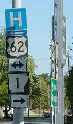
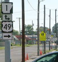
There was no "End" sign, but the north end of the route is there at Main Street, or US 62. That assembly was in the shadow of another assembly at far right; it is shown here:
|
Sanderson, Oct. 2007
|
|
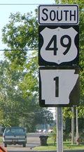
That was looking west on US 62; the north beginning of US 49 is to the left. Heading the opposite direction (east on Main), the beginning of US 49 is marked thus...
|
Sanderson, Oct. 2007
|
|
...and if a driver turns that way, they will see the first southbound sign for US 49:
|
Sanderson, Oct. 2007
|
|
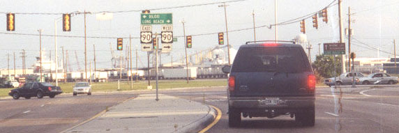
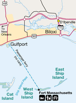
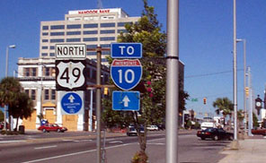
The south end of US 49 has always been in Gulfport, at its junction with US 90. But Beach Boulevard was not built until at least 1940, so originally US 90 stair-stepped its way through town along the grid streets. During that time, US 49 probably ended a block or two north of its current terminus at Beach Boulevard. No "End" sign was posted there -- only the two signs for each direction on US 90:
|
Nitzman, June 2001
|
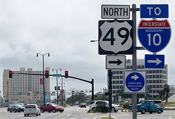
That was looking south on 25th Street. That sign tree may have been blown down by Hurricane Katrina in 2005; by 2007 it had been moved from the center median to the gore shown at far right, but it was back in the center median by 2009, and by 2013 this junction had been re-built and re-signed:
Sanderson, June 2007
|
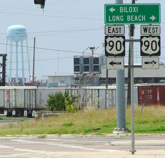
Karner, May 2013
|
|
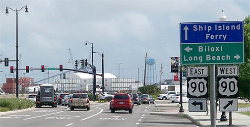
US 49 ends there, but one can continue straight ahead through the light to the Ship Island ferry. This is interesting, considering that there are other US routes which include ferry segments or which terminate at ferry docks:
|
National Park Service, 2002
|
|
It is also interesting that Ship Island Excursions has been in operation since 1926 (the same year US 49 was commissioned). But these are just coincidences, because this particular ferry has never carried vehicles. These photos were taken looking west on US 90:
|
Sanderson, June 2007
|
Karner, May 2013
|
|
US 49 begins to the right on 25th Avenue. Formerly if a driver turned that direction, there was a northbound confirming assembly, as shown in this photo...
|
Nitzman, 1999
|
|
...but that too was apparently another victim of the hurricane, and for several years the first confirming assembly was about four miles north of the terminus, near Airport Boulevard. However, sometime after 2013 a new first confirming marker was posted just north of US 90. These photos are from eastbound US 90; the south beginning of US 49 is to the left:
|
Nitzman, 1999
|

Karner, Dec. 2009
|
Research and/or photo credits: Nathan Edgars; Adam Froehlig; Martin Karner; Jeremy Lance; Chris Lawrence; Robert Mortell; Steven Nelson; Alex Nitzman; Dale Sanderson; Michael Summa
Page originally created 1999;
last updated Jun. 11, 2023.
last updated Jun. 11, 2023.
