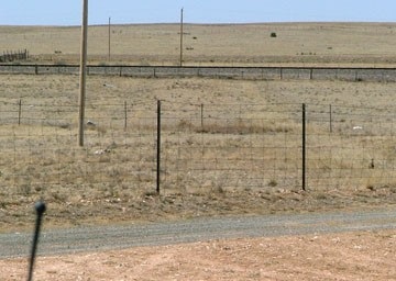
End of US highway 54 |
 |
Summa
|
Summa
|
|
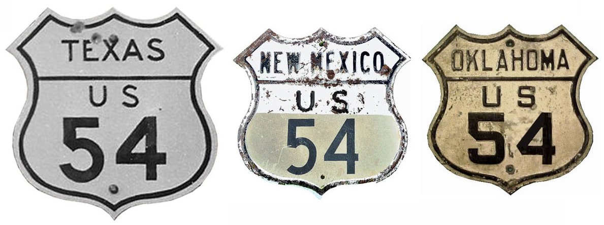
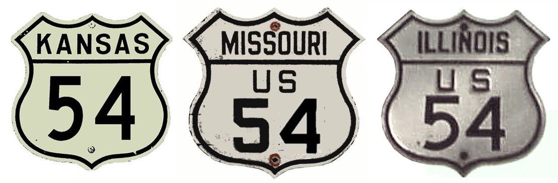
1926-1934
|
1934-1940
|
1940-1971
|
1971-present
|
|
Mileage: in 1989 AASHTO listed a figure of 1207 miles for US 54... however, that included the mileage of US 54's associated business routes. According to the state subtotals on AASHTO's 1989 spreadsheet, mainline US 54's actual end-to-end total at the time was 1197 miles. That closely matches our own 2020 measurement, which yielded 1198.6 miles. Historically, when US 54 went to Chicago, it was 1476.6 miles long.
|
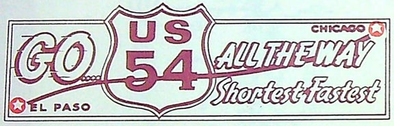
c. 1950s(?), US 54 Ass'n. Nat'l. Hdqtrs. Greensburg KS
|
|
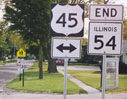
Note: the majority of New Mexico's segment of US 54 is signed north-south (from Santa Rosa south to the Texas state line). It is signed east-west everywhere else, including in El Paso, even though its bearing there is strongly north-south.
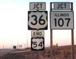
When the US routes were first commissioned in 1926, the east end of US 54 was not far from where it ends today: four miles west of Pittsfield, at its junction with US 36: |
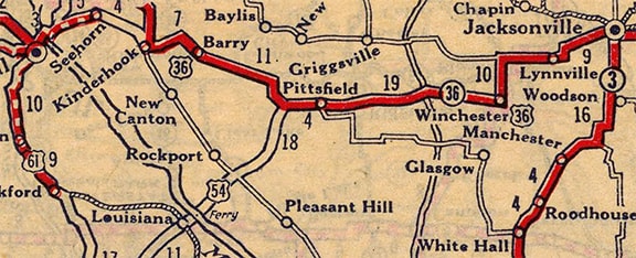
c. 1927, Rand McNally
|
|
US 36 originally followed what is now IL hwy. 106 from Hannibal MO through Pittsfield. Back when that was the case, the US 54 designation ended here (left is to Barry and Hannibal, straight is to Pittsfield):
|

Sanderson, Oct. 2002
|
|
Here, we are looking at what was historically the east beginning of US 54, as seen from westbound US 36:
|
date and attribution unknown; linked to source
|
|
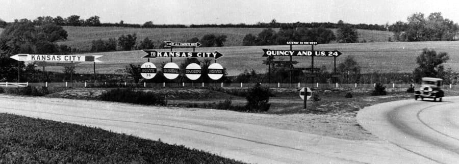
US 36 continued to the right, and the privately-installed signs indicated that route connected with US 24 and Quincy. US 54 began to the left; note that both directions were said to serve Kansas City. Today US 54 is the mainline to the left, while continuing west on old US 36 (now IL 106) requires a right turn:
|
Sanderson, Oct. 2002
|
|
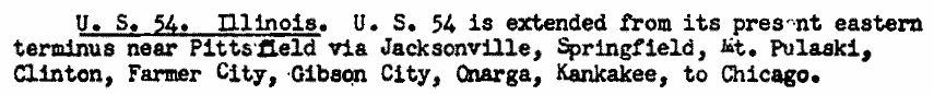
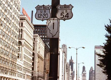
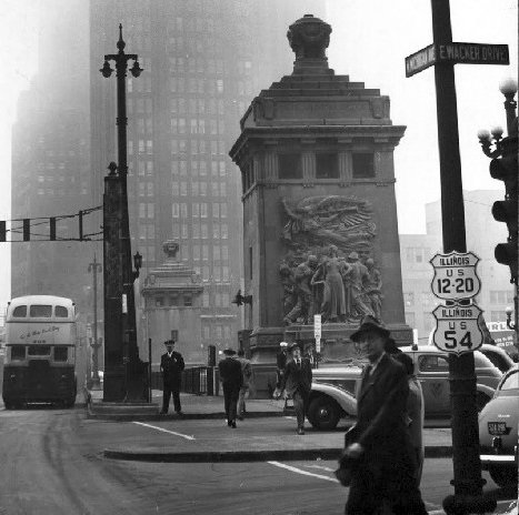
In 1940, AASHO approved an extension of US 54. It was overlapped with US 36 further east: through Pittsfield and Jacksonville, to Springfield. From there, US 54 followed what is now IL hwy. 54 northeast to Onarga. North of there, it overlapped with US 45 to Kankakee, and then northeast on a complicated (but almost entirely still driveable) route into downtown Chicago. US 54 ended up on Michigan Avenue; here are a couple vintage photos, both taken looking north:
Lindsay, 1958
|
c. 1946, unknown attribution, (click image for more info)
|
|
The preceding image was taken at Wacker Drive, approaching the bridge over the Chicago River. From there, the US 54 designation continued ahead for about a mile before ending at its junction with Lake Shore Drive (US 41):
|

Hargraves
|
|
That was also north on Michigan; Lake Shore comes in from behind the building on the right, and continues ahead. So that was the east end of US 54. In this next photo, we're looking the opposite direction: south on Lake Shore (which goes left here; Michigan is straight ahead):
|
Hargraves
|
That would have been the historic east beginning of US 54 until 1953. At that point, US 14 was extended south on Michigan to Jackson (where it junctioned with US 34 and 66), so US 54 was truncated to the same intersection (photos and more info on the Chicago page). In 1971, for reasons that are unclear, the US 54 designation was truncated out of Chicago, and back to its original east terminus west of Pittsfield.
|
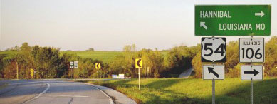
The segment of historic US 54 north of Onarga may well have been considered unnecessary, but removing the US route designation between Springfield and Onarga seems rather pointless. There is no obvious reason why US 54 shouldn't end here:
|
Sanderson, Oct. 2002
|
|
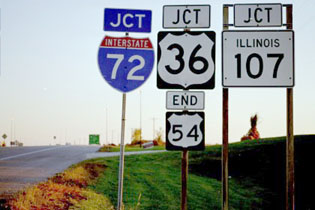
That was at US 45 in Onarga. In 1992, US 36 was re-routed onto a new freeway running between Springfield and Hannibal. That made it necessary to extend the US 54 designation along old US 36 into Pittsfield itself, and then north to the interchange where it ends today (about five miles northeast of Pittsfield):
|
Carlson
|
It was about 1996 that the I-72 designation was extended west of Springfield and applied to the US 36 freeway. At first, it looks like the DoT simply added an extra post, but now that assembly has been replaced; compare more recent signage at this same location:
Sanderson, Oct. 2002
|

Morrison, Apr. 2008
Interesting how the new assembly still had a smaller shield for US 54. That is now interchange 35 on I-72/US 36. And the assembly has since been replaced again:
|
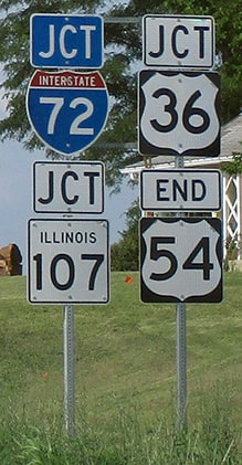
Sweeney, July 2018
|
|
Here is a view of the east beginning of US 54 as seen from I-72 (westbound and eastbound, respectively):
|
Sanderson, Oct. 2002
|
Barnes, Aug. 2016
|
|
The Clearview version had been installed by 2010. Next is an interesting assembly heading south at the end of IL 107 and the beginning of US 54. The I-72 interchange is just ahead, and that's where US 54 begins. But this signage was kind of unusual -- and potentially misleading:
|
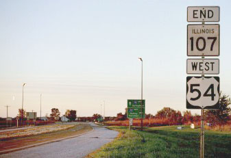
Sanderson, Oct. 2002
|
|
One could get the impression that both 107 and 54 end there. It would be better for the "WEST" tab to be replaced with either a "JCT" or a "BEGIN" tab. By 2017 it had been changed to something a little better:
|
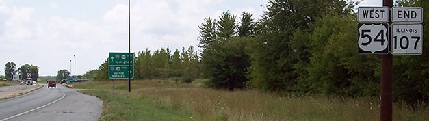
Mortell, summer 2017
|
|
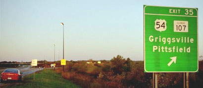
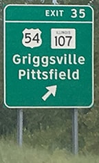
Continuing ahead, the first westbound confirming assembly looks like this:
|
Morrison, Apr. 2008
|
|
Originally the west end of US 54 was at US 70 in Vaughn NM. This lasted from 1926 to 1931; at that point, US 70 was rerouted west of Texico, such that it went through Alamogordo instead of Vaughn, and down to El Paso. But an extended US 60 took the place of US 70 west of Texico, so US 54 ended at US 60 for another two years:
|
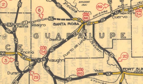
c. 1931, NMDoT
|
However, the current junction of US 54 and US 60 is not the same junction where US 54 once ended. This is because the US 70 of the 1920s (and the US 60 of the early 1930s) did not follow the current alignment of US 60 between Vaughn and Yeso. On the USGS map below, Vaughn is shown in the upper left, and Yeso is at lower right. Modern US 60 is the red line between the two; note how it remains on the north side of the railroad for the entire distance between the two towns:
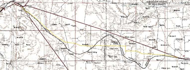
|
The original route of US 70-60 is highlighted in yellow. As can be seen on both maps above, the route had three railroad crossings between Vaughn and Yeso: one just southeast of Vaughn, one near the Duoro siding, and one near the Cardenas siding. Very little of this road is still driveable. It may have been when that USGS map was made (1954), but even back then it was shown as "unimproved surface". But this historic road doesn't even show up on most modern maps, and on aerial photos it looks like nothing more than a scratch running across private ranchlands.
This next image zooms in on the area just east of Vaughn. The background is a 1997 aerial photo blended with the corresponding USGS topo (which was based on aerials flown prior to 1978). The current highway alignments are highlighted in yellow, illustrating how the road configurations at both junctions have changed since the topo was made. But the really interesting thing visible on this photo is a scar running south and west from the current junction of US 54 and US 60. That is highlighted in green: |
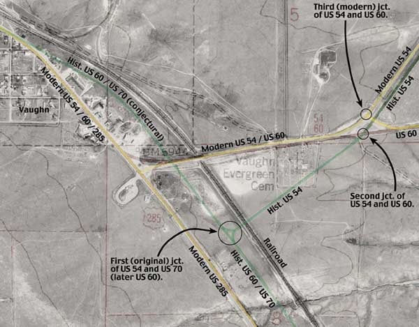
|
|
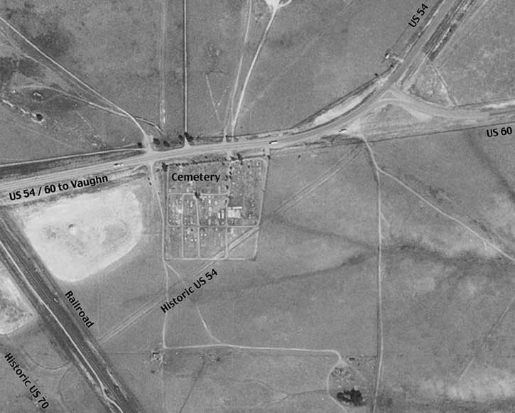
These scars are the ghosts of the original highways running through this area, and they allow us to pinpoint the location of the original west end of US 54. Note the cemetery in the image above, and use that for reference in the next photo, which is zoomed in a bit closer, and is unretouched except for the labels:
|
|
|
The borrow ditches that were used to grade the roadbeds of the historic highways are still visible, and it can also be seen that US 54 ended at a Y-junction with US 70 (lower left). These roads have been vacated, and the former rights-of-way have been sold into private ownership (as evidenced by the cemetery that is now situated where the old highway used to run). Some traces of the old road still remain, but it is probably noticeable only by someone who is specifically looking for it:
|
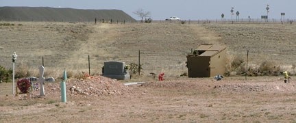
Sanderson, Mar. 2010
|
|
That was taken from the middle of the old right-of-way in the south part of the cemetery, looking northeast (the car in the background is on US 60, and the landform in the distance is Argonne Mesa, near Pastura, on top of which is a large windfarm). In that direction, a faint outline of the old roadbed is still visible. Looking the opposite direction, the old road is even less conspicuous:
|
Sanderson, Mar. 2010
|
|
Old US 60-70 ran parallel to the railroad visible in the middleground, just on the far side, so the original endpoint of US 54 was just a fraction of a mile in that direction.
This old route had a railroad crossing not far from Vaughn. If one follows the scar of old US 60-70 southeast a little ways from the photo above, they will come to the S-curve shown here: |

|
That is undoubtedly where US 70 crossed to the north side of the tracks, on its way to Joffre, Duoro, and eventually Yeso. A 1927 map shows this road as "graded", but all maps I've seen indicate that it was never paved. It is difficult to imagine what it must have been like to drive across New Mexico in the 1930s -- certainly it was no trivial endeavor.
In 1934, US 70 was rerouted again: west of Alamogordo, it went through Las Cruces instead of El Paso. At that point, the US 54 designation was extended south from Vaughn to Alamogordo, and then down to El Paso along the former route of US 70. That was also right about the time that modern US 60 was built between Vaughn and Yeso. A couple years later, US 285 was designated through Vaughn, and since then, the town has been situated at the junction of three US highways.
In 1934, US 70 was rerouted again: west of Alamogordo, it went through Las Cruces instead of El Paso. At that point, the US 54 designation was extended south from Vaughn to Alamogordo, and then down to El Paso along the former route of US 70. That was also right about the time that modern US 60 was built between Vaughn and Yeso. A couple years later, US 285 was designated through Vaughn, and since then, the town has been situated at the junction of three US highways.
The west terminus of US 54 in El Paso has shifted around a few times (photos and more info on the El Paso page). In 1974, US 62 and US 85 were extended to the crossing that was first served by US 54, and US 54 was redirected to the second border crossing in El Paso:
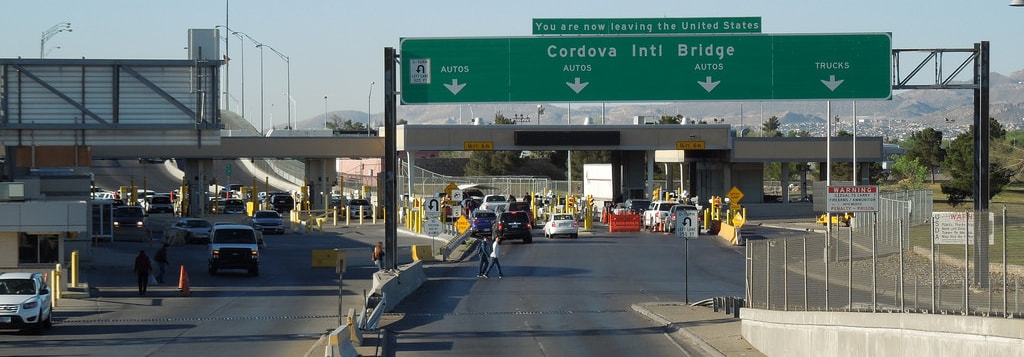
Sanderson, Mar. 2016
|
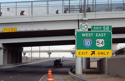
At some point things changed: US 54 is no longer directed to the Cordova crossing. However, as of 2016, signage is rather unclear exactly where US 54 is directed, because the last mention of the route is at the approach to the I-10 interchange:
|
Karners, Dec. 2011
|
|
That is posted on the Yandell Drive overpass. The next signage ahead used to mention US 54...
|
Elbert, Mar. 2007
|
|
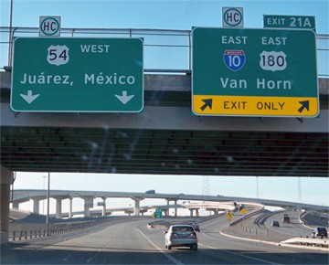
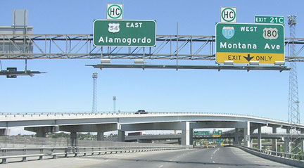
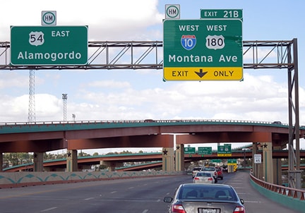
...but the new Clearview version of that sign bridge has changed significantly: there is no US 54 panel anymore. Also, I-110 to Juarez used to be a "hidden" designation, but it is signed now. However, all of US 54's last highway junctions (I-10, I-110, and US 62) are signed as "Exits", so we can assume the mainline is still US 54, until it ends at the interchange with TX Loop 375:
|
Elbert, Mar. 2007
|
|
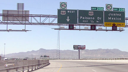
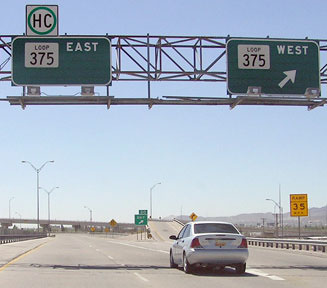
Heading west on Loop 375 (or the Border Freeway), a US 54 marker is oddly posted on the mainline, just before one reaches the exit ramp that leads to US 54:
|
Nitzman, Jan. 2006
|
|
That has been there for a long time; it was probably intended to be accompanied by a right arrow:
|
Sanderson, Mar. 2016
|
|
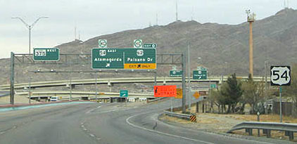
Once a driver exits to the west beginning of US 54, the first confirming sign looks like this:
|
Sanderson, Mar. 2016
|
|
In those photos the Franklin Mountains are prominent in the background. Next is the beginning of US 54 as seen from the opposite direction (eastbound on Loop 375):
|
Sanderson, Mar. 2016
|
|
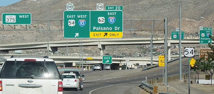
The overpass visible in that photo is the aforementioned Cordova crossing. After taking that exit and continuing just a bit ahead, at the I-10 interchange, there was once a cool old button-copy shield on one of the overhead signs:
|
Elbert, Mar. 2007
|
|
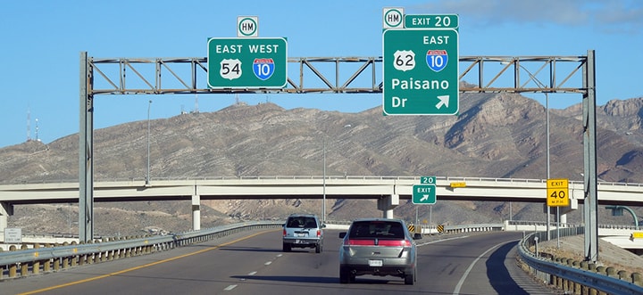
The backside of that sign is visible in one of the "Juarez Mexico" photos above. The button copy is now gone, the font is now Clearview, and the infrastructure has been redone in a distinctive Tex-Mex style:
|
Sanderson, Mar. 2016
|
Pittsfield, IL -- 1197 miles.
Research and/or photo credits: Joseph Barnes; Chuck Bell; Rich Carlson; Chris Elbert; Don Hargraves; Karin and Martin Karner; Jim Lindsay; Jeff Morrison; Robert Mortell; Alex Nitzman; Steve Riner; Dale Sanderson; Michael Summa; Collin Sweeney; David Thompson
Page originally created 2000;
last updated Dec. 16, 2023.
last updated Dec. 16, 2023.
