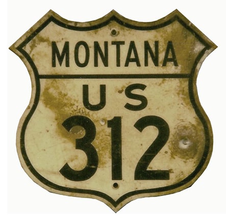
End of historic US highway 312 |
 |
|
|
|
The story of US 312 is closely intertwined with its parent (US 12) and sibling (US 212). The east end of US 12 has been in Detroit since the beginning in 1926. At that time, the west end was at US 10 in Miles City MT:
|
c. 1936, MT DoT
|
|
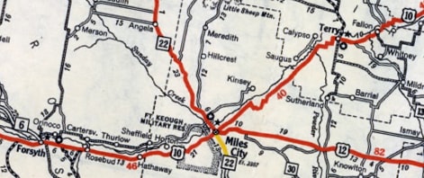
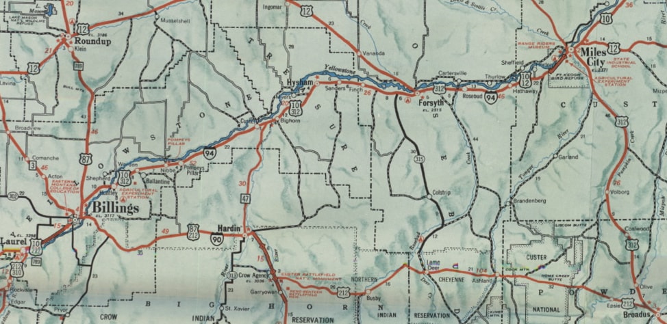
In 1938, apparently it was decided that the northeast entrance to Yellowstone National Park should be served by a US route, like all of the other entrances. In order to accomplish this, the US 12 designation was extended west along an astounding 160-mile overlap with US 10 through Billings to Laurel, and then southwest for another 10 miles via US 310. Meanwhile, the US 212 designation was extended westward from Belle Fourche SD to Broadus, but then went north via today's MT hwy. 59, ending at Miles City:
|
c. 1940, MT DoT
|
|
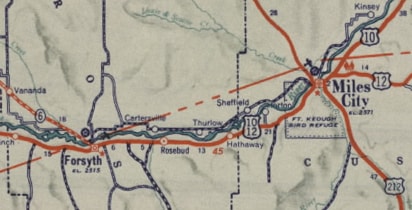
Twenty years later (1959), the US 12 designation was changed to its modern configuration: it split off from US 10 at Forsyth to follow its present route through Helena to Missoula. And thus US 312 was born: it followed the former route of US 12 from Forsyth through Billings to Yellowstone. It is unclear why AASHO approved this route, considering that it was intra-state, and that its easternmost 127 miles were overlapped with existing US routes, while only the westernmost 64-mile segment was solo:
|
c. 1960, MT DoT
|
|
This interactive image is looking west on Front Street in Forsyth. This was westbound US 12, which originally continued straight ahead. When it was rerouted in 1959, US 12 continued to the right (over the railroad bridge), and then straight ahead became the east beginning of US 312:
|
|
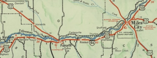
In 1961 (just 1.5 years later) another change took place: instead of ending at Miles City, US 212 was extended west from Broadus along its present path through Hardin to Billings, where it then subsumed US 312 the rest of the way to Yellowstone. So the west end of US 312 was truncated at Billings, but the east end of the designation was extended: overlapped with US 12 to Miles City, then south along US 212's former route to end at US 212 in Broadus:
c. 1962, MT DoT
|
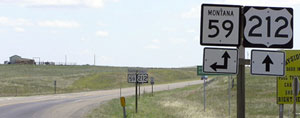
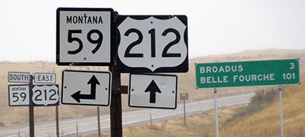
That is how things remained for nearly 20 years, until US 312 was decommissioned in 1979 (probably because it had only 76 standalone miles, all in one state). These photos were looking south on MT hwy. 59 in Broadus:
|
Elbert, July 2005
|
Sanderson, Oct. 2021
|
|
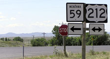
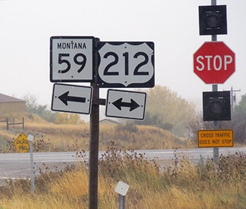
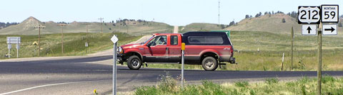
Today MT 59 overlaps with US 212 east from here to Broadus (about three miles) and then another four miles east before heading southward into Wyoming on its own. But that was formerly the east end of US 312. Here, we are looking east on US 212:
|
Elbert, July 2005
|
Sanderson, Oct. 2021
|
|
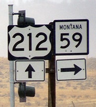
Broadus is ahead; to the left was historically the east beginning of US 312. This next view was from the opposite direction (west on US 212):
|
Elbert, July 2005
|
Sanderson, Oct. 2021
|
|
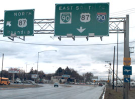
US 312 began to the right, on its way to Billings, which was where its western terminus was situated for most of its existence. This photo was looking south on Main Street, or US 87:
|
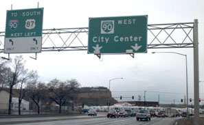
Sanderson, Mar. 2001
|
Formerly US 312 was dual-signed with US 87 to that point (1st Avenue North). 1st was originally US 10, and later US 12. Now it is just Business Loop I-90. This shot was looking east on 1st:
|
Sanderson, Mar. 2001
|
|
To the left was once the west beginning of US 312. Heading that direction, it was not far before US 312 split off from US 87. To this day, that road is still referred to as "Old Highway 312":
|
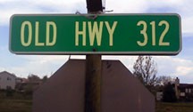
Scheidler, May 2010
|
Research and/or photo credits: Chris Elbert; Dale Sanderson; Zach Scheidler; Michael Summa
Page originally created 2001;
last updated Dec. 15, 2023.
last updated Dec. 15, 2023.
