End of US highway 97 |
 |
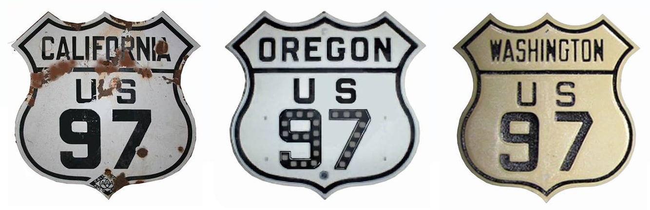
Summa
|
|
Mileage: in 1989 AASHTO listed a figure of 701 miles for US 97... however, that included the mileage of US 97's associated alternate route. According to the state subtotals on AASHTO's 1989 spreadsheet, mainline US 97's actual end-to-end total at the time was 663 miles. That closely matches our own 2020 measurement, which yielded 664.7 miles.
Claim to fame: US 97 was the only US route designation that the state of Alaska ever applied for (read more about that proposal). But it was never signed in Alaska, so the north terminus of US 97 has always been at the Canada border a few miles north of Oroville. This 1950s shot was taken looking south at the historic customs houses:
Claim to fame: US 97 was the only US route designation that the state of Alaska ever applied for (read more about that proposal). But it was never signed in Alaska, so the north terminus of US 97 has always been at the Canada border a few miles north of Oroville. This 1950s shot was taken looking south at the historic customs houses:
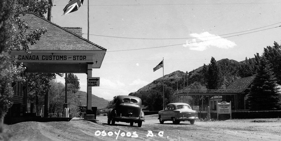
c. 1950 (linked to original)
|
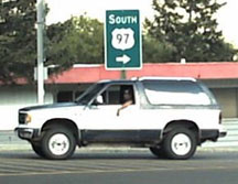
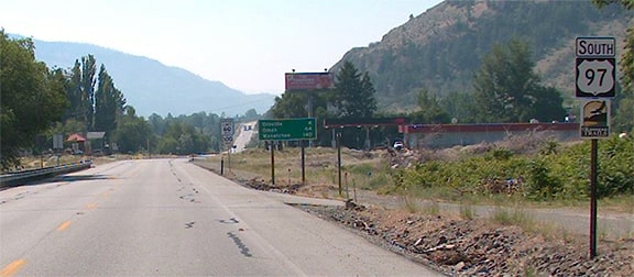
That was the perspective of a driver at the north beginning of US 97. Unless otherwise noted, the rest of these photos are from SRweb (WSDoT's web-based state route viewer). These first ones show the last northbound US 97 sign (just out of Oroville, about four miles south of the border):
|
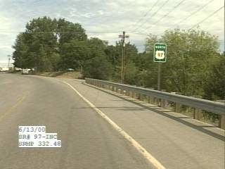
2000
|
2021
|
|
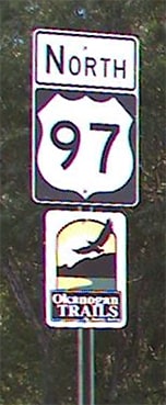
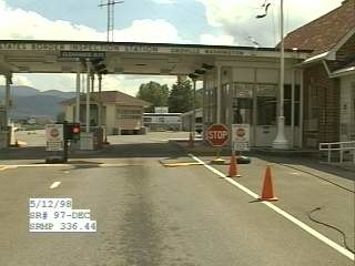
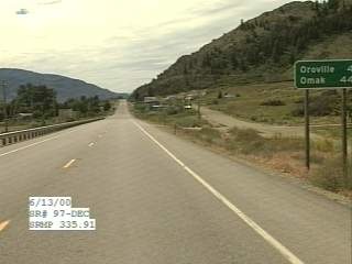
These photos were taken approaching the north end of US 97, including a closer look at the area right on the Canada boundary:
|

1998
|
|
|
Sometime after those photos were taken, a newer, massive, shared customs facility replaced the buildings shown there:
|
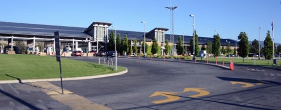
Sep. 2014 (linked to source)
|
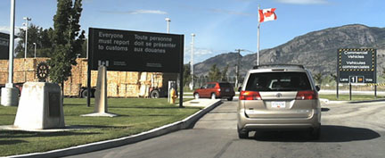
Heading the opposite direction, here is the north beginning of US 97 (viewed from the Canada border), the first US 97 sign (immediately after clearing customs), and a "Welcome to Washington" sign:
1998
|
|
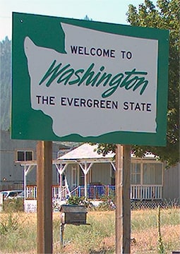
2021
|
2021
|
That last image shows the first southbound US 97 trailblazer, and here are some additional shots of that:

1998
|

2021
|
|
Next, the speed limits are given in both miles and kilometers, but the distances are listed only in miles:
|
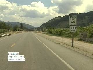
1998
|
2000
|
The original US 97 ran entirely along the west bank of the Okanogan and Columbia rivers, all the way from Oroville to Wenatchee. The highway has been upgraded over the years, and in three different stretches US 97 has been rerouted onto newer segments along the east banks of each valley. The old segments are still driveable, and one of them -- the stretch between Chelan and Wenatchee -- is now signed as Alternate US 97.
|
US 97 was an original 1926 route, but back then the designation diverged from its modern route at Klamath Falls OR, following instead today's OR hwy. 66 to the west, and ending at US 99 just south of Ashland:
|
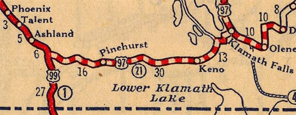
c. 1927, Rand McNally
|
|
Historic "Klamath Falls Junction" is no longer visible (except maybe during periods of extreme drought), because it is submerged beneath the waters of a reservoir (Emigrant Lake). By the time of this map, US 97 had already been changed to follow its modern route south out of Klamath, and US 99 had been rerouted above the level of the future reservoir, but the old highway routings (and US 97's old endpoint) were still shown:
|
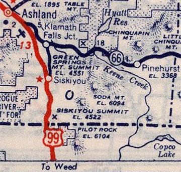
c. 1939, Rand McNally
|
|
Originally US 99 followed what is now OR 66 south and east out of Ashland. At the entrance to Emigrant Lake Park, OR 66 traffic now uses a newer road that skirts the reservoir, but old 99 continued down into the valley, following what is now the main entrance road (Emigrant Lake Road). Here is a park brochure, marked up with the approximate routes of the old highways:
|
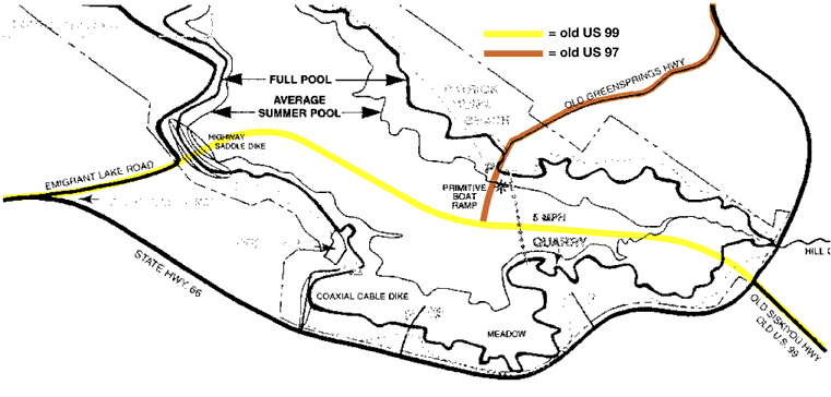
|
|
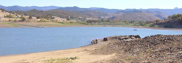
The former intersection of the yellow and orange lines is now submerged, but a year or two before that happened it was documented in this photograph; the south beginning of US 97 was to the right:
|
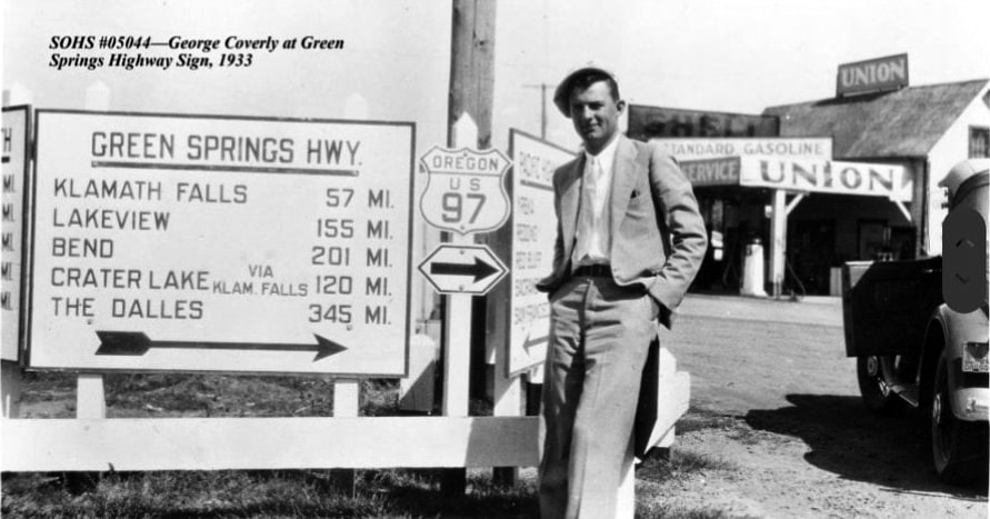
c. 1933, courtesy of Southern Oregon Historical Society (linked to source)
|
|
The other signs in that photo referenced destinations on US 99. One cannot use much of that old segment of US 99 today, because it soon disappears underneath the "highway saddle dike" -- one of several earthen impoundments that hold back the reservoir. But on the other side of the dike, one can still find segments of the old roads -- particularly when the water level is low, as it was at the time of these photos. This first one was looking along what was once southbound US 99:
|
Elbert, Oct. 2006
|
|
Formerly the road continued ahead, and somewhere under the water lies the historic junction with US 97, which followed that old road rising out of the lake at far left (now known as "Old Green Springs Highway"). The car parked over there is also visible in this photo:
|
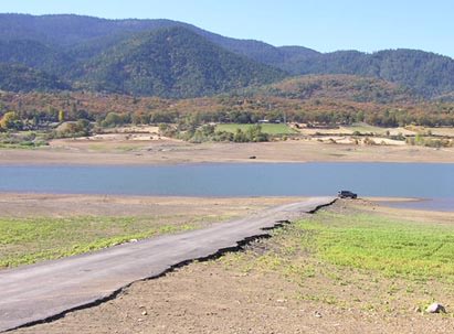
Elbert, Oct. 2006
|
|
That was looking along what used to be US 97; its original south end was straight ahead, but Klamath Falls Junction is underwater now. Next we are looking north on old US 99:
|
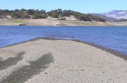
Elbert, Oct. 2006
|
|
The continuation of the old highway is visible on the far side of the lake. Down in the depths was the junction with US 97, which began off to the right. This photo was taken from the same spot, but looking the opposite direction (looking south on old US 99):
|

Elbert, Oct. 2006
|
|
The old highway was still quite visible there, although it gets more obscured by silt deposits as the elevation drops. Ahead, that aligns with what is now OR 273 (also called "Old Siskiyou Highway", which in turn leads to the town of Siskiyou at I-5's exit 6).
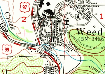
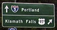
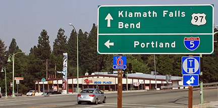
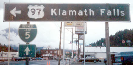
The Klamath Falls Junction endpoint lasted only a few years; in 1934 the south end of US 97 was shifted to its modern route: south from Klamath, ending at US 99 in Weed: |
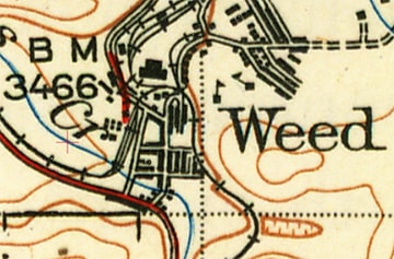
c. 1948, USGS
|
|
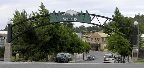
Today's alignment of US 97 through Weed is not original; historically traffic was routed through downtown via Main Street. This photo shows where US 97 originally ended:
|

Elbert, July 2004
|
|
That was looking south on Main at Weed Boulevard (old US 99). Here is a shot from the opposite direction:
|
Elbert, July 2004
|
|
Old US 99 runs across the bottom of the photo; the south beginning of US 97 was straight ahead. Today's US 97 skirts the west edge of town; where that meets old US 99 is a former terminus as well:
|
c. 1971, USGS
|
Elbert, July 2004
|
|
Today, since US 99 is gone, the US 97 designation continues left to I-5's interchange 747. But back when US 99 was still around, US 97 ended there. In this photo, northbound US 99 continued off to the left, and US 97 began straight ahead:
|
Elbert, July 2004
|
(detail)
|
|
That junction has now been reconfigured, such that US 97 is the mainline, while traffic wanting to continue north on old 99 (now CA hwy. 265) must make a left turn:
|
Elbert, July 2013
|
These photos were looking the opposite direction (southbound on old US 99); to the left was the old south beginning of US 97:
Summa, 1983
|
Elbert, July 2004
|
|
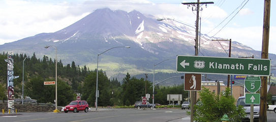
Mount Shasta is prominent in the background, but it is not visible in this photo, taken after that junction was reconfigured:
|
Elbert, July 2013
|
|
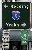
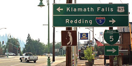
Today US 97 also turns right, following old 99 (now Business I-5), ending at the I-5 interchange. This photo was looking south on US 97 (old US 99) at I-5; the assembly at far right is also shown close-up:
|
Elbert, July 2004
|
Nitzman, Mar. 2005
|
Elbert, July 2013
|
|
The northbound onramp is to the right; southbound traffic goes under and then makes a left turn:
|
Elbert, July 2004
|
|
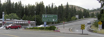
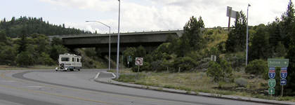
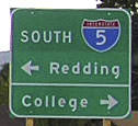
That marks the current south end of US 97. Here is a view approaching the south beginning as seen from I-5:
|
Nitzman, Mar. 2005
|
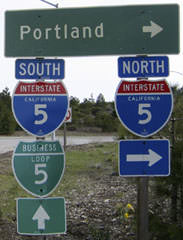
Note the exit number: that is a long way from San Diego. There are only two interstates that are long enough through a single state to have exit numbers that high: this one (I-5 in CA) goes up to exit 796, and I-10 in Texas goes up to exit 880.
|
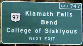
Signage at the exit itself is shown here; unfortunately CalTrans has replaced its older signs along the interstates, and of course they no longer use button reflector signage:
|

Roberts, Sep. 2004
|

Elbert, July 2013
|
|
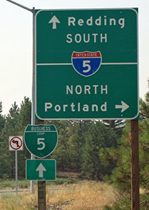
At the stop sign at the end of the offramp, this assembly is posted:
|

Nitzman, Mar. 2005
|
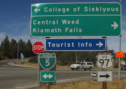
Dienhart, Oct. 2017
|
Research and/or photo credits: Paul Dienhart; Chris Elbert; Tom Fearer; Alex Nitzman; Mark Roberts; Dale Sanderson; Michael Summa
Page originally created 2001;
last updated Sep. 12, 2022.
last updated Sep. 12, 2022.
