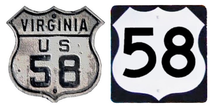
End of US highway 58 |
 |
|
1931-1933
|
1933-1996
|
1996-present
|
Summa
|
|
Mileage: in 1989 AASHTO listed a figure of 639 miles for US 58... however, that included the mileage of US 58's associated business/alternate routes. According to the state subtotals on AASHTO's 1989 spreadsheet, mainline US 58's actual end-to-end total at the time was 508 miles. That closely matches our own 2020 measurement, which yielded 509.3 miles.
|
|
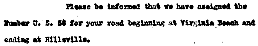
The west end of US 58 was originally at US 221 in Hillsville VA (US 52 had not yet been extended that far south). AASHO approved the new designation in July 1931:
|
The 1932 issue of Virginia's official state highway map was the only version that illustrated that arrangement:
|
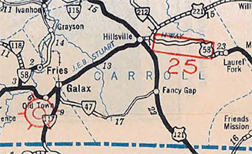
c. 1932, VDoT
|
|
This photo was taken looking east on US 58/north on US 221:
|

Summa, 1996
|
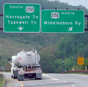
Originally US 58 probably began straight ahead at this junction (US 58 and US 221 go their separate ways about a quarter-mile ahead). The following year US 58 was extended west to its intersection with US 25E in the far western point of Virginia, just across the statelines from the towns of Cumberland Gap TN and Middlesboro KY. This junction no longer exists, but you can view maps, see photos, and get more information on the Cumberland Gap VA page.
|
In the mid- to late-1980s, the westernmost segment of US 58 was redirected to the south of its original alignment, such that its junction with US 25E (and its west end) was no longer in Virginia, but in Tennessee. This happened long before the tunnel opened for US 25E. Heading south from Kentucky and Virginia into Tennessee, US 25E went from two to four lanes at the VA/TN state line and made a sweeping right-hand turn. In that curve, the realigned US 58 came to a "T" intersection with 25E. Then 25E made a left-hand turn in the area where the trumpet interchange and the current end of US 58 is today. Today, the last several hundred feet of four-lane US 58 is on what was originally US 25E.
|
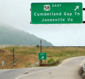
Since the Cumberland Gap Tunnel opened in 1996, US 25E no longer goes through Virginia at all. So US 58 had to be extended south just a bit further, essentially along the path of former US 25E. US 58 now ends at a trumpet interchange with US 25E just east of the tunnel, and just south of Cumberland Gap TN. This photo shows the signage at the current west end of US 58:
|
Sanderson, July 2007
|
|
This shot is of the western beginning of US 58, from northbound US 25E:
|
Sanderson, July 2007
|
|
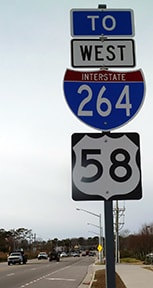
Drivers taking that exit very quickly encounter the first eastbound confirming assembly:
|
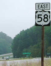
Sanderson, July 2007
|
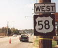
The green sign in the distance is shown close-up below:
|

Elkins, Aug. 2003
|
That was looking east on what is now US 58; its current west terminus is less than a mile behind the camera. But during the 1980s and 1990s, this was still northbound US 25E. Right about by this left turn for Cumberland Gap TN, US 25E made a left-hand curve toward the Virginia state line. The road heading off into the distance was the west beginning of US 58, but drivers had to make a right-hand turn off US 25E to get there. Even after the Cumberland Gap Tunnel opened, for a time US 58 traffic heading west still had to stop at this junction with the four-lane (old US 25E) and make a left turn, while the four-lane continued north into the Park. But later this intersection was completely realigned to the current configuration, with US 58 as the through route.
|
|
Since US 58 was commissioned in 1932, its east end has always been on the Atlantic shore; for photos and info about its original endpoint, see the Virginia Beach page. In 1956 its original route along Virginia Beach Boulevard became Business 58, while mainline US 58 traffic was rerouted along Laskin Road. As shown in this interactive image, the last eastbound marker is posted just east of Birdneck Road:
|
|
|
US 58 terminates about one mile ahead... but its exact endpoint is open to debate. According to the minutes of the Commonwealth Transportation Board, US 58 has ended at the intersection with Pacific Avenue since 1958. This photo was taken looking east on Laskin at Pacific...
|
Karners, Jan. 2017
|
...but is that really where US 58 ends? It's questionable (more below). What is certain, though, is that for about 40 years US 58 was signed one block further ahead, at its intersection with Atlantic Avenue. Here are a couple shots from there:
|
Nitzman, 2001
|
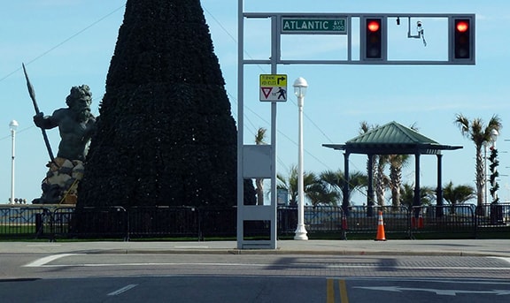
Karners, Jan. 2017
|
In 1956 (when US 58 traffic was moved onto Laskin), US 60 still ran along Atlantic, so that is where US 58 ended. But just two years later, Atlantic became Business 60, while mainline US 60 traffic was rerouted along Pacific. So VDoT truncated US 58 to Pacific, but the city of Virginia Beach is responsible for non-interstate signage, and they continued to sign US 58 to Atlantic until sometime in the 1990s. Since then, unfortunately, signage for all three routes (US 60, mainline US 58, and Business US 58) is virtually non-existent in this part of town.
|
And, making matters even more confusing: in 2013 VA Beach built a roundabout on Laskin, about five blocks west of Pacific, which encourages the main flow of inbound traffic to use 30th Street (one block south of Laskin), and outbound traffic to use 32nd Street (a block north of Laskin). Through traffic is discouraged from using Laskin itself, which now has a 25 MPH limit, stop signs at every intersection, and a speed hump. As of 2015, VDoT data showed that US 58 was still using Laskin, ending at Pacific. But as an independent city, VA Beach is the entity responsible for signage and maintenance (not VDoT). Considering the infrastructure the City has put in place to divert traffic away from Laskin, if they were to sign US 58 from Pacific, it is difficult to imagine they would direct traffic up Laskin. Therefore, it appears that the de facto endpoint of US 58 is on 30th at Pacific, and the east beginning is on 32nd at Pacific. But it is not possible to verify this in the field, since VA Beach has not posted any US 58 signs until just west of the roundabout:
|
Karners, Jan. 2017
|
That is the most recent first westbound marker, but formerly it looked like this:
Nitzman, 2001
|
Research and/or photo credits: H.B. Elkins; Karin and Martin Karner; Alex Nitzman; Mike Roberson; Dale Sanderson; Michael Summa
Page originally created 1999;
last updated Mar. 13, 2022.
last updated Mar. 13, 2022.
