US highway history and endpoints in the Brunswick, GA area
|
The I-95 corridor through Glynn County Georgia is essentially a straight shot, running parallel to the Golden Isles along the coast, and bypassing central Brunswick to the north and west. But US 17 (the predecessor of I-95) has always followed a more complex route through the Brunswick area. The endpoints of the other US highways in this region (US 25, US 82, US 84, and US 341) have always been dependent on the route of US 17 and/or I-95.
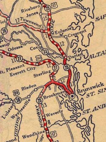
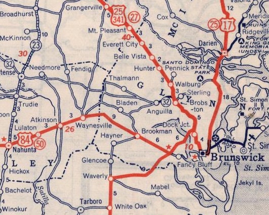
Back when the original US routes were commissioned in late 1926, most highways did not bypass cities. Rather, traffic was often directed right through central business districts, and US 17 through Brunswick was no exception. However, at the time none of the major bodies of water surrounding Brunswick had been bridged. So -- since US 17 was tasked with going far enough south to serve Brunswick, but also far enough north to get around the Turtle River and its tributaries -- the path of the highway between Darien and Waverly resembled a 50-mile-long "S"-curve. Contrast that with today's I-95, along which only 27 miles separate Darien (exit 49) and the Waverly area (exit 22). Georgia's official state highway maps from those early years were very generalized; the commercial map shown here illustrated the sinuous nature of US 17 in much better detail: |
|
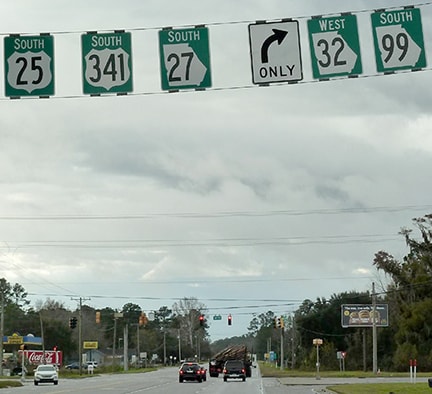
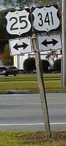
In 1927, the specifics of that giant "S"-curve were as follows: southbound from Darien, US 17 came into Brunswick on Glynn Avenue (as it does today). But at Gloucester Street, US 17 turned west, then north on Newcastle Street, then back east on "G" Street (in order to pass the Glynn County Courthouse); then north on Norwich Street up to Dock Junction. It is not clear when the road that carries US 341 today was first opened in the Dock Jct. area, so it is possible that US 17 used Old Jesup Road up to Sterling for a few years. At Sterling, US 17 turned west on what is now GA hwy. 32-99, while US 341 began straight ahead. This image was taken looking south on US 341 in Sterling:
|
|
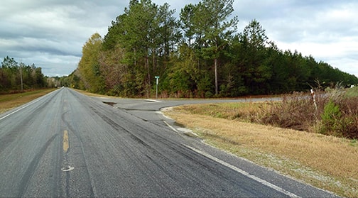
That was the original south end of US 341. Straight ahead was northbound US 17 (although it went south ten miles into Brunswick before turning in a northerly direction), while southbound US 17 was to the right on GA 32-99. At Anguilla those two routes split; US 17 continued along what is now GA 99 to the southwest. Today's intersection with Bladen Road was the original junction with US 84. This image, looking south on GA 99, shows Bladen beginning to the right, which was the original beginning of US 84:
|
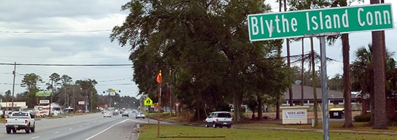
Ahead, US 17 passed through the communities of Georgetown, Brookman, Hayner, Glencoe, and Waverly, finally joining the modern US 17 corridor at White Oak. But that was the situation for only a year or two: in 1928, bridges were built over the Turtle River, South Brunswick River, and Little Satilla River. So from Dock Jct, US 17 was rerouted to follow Blythe Island Highway (now GA 303) south to the junction located just west of I-95's interchange 29 (going forward, this junction will be referred to as "West Brunswick").
|
Compared to US 17's original route, this cutoff saved about 11 miles. It also resulted in changes to the endpoints of the other US routes. US 84 was extended to W. Brunswick Jct. (photos from there are shown at the bottom of this page). US 341 was extended south (along what had been US 17) to Dock Jct. This photo was looking south on Old Jesup Road:
|
|
That is the road that carried US 341 in 1927. The road ahead is current US 25-341, an extension of Norwich Street, but originally it carried US 17, so US 341 probably ended at that intersection. In the background is visible the junction signage that is still posted there, even though Old Jesup is no longer on the state highway system; here is a close-up:
|
It is likely that this section of today's US 25-341 was not built until sometime in the 1930s. If so, then there was a period during which the south beginning of US 341 angled to the right, along Old Jesup Rd. Either way, southbound US 17 continued ahead for a short distance before curving left onto Blythe Island Hwy (that curve is visible just to the right of the trees behind the yellow semi).
|
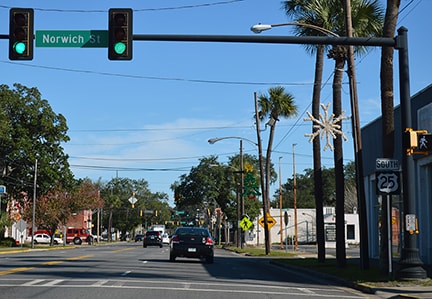
Later, when today's Norwich Extension was built, US 341 traffic was directed straight ahead (instead of along Old Jesup). So the terminus moved just a few hundred feet further ahead, where this photo was taken. US 17 still continued by curving to the left on Blythe Island Hwy, while straight ahead was the south beginning of US 341:
|
|
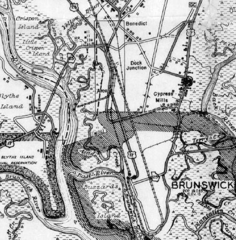
In 1938, the US 25 designation was extended southward, overlapping with US 341 to that same junction, as illustrated on this map:
|
Also shown on that map were the pre-1928 routes of both US 17 and US 84 (described above). This 1938 map of Glynn Co. highways strongly suggests that US 25-341 and US 84 both ended at their junctions with US 17 (rather than being overlapped with US 17 into central Brunswick):
|
|
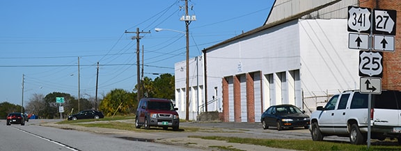
This photo was taken looking the opposite direction (south on US 25-341). The white suv at center was following what was once northbound US 17, which came in from the lower right corner and curved straight ahead. The white pickup at lower left was therefore at the historic south end of US 25-341:
|
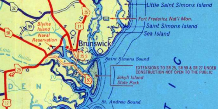
Ten years later, the official state highway map began to show that both the original Sidney Lanier Bridge and the Jekyll Island Causeway were under construction:
|
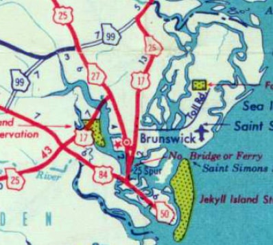
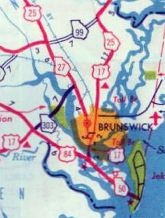
The 1953 issue was the first map to show that the US 84 designation had been extended to Jekyll Island:
|
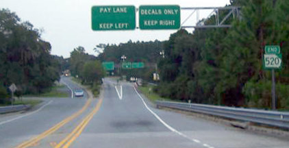
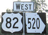
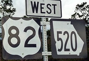
Today that segment is designated GA 520, and formerly there was an "End" assembly at the causeway landing on Jekyll Island:
All of those signs were there until at least 2009, but they are gone now...
|
|
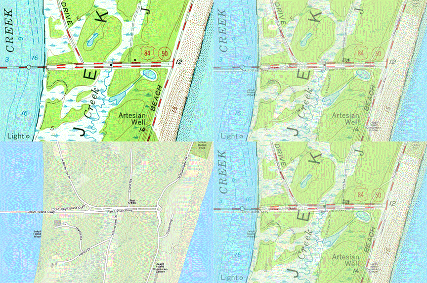
...and at any rate, the USGS topo from that time period specified that the US 84 designation extended further ahead, to Beachview Drive:
|
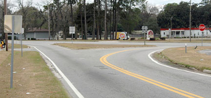
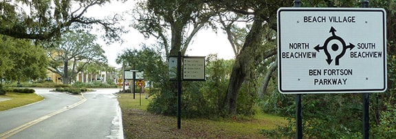
Beachview has since been realigned, and the historic terminus of US 84 is now buried beneath newer commercial developments. The traffic circle shown here is as far east as one can drive now on old US 84:
|
|
Although the Sidney Lanier Bridge was shown on the 1953 map above, it was also labeled "No bridge or ferry". The bridge did not actually open until 1956, and the 1957 map was the first to show it without a disclaimer:
|
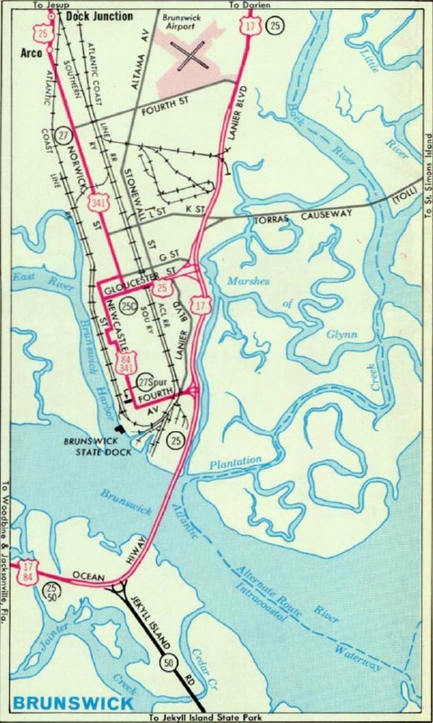
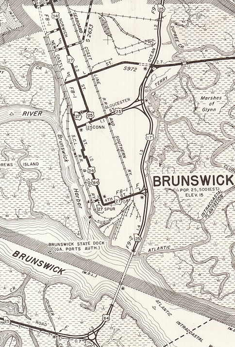
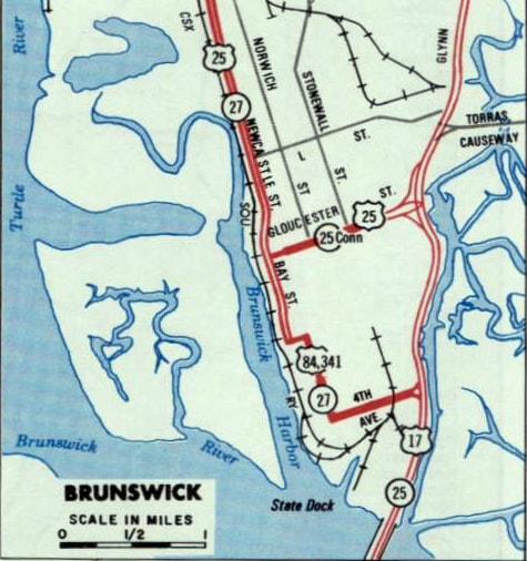
That was also the first map to indicate that US 17 traffic had been directed to use the new bridge. From there, the highway went west with US 84 to W. Brunswick Jct. There the two designations diverged, with US 17 resuming southward along its existing route. This change resulted in another two miles of reduced distance for through traffic on US 17. North from that junction, the former US 17 was designated GA hwy. 303 up to Dock Jct. It no longer made sense for US 25-341 to terminate at that point, so both designations were extended south into Brunswick, along roads that formerly carried US 17 traffic. The specific routings were well-illustrated on the maps below:
|
US 25 and US 341 were extended south on Norwich for an additional three miles, but at "G" St the routes diverged. US 25 traffic stayed on Norwich for another two blocks, then turned east on former US 17 (Gloucester), ending at its junction with current US 17 (Glynn). Meanwhile US 341 followed a different segment of old US 17 for a few blocks: traffic was directed to turn west on "G" past the courthouse, then south on Newcastle. The route continued past Gloucester for several blocks, including a jog around the west side of Hanover Park. At 4th Street, traffic was directed east, and (like US 25) the US 341 designation also ended at its junction with US 17. Since then, although the routings for both US 25 and US 341 have changed slightly, their endpoints remain the same to this day (see the main pages for US 25 and US 341).
|
Those maps show that one additional US route was changed when US 17 began using the Sidney Lanier Bridge: US 84 was truncated from Jekyll Island. Instead traffic was directed to remain with US 17 north across the new bridge. At 4th, US 84 went west with US 341, then north along Newcastle. At Gloucester, US 84 and 341 diverged, with US 84 turning east on Gloucester, ending at Norwich, where it junctioned US 25. In other words, US 84 was extended into downtown Brunswick in order to cover the only remaining stretch of former US 17 that was not replaced by US 25 or US 341: the segment of Gloucester between Norwich and Newcastle. This image was looking east on Gloucester:
|
|
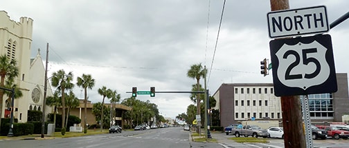
This was northbound US 25. It still is, but whereas today that route continues straight ahead, in 1956 US 25 continued by turning right on Norwich, and straight ahead was the east beginning of US 84.
That remained the case until about 1978, when the US routes in central Brunswick were changed a bit. Instead of using Norwich, US 25-341 traffic was directed down Newcastle, and at about "H" Street, the highway curved to align with Bay Street. At Gloucester, US 25 turned east to rejoin its older alignment. US 341 continued south on Bay, but at Prince Street traffic was directed east, and then US 341 resumed along its older route by turning south on Newcastle. US 84 continued to overlap with US 17, and then US 341, ending at its junction with US 25, as illustrated on this map: |
|
This photo was looking the opposite direction (north on Bay). Straight ahead is also northbound US 25, while southbound is to the right on Gloucester... but unfortunately this sign was posted past Gloucester, which is behind the camera. However, if it had been installed in the correct location, it would provide a good representation of signage at the former end of US 84, which overlapped with US 341 to Gloucester, and ended at this intersection...
|
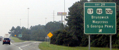
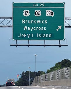
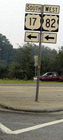
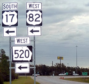
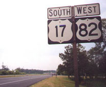
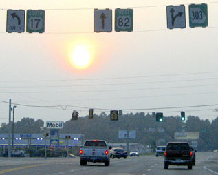
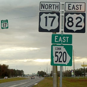
...at least, that is according to maps. However, it has been reported that right around that same time (1978), US 84 was signed only as far as Jekyll Island junction (at the south end of the Sidney Lanier Bridge). Another complexity: it has also been reported that, according to state route logs, US 84 technically continued to end at Jekyll Island all the way up until 1989 (despite official maps that showed otherwise). That was the year when the routes of US 82 and US 84 east of Waycross were swapped. US 84 now ends at Midway, and AASHTO's action explicitly stated that the former US 84 between I-95 and Brunswick was not a part of the new US 82. But since that time, reportedly GDoT's internal information says the US 82 designation still officially extends to Jekyll Island...
|
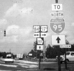
Here is a really cool, older photo from this junction:
|
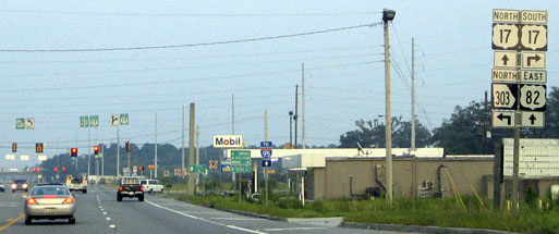
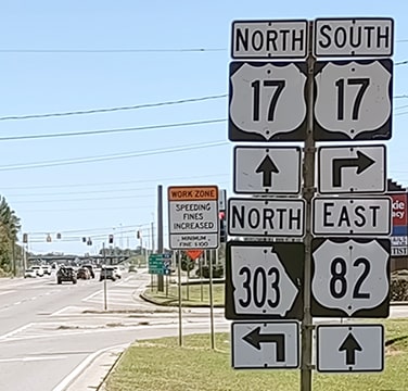
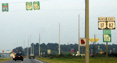
That was looking north on US 17, which formerly continued straight ahead, but was directed to the right after the Sidney Lanier Bridge opened. To the left was an historic east beginning of US 84. It is interesting to note that I-95 was not complete in this area at the time of that photo; that is why traffic was directed straight ahead (instead of to the right, where interchange 29 is today). But the coolest thing is that this photo was taken back when it was US 84 (not US 82) that ran through here. This next series was heading east on US 82:
|
Research and/or photo credits: James Allen; Paul DiGianfrancesco; Karin and Martin Karner; Herman Mortimer; JP Nasiatka; Alex Nitzman; Dale Sanderson; Michael Summa; Mac Watkins
Page originally created 2004;
last updated Oct. 24, 2023.
last updated Oct. 24, 2023.
