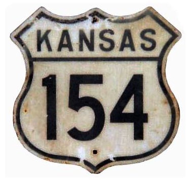
End of historic US highway 154 |
 |
|
|
|
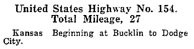
Claim to fame: for 40 years (from 1942 to its decommissioning in 1982) US 154 was the shortest US route. US 154 was among the original 1926 routes; this excerpt is from AASHO's Apr. 1927 route log:
|
|
|
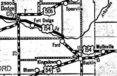
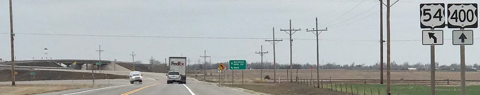
Today US 54 follows a diagonal route southwest from Mullinville... but when the US routes were first commissioned, that diagonal had not been built. Instead, US 54 went due west out of Mullinville (along what is now US 400). At the road now called "131 Spur", US 54 turned south and then stair-stepped its way through Bucklin. But if a driver were to continue west, they would have been at the east beginning of US 154, heading towards Dodge City:
|
c. 1932, KS DoT
|
|
This image was taken from that perspective; that is, looking east on what is now US 400. Historically this was westbound US 54, which continued to the left on "131 Spur Road" (Bucklin is a couple miles that direction). Straight ahead was the east beginning of US 154:
|
Sanderson, Mar. 2018
|
|
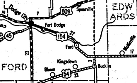
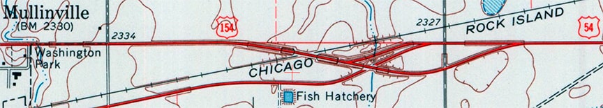
Kansas official maps suggest that it was about 1935 when the more direct diagonal route was built between Bucklin and Mullinville. However, US 54 was not explicitly shown to use that route until the 1938 issue. At that time, US 154 was extended a few miles east to Mullinville along the former US 54, and that became the east terminus of US 154 for the majority of its existence:
|
c. 1938, KS DoT
|
Initially US 154 traffic went over the railroad via a simple at-grade crossing. But already by about 1965 today's grade-separated overpasses had been built:
c. 1970, USGS
|
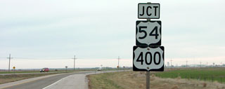
This shot was looking east on US 400 (it is unclear why the assembly announces a junction with US 400 when we are already on it). Mullinville is just behind the camera:
|
Sanderson, Nov. 2001
|
|
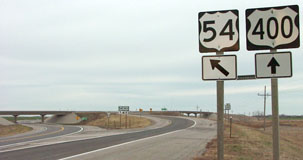
That is right about where US 154 curved to the right and approached its terminus at jct. US 54.
These next photos were looking east on US 54-400, where the two routes separate just outside Mullinville. This is the spot where US 154 (and later K-154) historically split off from US 54: |
Sanderson, Nov. 2001
|
Sanderson, Mar. 2018
|
The west terminus of US 154 was in Dodge City. The highway came into town on the road that is designated US 400 today, which becomes Trail Street locally (so named because it follows the route of the Santa Fe Trail). US 154 continued straight ahead on Trail all the way to 2nd Street. During the nascent years of the US route system, there was no US 56 or US 283 (which were later routed on 2nd), so the US 154 designation turned north on 2nd and ended at Front Street (which was probably the road that originally carried US 50-S traffic). Here is a photo that was taken when US 154 was still signposted in Dodge City:
|
1950s postcard (linked to source)
|
|
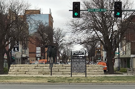
Today Front has been subsumed by Wyatt Earp Boulevard, and traffic is actually diverted just south of Front in the historic downtown area. This shot was looking north on 2nd at Wyatt Earp, and roughly shows the view at the west end of historic US 154. Front runs just behind the traffic signals, where the longhorn statue is located:
|
Sanderson, Nov. 2001
|
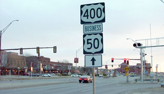
|
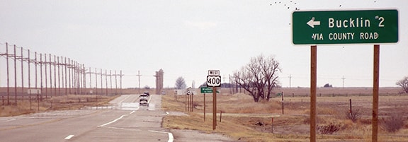
As of 2010, US 400 no longer runs through there, and Business 50 has been decommissioned. At the time of that photo, traffic coming from that direction had direct access neither to Front nor to 2nd (straight ahead), and since then an even more imposing physical barrier has been installed in that location:
|
Sanderson, Mar. 2018
|
|
This photo was looking east on Wyatt Earp. Historic US 50-S ran right in front of the buildings visible at far left, and US 154 began by turning right at the light (2nd):
|
Sanderson, Nov. 2001
|
|
After making that turn, 2nd immediately crosses the railyards. US 154 turned east again after one block, onto Trail St. This photo shows that view, looking south on 2nd (which would later also serve as US 56). Wyatt Earp is just behind the camera; Trail begins left at the light, and US 154 went that direction for over 50 years:
|

Sanderson, Nov. 2001
|
US 154 was decommissioned at AASHTO's Oct. 1979 meeting (although reportedly KDoT did not remove signage until 1982). For the next 15 years or so, its memory lived on, as its former route carried the designation "KS hwy. 154". But around 1997, Kansas decommissioned K-154, presumably because essentially the entire route is now part of US 400.
Research and/or photo credits: Nathan Edgars; Dale Sanderson; Michael Summa
Page originally created 2001;
last updated Dec. 9, 2023.
last updated Dec. 9, 2023.
