End of US highway 50 |
|
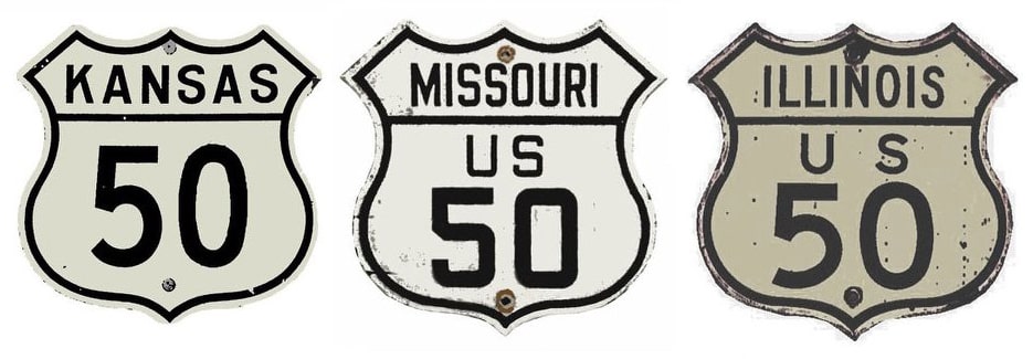
1926-1931
|
1931-1934
|
1934-1948
|
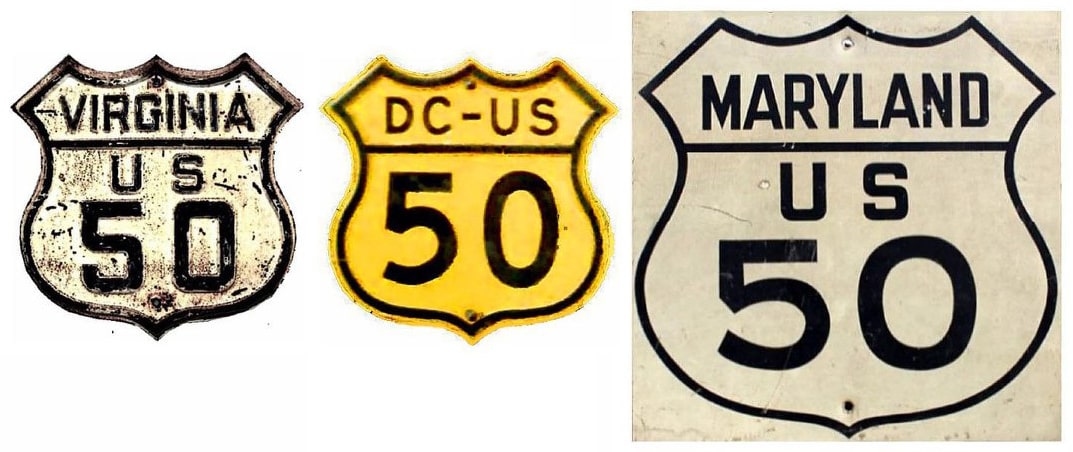
1948-1963
|
1963-present
|
|
Note: this page contains information about the mileage of US 50 during some of those timeframes, and the shifting location of its midpoint during those years.
|
|
As children many Americans were taught about the "golden spike" at Promontory Point, Utah. Placed in May of 1869, the story goes that it marked the final link in the country's first transcontinental railroad. However, virtually no one is taught that railroad was actually not "transcontinental" at the time: the Central Pacific went only as far west as Sacramento, and the Union Pacific did not have a permanent bridge across the Missouri until 1873. (Meanwhile, in 1870, the first permanent, uninterrupted chain of railroads connecting Atlantic and Pacific ports was completed at Strasburg, Colorado.)
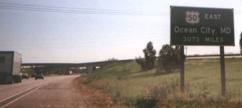
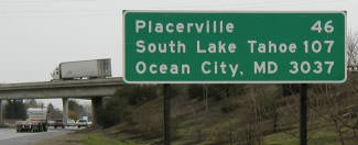
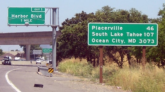
US 50, one of the better-known transcontinental highways, has a similar story. It was among the original 1926 routes, and at the time of its birth it was already nearly 3000 miles in length. However, many people do not realize that both ends fell short of reaching an ocean. Also, some sources indicate that it was either in poor condition or completely impassable between Ely NV and Thistle UT for the first two or three years. Regardless, it was not until 1948 that US 50 became truly "transcontinental".
US 50, one of the better-known transcontinental highways, has a similar story. It was among the original 1926 routes, and at the time of its birth it was already nearly 3000 miles in length. However, many people do not realize that both ends fell short of reaching an ocean. Also, some sources indicate that it was either in poor condition or completely impassable between Ely NV and Thistle UT for the first two or three years. Regardless, it was not until 1948 that US 50 became truly "transcontinental".
|
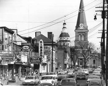
The original east end of US 50 was in Annapolis. Traffic came into the city on West Street, shown here:
|
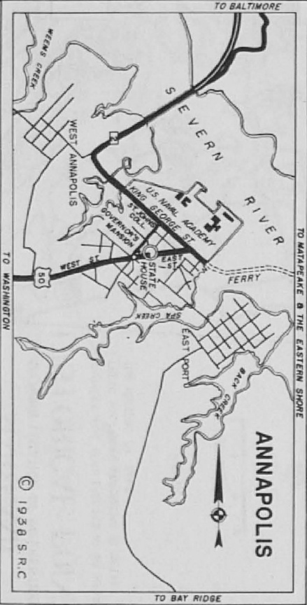
The church in the distance is situated in the middle of Church Circle, and some early maps indicate that was where US 50 ended. Beyond that the Maryland State House is visible, which sits within State Circle. According to the state highway map shown here, US 50 traffic negotiated both of those circles, and then continued on East Street:
|
|
Here, we are looking at the end of East St, at King George Street:
East is now one-way heading the opposite direction, but originally US 50 traffic came to this point and turned to the right here on King George. Today that movement will not get a driver very far, because that is now an entrance to the Naval Academy. But historically the ferry to the Eastern Shore docked at the end of King George.
|
|
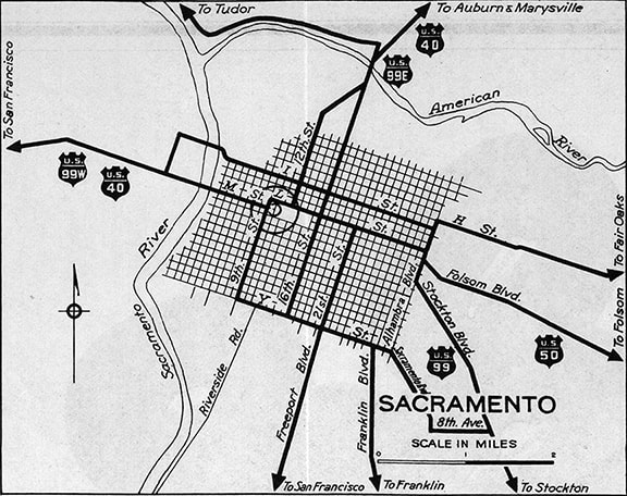
The west terminus of US 50 was originally in Sacramento. That much is clear from this map, although the specific intra-city routings were open to some interpretation:
|
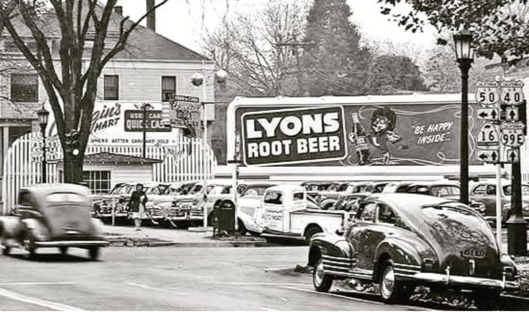
US 50 came in on Folsom Boulevard, meeting US 99 at Alhambra Boulevard. But rather than ending at that junction, it seems more likely that US 50 would have been overlapped with US 99 westward along "L" Street to a terminus at 16th Street, which would have allowed it to reach a junction with US 40, US 99E, and US 99W. That map suggests the possibility that US 40-99E traffic could have used 12th Street instead of 16th, but starting in 1938 the maps explicitly showed that highway traffic was directed to use 16th. And this photo, looking south on 16th, was taken not long after that:
|
By about 1940 (and by the time of that photo), highway traffic had been moved off "L", instead using "M" Street (aka Capitol Avenue) to the east of 16th and "N" Street to the west. But none of that affected the terminus of US 50, because in about 1932 that designation was extended south out of Sacramento and then west to Hayward. Then in about 1935, the route was extended again, this time to its junction with US 40 in Oakland. The Bay Bridge opened in 1936, and that is when US 50 was extended to San Francisco. Each of these endpoints are detailed on the Bay Area page.
|
In the 1940s, another Bay Bridge was planned: this one was at the other end of US 50, and it would span the Chesapeake. So in 1948, in anticipation of the new roadway, the US 50 designation was extended eastward from Annapolis to a new endpoint (more info on the Ocean City page).
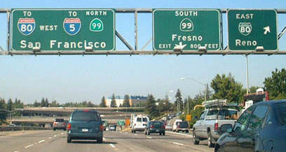
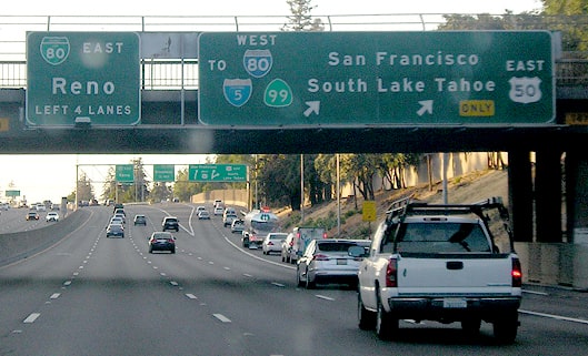
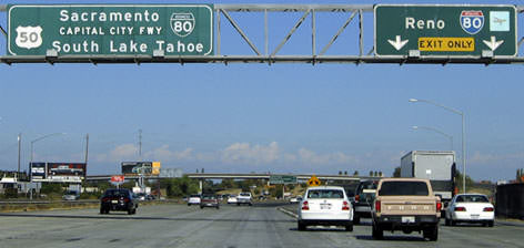
In 1963 the west end of US 50 was cut back to Sacramento (although signage may not have been changed until the early 1970s). I-80 originally followed what is now Business Loop I-80 (or the Capital City Freeway) through the city, so US 50 ended at what is now its junction with BL-80: |
|
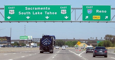
In fact, since there are no "West US 50" signs beyond the interchange shown above, it would be easy to believe that still marks the west end of US 50. But in 1980, when I-80 was changed to its current route (around the north and west sides of downtown), the US 50 designation was extended ahead, along the old I-80, ending where the freeway merges with modern I-80 in West Sacramento:
|
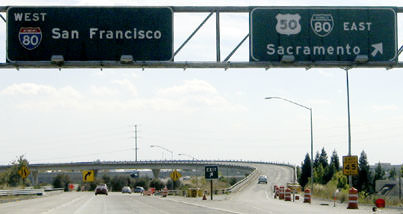
...and heading the opposite direction, the beginning of US 50 is announced thus:
|
Today's westernmost segment of US 50 used to be I-80, so the US 50 designation did not begin until a few miles ahead, where I-80 turned to the north. This was the west beginning of US 50 from about 1972-1980:
|
|
|
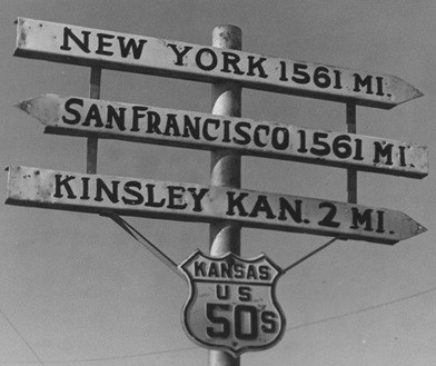
From the beginning in 1926 and for the next 30 years, US 50 had a significant split route in Kansas. At today's junction of US 56 and US 59 just west of Baldwin City, US 50-N followed today's US 56 all the way to Larned, then K-156 (former US 156) to Garden City. US 50-S went south via US 59 to Ottawa, and then west essentially along modern US 50, rejoining US 50-N in Garden City. Here is an interesting photo taken during that timeframe:
|
Incidentally, the 1925 US highway plan had US 50 following what actually ended up being commissioned as US 50-N the next year. US 50-S was marked as US 250 in the 1925 plan.
|
Research and/or photo credits: Nathan Edgars; Chris Elbert; Andy Field; Milton John Kleim Jr; Jeff Morrison; Alex Nitzman; Eric Rosenberger; Dale Sanderson; Dave Strong; Michael Summa; Marion Warren; Joel Windmiller
Page originally created 2000;
last updated Dec. 16, 2023.
last updated Dec. 16, 2023.

