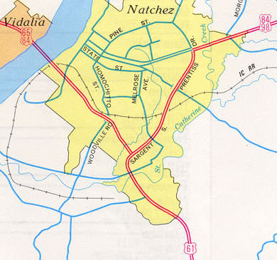
Current and historic US highway endpoints in Natchez, MS
|
1951-present
|
 |
|
In 1951 the US 65 designation was truncated from New Orleans back to Natchez. A few years later, in 1955, US 98 was extended westward from Pensacola to Natchez. By that time, through traffic had been rerouted onto a couple bypasses that skirt the city. Insets on Mississippi official state highway maps suggest that US 65 and US 98 shared a common terminus, at the same junction where US 98 and US 425 currently share a terminus:
|
c. 1991, MSDoT
|
|
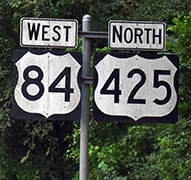
After crossing the Mississippi River from Louisiana, eastbound US 84 is on Junkin Drive in Natchez. Historically that was also southbound US 65, but now it is US 425 that is overlapped with US 84. This photo shows the last southbound US 425 marker:
|

Karners, Jan. 2010
|
|
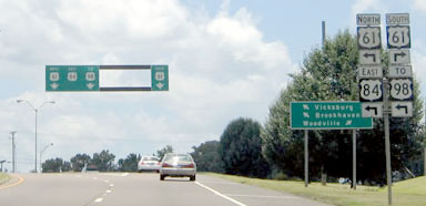
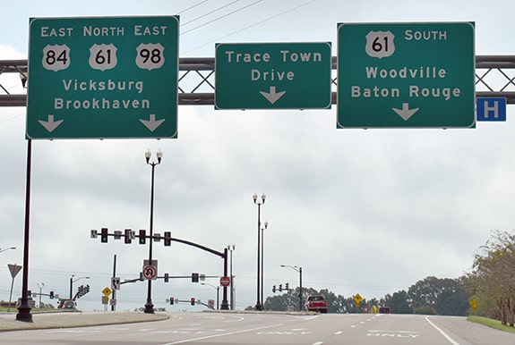
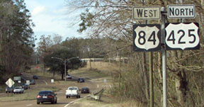
At Sergeant Prentiss Drive (the US 61 bypass), eastbound US 84 continues with northbound 61, but the US 425 designation ends. This photo (and some others on this page) were actually taken when it was US 65 that ended here; it was in 2005 that US 425 was extended along the former US 65 between Natchez and Clayton LA:
|
Cozart/Nitzman, June 2004
|
That stretch was formerly the westernmost segment of US 98, but now that route begins to the left at the junction ahead. Some of the photos on this page were taken during a brief time period during which Mississippi was in the process of removing US 98 references between Natchez and Bude. During that time most "East US 98" signs were changed to "TO US 98", but now just about all of them have been changed back to just US 98 (no "TO" modifier).
|
The green overhead signage in the background is shown close-up here:
|
Cozart/Nitzman, June 2004
|
|
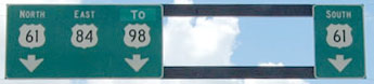
Visible there is the green-out "TO" sign above the US 98 shield, covering up what formerly said "East". (At last report, those signs remain unchanged -- there was no reference to US 65 then, so there was nothing that needed to be changed to US 425... although the lack of an "End" sign at this junction is unfortunate.) Just ahead, at the true terminus, the assembly shown here was posted:
|
Backlin, Dec. 2008
|
|
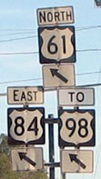
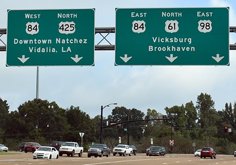
Some of the signs in this area had already been changed again within the next year: when that last photo was taken, road crews were in the middle of a project to convert that junction to a continous flow interchange. That project was finished by late 2009, and many of the new signs now refer to US 98 again (without the "TO" modifier, which is odd, considering that Mississippi had just made a fairly considerable effort to truncate US 98 to Bude). The south end of US 425 is now signposted as if it is also the west beginning of US 98:
|
Ivy/Nitzman, Oct. 2021
|
|
Heading south on Prentiss (US 61-84), US 84 splits off to the right on Junkin, and US 65 formerly began at that point, but now it is US 425 that begins to the right:
|
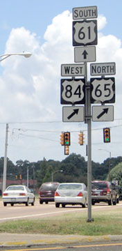
Cozart/Nitzman, June 2004
|

Karners, Jan. 2010
|
|
That is also the west end of US 98. The green signs in the background are shown close-up here:
|
Ivy/Nitzman, Oct. 2021 (mostly unchanged since 2010)
|
|
These next photos were looking the opposite direction (north on US 61) at the south beginning of US 65, and later US 425:
|
Cozart/Nitzman, June 2004
|
Ivy/Nitzman, Jan. 2009
|
|
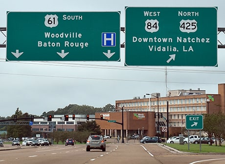
The newer overhead signage at that location indicates that US 425 begins to the left, and US 98 begins to the right:
|
Ivy/Nitzman, Oct. 2021
|
|
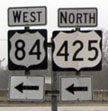
Drivers making that left turn soon encounter the first northbound US 425 confirming assembly (also shown in the header photo at the top of this page):
|
Backlin, Dec. 2008
|
Ivy/Nitzman, Oct. 2021
|
|
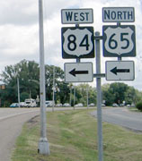
Despite what is shown on the map at the top of this page, I have seen some photos that suggest US 98 did not end at that junction, but instead was overlapped with US 65-84 all the way to the Mississippi River. Here is a photo that was taken a little further ahead:
|
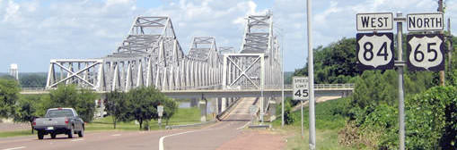
Cozart/Nitzman, June 2004
|
That was looking west across the bridge that crosses the Mississippi to Vidalia LA (the US 65 designation no longer extends that far south). It is possible that US 98 was formerly signed to this point, but it is certain that US 98 was never extended into Louisiana.
Research and/or photo credits: David Backlin; Justin Cozart; Brent Ivy; Karin and Martin Karner; Alex Nitzman; Dale Sanderson
Page originally created 2003;
last updated Dec. 19, 2023.
last updated Dec. 19, 2023.
