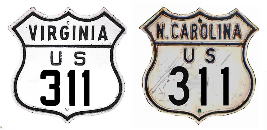
End of US highway 311 |
 |
|
1926-1932
|
1932-1934
|
1934-1966
|
1966-2003
|
|
2003-2012
|
2012-2018
|
2018-present
|
Summa
|
|
Mileage: in 1989 AASHTO listed a figure of 64 miles for US 311. Since then it has been truncated on one end and extended on the other, but coincidentally our own 2020 measurement yielded nearly the exact same distance: 65.4 miles.
|
|
|
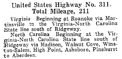
At first glance, it is puzzling how this quirky little highway was assigned the number "311" -- or really how it ended up with a US designation at all: even at its closest point, its implied "parent" (US 11) is still about 70 miles distant. But originally the route was much longer; this excerpt is from AASHO's April 1927 route log:
|
|
|
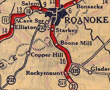
Click to view a map showing US 311's maximum southern extent in North Carolina. On its north end, originally US 311 did connect with US 11 in Roanoke:
|
c. 1927, Rand McNally
|
|
A 1929 map shows this junction was at Campbell Avenue and Jefferson Street. This photo shows that intersection as it appeared back then:
|
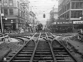
c. 1927, George Davis (Library of Virginia)
|
|
Looks like it was a major junction for the trolley system as well -- presumably those railroad ties were buried under pavestones before too long.
US 311's southern extent was longer too: at first it served Aberdeen, coming into town on what is now NC hwy. 5: |
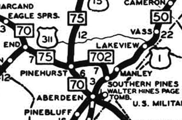
c. 1930, NC DoT
|
|
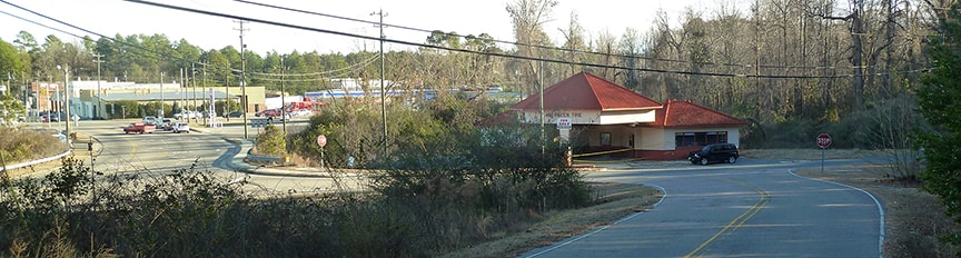
At the time, US 1 was on Pinehurst Street. This image was taken looking south on Keith Street, which most likely carried US 311 traffic, because today's NC 5 (visible along the left edge of the photo) had not yet been built:
|
Karners, Dec. 2016
|
|
US 311 ended at the junction ahead, near the old service station. Northbound US 1 was straight ahead (just to the left of the station, aligning with NC 5 in the background), while southbound was to the right on Pinehurst.
Later US 311 was even extended all the way down to Rowland, albeit very briefly (map). Here is a view from its former south end: |
Watkins, Jan. 2008
|
|
That was looking south on US 301 (Bond Street), which formerly carried US 217. For a time, US 311 began to the right on Main Street... but within a year or two, both ends had been truncated. In 1934, US 220 was extended southward into North Carolina, partially along the route of what had been US 311. So at that time, the north end of US 311 was cut; more info and photos on the Madison page. As a result of that same extension, the south end of US 311 was truncated at Asheboro:
|
c. 1939, Rand McNally
|
|
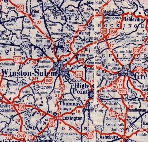
That shows a very small section of North Carolina, but nevertheless it is enough to illustrate the entire route of US 311 as it existed for the vast majority of its lifetime: from 1934 to 2003. Notice that US 311 essentially formed an alternate route off US 220, looping through Winston-Salem and High Point, so at that time US 311 should have been decommissioned and re-designated as Alternate US 220. At first, from Randleman, US 311 was overlapped with US 220 down to Asheboro (although that map was not large-scale enough to label the concurrency). This image is looking east on Salisbury Street:
|
|
|
Originally that was US 64, and the south beginning of US 311 was to the left on Fayetteville Street. Even after US 64 was moved to its current bypass, that intersection continued to mark the terminus of US 311. That was the case until 1966, when US 311's overlap with US 220 was eliminated, and the designation was cut back to Randleman. This photo was looking north on Main Street; downtown Randleman is about a mile in that direction:
|
Nitzman, 2000
|
|
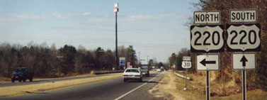
That road formerly carried US 220, and US 311 began to the left. Later US 220 was routed onto the freeway just west of there, and Main was designated Business 220. So then US 311 began about a half-mile west (left) of that point, at its interchange with modern US 220 (which is also I-73/I-74). That interchange is shown in this photo:
|
Nitzman, 2000
|
|
That was looking northwest at the south beginning of US 311. The off-ramp for northbound I-73/74/US 220 traffic is to the left, just behind the camera. The bridge in the middleground passes over the freeway. North is to the right, but if one wanted to go north on the freeway, the entrance ramp is to the left; it loops back around to the right to go under the overpass.
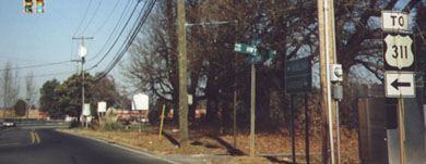
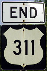
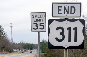
Heading back the opposite direction, an "End" sign was posted: |
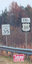
Curley, 2000
|
Ellis, May 2005
|
Clifton, 2014
In that last photo, the traffic signal marking US 311's first Randleman endpoint is visible in the distance.
|
|
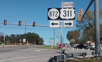
In 2003, AASHTO approved NCDoT's request to extend the US 311 designation northeast a few miles from Madison to a new endpoint in Eden. Actually, the route bypasses town to the south, and US 311 terminated at its junction with NC 14:
|
Roberts, Aug. 2011
|
Street View, Aug. 2011
|
Prince, Oct. 2007
|
|
That was where NCDoT maps since about 2003 showed US 311 ending, but that road was not actually signed as US 311 anywhere north of its old Madison endpoint until Aug. 2011... eight years after its extension was approved!
On the far left side of that first photo, the backside of another assembly is visible. Turning around in order to see the front, we find that it was a nice "Begin US 311" assembly: |
Roberts, Aug. 2011
|
Street View, Apr. 2013
|
|
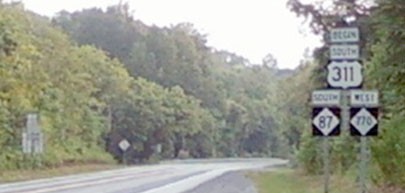
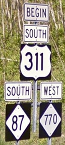
At first this extension to Eden was perplexing, but it finally began to make sense in early 2012, a few months after NC signed US 311 to that junction: it became apparent that NC had been working with neighboring Virginia to extend US 311 up to Danville. Eden had been simply a temporary endpoint. Signage in Danville went up in fall 2013; here is the assembly posted at the north end of US 311:
|

Karner, May 2013
|
|
That was on Berry Hill Road, at Martinsville Highway (or Business US 58). Here we are looking west on Bus. 58:
|
Karner, May 2013
|
Roberts, Nov. 2013
|
|
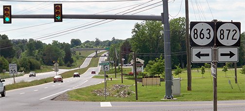
The north beginning of US 311 is to the left on what was formerly VA secondary route 863 (Berry Hill); signage was changed in October 2013. The overpass visible in the distance is mainline US 58, or Danville Expressway. Under this US Ends .com proposal, US 360 should be extended with US 58 to that point, then exit and come to this intersection, and then continue to the left, subsuming US 311 all the way to Winston-Salem.
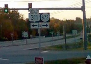
But as it currently stands, that is where US 311 begins. This photo was taken looking the opposite direction (east on Bus. 58): |
Younce, Apr. 2017
|
|
Immediately after taking a turn to the right, one sees the first southbound US 311 confirming marker:
|
_at_U.S._Route_58_Business_(Martinsville_Highway)_in_Callahans_Hills,_Pittsylvania_County,_Virginia.jpg)
famartin, Jun. 2018 (linked to source)
|
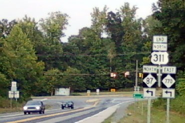
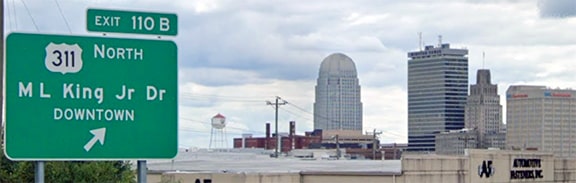
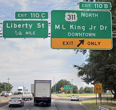
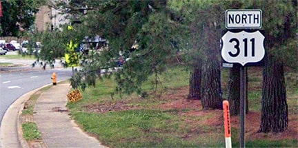
At its spring 2018 meeting, AASHTO approved NCDoT's proposal to decommission the southern segment of US 311 (that is, the portion between Winston-Salem and Randleman). So now the south end of US 311 is at its junction with US 52 in Winston-Salem. Between 2019 and 2021, some signage was replaced to reflect this truncation, although overhead signage on both southbound and northbound US 52 did not require any changes:
Aug. 2022, Google Maps Street View
|
Aug. 2022, Google Maps Street View
|
|
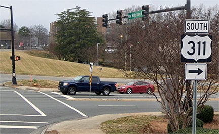
Heading east on MLK Drive, the first northbound confirming marker is shown here...
|
May 2022, Google Maps Street View
|
|
...although that assembly is not seen by drivers exiting from northbound US 52 (the offramp for which is visible in the background). US 311 traffic there is instructed to turn right on MLK, and then this confirming marker is posted after a couple blocks:
|
May 2022, Google Maps Street View
|
|
Heading the opposite direction, the last reference to US 311 is posted where traffic is directed to turn from New Walkertown Road onto MLK:
|
Jan. 2023, Google Maps Street View
|
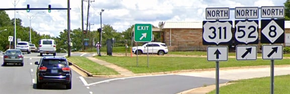
Historically there was a confirming marker just off to the right on MLK, but as of 2021 that shield had gone missing. And then still further ahead, there were additional references to US 311:
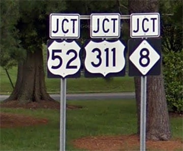
Jun. 2019, Google Maps Street View
|
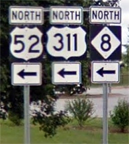
Jun. 2019, Google Maps Street View
|
Jun. 2019, Google Maps Street View
|
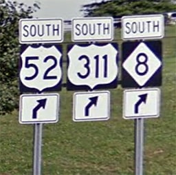
Any or all of those assemblies could have been modified with an "END" tab to note the terminus of US 311, but instead they were all replaced with assemblies that reference only US 52 and NC 8. Incidentally, that middle photo shows what was an error: northbound US 311 should not have been referenced there, because it would be a 180-degree turn, not to the left with US 52 and NC 8. And the last photo shows signage from back when US 311 continued further to the south via US 52.
The removal of that segment (south from Winston-Salem) was a good first step. But the route is still almost entirely in one state (the Virginia segment is only eight miles long), and now US 311 is only 65 miles in length. So there is more that needs to be done: NC and VA should agree to extend the US 360 designation southwest from Danville, completely subsuming US 311 between there and Winston-Salem (see this page for more info).
The removal of that segment (south from Winston-Salem) was a good first step. But the route is still almost entirely in one state (the Virginia segment is only eight miles long), and now US 311 is only 65 miles in length. So there is more that needs to be done: NC and VA should agree to extend the US 360 designation southwest from Danville, completely subsuming US 311 between there and Winston-Salem (see this page for more info).
Research and/or photo credits: Mark Clifton; Chris Curley; George Davis; Bob Ellis; Karin and Martin Karner; Alex Nitzman; Adam Prince; Mike Roberson; Opie Roberts; Dale Sanderson; Michael Summa; Mac Watkins; Morgan Younce
Page originally created 2000;
last updated Feb. 7, 2023.
last updated Feb. 7, 2023.
