Current and historic US highway endpoints in Richmond, VA
Note: for more info, maps, and photos beyond what is presented on this page, Michael Roberson's material about US 33/VA 33 in Richmond is highly recommended.
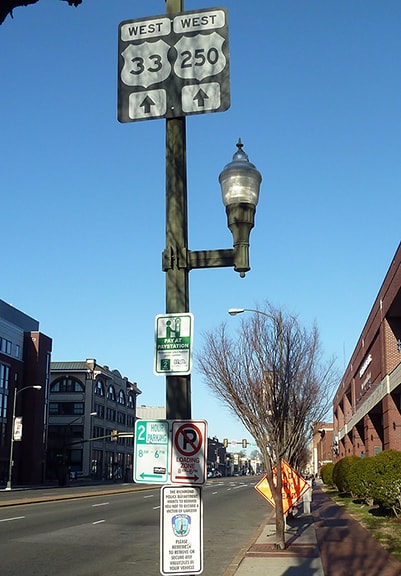
US 33 and US 250 have ended in Richmond since the 1930s. In 1935, US 250 replaced what had been VA 5 (and before that, VA 41) using Broad Street westward out of Richmond. A few years later, US 33 was extended into Richmond via Staples Mill Road. From their intersection at Staples Mill and Broad, the two routes have always (or at least almost always) been overlapped east on Broad into downtown. This is not commonly understood, partially because most maps are not at a large enough scale to label the concurrency. Compounding the confusion is the fact that much of the surface highway signage in Richmond is dismal: highways are signed incorrectly in many places, or simply not signed at all. So the question, "Where exactly do US 33 and US 250 end?" has a somewhat elusive answer... and the answer has changed over the years.
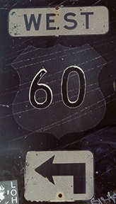
In 1935, southbound US 1 traffic was being directed off Chamberlayne Avenue onto Lombardy Street, then east on Broad, then south on Belvidere Street, crossing the James River via the Robert E. Lee Bridge. US 60 came from the east via Broad, then south on 2nd Street, which joins Belvidere just north of the Lee Bridge, so the two were concurrent across the river.
|
US 250 (and three years later, US 33 as well) came from the west on Broad and junctioned with US 1 at Lombardy. The three were most likely overlapped between there and Belvidere, but then US 33-250 continued on their own again to 2nd, where they ended at their junction with US 60:
|
From that perspective, straight ahead on Broad was eastbound US 60, while westbound was to the right on 2nd. US 33-250 ended there for nearly 40 years (although during the 1950s US 60 was converted to one-ways and altered three times, potentially changing the technical terminus point one block to the east and/or west on Broad. But by the end of that decade, the endpoint was back to 2nd and Broad, as explicitly defined in the CTB [Commonwealth Transportation Board] minutes of Sep. 1959.)
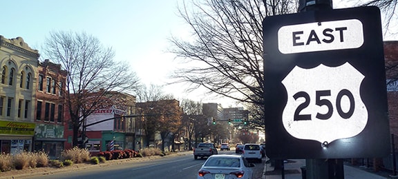
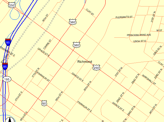
In 1974, westbound US 60 was rerouted off Broad by turning south on 21st Street, then continuing west on Main Street. In other words, US 60 was removed from Broad between 2nd and 21st, so US 33-250 was extended east on Broad, presumably to fill in "the gap". Strangely though, the gap was not entirely filled: US 33-250 was extended only to its junction with US 360 at 17th/18th Street, so the three blocks of Broad between 18th and 21st (US 60) had no US route designation. Now (at least according to some sources) the endpoint of US 250 has returned to that intersection, so photos from there are shown below, along with further discussion.
In 1974, westbound US 60 was rerouted off Broad by turning south on 21st Street, then continuing west on Main Street. In other words, US 60 was removed from Broad between 2nd and 21st, so US 33-250 was extended east on Broad, presumably to fill in "the gap". Strangely though, the gap was not entirely filled: US 33-250 was extended only to its junction with US 360 at 17th/18th Street, so the three blocks of Broad between 18th and 21st (US 60) had no US route designation. Now (at least according to some sources) the endpoint of US 250 has returned to that intersection, so photos from there are shown below, along with further discussion.
At this point, it should be noted that VA hwy. 33 was commissioned in 1938 to run from Richmond eastward to Stingray Point (on Chesapeake Bay just east of Deltaville). That was the same year US 33 was extended into Richmond, and the state highway number was obviously intended to be viewed as an extension of US 33. It is unclear why the whole thing out to Stingray Point was not simply designated as US 33; that would have eliminated the question of where US 33 becomes VA 33, and as a result there would not be so many erroneous US 33 signs posted on VA 33 and vice-versa. But as it stands, US 33 has never officially existed anywhere east of Richmond. In that city, VA 33 originally ran along Broad, ending wherever US 33 began (at 2nd prior to 1974, and at 18th after that). However, in 1981 VA 33 was rerouted to its current configuration, which uses the MLK Bridge and Leigh Street to "bypass" Broad. VA 33 connected to Broad on the west side of downtown, via Harrison and Hancock Streets (which formed a one-way couplet at the time). When that happened, VDoT presented the following request to AASHTO to truncate the US 33 designation:
AASHTO did approve VDoT's proposal... but in their meeting minutes summarizing what they approved, they completely mischaracterized what VDoT had asked for...
...and I believe that was the genesis of the confusion (which has persisted to this day) about US 33 in Richmond. Complicating the matter is the fact that the City of Richmond (not VDoT) is responsible for signposting non-interstate routes within its jurisdiction. So, while VDoT may have thought they got what they wanted from AASHTO, they may not have realized that AASHTO misconstrued what VDoT wanted, and/or they may have failed to communicate that to the City. At any rate, it has been reported that the way Richmond signposted US 33 in 1981 was more in line with AASHTO's erroneous description (rather than the description that VDoT had submitted to AASHTO).
Since then there have been major inconsistencies in official records that specify exactly where the transition between US 33 and VA 33 takes place:
Since then there have been major inconsistencies in official records that specify exactly where the transition between US 33 and VA 33 takes place:
- Initially Richmond signposted US 33 north of Broad along Harrison/Hancock, then Leigh. US 33 signage ended (and VA 33 signage began) at the MLK Bridge.
- The Dec. 1981 CTB minutes say VA 33 uses Harrison/Hancock to connect between Leigh and Broad.
- But the May 1982 minutes say VA 33 ends on Leigh at Hancock, while it is US 33 that occupies the Harrison/Hancock couplet.
- AASHTO's 1989 route log describes US 33 as "leaving US 250" (presumably via Harrison/Hancock), then "crossing US 1-301" (presumably Belvidere), and then ending at "jct. VA 33 (MLK Bridge)". In other words, this description was exactly how Richmond had signposted US 33 in 1981.
- VDoT's route logs from 2001 and 2003 say US 33 ends on Broad at Harrison, and that VA 33 ends at US 250 (Broad).
- But VDoT traffic logs from the same timeframe say eastbound US 33 ends on Hancock at Leigh, while westbound US 33 begins on Broad at Harrison.
- However, today it is impossible for eastbound US 33 traffic to make that movement: drivers cannot make a left turn from eastbound Broad to northbound Hancock because a median is there, and also the block of Hancock north of Broad is one-way southbound.
- Meanwhile, signage is deplorable: there are no US 33 signs on Broad anywhere east of Boulevard. Signage along Harrison, Hancock, Leigh, MLK, Mosby Street, Fairmount Avenue, and Nine Mile Road includes US 33 shields randomly interspersed with VA 33 markers all through the area. Non-interstate signage is the responsibility of the City, not VDoT, and it is obviously such a low priority in Richmond that it simply cannot be relied upon to determine actual route descriptions.
|
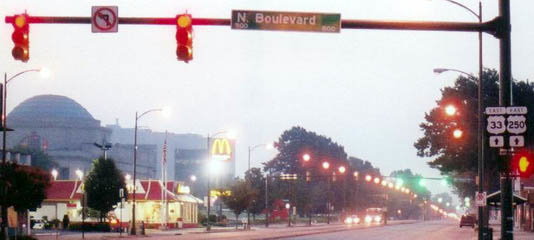
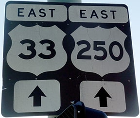
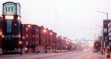
That shows the last eastbound US 33 confirming marker, posted at Boulevard, or VA 161 (there is another US 250 trailblazer further ahead). This next shot was about a mile ahead. Harrison is the traffic light, and Hancock is the next block beyond there, so this is about as close as one can come to showing a photo of the east end of US 33:
|
|
However, the traffic configuration in this area has changed since 1981, and it appears the authorities have overlooked a pretty big problem: one can no longer turn left from eastbound Broad onto Hancock. Harrison is now a two-way street, but left turns are not allowed from eastbound Broad onto northbound Harrison either. So eastbound US 33 no longer connects to eastbound VA 33. One solution would be to extend the US 33 designation a few blocks east, ending at jct. US 1-301 (Belvidere). Signage there should include "TO VA 33" pointing north on Belvidere. VA 33 itself could remain unchanged, although it would no longer share a common terminus with US 33. Otherwise, VA 33 could be extended west on Leigh, all the way to Boulevard, and then south to Broad. Eastbound Broad cannot turn left on Boulevard, but northbound VA 161 traffic is directed north on Sheppard Street (one block to the west of Boulevard). So US 33 could end there, and VA 33 traffic could be directed to go north on Sheppard to Boulevard. What a mess.
Anyway, as it stands, there is a US 33 trailblazer posted on Broad just west of Hancock: |
|
Presumably US 250's extension was intended to fill in "the gap" on Broad between 18th and 21st... well, actually by that time it was 23rd. You see, eastbound US 60 came north on 21st and simply turned east on Broad (as expected). But for some reason westbound US 60 traffic on Broad was directed to first go north on 23rd, then west again via the next block north of Broad (Marshall Street), and then finally south on 21st. In fact, there is still a sign relic attesting to that -- this is posted on northbound 23rd approaching Marshall:
|
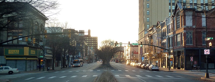
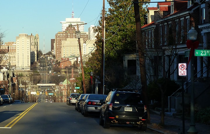
So US 250 was extended east on Broad to the point where westbound US 60 departed Broad, at 23rd. The following photo was taken looking west on Broad from 23rd; it can be used to visualize almost all of the Richmond endpoints:
|
|
The traffic signals just ahead are at 21st. Westbound US 60 formerly came to this point, then turned to the right here on 23rd, then left on Marshall (ahead again), then another left on 21st, coming across the photo from right to left. So straight ahead was the east beginning of US 250 from 1981-2003. At the bottom of the hill a couple railroad bridges are visible over Broad, and just this side of those bridges are a couple intersections with traffic lights. Those are at 17th and 18th Streets, or US 360, which is where US 33-250 began from 1974-1981, and also where US 250 begins now.
|
|
Further in the distance, the last tall building on the south (left) side of Broad is situated right at 2nd Street, which was the original Richmond endpoint of US 33-250. Beyond that a huge TV tower is visible; that is located between Boulevard (VA 161) and I-195. Shortly after crossing Boulevard, the alignment of Broad changes slightly, such that it passes just to the right of that tower. And not far beyond that is where US 33 splits off onto Staples Mill.
Anyway, that shows where US 250 began until 2003. At that time, US 60 was rerouted such that it no longer runs along any segment of Broad. That means, unless the description of US 250 was changed as well, it has a "dangling" end at 23rd... and as of Oct. 2008, that is exactly what VDoT's online mapping program was still showing:
|
|
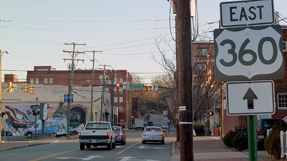
There is a subtle difference in color between numbered highways (red) and city streets (pink). Broad is red all the way to 23rd, implying that is still where US 250 ends. However, the 2003 route log indicates that US 250 was truncated back to its junction with US 360: on Broad at 18th again (which is where US 33-250 ended from 1974-1981). As of 2016, there were several signs referencing US 360 at that intersection, as well as some guide signs to the interstates, but not a single reference to US 250. This photo was taken looking north on 18th:
|
|
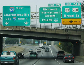
Ostensibly US 250 begins to the left on Broad. However, that route has not been signed anywhere east of I-95 for years. Speaking of I-95, this photo was taken from northbound:
|
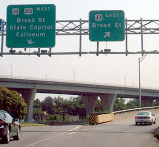
Hmm... well, US 33 has not come this far east on Broad since 1981. If a driver takes that offramp, it splits; here is the signage there:
|
Now that is really perplexing: on the left, it is true that westbound Broad is also westbound US 250. However, Broad does not pick up US 33 for another two miles. So a better way to put it might be "WEST US 250 TO US 33"... but even as it stands, at least it is not completely misleading. But what about the sign on the right, pointing to eastbound Broad? That actually leads to southbound 17th, which carries westbound US 360 traffic. US 33 has never been designated east of US 360. So maybe the intended reference was to VA 33? But VA 33 does not use Broad, and getting to the real VA 33 involves a fairly complicated series of turns, none of which are posted in the field. So perhaps that sign was based on pre-1981 routings: it was supposed to have a VA 33 marker, and it hearkens back to the time when VA 33 began to the east on Broad.
It should also be pointed out that, in several places, VA 33 is signposted with US 33 shields. Based on signage, one could easily get the impression that US 33 somehow shifts over to Leigh Street, goes over the MLK Bridge, then uses Mosby Street and Fairmount Avenue. As of 2016, the transition between US 33 and VA 33 as signposted appeared to be at the traffic circle where Fairmount junctions 25th Street and Nine Mile Road.
It should also be pointed out that, in several places, VA 33 is signposted with US 33 shields. Based on signage, one could easily get the impression that US 33 somehow shifts over to Leigh Street, goes over the MLK Bridge, then uses Mosby Street and Fairmount Avenue. As of 2016, the transition between US 33 and VA 33 as signposted appeared to be at the traffic circle where Fairmount junctions 25th Street and Nine Mile Road.
Research and/or photo credits: Adam Froehlig; Karin and Martin Karner; Dan Moraseski; Robert Mortell; Alex Nitzman; Mike Roberson; Dale Sanderson
Page originally created 2000;
last updated Dec. 1, 2020.
last updated Dec. 1, 2020.
