End of US highway 601 |
 |
|
1926-1932
|
1932-1934
|
1934-1950
|
1950-1975
|
1975-present
|
Summa
|
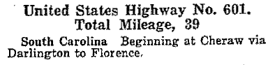
Mileage: in 1989 AASHTO listed a figure of 328 miles for US 601... however, it is unclear where that number came from, because according to the state subtotals on AASHTO's 1989 spreadsheet, mainline US 601's actual end-to-end total at the time was 297 miles (or 306 including the mileage of US 601's associated business routes). Our own 2020 measurement yielded 314.8 miles.
|
|
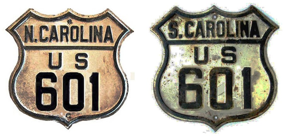
US 601 was one of the original 1926 routes, essentially running along what is now the US 52 corridor. With a south terminus in Florence, initially US 601 was an intra-state route, going only about 40 miles north, to Cheraw:
|
|
(Note that neither Florence nor Cheraw is served by US 601 today; an explanation for that will follow). Towards its north end, US 601 joined its parent route (US 1) a few miles south of town. However, at the time, neither US 1 nor US 601 followed the current alignments of US 1 or US 52. Originally US 1 ran through what is now Cheraw State Park, then along Old Cash Road. That curves to become 2nd Street in town, but the original bridge over the Pee Dee River was not on Powe Street (as today), but rather on Church Street. US 601 came in from the south on what is now Macedonia Church Road and Juniper Road.
|
US 601 could have ended at its junction with US 1 (Juniper at Old Cash), but it is just as likely that the two routes would have been dual-signed, with US 601 ending in Cheraw proper, probably where US 1 made a turn to cross the river. In other words: at the time US 1-601 followed parts of what is now signposted as Truck US 1-52. This photo was taken looking northwest on 2nd Street; where northbound Truck 1-52 traffic is directed to the right on Church Street. Historically this is where mainline US 1 turned right to cross the river, so US 601 probably ended here:
|
McDonald, Jul. 2019 (linked to source)
|
|
The current alignments of US 1 and US 52 opened to traffic in 1931, and this may have affected the location of US 601's terminus in Cheraw. Regardless, that would not have been the case for long, because in 1932, US 601 was extended north from Cheraw, up to Mount Airy. It came into town on Rockford Street, and followed that road all the way to its end at Main Street (which carried US 52 at the time):
|
Google Maps Street View, June 2013
|
|
That was looking east on Rockford; US 601's original Mt. Airy endpoint was there at Main. In 1953 US 52 traffic was rerouted to its current bypass, and Main became US 52A (or "Alternate"). In 1960 US 52A was redesignated as Business 52. But all during that time, US 601 ended at the same intersection. Then in about 1970, Business 52 was shifted from Main onto Renfro Street, which runs parallel to Main, just behind the trees visible in the photo above. So at that time, northbound US 601 jogged a block to the right on Main, then east again on Cherry Street, ending at Renfro:
|
c. 1994, from the book "The People of Route 601: Life in the Slow Lane", by Lex Youngman
|
Southbound 601 departed Renfro via Pine Street (one block to the left), rejoining Rockford via either Main or Graves Street. In 1995 all US 601 traffic moved off Rockford via Graves, then west on Pine, ending at Renfro, where this photo was taken:
Coniglio, Aug. 1997
|
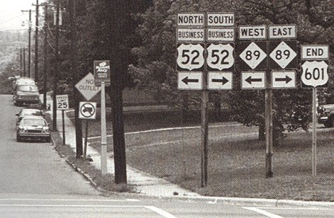
Then in 1999, the US 601 designation was truncated to the US 52 bypass, removing it from downtown Mt. Airy. But some signs there still reference US 601; here is a view from southbound Main:
|

Morrison, Aug. 2005
|
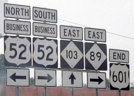
|
Formerly US 601 went to the right on Pine, which is the preferred connector to Rockford, via Graves, one block to the right. But by the time of that shot, the US 601 designation had been truncated, as evidenced by these photos:
|
Clifton
|
Younce, Feb. 2017 (unchanged since Aug. 2005)
|

Dienhart, Jun. 2024
|
|
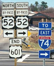
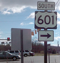
Until 1999, US 601 continued ahead on Rockford for another mile or so. Here, we are looking at the north beginning of US 601 as seen from southbound US 52:
|

Morrison, Aug. 2005
|
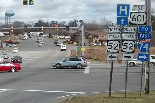
Younce, Feb. 2017
|
In 1934, the US routes in this part of North Carolina began to look more like what we see today: the US 52 designation was assigned to the Mt. Airy/Winston-Salem/Salisbury corridor, and then into South Carolina. So the US 601 designation was truncated such that it ran only from Mt. Airy to Salisbury, via Yadkinville and Mocksville. In other words, it became an intra-state route again, but this time in North Carolina:
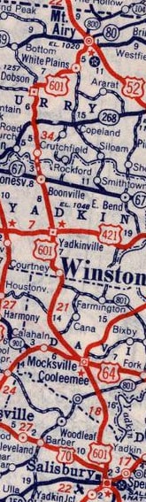
c. 1939, Rand McNally
|
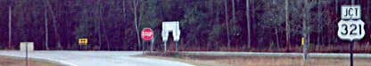
In 1950, US 601 was extended south from Salisbury along its modern route, returning to South Carolina. Where it reached US 321 south of Pineland, the two highways were overlapped down to a common terminus at US 17 in Hardeeville.
|
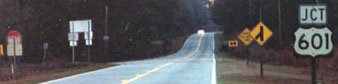
|
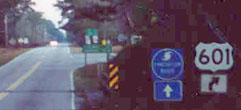
The front side of the assembly referenced above is visible in the distance; it is shown more closely in this photo:
|
Dawson, Dec. 2001
|
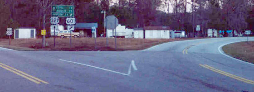
|
That shot encompasses not only the junction where US 601 splits off from US 321, but also the confirming signs for each route. The assembly itself is shown more clearly in this photo:
|
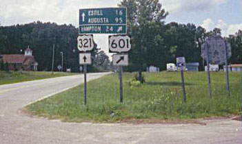
Prince, Aug. 2001
|
Research and/or photo credits: Mark Clifton; Greg Coniglio; David Dawson; Paul Dienhart; Martin Karner; Candy McDonald; Jeff Morrison; Adam Prince; Mike Roberson; Dale Sanderson; Michael Summa; Morgan Younce; Lex Youngman
Page originally created 2000;
last updated Jun. 22, 2024.
last updated Jun. 22, 2024.
