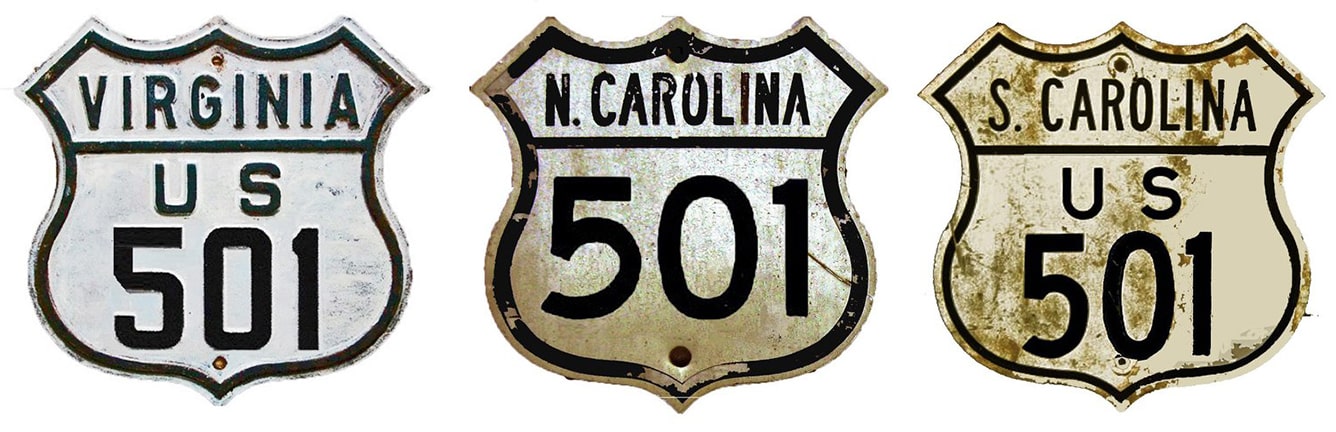
End of US highway 501 |
 |
|
1926-1933
|
1933-1934
|
1934-1944
|
1944-present
|
Summa
|
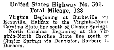
Mileage: in 1989 AASHTO listed a figure of 383 miles for US 501... however, that included the mileage of US 501's associated business/alternate routes. According to the state subtotals on AASHTO's 1989 spreadsheet, mainline US 501's actual end-to-end total at the time was 355 miles. That closely matches our own 2020 measurement, which yielded 353.6 miles.
|
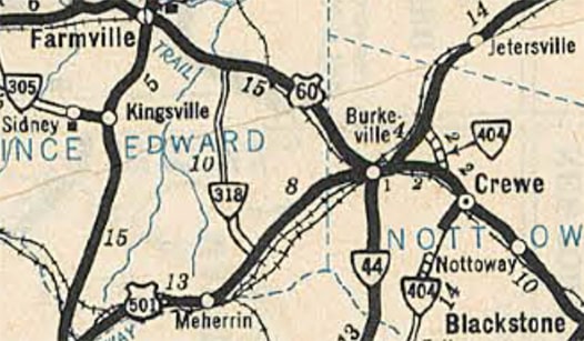
US 501 was among the inaugural routes of 1926. Heading north from Halifax VA, US 501 originally followed what is now VA hwy. 360 and US 360, terminating in Burkeville:
|
c. 1932, VDoT
|
|
US 501 ended at its junction with US 60 (which was later replaced by US 460). In this photo, we are looking north on VA hwy. 621, which was formerly US 501:
|
Roberson, Feb. 2008
|
|
After crossing under the railroad, that junctions VA 716, or Namozine Street, which originally carried US 60 (and later US 460, before the current US 360-460 interchange was built). This perspective was looking west on Namozine, or historic westbound US 60:
|
Roberson, Feb. 2008
|
|
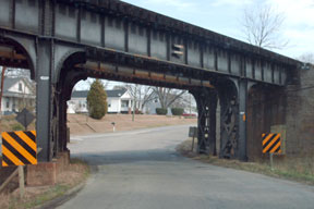
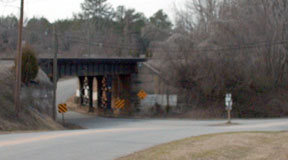
US 501 began by turning left onto Burkes Tavern Road. That railroad bridge is dated 1932, so originally it was probably an at-grade crossing, but US 501 traffic went underneath it for a couple years.
At the time, the south end of US 501 was in Durham: |
c. 1930, NC DoT
|
|
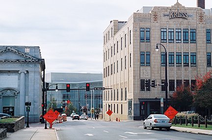
There, old US 501 is now designated Business 15/501. This photo was looking south on Magnum Street, where US 501 ended at its junction with Main Street, which originally carried US 70:
|
Osborne, Dec. 2012
|
Originally US 60 followed a different corridor west of Richmond, passing through Burkeville, Farmville, Lynchburg, and Glasgow before arriving at Buena Vista (by the way, forget anything you know about Spanish: locals pronounce this "Byoo-nuh VIS-tuh", just like the Buena Vista in Colorado). That changed in 1933, when US 60 traffic was rerouted essentially along its current corridor between Richmond and Buena Vista. Portions of its old routing were renumbered with the new US 360 or US 460 designations...
|
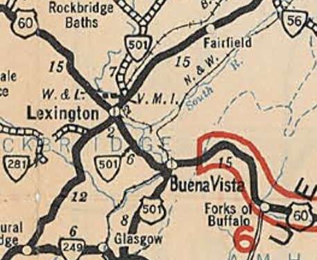
...but US 501 was also rerouted as a part of this change. From Halifax, US 501 was directed up to Lynchburg, where it then followed former US 60 up to Buena Vista. The segment northwest from Buena Vista to Lexington remained US 60, so there was no reason not to terminate US 501 in Buena Vista, and that is what is shown on every map I have ever seen. In fact, Virginia's official 1933 map explicitly shows US 501 ending in Buena Vista, with SH 501 continuing northwest from there with US 60 to Lexington before splitting off to the north on its own:
|
c. 1933, VDoT
|
However, VDoT was not actually responsible for making those state highway maps, and their internal information clearly stated that US 501 ended in Lexington, not Buena Vista. For example, these excerpts are from a 1934 letter in which VDoT was correcting the information in AASHO's route log:
|
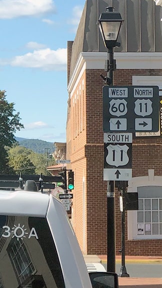
For the first few years, US 60-501 came into town on Washington Street. At Main Street (which carried both directions of US 11), the US 501 designation ended, while US 60 continued straight ahead on Washington...
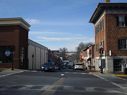
Sweeney, Feb. 2020
...however, in 1939 US 60-501 traffic was moved one block south, to Nelson Street. This photo was looking west on Nelson at Main, showing another brief Lexington endpoint...
|
Jon, Oct. 2020 (linked to original)
|
|
This 1941 route log shows that Virginia still considered US 501 to end at its junction with US 11 in Lexington at that time...
|
c. 1941, VDoT route log
|
...but that did not last much longer: US 501 was truncated to Buena Vista in 1944. Here is that item from the minutes of AASHO's 1944 meeting:
|
Prior to the current highway junction in Buena Vista, there was a different road configuration, as shown on this animated image (which is switching between the 1940 and 1950 USGS topos)...
|
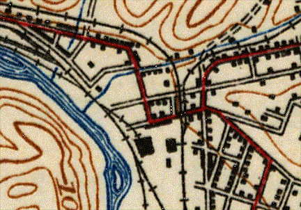
c. 1940 and 1950, USGS
|
|
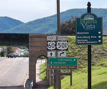
...but by the time US 501 was truncated to Buena Vista, US 60 had been changed to its current configuration along 29th Street, so US 501 ended at the same location it does today: on Beech at 29th:

Karner, May 2013 (unchanged since at least 2005)
|
No "End" sign was posted, only one's options at US 60, along with a notice that the I-81 interchange is to the left. This shot shows the north beginning of US 501 as seen from westbound US 60...
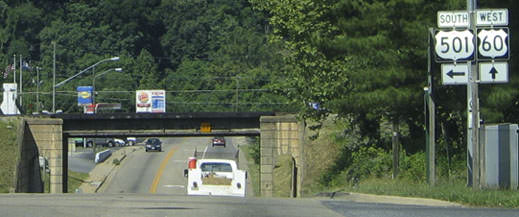
Nitzman, June 2005 (unchanged as of 2013)
|
|
...and these next ones were taken from the opposite direction, on both sides of the railroad overpass:
|
Karner, May 2013
|

Nitzman, June 2005 (unchanged as of 2013)
|
|
Drivers taking that right turn will soon see the first southbound confirming marker:
|
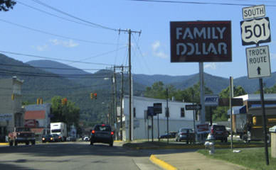
Nitzman, June 2005 (unchanged as of 2013)
|
|
In 1934, the US 501 designation was extended south to its present terminus in Myrtle Beach:
|
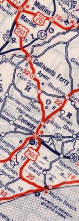
c. 1939, Rand McNally
|
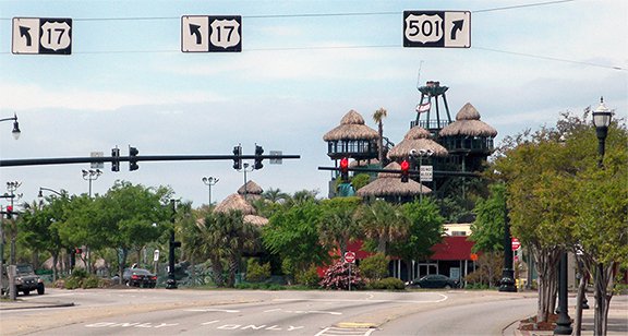
The photo below was looking east at the south end of US 501. Here, southbound US 17 traffic is directed to turn right on 8th Avenue North, and then right again on historic US 17 (now Business US 17), or Kings Highway. Main Street traffic that continues straight (to the left in this photo) merges with Kings Hwy, but there was no indication that is northbound Bus. 17:
|
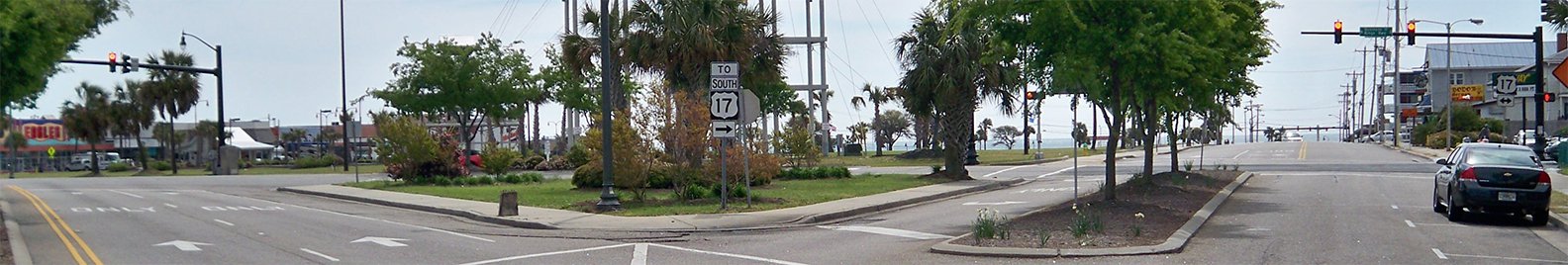
Karners, Apr. 2014
|
This photo shows the signage approaching US 501 from the north on Kings Hwy:
|
Karners, Apr. 2014
|
|
Heading the opposite direction (north on Bus. 17), US 501 traffic is not directed all the way to Main; instead 3rd Avenue South is signed as "TO US 501 North". If a traveler misses that, Kings Hwy meets Main at a fairly sharp angle, so left turns are not permitted at that intersection. Instead drivers are directed to turn left at 8th Av North...
|
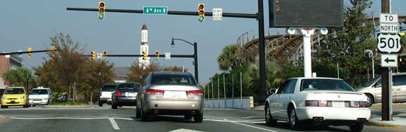
Cozart/Nitzman, Nov. 2006
|
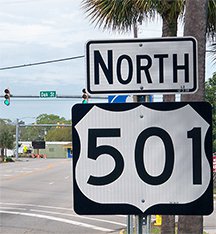
|
...and then left again at Main after about a half-block. In the photo above, that sign has since been replaced with a simple "JCT US 501" sign, with no directional arrow. The light in the distance is Main, or mainline 501. Once drivers have turned onto that road, the first northbound US 501 sign is posted immediately:
|
Karners, Apr. 2014
|
Research and/or photo credits: Justin Cozart; Martin Karner; Alex Nitzman; Steve Osborne; Adam Prince; Mike Roberson; Dale Sanderson; Michael Summa; Collin Sweeney
Page originally created 2001;
last updated Apr. 19, 2022.
last updated Apr. 19, 2022.
