End of US highway 163 |
 |
|
1970-1983
|
1983-1985
|
1985-present
|
*Note: in 1989 AASHTO listed a figure of 201 miles for US 163, because both AASHTO and UDoT still officially list Crescent Jct. as the northern terminus of US 163. However, UDoT has not signposted it that way since 1983.
|
As of 2020, the signposted segment of US 163 measures 64.6 miles. The former segment to Crescent Jct. adds another 136.1 miles, so historically US 163 was 200.7 miles long.
|
|
US 163 is a misnumbered highway, as it cannot be considered a branch of US 63. There was no excuse when it was commissioned in 1970: there were other possibilities that would have made more sense (some examples and more thoughts on the anomalies page). More recent maps might lead to speculation that US 163 took its number from UT hwy. 163 (which formerly headed east from Bluff), but that designation did not exist back when US 163 was assigned.
|
Annoying number notwithstanding, US 163 makes for a very scenic drive; breathtaking scenery abounds along nearly the entire route. The south end of US 163 has always been in Kayenta, which is on the Navajo Indian Reservation in northeastern Arizona:
|
Sanderson, July 2004
|
Dienhart, May 2017
|
|
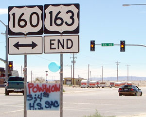
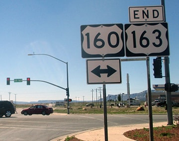
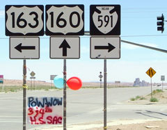
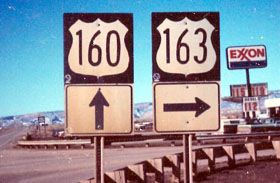
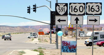
US 163 terminates at its junction with US 160; travelers making a right at that intersection are heading southwest toward Tuba City. Drivers turning left will be on their way to the Four Corners monument, where AZ, NM, CO, and UT meet. Straight ahead is southbound on Navajo hwy. 591, which is indicated on some of the following photos. This first group was from eastbound US 160:
|
Sanderson, July 2004
|
Summa, 1988
|
|
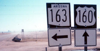
Church Rock is visible in the distance. In that second photo, the AZ 163 sign was erroneous; they had it correct heading the opposite direction:
|
Summa, 1988
|
Sanderson, Jul. 2004 (same as of 2019)
|
|
Those are looking towards Marsh Pass, which is where 160 crosses from the San Juan basin to the Little Colorado watershed. If a traveler turns to the right, they are at the south beginning of US 163, and they will soon see the first northbound confirming marker:
|
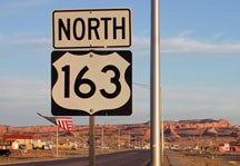
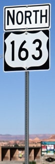
Kasprzyk, Mar. 2009
|
Kasprzyk, Sep. 2021
|

Kasprzyk, Mar. 2009
|
Visible in the background of that second photo is the prominence known as Agathla Peak. From that junction, it is about 23 miles to the Utah line, and then another 41 miles to the junction near Bluff where US 163 signage ends. But does the route actually end there? Spoiler alert: there are not many endpoints that are more difficult to determine than the north terminus of US 163.
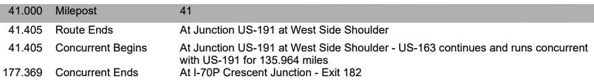
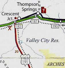
When it was first commissioned in 1970, the US 163 designation continued north of Bluff along present-day US 191, all the way up to Crescent Junction. The following year, Utah and Wyoming petitioned AASHO to extend the designation further north, all the way to Yellowstone (more info here). But the request was denied, and AASHTO's route log still lists Crescent as the northern terminus. Granted, that list is not authoritative in all cases, and in fact Utah's legislative description has US 163 ending at Bluff. So does the route summary at the beginning of UDoT's 2016 reference sheet for US 163:
When it was first commissioned in 1970, the US 163 designation continued north of Bluff along present-day US 191, all the way up to Crescent Junction. The following year, Utah and Wyoming petitioned AASHO to extend the designation further north, all the way to Yellowstone (more info here). But the request was denied, and AASHTO's route log still lists Crescent as the northern terminus. Granted, that list is not authoritative in all cases, and in fact Utah's legislative description has US 163 ending at Bluff. So does the route summary at the beginning of UDoT's 2016 reference sheet for US 163:
But there is more to consider: Utah's legislated routes do not account for overlaps. As of 2015, UDoT's list of concurrent routes still showed US 163 overlapping US 191 up to Crescent. And get this: the very same 2016 document shown above contradicts itself: the last entry states that US 163 overlaps US 191 to Crescent!
This is not the only case where UDoT behaves strangely with regard to its US route overlaps (see also US 189). For some reason, Utah seems to want US 163 defined as if it ends at Crescent, but signposted as if it ends at Bluff. In 1983 they removed the US 163 signs north of Monticello, and then two years later US 163 signage ended at U-163 in Bluff (that route has since been renumbered as U-162). It wasn't until 2004 that UDoT placed an "End US 163" assembly at its junction with US 191 a few miles southwest of Bluff. These shots were looking north on US 163:
Elbert, July 2005
|
Handler, Oct. 2019
|
|
No "End" assembly was posted during my visit in 2004; this was the assembly at the actual junction:
|
Hamilton, Sep. 2003
|
|
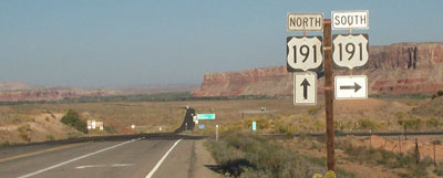
The mainline ahead is northbound US 191. Bluff is about four miles in the distance; it sits at the foot of that, um... bluff at far left. These next photos were taken looking north on US 191:
|
Sanderson, July 2004 (gone as of 2019)
|
Handler, Oct. 2019
|
|
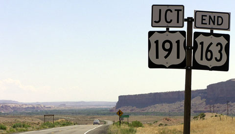
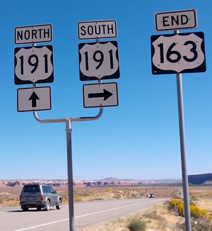
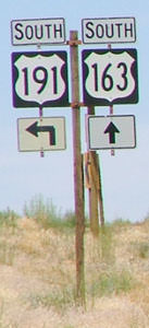
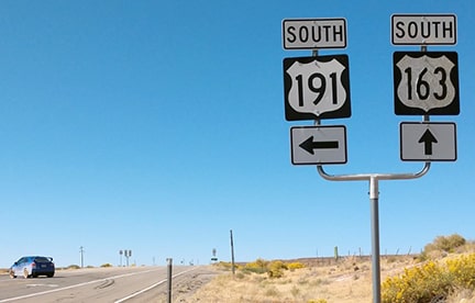
The signed beginning of US 163 is to the left. Here is the view heading the opposite direction (south on US 191):
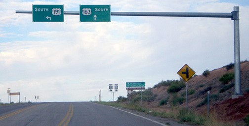
Salek, Sep. 2011 (unchanged as of 2019)
|
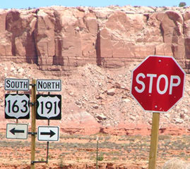
To continue south on US 191, travelers must make a left turn; straight ahead is the north beginning of US 163. The sign in the distance has some interesting control destinations:
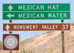
Sanderson, July 2004
|
|
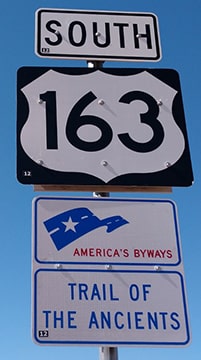
The sign at bottom says "Trail of the Ancients". This photo shows the signage just beyond that, at the physical junction:
|
Sanderson, July 2004
|
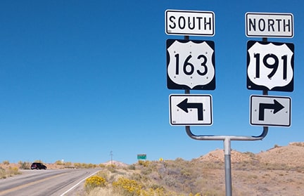
Handler, Oct. 2019
Straight ahead is the first southbound US 163 trailblazer:
|
Handler, Oct. 2019
|
|
None of those signs seem to leave any question as to where US 163 begins. But right about the same time UDoT finally cleared up the signage issues around Bluff, their official state highway map was changed to reflect the overlap to Crescent (which obviously contradicted the way US 163 was actually signposted on the road):
|
c. 2005, UDoT
|
It is perplexing to imagine what prompted that change on the map... and also why UDoT insists on making what should be a simple thing so complicated.
Incidentally, the original US 163 in Iowa was a legitimately-numbered branch of US 63. |
Research and/or photo credits: Paul Dienhart; Chris Elbert; Alan Hamilton; Mark Handler; Bruce Kasprzyk; Matt Salek; Dale Sanderson; Thomas Silas; Shayne Stephens; Michael Summa
Page originally created 1999;
last updated Nov. 24, 2021.
last updated Nov. 24, 2021.
