Historic US highway endpoints in the West Memphis area
|
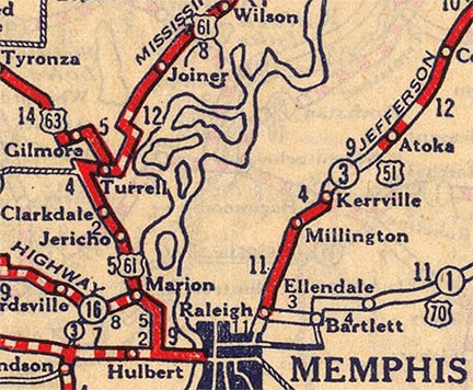
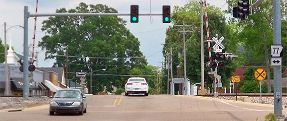
For the first 65 years of the US highway system, the south end of US 63 was at various locations in Crittenden County, Arkansas (which is across the Mississippi River from Memphis). Starting in 1927, US 63 ended in Turrell at its junction with US 61... but at the time, both highways were on different alignments than today:
|
|
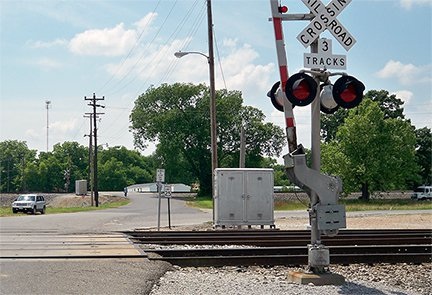
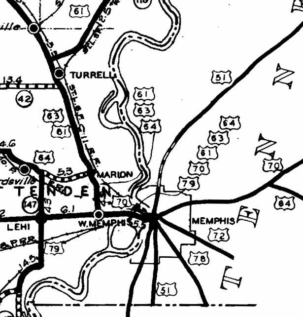
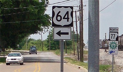
In between the two sets of tracks (right near the speed limit 25 sign), US 63 began by heading north (right) on Eureka Road. Official Arkansas state highway maps as late as 1937 explicitly note Turrell as the south terminus of US 63. But several changes in this area took place right in and around 1939. From Gilmore to Turrell, US 63 was rerouted along the west edge of both towns (following today's US 63 and AR highway 77). US 61 was rerouted to its current corridor, so the junction with US 63 was where I-55's interchange 23 is now (right between Gilmore and Turrell). But also right about this time, the south end of US 63 was officially extended to Memphis. All of these changes were shown on the 1941 official map:
|
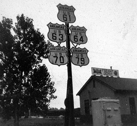
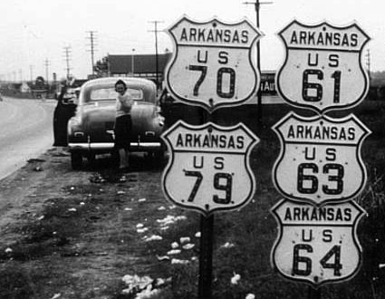
(Incidentally, that was the first year US 79 was shown east of the junction marked "Lehi" on that map). Note that US 63 was overlapped with US 61 south of Turrell. Not only that, but also the cartographer was very intentional about showing that the road from Marion to West Memphis was US 61-63-64, and the road from West Memphis to the Tennessee line was 61-63-64-70-79... and this photo proves that the road was signposted that way:
|
Arkansas really had no reason to extend US 63, but they may have done it at the request of one or more neighboring states: the minutes from a 1940 AASHO meeting show that a request was denied to extend the US 63 designation south to Gulfport MS. The proposed routing would have entirely overlapped US routes 51 and 49 through Tennessee and Mississippi, so AASHO had to deny it. Here is that agenda item from the minutes of the 1940 meeting:
|
|
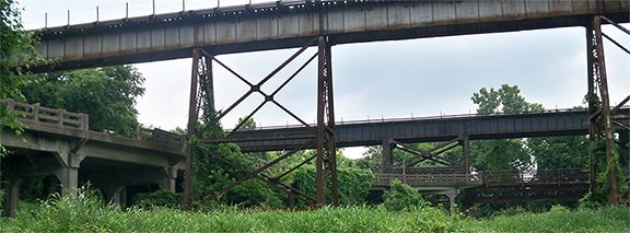
The note in the margin at left says "NO; amend to extend #63 into Memphis". However, I don't think Tennessee ever bothered to signpost the US 63 designation, so for the next 60 years the south terminus was at the AR/TN line over the Mississippi River at Memphis. For the first decade of that time period, all highway traffic used the Harahan Bridge. This photo was taken from the Arkansas side, looking north:
|
|
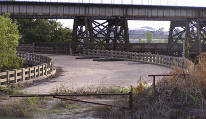
Running across the top of the photo is the Frisco bridge, a rail-only facility that opened in 1892. The bridge beyond that is the Harahan, built in 1916 to accommodate wagons/autos as well as trains. At far left (passing underneath the Frisco) is the elevated connecting road that carried vehicles between West Memphis (off to the left) and the Harahan. It had an "S" curve which straightened out (near the center of the photo) to run parallel to the bridge. Here is a view from that roadway:
|
|
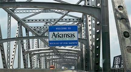
Not visible (off the right edge of those photos) is a ramp that carried traffic up to the same level as the rail deck. So US 63 ended on that bridge at the stateline, starting in about 1939. In about 1941, US 79 was temporarily extended to the same endpoint, before being extended through Tennessee and into Kentucky in 1944 (incidentally, in late 2016, the Harahan Bridge was re-opened to recreational users). In 1949, the current Memphis-Arkansas Bridge opened just to the south of these two bridges. So from then until 1999, US 63 was routed onto that bridge, with its south terminus still at the state line...
|
|
...but again, that was the official terminus according to AASHTO. Whether or not Arkansas ever signed US 63 that far is unknown -- it certainly was never necessary. But historic highway maps indicate that it did eventually become necessary for Arkansas to sign US 63 south of Turrell. The 1952 map was the first to show the bypass across the northeast quadrant of West Memphis. This is better known as I-55 today, but at the time it was signed as US 61. Originally US 61 traffic had been directed straight down Missouri Street and then east on Broadway. But when it was moved to the bypass, the 1953 map explicitly showed that the US 63 designation was extended along old US 61 down Missouri, ending at Broadway (US 70):
|
|
This photo is looking east on Broadway; in the distance are visible some of the skyscrapers in downtown Memphis:
|
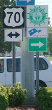
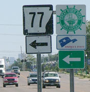
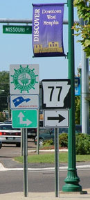
Officially US 63 continued to the vicinity of those buildings, but signage probably began to the left on Missouri, where AR 77 begins today. Here we are looking the opposite direction (west on Broadway):
|
|
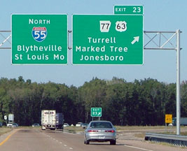
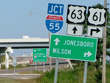
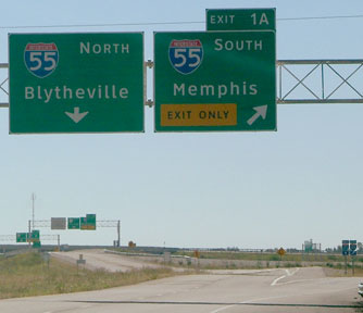
That was US 64, which continued to the left on Military, while straight ahead was the south beginning of US 63. Later still, the US 63 designation was truncated to I-55's interchange 23 near Gilmore. This was taken looking north on I-55; US 63 began at this exit:
|
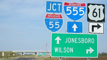
...although since then US 63 has been overlaid by the I-555 designation, so on many of the signs approaching that interchange, references to US 63 have been de-emphasized at the expense of I-555...
|
That was where US 63 ended. Effectively, it still ends there, as there is no signage to indicate US 63's implied route continuing along southbound I-55. But in 1999, the south end of US 63 was officially extended that way -- an entirely new direction -- to a new endpoint in Ruston LA. To many highway enthusiasts, this seems like an unnecessary and ill-advised move (more commentary and photos).
Research and/or photo credits: Ernie Deane; Nathan Edgars; Martin Karner; Jeff Morrison; Dale Sanderson; Dale Sauter; Stephen Taylor
Page originally created 2000;
last updated Jul. 10, 2021.
last updated Jul. 10, 2021.
