End of US highway 277 |
 |
|
1929-1950
|
1950-1964
|
1964-present
|
Summa
|
Mileage: in 1989 AASHTO listed a figure of 638 miles for US 1... however, that included the mileage of US 277's associated spur routes. According to the state subtotals on AASHTO's 1989 spreadsheet, mainline US 277's actual end-to-end total at the time was 633 miles. That closely matches our own 2020 measurement, which yielded 631.3 miles. Historically, when it went to OKC, US 277 was 645.4 miles long.
|
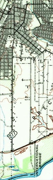
c. 1943, USGS
|
The reason US 277 is numbered as such is because it originally connected with its parent route (US 77); see the Oklahoma City page for more info.
Until 1950 the south end of US 277 was in Del Rio, at the international border. The highway came into town with US 90 from the north (as it does today), but at Gibbs Street, US 277 did not turn east with US 90. Rather, it continued south over the railroad via today's Spur 297. At Garfield Street, US 277 turned southwest. At some point that roadname changes to Las Vacas Street; US 277 followed that all the way to its end. At Frontera Road traffic was directed southeast to the present-day customs station. Drivers can no longer do that today, because the Border Patrol has gated off Frontera after its intersection with Alderete Lane: 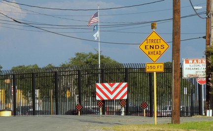
Sanderson, Aug. 2013
The information given on the now-obsolete yellow sign attests to the fact that US 277 historically continued straight through there.
|
|
It is only about 100 yards to the customs area, where there is another gate; this photo was taken from there, looking the opposite direction:
|
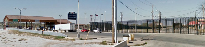
Google Maps Street View, Mar. 2013
|
At left is the port of entry to Mexico, and the historic south end of US 277. At right, Frontera is visible behind the gate (as well as the backside of the "Warning" and "Stop" signs shown in the first photo). Northbound US 277 traffic used that road, then turned right on Las Vacas to get to Del Rio.
|
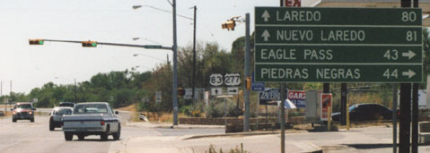
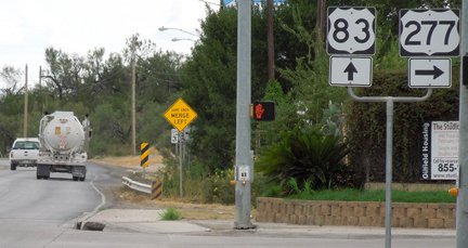
In 1950, that became the terminus of "Spur US 277", because mainline 277 was extended southeast to Carrizo Springs. These photos were all looking southeast on Pena Street. They show the last southbound sign, as well as the actual terminus, which is at the stoplight in the background (First Street, which carries US 83):
|
Taylor, 2000
|
Karners, Dec. 2014
|
Sanderson, Aug. 2013
|
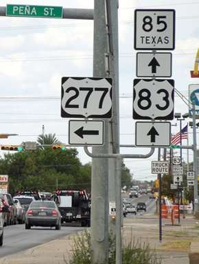
These shots were looking southwest on First, at the intersection with Pena:
Taylor, 2000
|
Sanderson, Aug. 2013
|
|
Next is a photo from the opposite direction (north on US 83)...
|
Sanderson, Aug. 2013
|
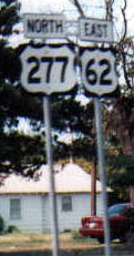
...and drivers who take that left turn onto Pena soon see the first northbound US 277 confirming marker:
|
Sanderson, Aug. 2013
|
During the 1960s, not only was OKC's freeway system being developed, but there was also a need to vacate a segment of Meridian Road so that the airport could expand to the east side. Since US 62 was a through route, traffic was redirected onto what is now I-44 and I-240. But US 277 was not a through route, so in 1964 the Oklahoma DoT had to determine where the designation should end.
|
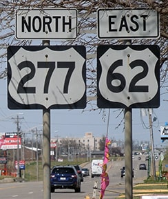
A purist would argue that the route still should have connected with US 77. On the other hand, a minimalist might have pointed out that there was no longer any need for the northernmost 37 miles of US 277: since that entire segment was overlapped with other US routes, the designation may as well have been truncated to its junction with US 81 in Ninnekah. But OKDoT did not choose either option. Instead, they let US 277 continue to exist as far as possible along its original route. At the point where US 62 was redirected onto I-44, the US 277 designation was truncated. That interchange is within the city limits of Newcastle (an OKC suburb). These photos show the northernmost US 277 sign; this was on Meridian (or Main Street), about 3/4 mile south of the interchange with I-44 (locally known as the H.E. Bailey Turnpike):
|
Todd
|
Sanderson, Apr. 2021
|
Even though one does travel north to get to OKC, US 62 is an east-west highway. Later that "North" was covered with a patch, correcting it to "East", but as of 2021 the entire sign was ready for replacement:
|
Sanderson, Apr. 2021
|
|
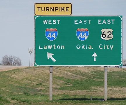
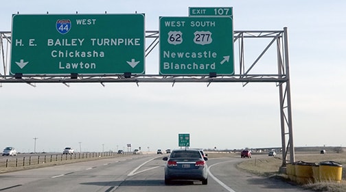
Here are some shots of the north beginning of US 277, as viewed from the exit on westbound I-44:
|
Todd
|
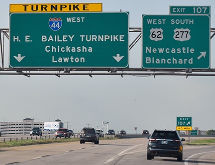
Stuve, Mar. 2014
|
Ivy / Nitzman, May 2022
|
|
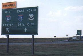
Historically, the sign posted in the gore included route shields...
|
Street View, May 2012
|
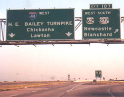
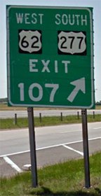
...but the 2019 / 2020 replacement does not. Immediately after that, the first standalone trailblazer is posted:
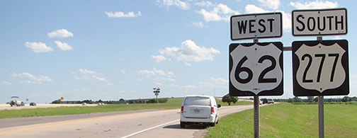
Backlin, Aug. 2018
|
Ivy / Nitzman, May 2022
|
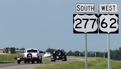
Sometime between 2018 and 2021 those signs were replaced, and for some reason US 277 now has first billing.
Since US 277 no longer connects with US 77 anyway, this 30-mile overlap with US 62 is pointless. The seven-mile overlap with US 81 (from Ninnekah up to Chickasha) is appropriate, because it allows the north-south US 277 to junction with an east-west route (US 62). But there is no longer any good reason for US 277 to exist between there and Newcastle. |
Research and/or photo credits: David Backlin; Brent Ivy; Karin and Martin Karner; Alex Nitzman; Dale Sanderson; Eric Stuve; Michael Summa; Stephen Taylor; Cary Todd
Page originally created 2000;
last updated Dec. 4, 2023.
last updated Dec. 4, 2023.
