End of historic US highway 180 [i] |
 |
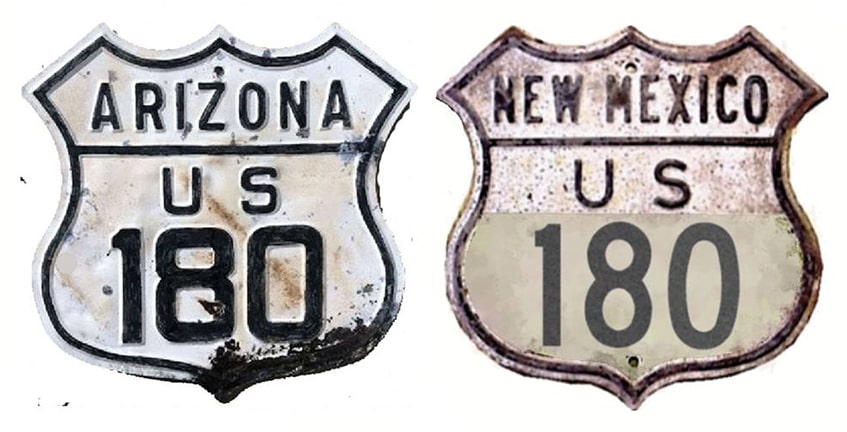
Summa
1926-1934
|
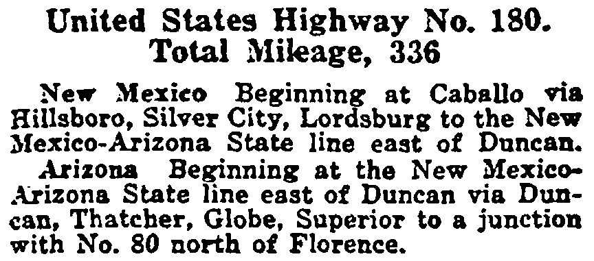
By our measurements, US 180 measured approximately 303 miles in total length, although the original description in AASHO's Apr. 1927 route log listed it at 336 miles:
|
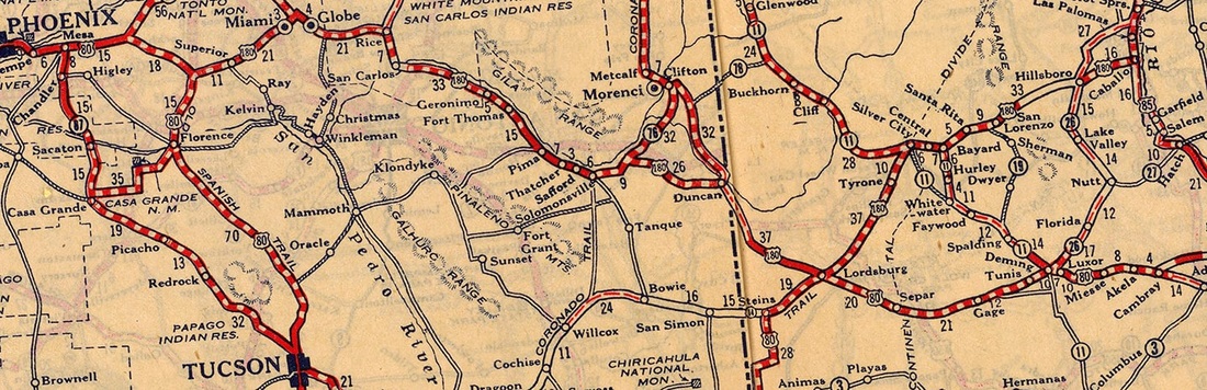
c. 1927, Rand McNally
|
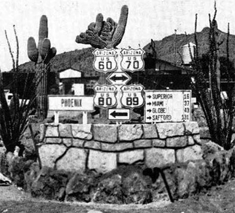
Today's US 180 is actually the second route to be assigned that number. The original US 180 began at its junction with US 80-89 at Florence Junction. This photo was taken there, looking north on westbound US 80/northbound US 89. The date range is quite narrow: it could only have been taken after 1932 (when US 60 was extended through Arizona) and 1935 (when the US 180 designation was eliminated):
|
c. early 1930s, courtesy of Preserving Arizona
|
|
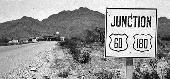
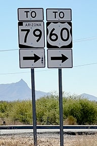
Ahead at the actual junction (where a building and a water tower are visible), US 60 ran both left and right, and also to the right was the west beginning of US 180. This next photo shows signage right at the junction, although this was taken a few years later, after US 180 had been decommissioned:
|
c. 1938, Arizona Highways
|
|
Today US 70, US 80, and US 89 have all been truncated such that they no longer run through this area. And the former US 60 has been bypassed by a newer alignment, so as a result the original highway now dead-ends in both directions. This next photo shows the only signage that is still posted in roughly the same location as the historic photos above:
|
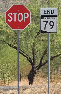
Sanderson, Oct. 2023
|
|
These modern photos were taken from what was once eastbound US 80/southbound US 89. Those routes continued to the right at this junction, while straight ahead was the west beginning of US 180:

Karners, Dec. 2011
|
Sanderson, Oct. 2023
|
|
Later that segment became part of US 60-70, but today it serves only as a frontage road to modern US 60, and it dead-ends in about a half-mile (hence the yellow signs in the middleground). These photos show the opposite direction:
Hamilton, Dec. 2007
|
Sanderson, Oct. 2023
|
|
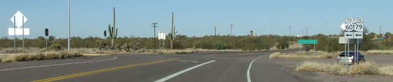
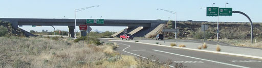
That was looking west at the historic end of US 180. That is the original "Florence Junction": straight ahead was westbound US 80/northbound US 89, while southbound/eastbound was to the left. If one turns left there today, they immediately come to an interchange with the newer US 60 expressway:
|
Hamilton, Dec. 2007
|
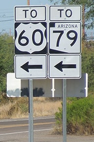
Straight ahead is AZ hwy. 79 to Florence and Tucson. US 60 goes west (right) to Phoenix, while Globe is to the left. But originally from this point it was US 180 that went east to Globe, and then continued southeast into New Mexico. Near Lordsburg, US 180 came within three miles of rejoining its "parent" route (US 80), but instead veered off to the northeast.
|
From there the assigned routing was through Silver City and over Emory Pass to Caballo, where US 180 ended at its junction with US 85. However, there is some question as to whether the segment between Hanover and Hillsboro was even a driveable auto route during that time period. Suggesting that it was not are maps such as this one, which shows a gap in the road where Emory Pass should be...
|
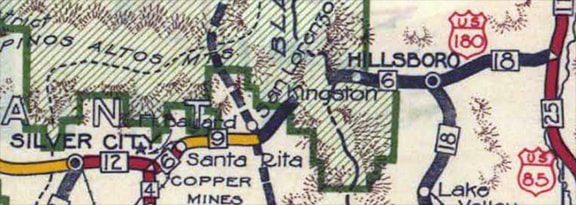
c. 1934, NM DoT
|
|
...as well as the fact that the route was decommissioned after only about nine years. US 70 took over the segment west of Lordsburg, but the Emory Pass segment has not been a part of the US route system since then.
|
|
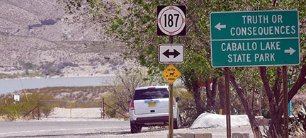
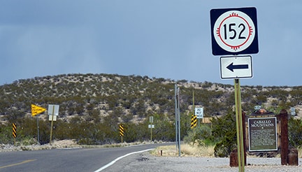
These photos were taken looking east on NM hwy. 152, at the historic eastern terminus in Caballo. I-25's interchange 63 is just behind the camera. Old US 180 is now NM 152; in the distance is NM 187, which was originally US 85:

Faye and Sandy, Apr. 2006
|
Sanderson, Mar. 2016
|
|
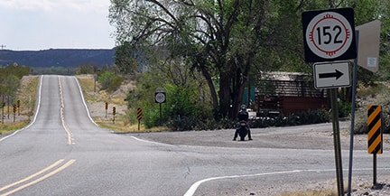
The Caballo Mountains dominate the horizon in that direction, and part of Caballo Reservoir is visible in the background. US 180 ended at that T-junction. This photo shows a view approaching that junction from the south:
Sanderson, Mar. 2016
|
That was once northbound US 85, and US 180 began to the left. The view below is from the opposite direction:
Sanderson, Mar. 2016
Although this original US 180 and the current US 180 are not related, the current route does overlap the historic route between Silver City and Santa Clara NM (although back in the days of the original US 180, the town of Santa Clara was known as "Central").
|
Research and/or photo credits: Tom Fearer; Alan Hamilton; Karin and Martin Karner; Dale Sanderson; Faye and Sandy; Michael Summa
Page originally created 2005;
last updated Dec. 9, 2023.
last updated Dec. 9, 2023.
