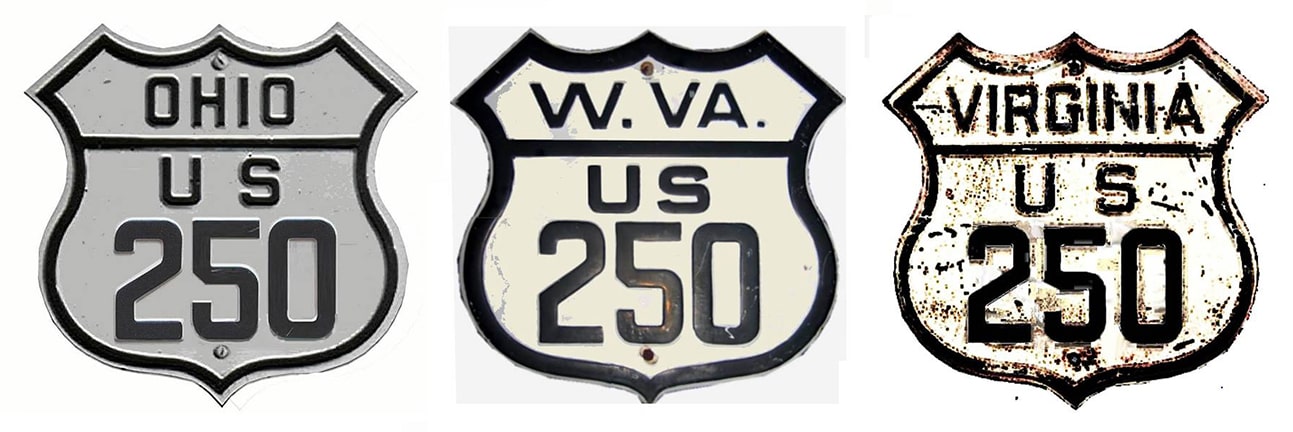
End of US highway 250 |
 |
|
1928-1932
|
1932-1934
|
1934-present
|
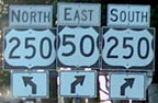
Note: US 250 is signed north/south in West Virginia.
|
Summa
|
Mileage: in 1989 AASHTO listed a figure of 518 miles for US 250... however, that included the mileage of US 250's associated business route. According to the state subtotals on AASHTO's 1989 spreadsheet, mainline US 250's actual end-to-end total at the time was 514 miles. That closely matches our own 2020 measurement, which yielded 509.9 miles (reroutings and realignments likely explain the difference).
|
The 1925 preliminary plan for the US highway system had a "US 250" in Kansas, running essentially along modern US 50 from Baldwin City to Garden City. As a result, this number did appear on some maps, but it was never approved; the route ended up being designated "US 50-S" in the 1926 final plan.
|
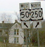
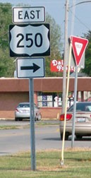
So the only "real" US 250 is the current one, which originally appeared in 1928, running from Norwalk to US 50 near Grafton. There, heading east on US 50, the south beginning of US 250 was once to the left...
|
Nelson, Apr. 2008
|
...but now it extends ahead with US 50 for a couple miles, before the routes go their separate ways again at Pruntytown. Heading the opposite direction, this photo shows modern signage at the original beginning of US 250:
|
Nelson, Apr. 2008
|
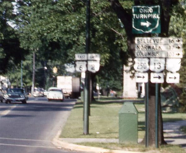
...and, remarkably, the photo below (which shows the same junction) was taken during the brief timeframe when US 250 actually terminated there. Unfortunately no US route shields were shown, but there was a quaint sign tree giving mileage to Fairmont, Grafton, and Clarksburg:
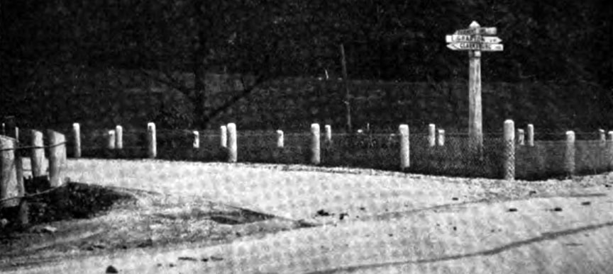
from the 1928-1929 annual report of the State Road Commission of WV
In 1934 the US 250 designation was extended eastward from there; photos and more info on the Richmond page.
The original west end of US 250 was in Norwalk, as illustrated on this map: |
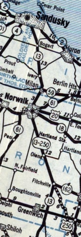
c. 1929, OH DoT
|
|
This photo was looking north on Benedict Avenue at Main Street (which today carries OH hwy. 61, but was once US 20):
|
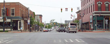
Nelson, May 2008
|
|
Historically US 250 ended there (but as you can see it now continues ahead on Whittlesey Avenue). This photo was looking west on Main:
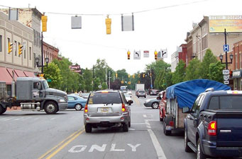
Nelson, May 2008
To the left on Benedict was the original west beginning of US 250.
In 1932, US 250's west end was extended to Sandusky, and the state highway map was changed accordingly: |
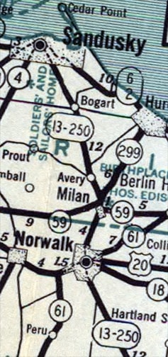
c. 1933, OH DoT
|
|
Originally westbound US 250 turned off Milan about a half-mile before Sycamore Line (yes, "Line" -- not "Lane"), left onto Perkins Aveune. Then it went north on Columbus Avenue, and ended downtown at Washington Street, or US 6. The following photo was taken during that timeframe, looking east on Washington. The west beginning of US 250 was to the right on Columbus:
|
courtesy City of Sandusky, date unknown
|
|
Today OH 101 shares Washington's pavement with US 6, and Columbus carries the OH 4 designation. This photo shows some current signage at the same intersection, but heading the opposite direction:
|
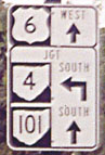
Fannin, 2001
|
|
That was from westbound Washington, at the intersection with Columbus. OH hwy. 4 follows historic US 250 for a few blocks, and then veers off to the southwest via Hayes Avenue. It is unclear whether the remainder of old 250 is still on the state highway system. Today the US 250 designation comes in on Milan Road and ends on Sycamore Line at Cleveland Road (US 6):
|
Reighard, Aug. 2003
|
|
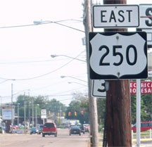
That was looking north at the end of US 250. Beyond the green sign an "End" assembly is visible, shown close-up in this series of photos:
|
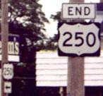
Fannin, 2001
|
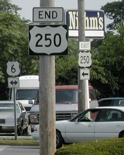
Kaiser, July 2006
|
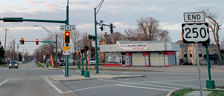
Lintz, Apr. 2022
|
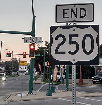
Turner, Sep. 2023
|
|
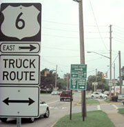
Also visible is signage for the beginning of US 250 for westbound US 6. Eastbound US 6 traffic approaching the west beginning of US 250 encounters this sign...
|
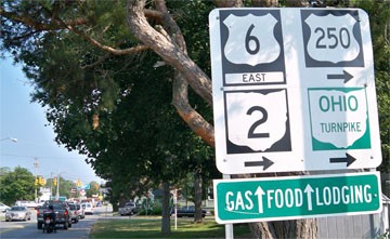
Karners, Aug. 2010
|
...and then this one at the junction with Sycamore:
|
Karners, Aug. 2010
|
Drivers turning there immediately see a "Begin" assembly (with a zero mile marker), and then after one more block the first eastbound confirming marker:
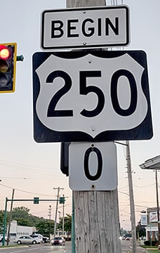
Turner, Sep. 2023
|
Karners, Aug. 2010
|
Turner, Sep. 2023
|
Research and/or photo credits: Marc Fannin; Cameron Kaiser; Karin and Martin Karner; Josh Lintz; Steven Nelson; Jason Reighard; Mike Roberson; Dale Sanderson; Michael Summa; Charles Turner
Page originally created 2001;
last updated Dec. 3, 2023.
last updated Dec. 3, 2023.
