US highway endpoint in Gallup, NM1992-present
|
 |
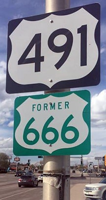
US 666 originally used 3rd Street to connect with US 66 in Gallup. In 1938, the south end of US 666 was extended west out of Gallup and into Arizona. But in 1992, Arizona removed the US 666 designation from their state (replacing it with a southern extension of US 191), so the southern terminus of US 666 returned to Gallup once again (but by this time, traffic had been rerouted onto a newer bypass called Munoz Drive). Then in 2003, the entire remaining segment of US 666 (from Gallup to Monticello UT) was replaced with the US 491 designation.
At first glance, one would think that US 666 would have ended at its interchange with I-40, and that Munoz south of that interchange is designated NM hwy. 602. However, the reality is that 666 continued to end where it technically should have: at its junction with historic US 66 (which is now NM 118/Business Loop I-40). And according to signage, its successor (US 491) may still continue south of I-40 to end at old US 66.
When the Munoz bypass was constructed around Gallup, it was not possible to build an at-grade intersection with old route 66, because of the nearby river and railyards. Instead, the two highways are connected via a couple side roads. The progression of photos below (shot both before and after US 491 was commissioned) tells the story nicely. I was in Gallup in 2006, but at the time this entire interchange was under construction, and all the signage was either down or covered up, so I didn't get any photos. But presumably many of the new signs I photographed in 2013 were erected later that same year (2006). These first shots were looking east (towards downtown Gallup) on old US 66:

Hamilton, 2000
|
Hamilton, Oct. 2003
|
Hamilton, Oct. 2003
|
|
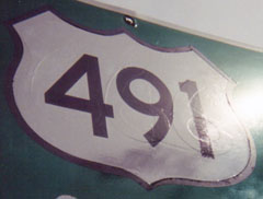
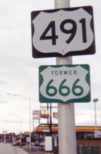
The overpass is Munoz, and drivers get to it by turning to the right there on Arnold Street. Originally the old US 666 signs were simply covered with US 491 decals (as can be seen in the close-up photo above). But by 2013, new signs had been posted:
|
Sanderson, Mar. 2013
|
|
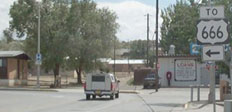
Here are a couple shots taken from the opposite direction (westbound on old US 66):
|

Teresco, Sep. 2003
|
Sanderson, Mar. 2013
|
|
After making that turn to the south on Arnold, traffic was then directed east on Aztec Avenue...
|
Hamilton, 2000
|
Hamilton, Oct. 2003
|
|
...although those signs were not replaced after the 2006 reconstruction. Turning to the left on Aztec, we reach the intersection with Munoz, shown here:
|
Hamilton, 2000
|
Hamilton, Oct. 2003 (gone by 2008)
|
US highway traffic was directed left, over old US 66, and north to Shiprock... but those signs are also gone now, so travelers need to have their wits about them (always a good practice in New Mexico, given the generally haphazard signage there). After turning north, drivers pass beneath a sign bridge, shown here:
Hamilton, 2000
|
Hamilton, Oct. 2003
|
Sanderson, Mar. 2013
|
|
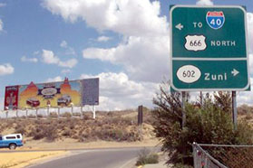
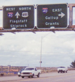
Continuing ahead, the first standalone confirming marker was posted just before reaching I-40...

Sanderson, Mar. 2013
|
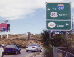
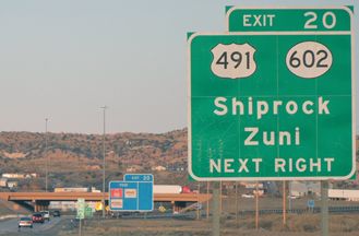
...while on the far side of the interchange was another shield, along with a reference to its predecessor:
|
|
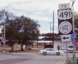
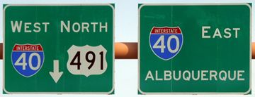
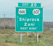
Now, heading the opposite direction (south on Munoz), the last reference to US 491 is posted as one approaches the I-40 interchange:
|
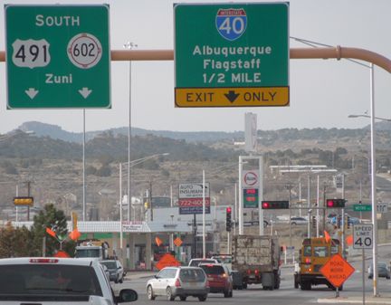
Sanderson, Mar. 2013
|
|
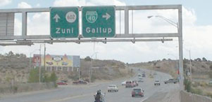
After passing over I-40, drivers reach the same sign bridge shown in some of the photos above:
|
Hamilton, 2000
|
Sanderson, Mar. 2013
|
|
After turning to the right there on Aztec, and then another right on Arnold, travelers reach what may the actual terminus of US 491 (and the former terminus of US 666), at its junction with old US 66/BL I-40. This photo shows the signage posted across the road:
|
Hamilton, Oct. 2003
|
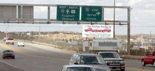
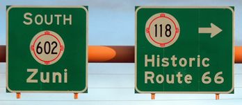
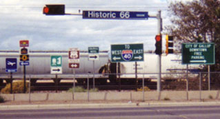
US 66 through town followed what was originally called Railroad Avenue, but already by 1931 the street name was officially changed to "66 Avenue" to capitalize on the route's popularity, and it has since been changed to "Historic 66 Av" (also visible is a brown sign denoting "Historic US Route 66"). While that may technically be the terminus of US 491, we will also review the perspective from I-40, because the way it is signed from there makes it look like the route begins at the interstate:
Sanderson, Mar. 2013
|
Cozart
|
Cozart
|
|
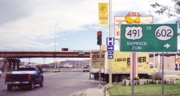
Heading eastbound, directions for both US 666 and NM 602 were formerly very specific, but now when a driver takes that exit, the only directions given are on a small sign, mounted on a signal mast at the end of the offramp:
|
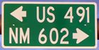
Sanderson, Mar. 2013
|
|
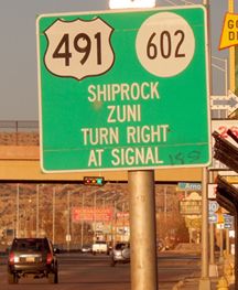
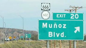
The signs heading the opposite direction (westbound) look like they were not replaced; rather, a 491 decal was stuck more-or-less on top of the old 666 shield:
|
Sanderson, Mar. 2013
|
Sanderson, Mar. 2013
|
|
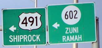
The directions at the end of the westbound offramp were more satisfactory than those for eastbound traffic:
|
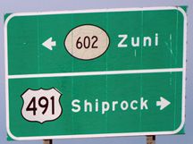
Sanderson, Mar. 2013
|
Research and/or photo credits: Justin Cozart; Alan Hamilton; Brent Ivy; Chris Kalina; Dale Sanderson; Jim Teresco
Page originally created 2003;
last updated Apr. 21, 2020.
last updated Apr. 21, 2020.
