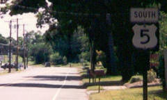
End of US highway 5 |
 |
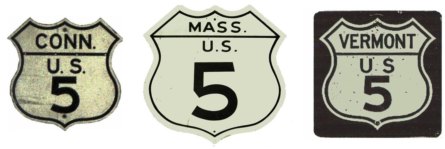
Summa
|
1926-present
|
|
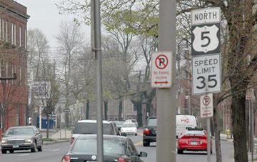
Mileage: in 1989 AASHTO listed a figure of 300 miles for US 5. That closely matches our own 2020 measurement, which yielded 300.5 miles.
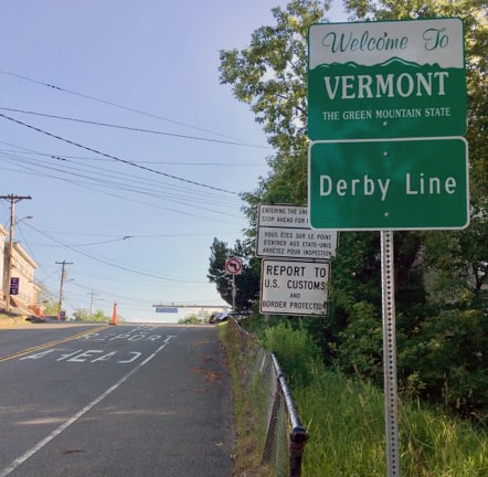
The last northbound US 5 marker is posted four miles before the road reaches its terminus at the Canada border in Derby Line:
|
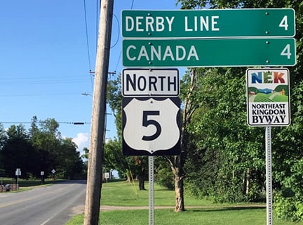
Bourey, Jul. 2019
|
|
Approaching the boundary, the road splits; non-local trucks are not allowed to use this port of entry, so instead they are routed east (right) to customs at I-91's northernmost interchange:
|
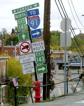
Sanderson, Oct. 2004
|
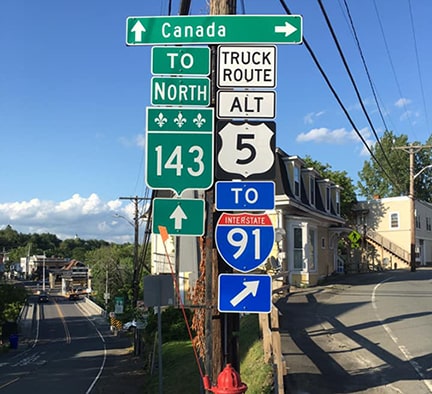
Bourey, Jul. 2019
|
|
Passenger cars may continue straight ahead on US 5, down the hill towards a small bridge. Note the building with an American flag at lower left: that straddles the international boundary (a plaque near the US customs building cites this as an example of the goodwill between the two countries, and in particular between these border communities). It is also visible in these next photos, as is an "End" assembly that was added in 2016:
|
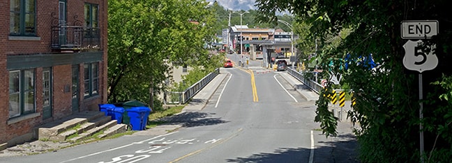
Cameron, July 2017
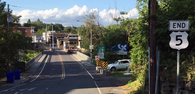
Bourey, Jul. 2019
|
|
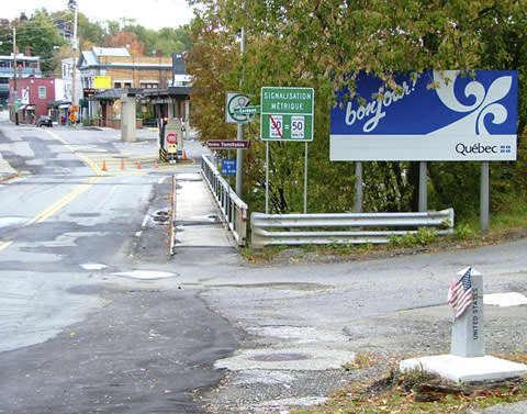
Across the road from that building is a small monument marking the line, shown in the foreground of this photo:
|
Sanderson, Oct. 2004
|
|
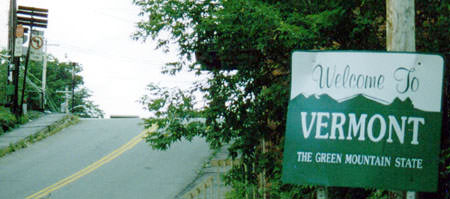
The Canadian customs station is visible in the background of both photos. Coming the opposite direction, people entering the U.S. via route 5 first see this:
Mortell, 1996
|
Bourey, Jul. 2019
|
|
In the distance can be seen the backside of the sign assembly for northbound traffic (shown previously). Just over the hillcrest, drivers are stopped at the port of entry pictured here:
|
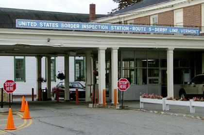
Sanderson, Oct. 2004
|
|
The first southbound confirming marker is about a half-mile ahead, after passing out of Derby Line:
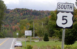
Sanderson, Oct. 2004
|
Bourey, Jul. 2019
|
About 300 miles ahead, the last such marker looks like this:
Mortell, 1996
|
|
The south end of US 5 has always been in New Haven, although not always at the same junction. Initially traffic was routed into the city via State Street, a little beyond its current endpoint, then west on Edwards Street, south on Whitney Avenue, and finally on Temple Street, right through New Haven Green, ending at Chapel Street (which carried US 1 at the time). This interactive photo is looking west on Chapel:
|
|
|
The south beginning of US 5 was originally to the right on Temple. That was the case until the mid-1930s, when US 5 was redirected along a route that bypassed the downtown area and the Yale University campus. Traffic ended up on Davenport Avenue; this view is looking to the west:
|
|
|
Today the road curves slightly left to the Columbus Avenue intersection (US 1). But back in the day, US 5 went through what is now a pedestrian-only area, visible on the right-hand side of that image. This merged with Columbus right at Ella Grasso Blvd, forming a busy 5-way intersection that has since been mitigated:
|
c. 1943, USGS
|
|
By 1954 the US 5 designation had been moved back onto State, but right about where it originally turned west onto Edwards, it instead turned south on East Street, ending at its junction with Water Street (US 1):
|
c. 1954, USGS
|
|
This shot is looking west on Water. US 5 once began to the right on East St, but this view changed a lot when the interstates were built:
|
|
|
I-91 opened to traffic in 1966, and that is when the US 5 designation was truncated to its current endpoint. This photo was taken from northbound I-91:
|
Nitzman, July 2004
|
|
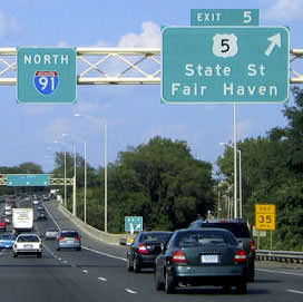
Upon taking exit 5, the offramp lines up with northbound State, and the south beginning of US 5 is straight ahead (southbound State is to the left under I-91, and to the right is James Street):
|

Mortell, May 2007 (sign gone by 2010)
|
Today the first northbound marker is about a half-mile ahead (north on State, near Grace Street):
|
Mortell, May 2007
|
|
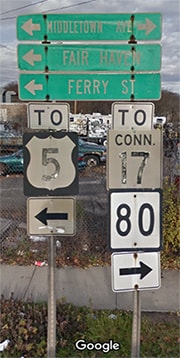
Heading south on I-91, things are quite a bit different. For one thing, it is not clear why US 5 traffic isn't directed to use exit 7 -- no one is looking for "southbound" US 5 at that point, and it is quicker and easier to get to northbound State by using Middletown Avenue and Ferry Street. And, in fact, drivers who do take that exit are indeed provided with directions to US 5 at the end of the offramp:
|
|
Nevertheless, it is exit 6 that is marked for US 5. After one exits, there are no more directional signs for US 5, even though one must make two left turns in order to get onto State.
|
Research and/or photo credits: George Bourey; Pat Cameron; Nathan Edgars; Martin Karner; Robert Mortell; Alex Nitzman; Dale Sanderson; Michael Summa
Page originally created 2001;
last updated June 25, 2020.
last updated June 25, 2020.
