End of US highway 401 |
 |
Summa
|
|
Mileage: in 1989 AASHTO listed a figure of 270 miles for US 401... however, that included the mileage of US 401's associated business routes. According to the state subtotals on AASHTO's 1989 spreadsheet, mainline US 401's actual end-to-end total at the time was 250 miles. That closely matches our own 2020 measurement, which yielded 251.9 miles.
|
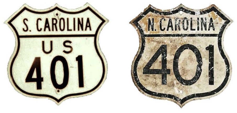
The original US 401 was commissioned in 1927; it was entirely in Virginia, running between South Hill and South Boston along what is now US 58. That designation was decommissioned in 1931. Maps from the following year show a second US 401 -- this one serving Raleigh NC, Walterboro SC, and points between -- but this road was decommissioned after only two years, mostly replaced by US 15. It was not until 1956 that the US 401 designation was resurrected again; it is this third version that still exists today. Since then, the south end of US 401 has always been in Sumter:
|
c. 1962, SC DoT
|
|
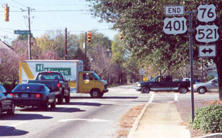
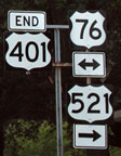
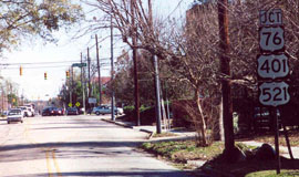
These photos were looking west on Calhoun Street; the intersection is Washington Street, which once served as US 76-521, but apparently the routing of US 521 has changed a bit in recent years:
|
Dawson, Dec. 2001
|
Nitzman, May 2007
|
|
This shot was taken from the opposite direction (east) on Calhoun, which is SC hwy. 763 at this point; US 401 begins on the other side of the light (Washington):
|
Dawson, Dec. 2001
|
|
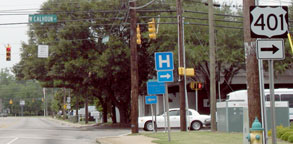
The first northbound US 401 sign is near the yellow pedestrian signs in the distance; it is shown in more detail here:
|

Dawson, Dec. 2001
|

Nitzman, May 2007
|
|
In about a half-mile, Calhoun becomes Oswego Highway, which veers to the northeast, towards Darlington. This shot was from northbound Washington; the south beginning of US 401 is to the right on Calhoun:
|
Nitzman, May 2007
|
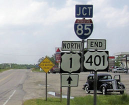
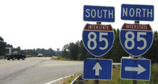
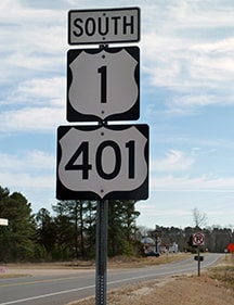
Originally the north end of US 401 was in Norlina. In 2001 the designation was extended about seven miles to the north, overlapped with US 1. These shots were taken looking that direction, showing US 401's current terminus at North Carolina's northernmost I-85 interchange:
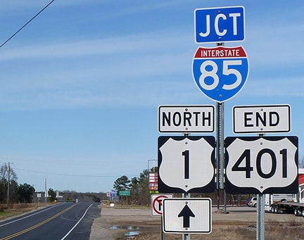
Karners, Dec. 2016
|
Robb, Apr. 2006
|
Nitzman, June 2005
|
Here we are looking the opposite direction (south on US 1) at the north beginning of US 401 and its first (and now second) southbound confirming markers:
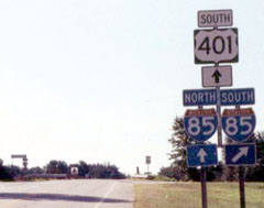
Nasiatka, Aug. 2003
|
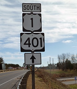
Karners, Dec. 2016
|
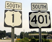
Nitzman, June 2005
|
Karners, Dec. 2016
|
|
And lastly, here is a view of the north beginning of US 401 as seen from I-85:
|

Nitzman, June 2005
|
Research and/or photo credits: David Dawson; Karin and Martin Karner; J.P. Nasiatka; Alex Nitzman; Bob Robb; Dale Sanderson; Michael Summa
Page originally created 2000;
last updated Dec. 7, 2023.
last updated Dec. 7, 2023.
