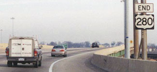
End of US highway 280 |
 |
|
1931-1941
|
1941-1953
|
1953-present
|
|
Mileage: in 1989 AASHTO listed a figure of 392 miles for US 280. That closely matches our own 2020 measurement, which yielded 388.5 miles (reroutings and realignments likely explain the difference).
|
|
|
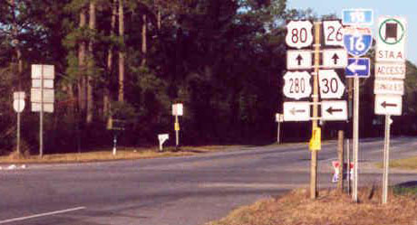
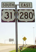
Originally US 280's east terminus was in Savannah. In 1941, the 20-mile overlap with US 80 was eliminated by truncating US 280 to its current endpoint in Blitchton. Approaching the east end of US 280, its parent route is identified on junction signage:
|
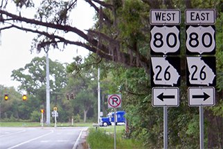
Karners, Apr. 2014
|
|
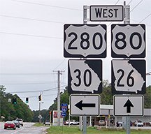
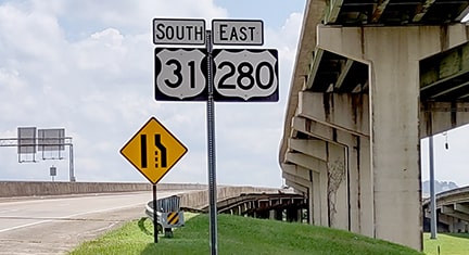
These photos show the most recent "End" assemblies that have been posted at the intersection ahead:
|
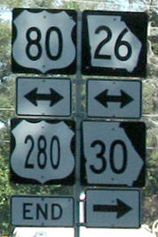
Nitzman, Dec. 2006
|
Karners, Apr. 2014
|
|
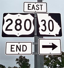
Until 1941, US 280 continued to the right (east) with US 80. Here is the signage for eastbound US 80 traffic, at the east beginning of US 280:
|
Nitzman, Dec. 2006
|
|
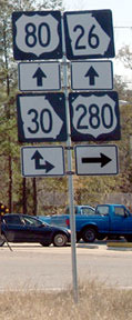
All signage at this junction was replaced in 2012. These shots were taken from the opposite direction: westbound US 80 (which runs northwest at this point). The east beginning of US 280 is to the left:
|
Dawson, Dec. 2001
|
Karners, Apr. 2014
|
|
US 280 begins by heading southwest; if a traveler turns that way, they will soon see the first westbound US 280 marker, shown here:
|
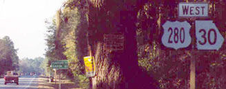
Dawson, Dec. 2001
|

Karners, Apr. 2014
|
Just behind the assembly shown at left was a grand old tree whose canopy arched over the entire roadway... but unfortunately that is gone now. The green sign in distance gave mileage to Pembroke and Claxton, but now it references only Pembroke. I-16's interchange 143 is about a mile ahead.
|
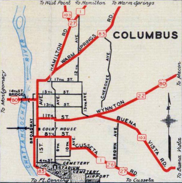
At the time of its commissioning, US 280 was intended to extend west to Columbus, but Georgia's own maps suggest that, at first, it may not have been signed beyond Cusseta:
|
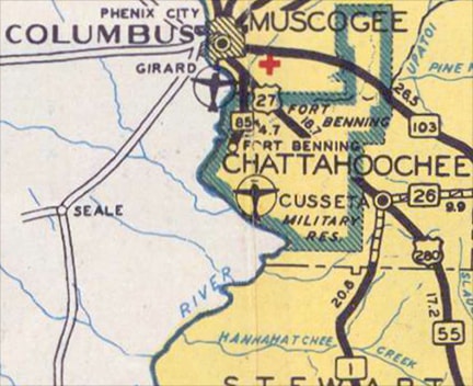
c. 1938, GA DoT
|
GA route 55 ended in Cusseta, at its junction with GA 1 (which carried US 27). So when US 280 was commissioned to run along GA 55, Georgia may have stopped signing US 280 at the same junction where they stopped signing GA 55. None of the Columbus insets through 1949 included a US 280 shield:
c. 1938, GA DoT
|
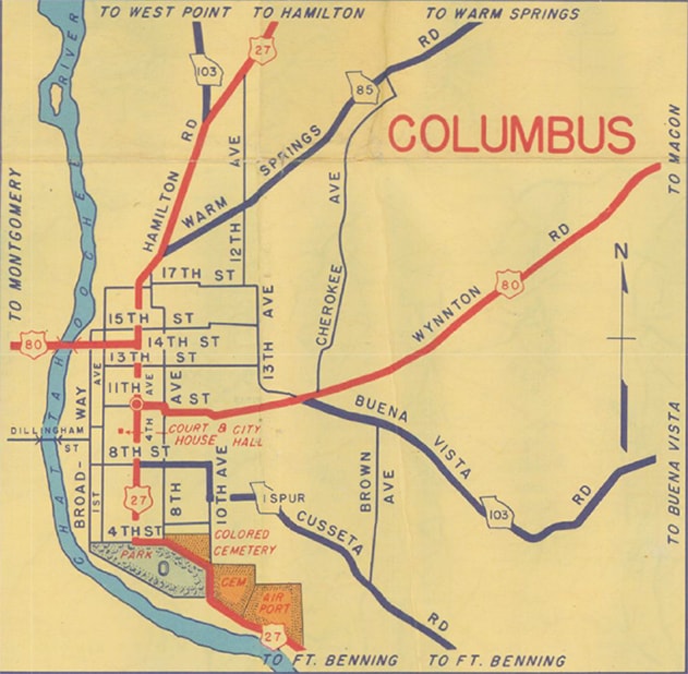
c. 1949, GA DoT
|
The 1950 inset was the first to show US 280 coming into Columbus, and that was only a few years before US 280 was extended west into Alabama. It was also the first map to show US 80 using 13th Street (instead of 11th Street), suggesting that US 280 ended on 4th Avenue at 13th St. However, US 80 may never have actually been signed along that route, because the inset from two years later already had US 80 back on 11th St:
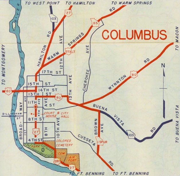
c. 1950, GA DoT
|
c. 1952, GA DoT
|
|
So the US 280 designation almost certainly ended on 4th Av. at 11th St. 4th Av. has since been renamed to Veterans Parkway; this photo was taken looking north on Veterans:
|
Sanderson, Nov. 2017
|
|
US 280 came up to that point and ended (straight ahead was westbound US 80, while eastbound was to the right on 11th).
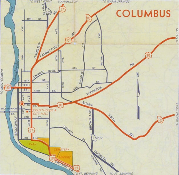
In 1953, US 280 was extended west to Birmingham. This was done in part because US 241 had been decommissioned, but Alabama officials wanted to keep a US route of some kind along US 241's former segment between Phenix City and Sylacauga (this article has more info). US 280 traffic came into Birmingham on Cahaba Road, then Arlington Avenue, which becomes Highland Avenue. US 280 junctioned US 31 at 20th Street, and the two routes were twinned east on South 7th Avenue, then north on 24th Street: |

c. 1956, Gousha
|
|
How far north on 24th did US 280 ride along with US 31? It may be difficult to top this map in terms of its ability to answer that question:
|
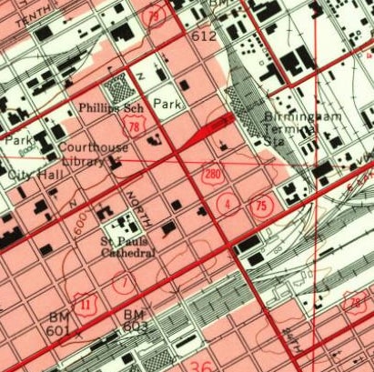
c. 1959, USGS
|
That showed US 280 going at least as far as North 5th Avenue. Although that was an arterial, it was not a signed route, so it seems likely that the US 280 designation would have gone a couple blocks farther north, ending at North 8th Avenue (since renamed to Rev. Abraham Woods Jr. Blvd), which was the intersection where both US 31 and US 78 traffic made 90-degree turns.
|
|
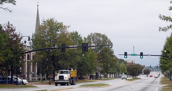
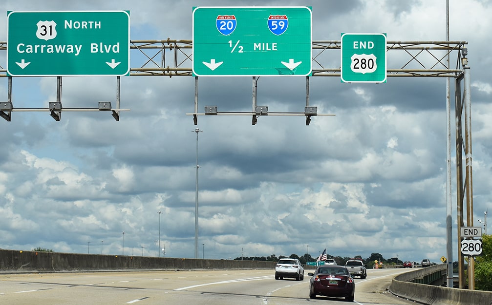
The first segment of the Red Mountain Expressway (aka Elton B. Stephens Expwy) was opened to traffic in 1970, and it began to replace the functionality of 24th St. However, it was not completed all the way north to its interchange with I-20/59 until the 1980s, and that is when the current terminus of US 280 was established (AASHTO approved the reroute in June 1989). This photo shows the final westbound US 280 marker:
|
Lintz, Apr. 2018
|
|
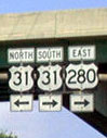
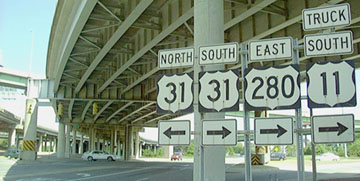
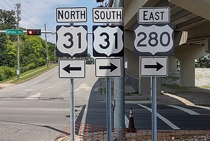
US 280 does not terminate for another mile, but all signs beyond that one refer only to US 31... until we get to the sign bridge below, which has two different "End" signs, one pole-mounted and one overhead-mounted:
Nitzman, 2001
|
Nitzman, Jun. 2022
|
|
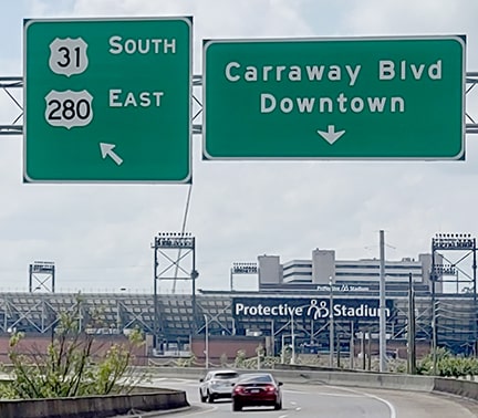
US 280 overlaps with US 31 up to that point; the US 31 designation continues ahead, along Carraway Boulevard (aka 26th Street). The following progression shows the west beginning of US 280 from the perspective of northbound Carraway/26th. The road now bends to the east to meet the new freeway:
|

Nitzman
|
|
A left turn continues north on Carraway/26th, while a right turn is a ramp southbound onto the new expressway:
Nitzman
|
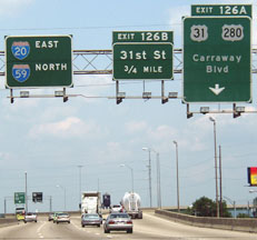
On that ramp, the shields shown here are posted at the true beginning of US 280:
|
|
In this photo, we are looking south on Carraway/26th. Ahead is the ramp to the expressway (the shields for which are shown above). A right turn allows drivers to continue south on Carraway:
|

Nitzman
|
|
Heading south on Carraway will also allow traffic to come back towards the camera (via the ramps shown at far right) and connect with I-20/59. These photos were looking east on 11th Avenue, which is actually a block or two north of the true beginning of US 280:
Nitzman
|
Mortimer, Aug. 2023
|
|
These next photos show the west beginning of US 280 as seen from southbound I-59/westbound I-20:

Patriarca, May 2003
|

Ivy / Nitzman, May 2022
|
|
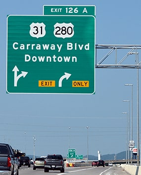
Traffic exiting there is directed onto a C/D road, and the fork leading to the west beginning of US 280 is signposted thus:
|
Mortimer, Aug. 2023
|
|
This set shows US 280's begin point from the opposite direction (north/east I-20/59):
|
Patriarca, May 2003
|
NItzman, Jun. 2022
|
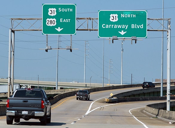
NItzman, Jun. 2022
|
Research and/or photo credits: David Dawson; Nathan Edgars; Brent Ivy; Karin and Martin Karner; Josh Lintz; Herman Mortimer; Alex Nitzman; Chris Patriarca; Dale Sanderson
Page originally created 2001;
last updated Aug. 30, 2023.
last updated Aug. 30, 2023.
