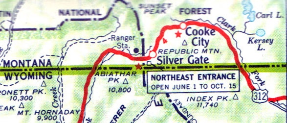
US highway endpoint at Yellowstone's northeast entrance
|
1938-present
|
 |
|
The northeast entrance of Yellowstone National Park was first served by a US highway in 1938, when the US 12 designation was extended southwest from Miles City to Silver Gate, via Billings and Red Lodge:
|

c. 1951, Gousha
|
|
That lasted about 20 years, until the route of US 12 was changed to run west from Forsyth (as it does today). In 1959, US 312 was commissioned to serve US 12's former corridor from Forsyth to Silver Gate. Here is a map illustrating that, as well as that agenda item from the minutes of AASHO's 1959 meeting:
|
c. 1960, Gousha
|

Then, just two years later, the route of US 212 was changed: it was truncated at Broadus MT, and instead of heading north from there to Miles City, it went west via its current path. So the route from Billings to Silver Gate became a part of the extended US 212, and the west end of US 312 was cut back to Billings. Here is that item from the 1961 application to AASHO:
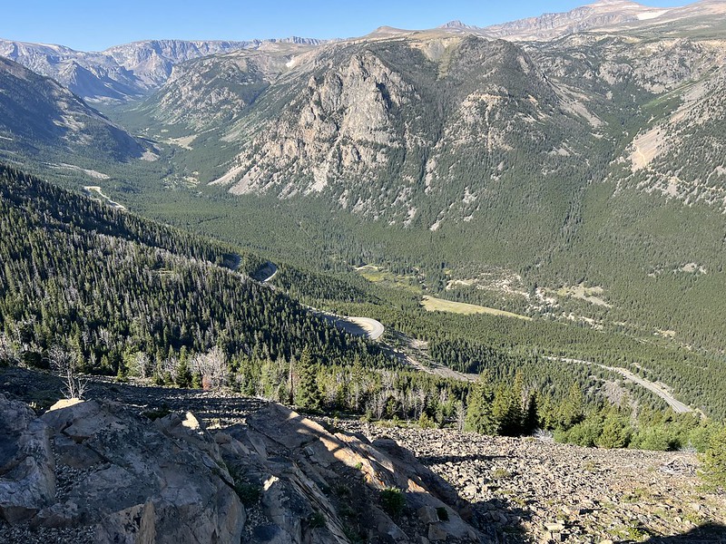
US 312 was completely decommissioned in 1981, but US 212 continues to serve the northeast entrance to Yellowstone. From Red Lodge, the highway heads southwest up the valley of Rock Creek. This westernmost segment of US 212 is known as the Beartooth Highway, and it is a spectacular drive. When open to traffic (which is typically only about five months out of the year), US 212 ascends nearly 3000 feet up a flank of the Beartooth Mountains via a series of four major hairpins (and several additional twists and turns in between). This photo was taken from one of those switchbacks, looking upvalley. Down below, some of the lower-elevation segments of US 212 and its hairpins are visible:
|
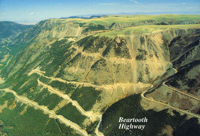
This postcard shows that same segment of US 212, but the photo was taken from the opposite side of the valley.
|
|
There it can be seen that the top of the Beartooth Mountains is a relatively flat plateau. Once atop that plateau, US 212 crosses into Wyoming, where ominous-sounding signs announce "Road not maintained; travel at own risk". Indeed, the quality of the road is significantly worse than a typical US highway. This is because the road is not serviced by WYDoT. Rather, it is maintained by the National Parks Service (even though it is not within the boundaries of Yellowstone or any other National Park). After another series of switchbacks, US 212 reaches the summit of Beartooth Pass at an elevation of just under 11,000 feet. Then the road descends into the Clarks Fork valley, and after an unmarked crossing back into Montana, US 212 reaches the head of that stream at Colter Pass. A brief descent from there brings drivers into the communities of Cooke City and Silver Gate.
|
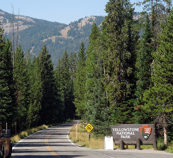
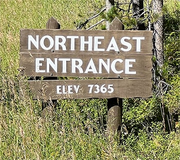
A couple tenths of a mile beyond Silver Gate travelers reach the Yellowstone boundary; these photos show the sign posted at the Park's northeast entrance:

Elbert, summer 2003
Barronette Peak visible in the background. The road itself continues ahead into the Park, but the US 212 designation ends here at the Park boundary:
|
Sanderson, Sep. 2022
|
|
Over the years that point has marked the east end of US 12, US 212, and US 312. That is still in Montana, although the Wyoming line is literally just a few steps off the left side of the road. A little ways ahead from the Park entrance is the sign shown here (which, to be clear, is inside the Park boundary and therefore not on US 212):
|

Teresco, July 2003
|
Sanderson, Sep. 2022
|
|
Not far beyond that is the entrance station, and then the road crosses back into Wyoming, where it remains all the way to Tower Junction.
Heading the opposite direction (eastbound), drivers see this mileage sign just before leaving the northeast portal of the Park; all of these destinations (except Cody) are on US 212: |
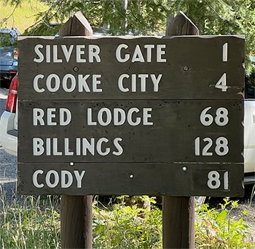
Sanderson, Sep. 2022
|
|
Just ahead from there, historically there was actually a US 212 sign within the Park (right across the road from the Northeast Entrance sign shown above). This was strange, not only because officially US routes do not exist within the Park, but also because it was a cut-out shield (undoubtedly posted by NPS):
Elbert, July 2009 (installed by 2007; gone by 2013)
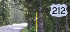
Just ahead, after crossing out of the Park boundary, US 212 officially begins. There was no trailblazer to mark the route -- only a Forest Service sign for the Beartooth Scenic Byway -- but drivers are treated to a nice view of Republic Mountain:
|
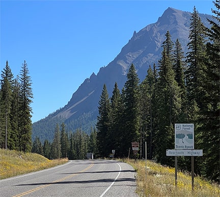
Sanderson, Sep. 2022
|
|
As of 2009 the first trailblazer was about 16 miles east of there, at the junction with WY 296...
|
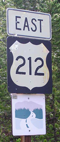
Elbert, July 2009
|
...but by 2022 even that was gone, and there were precious few trailblazers anywhere between Yellowstone and Red Lodge (I suspect this is because lots of people have harvested their own special "souvenirs" of this unforgettable drive). The first reference to US 212 was still at the junction with WY 296, but that was on a large sign for the benefit of travelers at the north end of 296, and not easily visible to drivers on US 212.
|
Research and/or photo credits: Chris Elbert; Dale Sanderson; Jim Teresco
Page originally created 2003;
last updated Dec. 15, 2023.
last updated Dec. 15, 2023.
