End of US highway 53 |
 |
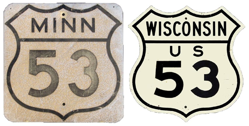
Summa
|
|
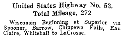
Mileage: in 1989 AASHTO listed a figure of 407 miles for US 53... however, that included the mileage of US 53's associated business route. According to the state subtotals on AASHTO's 1989 spreadsheet, mainline US 53's actual end-to-end total at the time was 403 miles. That closely matches our own 2020 measurement, which yielded 402.3 miles.
|
US 53 was an original 1926 route, but at the time it went only as far north as Superior. This excerpt is from AASHO's 1927 route log:
|
|
|
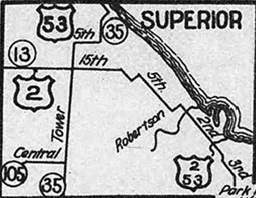
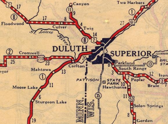
US 53 junctioned US 2 about a dozen miles southeast of the city (as it does today), and the two routes overlapped up to Superior:
c. 1928, Wisconsin DoT
|
c. 1927, Rand McNally
|
|
According to the 1927 DoT map, US 2 and US 53 remained together all through Superior, following Tower, 5th St, Grand Av, and Lamborn up to the Interstate Bridge. However, as soon as the Arrowhead Bridge was opened in 1927, the US 2 designation was changed to use that crossing (as shown on the map above). Minnesota did not have a use for the US 53 designation until 1934, so until then, the route quietly ended at the stateline over St. Louis Bay, with US 2 continuing across and on through Duluth MN. Both bridges have since been replaced by newer spans, but an orphaned segment of the old Interstate Bridge still stands:
|
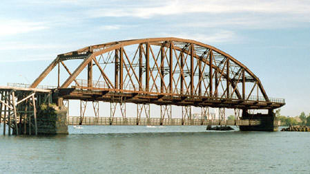
Castleman, 2005
|
|
In 1934, the north end of US 53 was extended to International Falls (before then, the segment from Virginia MN to I-Falls had been US 169). Now US 53's north terminus is concurrent with US 71.
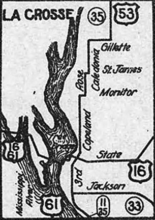
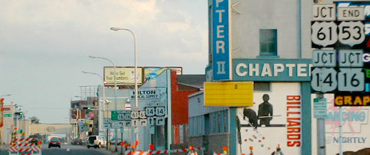
The south end of US 53 has always been in La Crosse, but the current bridge over the Mississippi was not built until 1939. Originally in La Crescent, US 16-61 split off the current routing via Pettibone Drive, and crossed the river via a no-longer-extant bridge (it collapsed in 1935 when a car hit one of its abutments). This lined up with Mt. Vernon Street in La Crosse (which is now vacated, but this was the next diagonal street south from Pearl Street). From there, traffic immediately went north on Front Street, then east on State Street. At 3rd Street, there was a junction: US 61 turned south, while US 16 continued straight ahead... and to the north on 3rd was the south beginning of US 53: |
c. 1928, Wisconsin DoT
|
|
This image was looking south on 3rd, at what was originally the south end -- straight ahead was southbound US 61; to the left on State was eastbound US 16; and the opposite directions of those routes were to the right:
|
Mortell, summer 2017
|
|
Today US 53 continues several more blocks ahead. Visible in the distance is a parking garage; that is approximately where the last southbound trailblazer was posted:
|
Sanderson, Jun. 2022
|
|
This photo was looking south on 3rd, before the Cameron Street bridge opened in 2004:
|
Bratney, June 2002
|
|
The actual end of US 53 was about a block ahead (where the cars were), at the Cass Street intersection. Now Cass is one-way westbound, so US 53 ends two blocks ahead, at Cameron. By 2006 that "End" assembly had not changed (and it really did not need to). As of 2017 the "End" sign was posted about halfway between Jay and King streets, 2.5 blocks north of US 53's actual terminus:
|
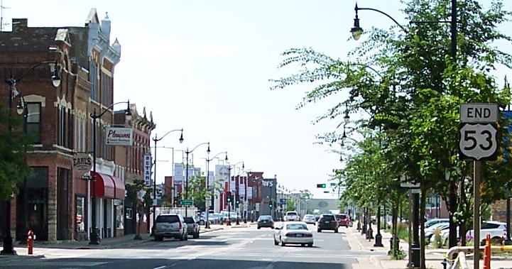
Mortell, summer 2017
|
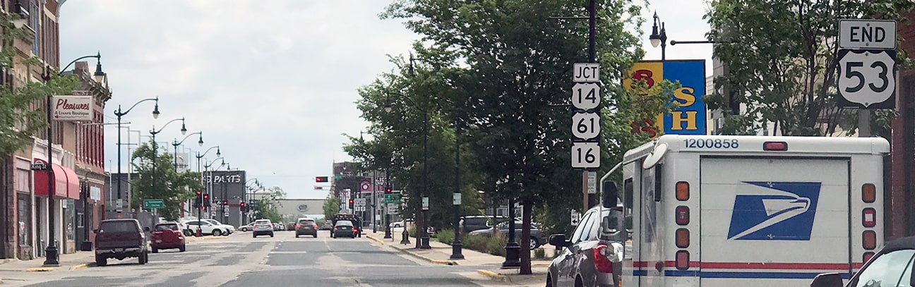
Sanderson, Jun. 2022
|
Several more photos from these junctions can be found on Jeff Morrison's US 53 page. These next shots show both the old and the new signage at Cass:
Bratney, June 2002
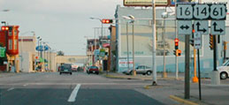
The US 53 designation formerly ended there; ahead is eastbound US 14/southbound US 61. To the right, US 14-61 crosses the Mississippi River to La Crescent MN. At the time, one could also go left on Cass, but now that is one-way to the right. Here is a more recent photo of signage at the same intersection:
|
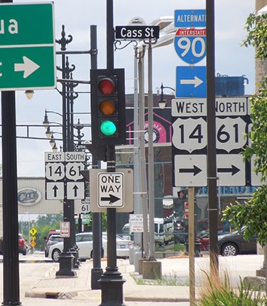
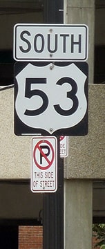
Sanderson, Jun. 2022
|
|
Drivers turning to the right at that point are treated to a nice view of the Mississippi River spans:
|
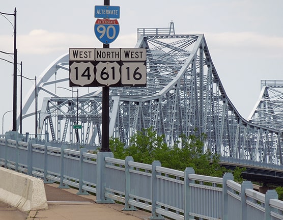
Sanderson, Jun. 2022
|
|
This shot was looking east on Cass. US 14-61 traffic had just gone south (right) on 3rd (just behind the camera), so this was only eastbound WI hwy. 16 (historic US 16). Northbound US 53 began to the left on 4th Street:
|
Bratney, June 2002
|
|
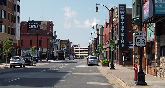
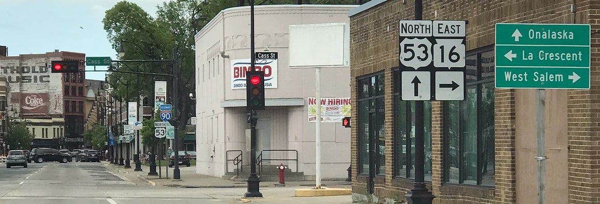
Today, since US 53 is routed along a one-way pair in downtown La Crosse, the northbound beginning is one block to the right from there. This next series of photos illustrates the current setup; this first one was taken on eastbound US 14 / southbound US 61, approaching the bridges over the main channel of the Mississippi River:
|
Sanderson, Jun. 2022
|
|
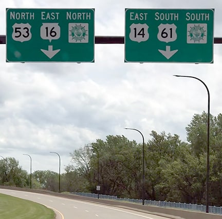
That is the earliest reference to US 53. Ahead, US 14-61 traffic turns south on 3rd, but drivers who continue straight on Cameron see a junction sign for US 53:
|
Sanderson, Jun. 2022
|
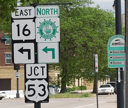
The beginning of the designation is to the left on 4th; this image shows both the first and the second northbound US 53 markers:
Sanderson, Jun. 2022
|
A closeup of that second sign shows that US 53 also serves as a segment of Wisconsin's Great River Road. I-90's interchange 3 is about six miles straight ahead:
|
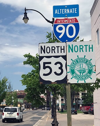
Sanderson, Jun. 2022
|
Research and/or photo credits: Neil Bratney; Monte Castleman; Nathan Edgars; Jeff Morrison; Robert Mortell; Dale Sanderson; Michael Summa
Page originally created 2001;
last updated Jun. 12, 2022.
last updated Jun. 12, 2022.
