End of US highway 190 |
 |
|
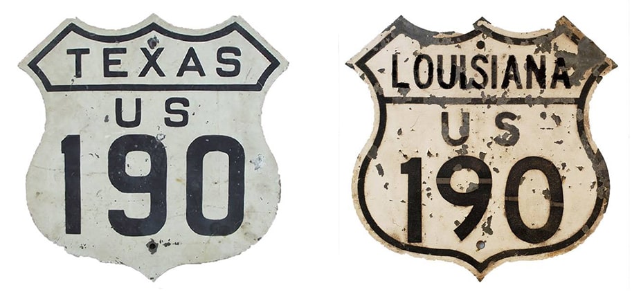
1926-1934
|
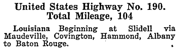
1934-1977
|
1977-present
|
Summa
|
Mileage: in 1989 AASHTO listed a figure of 883 miles for US 190... however, that included the mileage of US 190's associated business routes. According to the state subtotals on AASHTO's 1989 spreadsheet, mainline US 190's actual end-to-end total at the time was 875 miles. That is close to our own 2020 measurement, which yielded 867.5 miles (reroutings and realignments likely explain the difference).
|
|
US 190 has been around since the beginning of the US highway system (Nov. 1926); the preceding excerpt was from AASHO's Apr. 1927 route log. Initially US 190 was a short intra-state route with its west terminus in Baton Rouge:
|
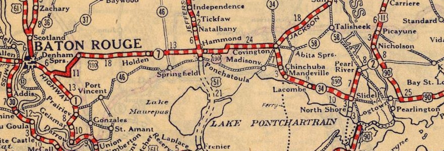
c. 1927, Rand McNally
|
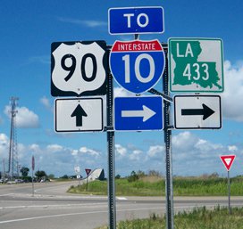
The east end of US 190 has always been at its junction with US 90 in the Slidell area. Initially, however, US 90 followed what is now US 11 right through Slidell. So at the time, US 190 came into town via Gause Boulevard and ended at Front Street. This photo was looking north on Front:
|
Nitzman, Nov. 1999
|
During the late 1920s that was eastbound US 90, and to the left on Gause was the east beginning of US 190. In 1936, US 90 was changed to follow its current routing south and east of Slidell. At that time, the US 11 designation was extended south and west into Slidell along the former US 90.
|
In town, US 190 joined with it, and the two were overlapped down today's LA hwy. 433. US 190 ended at its junction with US 90...

Karner, Jun. 2013
|
...while US 11 was duplexed with US 90 into New Orleans. This shot was looking west on US 90:
Karner, Jun. 2013
|
|
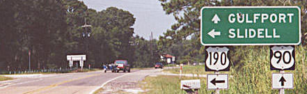
During the 1930s, US 190 began to the right. That was also northbound US 11, while southbound was straight ahead (with westbound US 90). US 190's current east terminus was established in the 1940s. These photos show the east end:

Nitzman, Nov. 1999
|
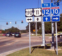
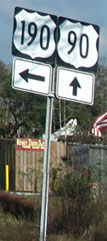
That sign is gone now -- as are some of the others shown on this page -- presumably victims of Hurricane Katrina. It was not until late 2009 that some kind of directional signage was posted for the benefit of drivers on US 190...
Karners, Dec. 2009
...and, underinformative as it was, at least it was a bit of an improvement.
|
|
The shots below were taken from eastbound US 90, at the east beginning of US 190. This first sign is no longer with us, but a couple years after Katrina, traffic heading this direction saw a replacement assembly, and later even an "upgrade":
|
Field/Nitzman, June 2001
|
Nitzman, Dec. 2007
|

Backlin, Mar. 2009
|
|
Nitzman, Oct. 2016
|

|
...and travelers taking that right turn will soon see the first westbound confirming marker:
|
Nitzman, 1999
|
Backlin, Mar. 2009
|
Nitzman, Oct. 2016
|
|
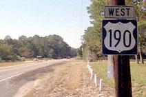
In 1934 the US 190 designation was extended west from Baton Rouge to a new endpoint in Brady (photos and more info at that link).
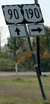
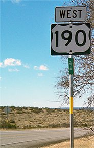
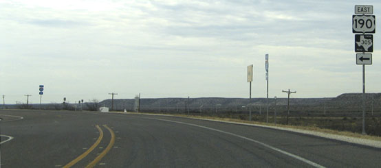
In Oct. 1977 AASHTO approved an extension of US 190 further west from Brady, to its current terminus: a remote interchange near Iraan (pronounced eye-ra-ann). The last westbound US 190 sign is about 12 miles west of Iraan, in Pecos County: |
Karners, Dec. 2014
|
|
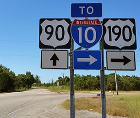
The west end of US 190 is at a godforsaken spot two miles further west, at I-10's interchange 307. No "End" sign was present -- only these two signs noting one's options at I-10:
|
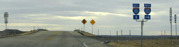
Nitzman, Jan. 2006 (unchanged as of Dec. 2014)
|
|
At far right an "East US 190" sign is visible; that is for travelers exiting from westbound I-10. This photo is from just ahead, on the far side of the bridge over I-10:
|
Ivy/Nitzman, Aug. 2019
|
|
That is where westbound US 190 actually ends. The crossroad is not only an on- and off-ramp for I-10; it is also a two-way frontage road... which seems like overkill, way out here in the vastness of the Trans-Pecos (but that is pretty standard for Texas freeways). The frontage road is visible along the right side of this photo:
|

Nitzman, Jan. 2006
|
|
That was from eastbound I-10, and it was the only approach sign that specifically referred to US 190. After a traveler exits to the frontage road, this is the sign directing traffic to the west beginning of US 190:
|
Nitzman, Jan. 2006
|
|
Upon turning that direction, the first confirming marker is posted:
|

Karners, Dec. 2014 (unchanged since at least Jan. 2006)
|
|
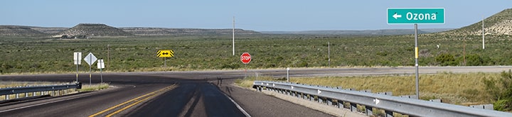
On the other side of the overpass is an expansive view of the westernmost mileage of US 190:
|
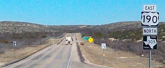
Karners, Dec. 2014
|
The sign in the distance says "Speed Limit 75". In 2006, it was only 70, but that was still faster than rural interstate highways in some other states.
Research and/or photo credits: James Allen; David Backlin; Andy Field; Adam Froehlig; Brent Ivy; Karin and Martin Karner; Alex Nitzman; Dale Sanderson; Michael Summa; Stephen Taylor; "Urban Prairie Schooner"
Page originally created 1999;
last updated Dec. 10, 2023.
last updated Dec. 10, 2023.
