End of US highway 276 |
 |
|
1932-1940
|
1940-1959
|
1959-1968
|
1968-1984
|
1984-present
|
Summa
|
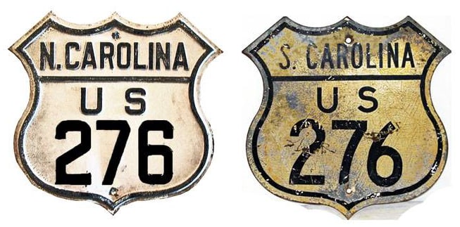
Mileage: in 1989 AASHTO listed a figure of 108 miles for US 276. That closely matches our own 2020 measurement, which yielded 106.3 miles (reroutings and realignments likely explain the difference). Historically, when it went to Clinton, US 276 was 136.3 miles long.
|
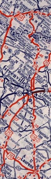
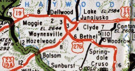
c. 1939, Rand McNally
|
|
|
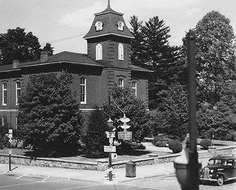
...however, about one year before these historic photos were taken, the US 276 designation had been extended north, by overlapping with US 64 for a short distance. Below is a more recent photo of that same junction; the courthouse is at far right:

Nitzman, July 2004
The truck was on Broad; to the right on Main was the original north beginning of US 276. This next photo shows historic signage at the original north end of US 276:
|
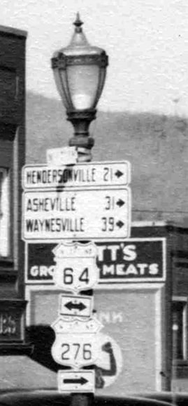
c. 1940, attribution unknown
|
In that photo, the courthouse was behind the camera. Those signs were intended for drivers heading northwest on Main, where US 276 ended at its junction with US 64. But about one year prior to this photo, US 276 was extended, so the US 276 sign at the bottom was added. To this day the designation continues further north by overlapping with US 64 to the right on Broad -- that happened in 1939, when US 276 was extended north to Waynesville:
|


c. 1956, Gousha
|
This shot was looking north on Main Street in Waynesville. Today this is Business 23, but originally it was mainline US 23, and during the 1940s and '50s, the north beginning of US 276 was to the right on Pigeon Street:
|


|
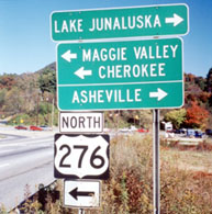
Historically US 276 began to the right, but in about 1960 it was extended ahead with US 23 for a few blocks, before splitting off onto Russ Avenue. US 276 then continues a couple miles north, to its junction with US 19 at Lake Junaluska:
c. 1960, NC DoT
|
This photo was looking north at that junction; today US 276 overlaps west from here with US 19. That lasts for about two miles, and then US 276 splits off to the north again, towards I-40. But during the 1960s the north end of US 276 was here:
Sanderson, Oct. 2000
|
|
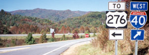
In 1968 the US 276 designation was extended to its current terminus. This is at I-40's interchange 20 in Cove Creek, although US 276 was extended to that interchange even before I-40 was complete through the area:
c. 1970, NC DoT
|
To the left is a two-way road that crosses under the interstate. It is unclear why a "To" sign was used: if that is not US 276 to the left, then what is it? And that was not the only instance -- this was taken looking south on 276, after crossing under I-40:
|

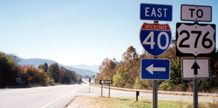
Sanderson, Oct. 2000
|
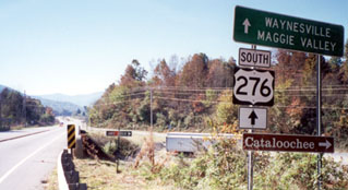
South of the off-ramp, the "To" signs disappear. The road coming in from the right is Cove Creek Road -- which was part of NC hwy. 284, until US 276 took over in 1968. The sign in the distance is shown close-up in this photo:
|
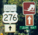
LeBlanc, Oct. 2000
|
|
Meanwhile, in 1960, I-385 between Greenville and Clinton was opened to traffic... except originally it was not designated I-385. Instead, the US 276 designation was applied to this new freeway, which initially ended at its interchange with SC 56. I-26 had been built only as far north as Newberry, so US 276 traffic was directed south on SC 56, joined with SC 72, and ended on Broad at US 76 (or Carolina Avenue). This photo was looking west on Carolina:
|
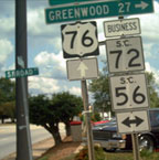
Nelson, 2006
|
|
For a few years, US 276 began to the right on Broad. But before long I-26 was complete through the area, and when that happened, US 276 was truncated to its interchange with I-26 (at what is now the south end of I-385):
|
This photo was looking west on I-26. Originally, the freeway that begins to the left was US 276...
Nitzman, Oct. 2001
|
|
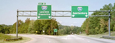
...but in 1984, that freeway was renumbered as I-385, and the US 276 designation was truncated to its current terminus in Mauldin. This photo shows the exit off northbound I-385 where US 276 begins:
|
Nitzman, 2000
|

Field/Nitzman, 2004
|
|
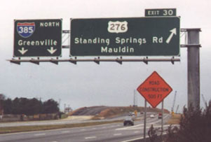
Beyond that point, I-385 veers to the right to bypass Mauldin, but US 276 continues straight on that alignment and becomes Laurens Road, the original highway through Mauldin and on to Greenville. I-185 was extended to that interchange in 2001. This interactive image shows the end of US 276, where it has an interchange with I-185 and merges into I-385:
|
|
Research and/or photo credits: John Allen; Andy Field; Brian LeBlanc; Steven Nelson; Alex Nitzman; Mike Roberson; Dale Sanderson; Michael Summa
Page originally created 1999;
last updated Nov. 27, 2021.
last updated Nov. 27, 2021.
