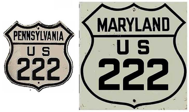
End of US highway 222 |
 |
Summa
|
1926-1927 (unsigned)
|
1927-1928 (unsigned)
|
1928-1931
|
|
1931-1936
|
1936-1954
|
1954-1995
|
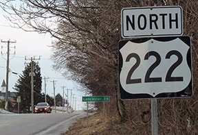
1995-present
|
|
Mileage: in 1989 AASHTO listed a figure of 113 miles for US 222... however, that included the mileage of US 222's associated business route. According to the state subtotals on AASHTO's 1989 spreadsheet, mainline US 222's actual end-to-end total at the time was 109 miles. Our own 2020 measurement yielded 95.0 miles (reroutings and realignments likely explain the difference). At its maximum historic extent, US 222 was 111.2 miles long.
|
|
|
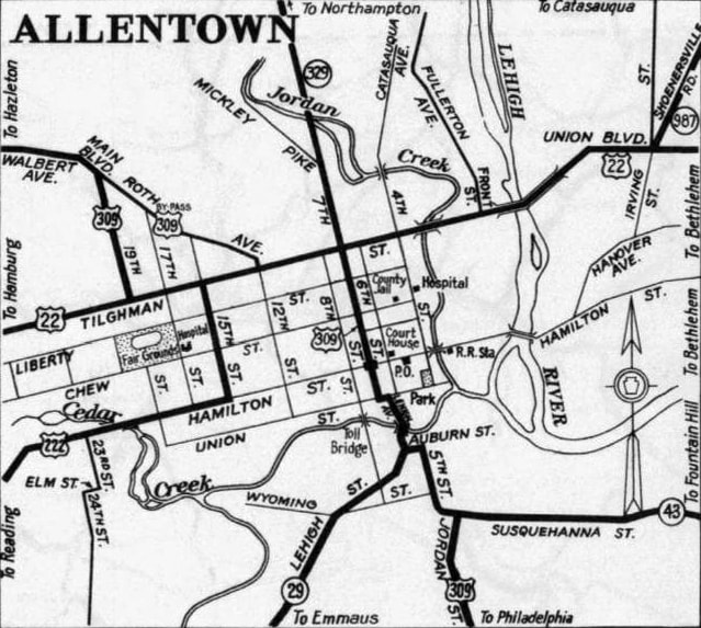
US 222 was among the original 1926 routes, but the AASHO map that was approved that year showed US 222 only between Reading and Lancaster. The road heading south from Lancaster was labeled as US 230, not US 222. However, that may have been simply a map error, because already by early 1927, AASHO's route log listed US 230 as Harrisburg-Lancaster, while US 222 started in Reading, went through Lancaster, and continued south. But this brings up a couple questions: why did US 222 end in Reading? And why was it numbered as a branch of US 22 when US 22 doesn't even run through Reading? The answer to both is: originally US 22 did run through Reading, via what is now US 422 towards Harrisburg and US 222 towards Allentown.
Modern US 22 (which is a straight shot between Harrisburg and Allentown, avoiding Reading) was rerouted in 1931; at that time the US 222 designation was extended to Allentown via old US 22. At first, US 222 came in on Hamilton Street, then 15th Street, ending at its junction with US 22 on Tilghman Street: |
c. 1940, PennDoT
|
|
This interactive image shows the view from that perspective: looking north on 15th, where US 222 ended at Tilghman:
|
|
|
By 1954, the modern US 22 had been built (Lehigh Valley Thruway), so the US 222 designation was extended east on Tilghman (old 22) to 7th Street (which also carried US 309). From that point both routes were overlapped north on 7th (which becomes MacArthur Road) to an interchange with the new US 22; US 309 continued north, but US 222 ended there. This shot was looking south on MacArthur:
GargoyleMT, Sep. 2006
That was southbound US 309, which continued straight ahead, but at the US 22 interchange (just ahead), MacArthur picked up the US 222 designation as well. This next photo is from a 1958 publication which just happened to show signage for the beginning of US 222 as viewed from westbound US 22 (note the interchange was a little different back then; it was a full cloverleaf at the time):
|
c. 1958 (linked to source)
|
|
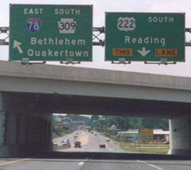
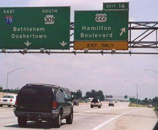
Traffic exiting there looped around and joined southbound 7th. But that lasted only a few years: in the late 1950s US 222 was changed again. This time it was completely removed from downtown Allentown, instead joining with the new US 309 bypass (part of which now doubles as I-78) around the south and west edges of the city. Its new north end was at a different interchange with US 22:
|
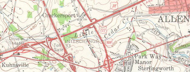
c. 1957, USGS
|
|
Despite the fact that US 222 is numbered as a branch of an east-west route, it runs north-south, and it is signed north-south. Here is how that interchange was signed in 2000:
|
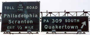
Nitzman
|
Today's PA 309 south was formerly US 309 south, and US 222 began there too. Maybe it is a PennDoT thing to spell out the routes instead of using route shields -- same thing in this photo:
|
Sanderson, Feb. 2007
|
|
That was looking north on PA 309 at what was for a short time the north end of US 222.
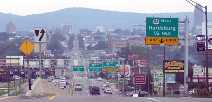
In the 1960s US 222 was truncated to its current terminus at I-78's exit 54 (which is actually just outside Allentown, in Dorneyville). Formerly a sign was posted there reading "Jct 309 / End 222". But by the time of these photos, no "End" sign was posted, which is rather unusual for Pennsylvania... but that may have been intentional, since PA 222 begins straight ahead: |
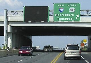
Elbert, July 2006
|
|
The photo below was taken from the opposite direction, looking at the north beginning of US 222. This is westbound on Hamilton, heading out of Allentown and Dorneyville:
|
Nitzman, 2000
|
To the left of the camera is the off-ramp from westbound I-78. So travelers turning left from there (towards the direction of this photo) are at the beginning of US 222.
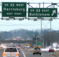
This photo shows the exit from eastbound I-78 to the north beginning of US 222: |
Nitzman, 2000
|
|
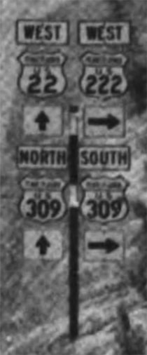
Note that there is only a US 222 shield -- even though, if one were to turn left (towards Allentown) at the bottom of the offramp, they would actually be on PA 222. Indeed, at the end of the ramp that there was a sign for north US 222, as well as south. And signage from the opposite direction (west on I-78) indicated that both directions were still designated as US 222...
|

Sanderson, Feb. 2007
|
...although PA 222 was not immediately designated as such at the time US 222 was truncated out of the downtown area. Rather, it has been around only since 1991. In both 1988 and 1990 PennDOT had asked for AASHTO's approval to extend the US 222 designation into downtown Allentown, but the requests were denied. So the following year they signposted the route as PA 222.
|
|
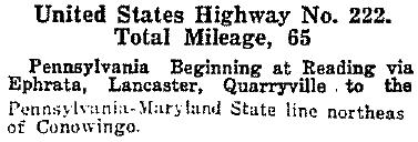
When the US routes were first commissioned, US 222 did not enter Maryland, so its south end was at the Pennsylvania line south of Wakefield:
|
|
Bender, July 2010
|
|
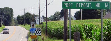
Originally US 222 did not go as far as Port Deposit, and it doesn't today either, but that mileage sign was probably erected during the timeframe when US 222 actually did extend through there (more on that later). But Pennsylvania probably did not even signpost its US routes until 1928, and by then the US 222 designation had been extended into Maryland:
|
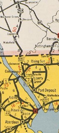
c. 1936, MD DoT
|
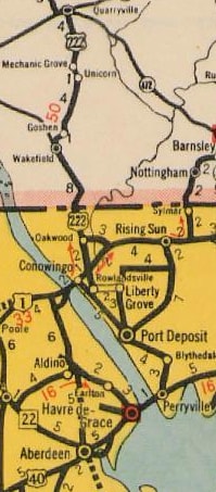
...and the route extends about three miles ahead, to its junction with US 1 at Conowingo. Approaching that intersection, a somewhat verbose sign is posted:
Bender, July 2010
|
|
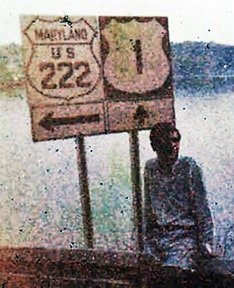
More about that below. But first, this next photo was taken from just ahead, at the south end of US 222:

Bender, July 2010 (unchanged since at least 2000; still standing as of 2017)
Today the designation ends at the signal ahead, and that was also the arrangement back in the 1930s. But in 1936, the US 222 designation was extended further south, along what is now signed as MD hwy. 222. It overlapped with US 1 southwest for about a mile, and then it resumed heading southeast along the Susquehanna for another ten miles or so.
|
This photo shows the old signage where southbound US 222 diverged from southbound US 1:
c. 1980s? (attribution unknown)
US 222 terminated at what is now MD hwy. 7 in Perryville, but which back then was US 40 (drivers had to use a ferry to get across to Havre de Grace):
|
c. 1938, MD DoT
|
|
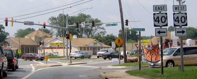
This photo was looking eastbound in Perryville along Broad Street, which is historic US 40. Starting in 1936, the south beginning of US 222 was to the left on Aiken Avenue (which is now designated as MD 222):
|

Nitzman, Mar. 2004
|
|
This shot was taken looking the opposite direction: west on the former US 40, with the historic south beginning of US 222 to the right on Aiken:
|

Karners, Dec. 2016
|
|
The modern US 40 bridge opened in about 1942 (and that is when this road became MD 7). It appears the historic US 40 bridge (ahead of the railroad bridge visible in the distance) was dismantled around 1950. Nevertheless, it seems that the US 222 designation remained on this segment south of US 40 for several more years. The 1975 USGS topo map still showed that, but the 1985 topo showed that the half-mile or so of US 222 south of US 40 had become a state route, and that the US 222 designation had been truncated to its junction with US 40 (just north of town):
|
Field, Jun. 2014
|
|
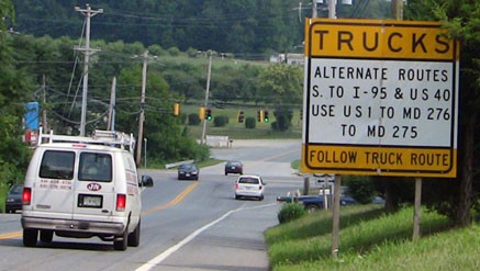
In 1995, US 222 was truncated back to its old south terminus at US 1 in Conowingo. The road through Port Deposit (between Conowingo and Perryville) is narrow and not very conducive to truck traffic. So Maryland decided to remove the US route designation from that segment. Instead, they signed it as MD 222, and then they directed truck traffic to use a more suitable route (namely to the east on US 1, and then south via MD 276). So that is what the trucker signage above is all about (and there are more examples below). This next shot is from northbound US 1, at the south beginning of US 222:
|

Bender, July 2010 (unchanged since at least 2004)
|
|
Pretty standard. But signage from the opposite direction on US 1 was strange: no reference to US 222 at all... only a mention of Truck MD 222:
|

Bender, July 2010
|
Possibly that was because southbound US 1 is also Truck MD 222 up to that point, so the intent was to make sure truck traffic following that route turned to the right there (instead of continuing ahead on US 1, which is also vanilla MD 222, which is not truck-friendly). Anyway, it had been replaced by 2017:
|
Karners, Jan. 2017
|
|
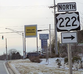
If a driver takes that right turn, the first signage confirms that they are indeed on northbound US 222:
|
Nitzman, 2000
|
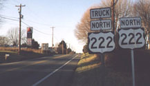
Formerly there was a strange sidekick there, too, but that curious "Truck" assembly was gone by 2004:
|
Karners, Jan. 2017
|
Research and/or photo credits: Jesse Bender; Chris Elbert; Andy Field; Karin and Martin Karner; Jeff Kitsko; Dave Montuori; Dan Moraseski; Alex Nitzman; Mike Roberson; Dale Sanderson; Michael Summa; "GargoyleMT"
Page originally created 2000;
last updated Nov. 29, 2023.
last updated Nov. 29, 2023.
