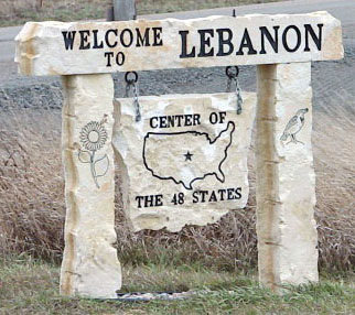
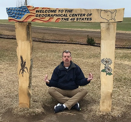
Geographical center of the lower 48 states near Lebanon Kansas |
 |
|
This photo shows the "Point of Interest" sign that the state had posted along eastbound US Highway 36 west of Lebanon KS (and there was an identical sign on the other side of Lebanon as well, for westbound US 36 traffic):
|
Sanderson, Feb. 1992
|
|
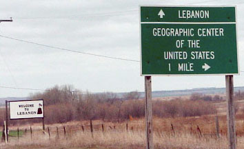
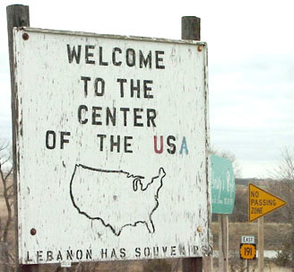
Travelers who exit US 36 and head north about a mile on US 281 will see signs such as the one shown here around Lebanon:
|
Sanderson, Nov. 2001
|
North-central Kansas is known as "Post Rock Country". There are not many trees from which to make fenceposts. However, the early settlers in the area found there are a lot of limestone outcroppings, so the rocks were cut and used for that purpose. It's a neat local distinctive, and recently people have begun using post rock for other decorative purposes. Kansas' state flower (the Sunflower) and state bird (the Meadowlark) are the other images cut into the rock.
|
|
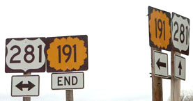
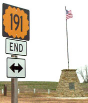
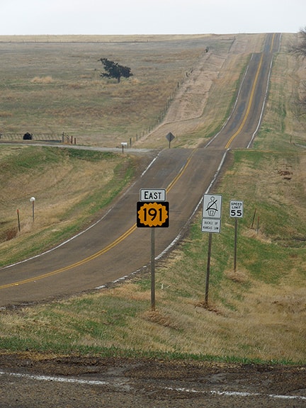
About one mile further north of Lebanon is the east beginning of KS hwy. 191, which is a mile-long road that exists for the sole purpose of transporting sightseers to the Geographic Center. In this photo, the sign assembly at far right is for northbound 281 traffic:
|
Sanderson, Nov. 2001
|
|
This photo was taken from southbound US 281:
|
Sanderson, Nov. 2001
|
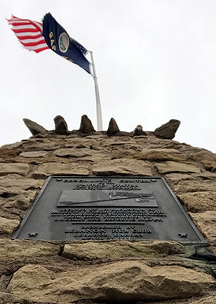
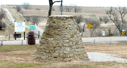
Turn to the west on K-191, and in one mile the highway ends at a T-intersection with a gravel section-line road. Visible ahead is a stone monument that marks the geographic center of the United States:
|
Sanderson, Nov. 2001
|
|
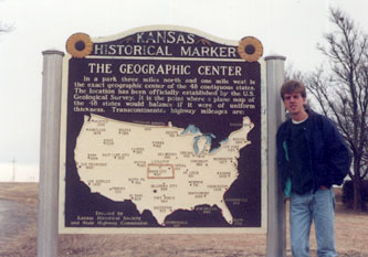
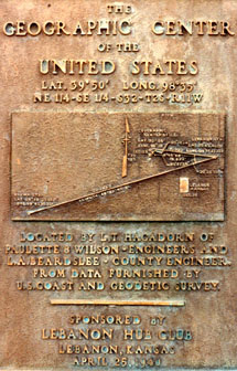
That monument marks the exact center of the 48 contiguous states. That means, ostensibly, if one were to take a two-dimensional map of the 48 states and balance it on a pencil, the pencil would be pointing right there. A close-up of the plaque on the monument is shown here:
|
Sanderson, Feb. 1992
|
Sanderson, Mar. 2018
|
Looks like that plaque was made in 1940 -- the information on it became obsolete in 1959 (more on that below).
|
|
There are a few other things to see here, too. For one thing, it looks like the boarded-up building in the background of this photo once served as a hotel...
|

Sanderson, Nov. 2001
|
...kind of funny to imagine this place as an overnight vacation destination. The white building in the foreground is a tiny "U.S. Center Chapel", shown close-up here:
|
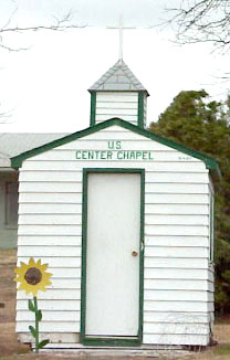
Sanderson, Nov. 2001
|
Sanderson, Mar. 2018
|
There was also a miniature "map" of Kansas, the border of which is formed by seedlings. This photo was taken from the backside of the monument, looking east along almost the entire length of K-191:
Sanderson, Nov. 2001
|
|
The white sign at left is shown close-up here:
Sanderson, Nov. 2001
|
Sanderson, Mar. 2018
|
With the addition of Alaska and Hawaii to the Union, the geographic center of the U.S. shifted to an even more remote spot, about 20 miles north of Belle Fourche SD. The so-called geographic center of the North American continent is near Rugby ND, although the scientific center of North America is near Center ND (more about both sites here).
|
Research and/or photo credits: Dale Sanderson
Page originally created 1998;
last updated Nov. 3, 2021.
last updated Nov. 3, 2021.
