End of US highway 77 |
 |
Summa
|
Summa
|
|
1926-1929
|
1929-1930
|
1930-1932
|
1932-1945
|
|
1945-1966
|
1966-1981
|
1981-present
|
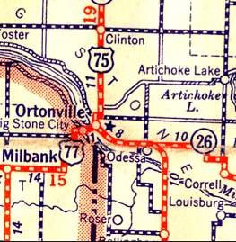
Mileage: in 1989 AASHTO listed a figure of 1399 miles for US 77... however, that included the mileage of US 77's associated business/bypass/alternate routes. According to the state subtotals on AASHTO's 1989 spreadsheet, mainline US 77's actual end-to-end total at the time was 1305 miles. That closely matches our own 2020 measurement, which yielded 1303.0 miles (reroutings and realignments likely explain the difference). Historically, when US 77 went to Ortonville, it was 1530.6 miles long.
|
US 77 was an original route, commissioned in 1926. At the time its south end was in Dallas. The original north end of US 77 was in South Sioux City NE (just across the river from its current endpoint in Sioux City IA).
|
|
|
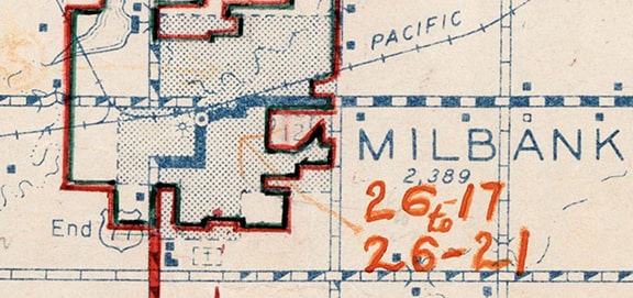
In June 1929, US 77 was extended north to its junction with US 12 in Milbank. At the time, US 12 did not cut across town via 4th Avenue, as it does today. Rather, US 12 traffic remained on Milbank Avenue/149th Street to Main Street; jogged south to cross the railroad; east on Railway Avenue; north on 6th Street; and finally east again on Milbank/149th. US 77 came north on Dakota Street; east on 4th Ave; and north again on Main, ending at Railway (jct. US 12). All of that was illustrated on this map (including a notation for "End US 77"):
|
1950 Census enumeration district map, using a 1936 base
|
|
The view in this interactive image is south on Main. Originally eastbound US 12 traffic turned left here at Railway, while straight ahead on Main was the north beginning of US 77:
|
|
|
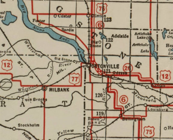
But that endpoint was very brief: already by September of that same year, there were requests to dual-sign US 77 east with US 12 to jct. US 75 in Ortonville, and that extension was approved in May 1930:
|
c. 1930, MNDoT
|
c. 1933
|
In Ortonville, the routings of both US 12 and US 75 have changed over the years. When US 77 was first extended into Ortonville, US 75 did not bypass the city as it does today. Instead it continued along its northwesterly angle into town (following what is now MN hwy. 7), then jogged back out to the north and east to rejoin today's US 75 alignment towards Clinton (the preceding map suggests that the east-west segment of US 75 was on Stevens Avenue). Not only that, but it appears US 12 coming eastbound from Big Stone City was about a block south of its modern alignment:
|
Bear, Dec. 2012
|
|
That shows the original highway, along with an old concrete railroad overpass. The Minnesota River is just behind the camera, and the South Dakota border is about a half-mile beyond that. At one time this was probably US 12 and US 77. Just ahead is the junction with modern US 12:
|
Bear, Dec. 2012
|
This last segment of the road was likely realigned when the new US 12 was built to the right. The original US 12-77 probably curved slightly to the east and met US 75 just to the right of this intersection (right about where MN 7 splits off to the south today). US 77 would have ended there at a fairly straightforward four-way junction with US 75. US 12 would have continued straight through this intersection (as opposed to having a jog, like it does today where it multiplexes with MN 7), and then continued east along Oak Avenue.
|
At some point US 12 was changed to its current alignment between Big Stone City and Ortonville (that is, a block north of its original alignment). If that happened before the US 75 bypass was built, then US 77 would have ended at the intersection shown here:
|
Otterson, July 2003
|
There we are looking eastbound on US 12 at its junction with MN 7 (old US 75); US 12 continues to the right with MN 7. After one block, the mainline (US 12) veers left, continuing eastward again, while southeastbound MN 7 is a right turn. If a driver were to turn right before they reached that next junction (heading west, across the railroad), they would be on the original US 12... and probably also on a historic north beginning of US 77.
|
Also at some point, US 75 was changed to its modern alignment, which bypasses Ortonville to the east (based on the architecture along that stretch, this may have happened in the late 1950s - early 1960s). If it was prior to 1981, then the US 77 designation probably would have been extended with US 12 about a half-mile further east, to its junction with the new US 75. If so, then that terminus is shown here:
|
Otterson, July 2003
|
|
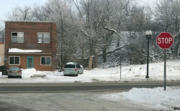
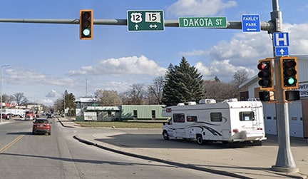
That was looking east on US 12 at US 75, just south and east of Ortonville. In 1966 the north end of US 77 was truncated such that it once again ended at Milbank. However the specific location of the terminus was different, because by that time US 12 had been changed to its current alignment through town. US 77 still came north on Dakota Street, but it ended at 4th Ave (jct. US 12). This image was looking east on 4th:
|
Google Maps Street View, Nov. 2023
|
Today SD hwy. 15 runs both ways along Dakota, but during the late '60s and '70s, US 77 began to the right on Dakota. At their Oct. 1981 meeting, AASHTO approved the truncation of the north end of US 77 to its current terminus in Sioux City. (Actually, the language of their approval shows that it was truncated to the Iowa-Nebraska state line, but Iowa DoT considers US 77 to extend just north of there, to its junction with I-29.)
|
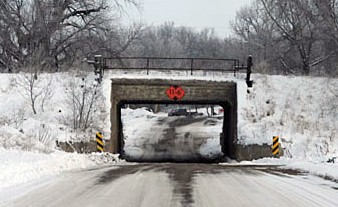
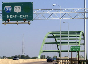
These photos show the last northbound reassurance marker; US 77 ends on the far side of the bridge visible in the background:
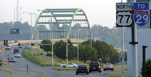
Sanderson, Aug. 2005
|
Sanderson, Jun. 2022
|
|
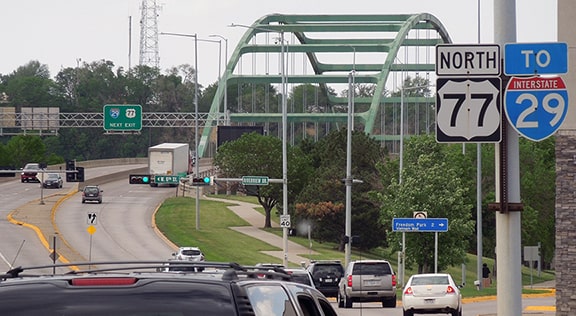
That is in South Sioux City NE; the bridge leads over the Missouri River to Sioux City IA (and to the west [left] from that bridge, the southeasternmost tip of South Dakota is visible, lying between the Missouri and Big Sioux rivers). The "End" sign is visible in the distance at right, but first a close-up of the overhead sign visible at left:
Sanderson, Aug. 2005
|
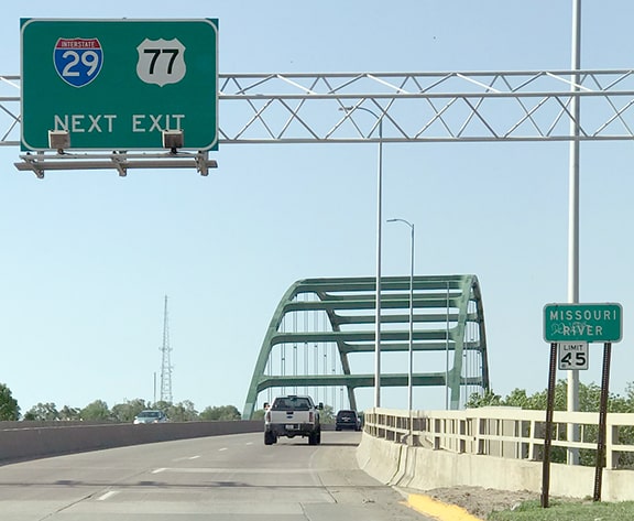
Sanderson, Jun. 2022
|
|
That sign dates back to the time when US 77 used northbound I-29 to continue north to Ortonville. I had assumed that when that sign was due for replacement, the reference to US 77 would be removed, but clearly that was not the case. Signage notwithstanding, US 77 no longer exits there -- rather, it ends just ahead, as the sign on the far side of the bridge indicates:
|
Sanderson, Aug. 2005
|
Sanderson, Jun. 2022
|
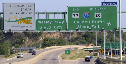
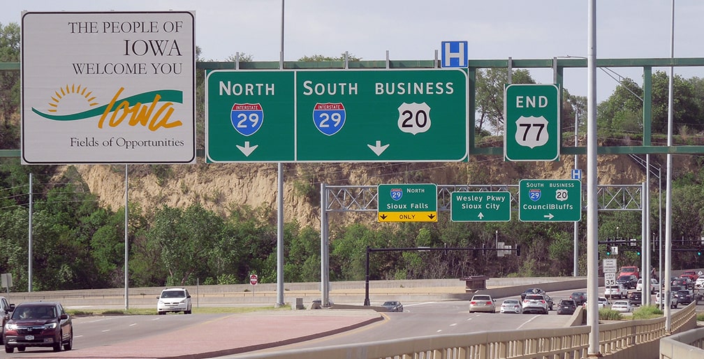
I-29 runs perpendicular (under the viaduct), and Wesley Parkway (straight ahead) is a local spur into downtown.
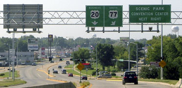
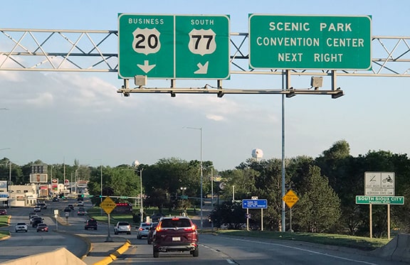
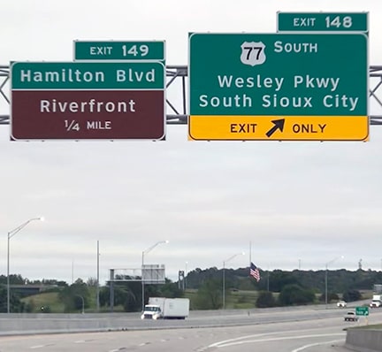
Heading the opposite way on Wesley, the north beginning of US 77 is heralded thus: 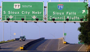
Sanderson, Aug. 2005
|
Sanderson, Jun. 2022
|
|
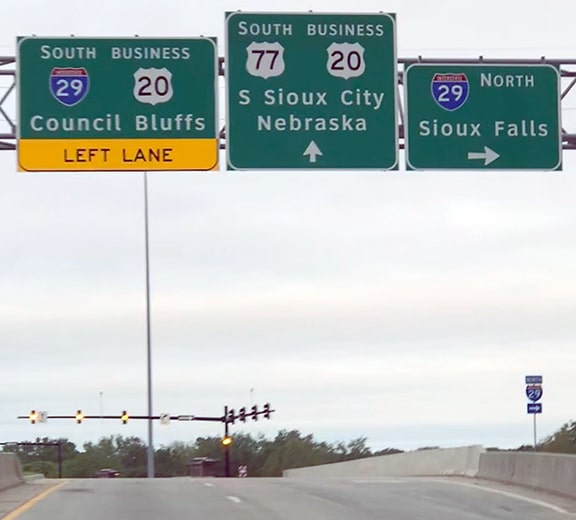
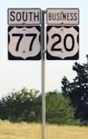
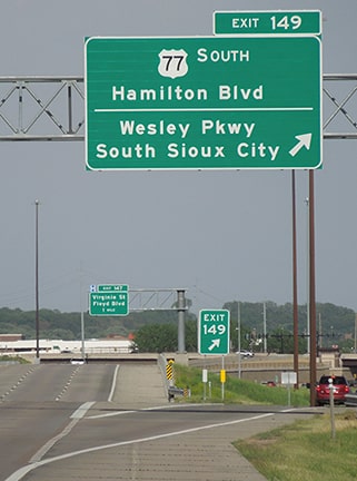
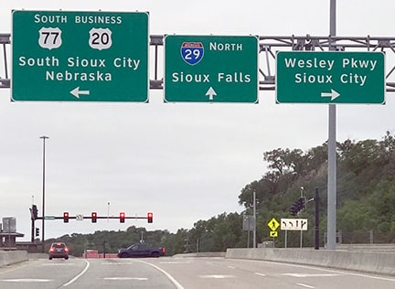
Ahead is also Business US 20, as indicated on the trailblazer just ahead, and then US 77 crosses the Missouri and enters Nebraska:
Sanderson, Jun. 2022
|
Sanderson, Jun. 2022
|
|
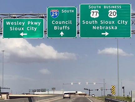
Just south of the bridge, the two routes split, with Business 20 continuing ahead on Dakota Avenue and US 77 turning west on 9th Street:
Sanderson, Aug. 2005
|
Sanderson, Jun. 2022
|
|
Upon making that turn, one encounters the first standalone southbound confirming marker:
|

Sanderson, Aug. 2005
|
For more detailed information about this terminus -- and to view many more photos (including some taken from both directions on I-29) -- please view Jeff Morrison's page.
|
And finally, here are some photos showing the north beginning of US 77 as seen from both directions of I-29 (two from southbound, and then two from northbound):
Sanderson, Jun. 2022
|
Sanderson, Jun. 2022
|
Sanderson, Jun. 2022
|
Sanderson, Jun. 2022
|
|
The south end of US 77 was officially extended to Corpus Christi in 1932, although at first it may not have been signposted south of Sinton. This photo was looking east on Sinton Street:
|
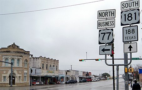
Karners, Jan. 2015
|
Today Sinton carries both US 181 and Business 77, which continues to the left on Vineyard Avenue. For a brief time the south beginning of US 77 may have been to the left, but it was not long before the US 77 designation was co-signed with US 181 into Corpus Christi. In 1945 the US 77 designation was removed from the segment between Sinton and Corpus; instead the route followed its current corridor through Kingsville and all the way down to Mexico at Brownsville.
Research and/or photo credits: Jake Bear; Monte Castleman; Jason Hancock; Karin and Martin Karner; Bob Otterson; Dale Sanderson; Michael Summa; Mike Wiley
Page originally created 2000;
last updated Dec. 21, 2023.
last updated Dec. 21, 2023.
