End of US highway 287 (north segment)
|
(not to be confused with the separate southern segment of US 287)
|
 |
|
Mileage: in 1989 AASHTO listed a figure of 282 miles for US 287[n]. That closely matches our own 2020 measurement, which yielded 281.2 miles (reroutings and realignments likely explain the difference). (Note that US 287 does not exist within Yellowstone National Park, and although the route is implied to run through Yellowstone, the Park divides US 287 into two separate segments.)
|
|
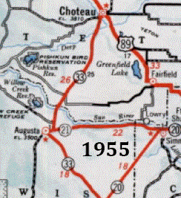
Originally in Montana, the road from West Yellowstone up to Three Forks was MT hwy. 1. Three Forks to Helena was US 10N; Helena to Wolf Creek was US 91; and Wolf Creek to Choteau was MT 33. But in about 1957, Montana designated that entire corridor as state highway 287. Clearly they were setting things up to extend the US 287 designation northward along that route, but for some reason that did not actually happen until 1965:
|
|
|
So technically (since there are no US routes within the boundaries of Yellowstone) US 287 now consists of two segments. However, the US highways surrounding Yellowstone are numbered such that, whichever highway a traveler uses to enter the Park, they may resume using the same highway on the opposite side.
|
|
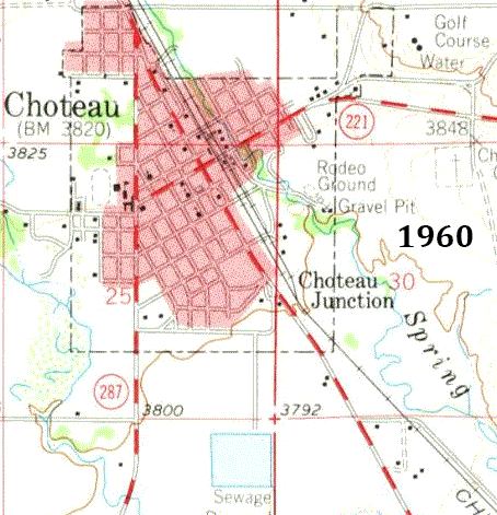
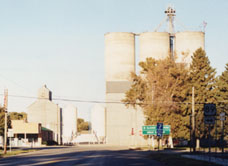
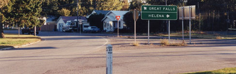
Those maps indicate that originally US 287 traffic was directed to use 1st Street North (rather than Division Street) in Choteau. The following postcard image (taken looking southeast on Main Avenue, or US 89) was made shortly before US 287 was extended into town, as the highway marker at right indicated state highway 287. But within the next few years, the north beginning of US 287 was to the right on 1st St. N:
|
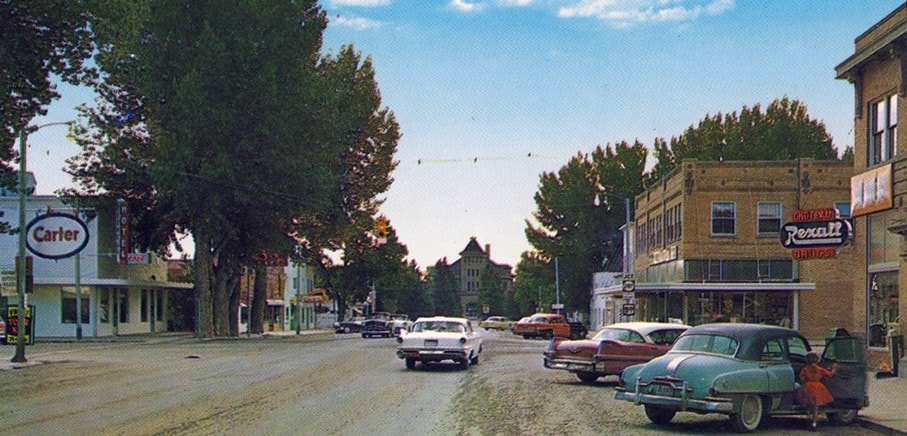
c. late 1950s - early 1960s, attribution unknown
|
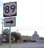
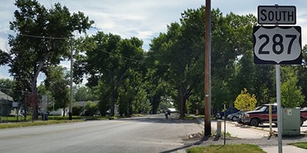
At some point, perhaps in the 1990s, US 287 was changed to its modern configuration, which uses Division, one block to the south of 1st St. N. (or to the right from the photo above). This photo shows the current north end of US 287; note that the US 89 sign at lower right had arrows going both ways:
|
Taylor, 2000
|
At the time, traffic heading that way on Division was allowed to go any direction at the upcoming intersection (Main). But that is the point where traffic on Main bifurcates in order to go around opposite sides of the courthouse circle (behind the trees at far right). That intersection was the site of a disproportionate amount of traffic incidents, so shortly after that photo, the half-block of Division west of Main was changed to a one-way road, open only to westbound traffic. So now all US 287 traffic must go around the west side of the courthouse, even drivers who want to head north on US 89:
|
Elbert, July 2008
|
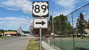
Ivy/Nitzman, Aug. 2016
|
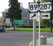
Northbound US 89 is actually to the left, but drivers can no longer turn that direction. Instead, all traffic must follow what essentially amounts to a one-way rotary around the courthouse. As of 2011, no further US 89 shields were posted ahead. Only the control points "Great Falls" and "Glacier National Park" precede the gore that separates northbound and southbound US 89 traffic, which is a bit underinformative.
|
|
The courthouse is visible in this shot, which was taken looking southeast on Main (southbound US 89). Here US 89 traffic begins to curve to the right onto Division, but then curves back left to go around the right-hand side of the courthouse, and two-way traffic resumes on the opposite side...
|
Elbert, July 2008
|
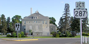
...however, instead of going around the courthouse, if a driver remains on Division, then they are on the north beginning of US 287. Formerly another green sign was posted in the gore; this is gone now, but the first southbound confirming marker is right across the road from the gore:
|
Taylor, 2000
|
Ivy/Nitzman, Aug. 2016
|
This series was taken from the opposite perspective: heading northbound on US 89, looping around the east and north sides of the courthouse. US 89 continues by curving back to the north on Main, while to the east on Division is the north beginning of US 287:
Elbert, July 2008
|

Elbert, July 2008
|

Elbert, July 2008
|
In 1967 Montana requested to have the US 287 designation extended north from Choteau to the Canada line at the Port of Piegan. It would have overlapped US 89 for the entire distance, over 120 miles, but AASHO did not approve.
Research and/or photo credits: Chris Elbert; Brent Ivy; Alex Nitzman; Dale Sanderson; Michael Summa; Steven Taylor
Page originally created 2001;
last updated Feb. 27, 2023.
last updated Feb. 27, 2023.
