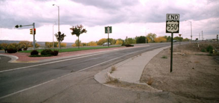
Historic US highway endpoint in Farmington, NM
|
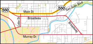
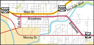
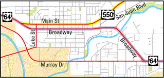
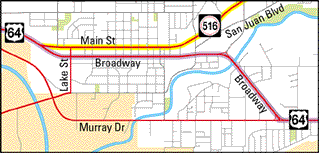
The downtown Farmington maps that follow show the road pattern as of 2001, which has undoubtedly changed over the years (for example, in the map below, US 550 probably used San Juan Boulevard during the early years). Nevertheless, they should serve to illustrate the essential function of US routes through Farmington. In 1934, US 550 was extended such that it passed through Farmington, ending 25 miles to the west at US 666 (now US 491) in Shiprock:
|
That was a good change for a couple reasons: for one thing US 550 was probably signed north/south from Montrose to Farmington, but then likely changed to east/west between Farmington and Shiprock. But US 64 was already an east/west route, so it made sense to have it absorb the east/west segment of US 550. Also, it was kind of strange to have US 64 (a 2000-plus-mile route coming from the Atlantic Coast) terminating at US 550 (a little 150-mile branch route).
|
US 550 was rerouted southward from Aztec, such that its terminus is now in Bernalillo (just north of Albuquerque). Since then, no US routes have endpoints in Farmington. But this photo was taken back when US 550 still ended there; the perspective was westbound on Main where it merges with Broadway:
|
|
Between 1974 and 1989, US 550 continued ahead, and it was US 64 that ended here. This interactive image is looking the opposite direction (east on Main):
|
|
Straight ahead is Broadway; drivers wanting to continue east on Main today must make a left hand turn here. For a time that movement was US 550. In 1972, straight ahead on Broadway became the west beginning of US 64. Then from 1989 to 1999, left on Main was the south beginning of US 550.
Research and/or photo credits: Dennis McClendon; Dale Sanderson
Page originally created 2004;
last updated Jan. 25, 2017.
last updated Jan. 25, 2017.
