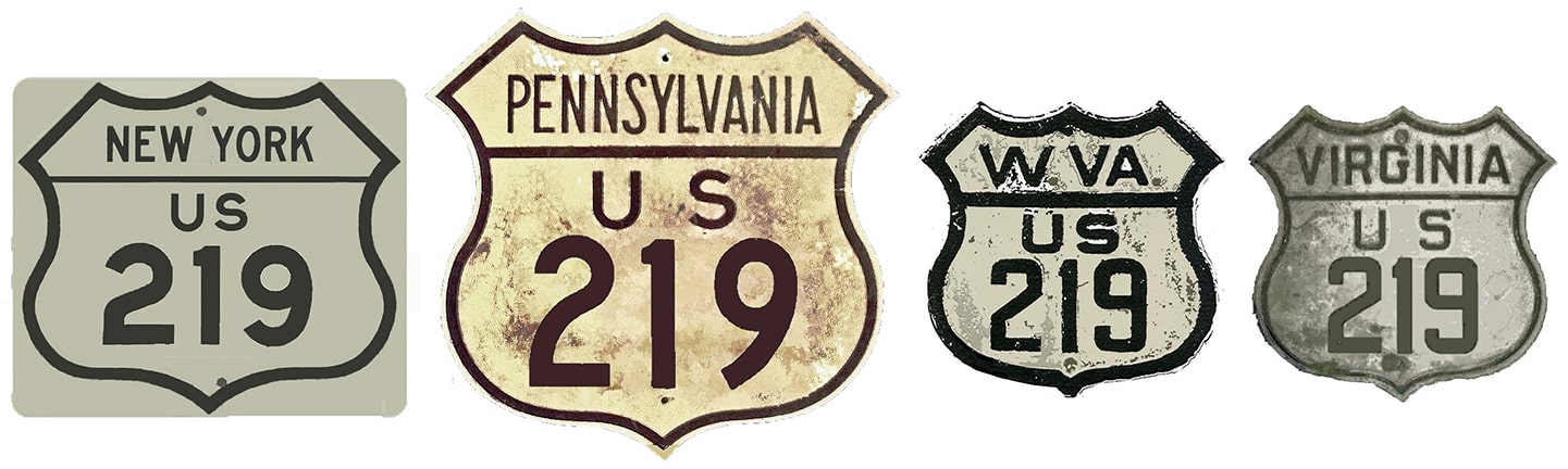
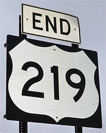
End of US highway 219 |
 |
|
1926-1927
|
1927-1934
|
1934-1966
|
1966-1971
|
1971-present
|
Summa
|
|
|
Mileage: in 1989 AASHTO listed a figure of 535 miles for US 219. Our own 2020 measurement yielded 513.4 miles (reroutings and realignments likely explain the difference). Historically, when it went to Princeton, US 219 was 531.5 miles long.
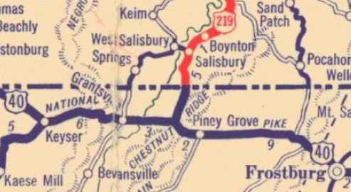
The south beginning of US 219 was originally at its junction with US 40 near Grantsville:
|
c. 1930, Penn DoT
|
|
This photo was looking west on old US 40 (now Alt US 40). US 219 began to the right on what is locally known as Chestnut Ridge Road:
Sanderson, Feb. 2007
In 1935, US 219 was extended south (left) to its junction with US 19-21 in Princeton:
|
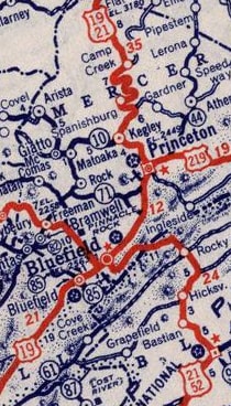
c. 1940, Rand McNally
A few years after that map was made, US 460 was extended into Princeton along US 219 (and then further west, via US 19-21). This photo showed one of the last US 219 southbound markers, back when it was still dual-signed into Princeton with US 460. This was looking west on Thorn Street/Oakvale Road, at its junction with Rogers Street/Athens Road:
|
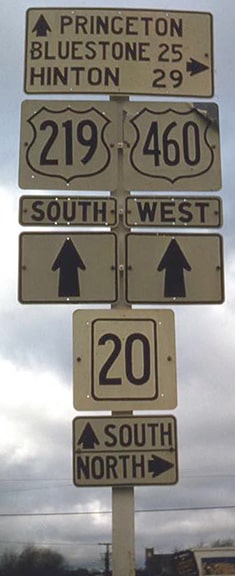
Lindsay, 1960
|
|
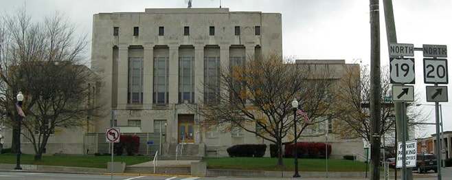
Ahead from there, Thorn becomes Mercer Street. Initially US 219 followed Mercer all the way to Main Street, and then west a couple blocks to its terminus at the courthouse square, where it junctioned US 19-21:
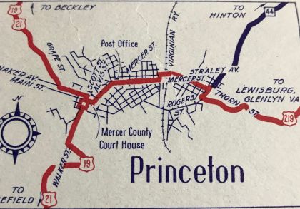
c. 1938, WVDoT
|
That remained the case until approx. 1944. At that time, highway traffic was directed off Mercer via Honaker Avenue (instead of Main), following the same route as today's WV hwy. 20. That arrangement was illustrated on this map:
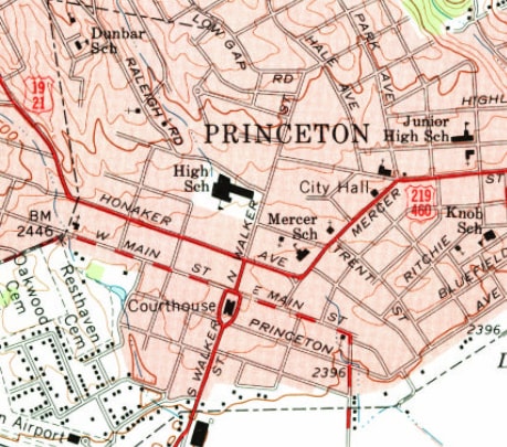
c. 1962, USGS
|
|
I have not seen a map detailed enough to show whether US 219 ended on Honaker at Walker Street, or whether it turned south on Walker for one block (with US 19-21) and continued to end at the courthouse. I consider the latter arrangement to be more likely, and indeed this postcard did show a US 219 shield at the courthouse:
|
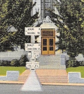
c. 1945
|
|
This photo was taken looking south on Walker. After about 1944, it is likely that this was the south end of US 219, but prior to that, US 219 began to the left on Main:
|
Alpert (linked to source)
|
|
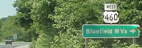
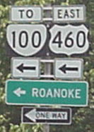
In about 1946, US 460 was extended through the Princeton area, and it was overlapped with the segment of US 219 between there and Rich Creek. Then in 1966 the south terminus of 219 was truncated to its junction with US 460 at Rich Creek. Heading south on 219, one comes into Rich Creek on Federal Street. At the time, today's US 460 had not yet been built; instead traffic ran along Old Virginia Avenue. This photo was looking south on Federal at Old Virginia:
|
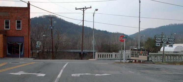
Roberson, Mar. 2007
|
|
Until about 1973, that was the south end of US 219. When modern US 460 (visible in the background) was opened to traffic, US 219 was directed west (right) one block, then south again on Island Street to its junction with the newer four-lane highway. These photos were taken looking south on Island, at the south end of US 219:
|
Elkins, June 2001
|
Elkins, June 2001
|
|
These photos show the south beginning of US 219 as seen from westbound US 460. Traffic turns right on Island for about a block, then right again on Old Virginia for another block, then left on Federal and out of town:
|

Summa, 1992
|

Prince, May 2001
|
|
US 219 was among the original 1926 routes, although AASHO's map from that time showed it ending in DuBois, while it was US 119 that ran north to the NY state line north of Bradford. But already by 1927, AASHO's route log had US 219 continuing north of DuBois to Bradford, and Pennsylvania did not sign its US routes until at least 1928 anyway. In 1934 the north end of US 219 was extended across the NY line and up to Hamburg (which is a few miles south of the current terminus, but this was before the modern US 219 freeway was built):
|
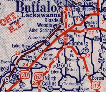
c. 1939, Rand McNally
|
|
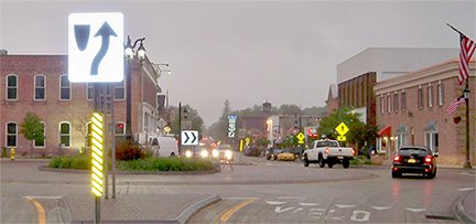
This photo shows signage looking west on Main Street. Today this is NY hwy. 391, which ends here at its junction with US 62 (northbound is to the right on Buffalo Street, and southbound is straight ahead on Main):
Karner, June 2013
|
Originally that was the north end of US 219. This photo was looking the opposite direction:
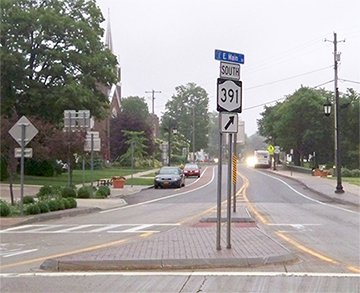
Karner, June 2013
|
|
Originally the north beginning of US 219 was straight ahead. As a matter of fact, in 2001 it was reported that there were still US 219 signs posted along the entire length of 391 (the other end of which is about 3 miles southeast, at modern US 219 in North Boston).
It was about 1971 when the US 219 freeway serving the Buffalo area was opened. Today the north end of US 219 is in the suburb of West Seneca; here is the last northbound marker: |
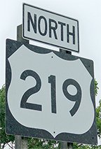
Karner, June 2013
|
|
That was posted at Lake Avenue. About a mile ahead, the US 219 designation ends at its interchange with I-90 (also known as the New York State Thruway):
|

Nitzman, 2001
|
Karner, June 2013
|
|
These photos were taken heading south out of Buffalo on westbound I-90, at the north beginning of US 219:
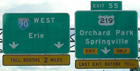
Morrison, July 2007
|
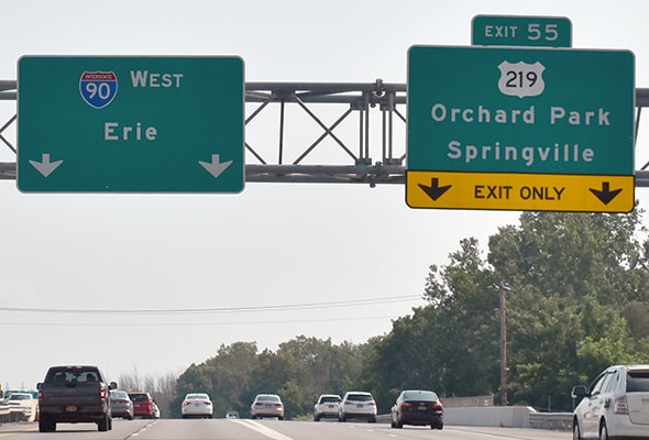
Nitzman, Aug. 2021
|
|
Reportedly there are nine overhead signs for US 219 before the route actually splits off from I-90. The exit actually goes to a collector-distributor road, which parallels I-90 for some distance before diverging:
|
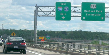
Morrison, July 2007
|
|
Drivers who follow US 219 there will soon see the first standalone southbound confirming marker:
|
Karner, June 2013
|
Research and/or photo credits: H.B. Elkins; Martin Karner; Doug Kerr; Jim Lindsay; Jeff Morrison; Alex Nitzman; Adam Prince; Mike Roberson; Dale Sanderson; Michael Summa; Andrew Turnbull
Page originally created 2000;
last updated Dec. 3, 2023.
last updated Dec. 3, 2023.
